
Anti-Atlas
Description
South of the High Atlas range in Morocco.
Liens
Données
Rapports
Guides et cartes
Hébergement
Organisations
Voyagistes
GPS
Autre
Livres

Stanfords
United Kingdom
United Kingdom
- Morocco Rock: The Anti-Atlas
- The Anti-Atlas, by Morocco Rock, is the latest selected climbs guide to Morocco`s winter sun trad climbing destination, featuring the very best routes to be found in the region around the busy market town of Tafraout, and only a couple of hours from Agadir airport.This revised and updated guide documents a colossal 1700 routes on over 100... Lire la suite

Stanfords
United Kingdom
2018
United Kingdom
2018
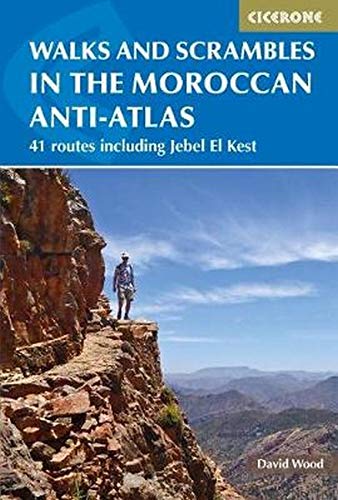
- Walks and Scrambles in the Moroccan Anti-Atlas: Tafraout, Jebel El Kest, Ait Mansour, Ameln Valley, Taskra and Tanalt
- The walks and scrambles in this guidebook explore the wild and rugged landscapes of the Anti-Atlas mountains of southern Morocco, with Tafraout and the Ameln Valley as the main base. 41 adventurous routes of between 3 and 40km include Jebel el Kest, Adra Mkorn and Ait Mansour, with an outline of a 1 week long-distance trek across the north-west... Lire la suite
- Also available from:
- The Book Depository, United Kingdom
- De Zwerver, Netherlands

The Book Depository
United Kingdom
2018
United Kingdom
2018
- Walks and Scrambles in the Moroccan Anti-Atlas
- Tafraout, Jebel El Kest, Ait Mansour, Ameln Valley, Taskra and Tanalt Lire la suite
De Zwerver
Netherlands
2018
Netherlands
2018
- Wandelgids Walks and Scrambles in the Moroccan Anti-Atlas - Marokko | Cicerone
- Guidebook to 41 graded walks and scrambles in the Anti-Atlas mountains of southern Morocco. Routes from 3 to 25km, including a summary of a 1 week long-distance trail from the north to the south of the Anti-Atlas. Covers 6 main areas, including Tafraout, Jebel El Kest, Ait Mansour, Ameln Valley, Taskra and Tanalt. Lire la suite

The Book Depository
United Kingdom
2014
United Kingdom
2014
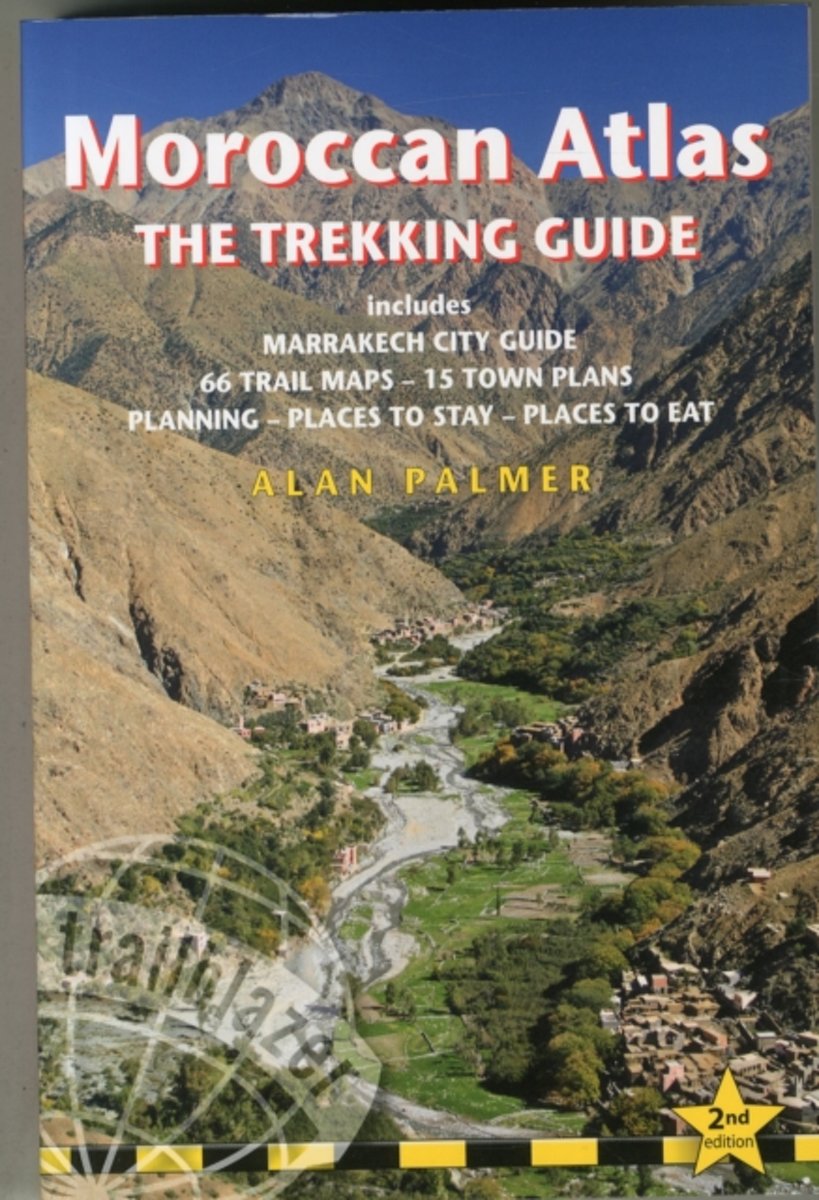
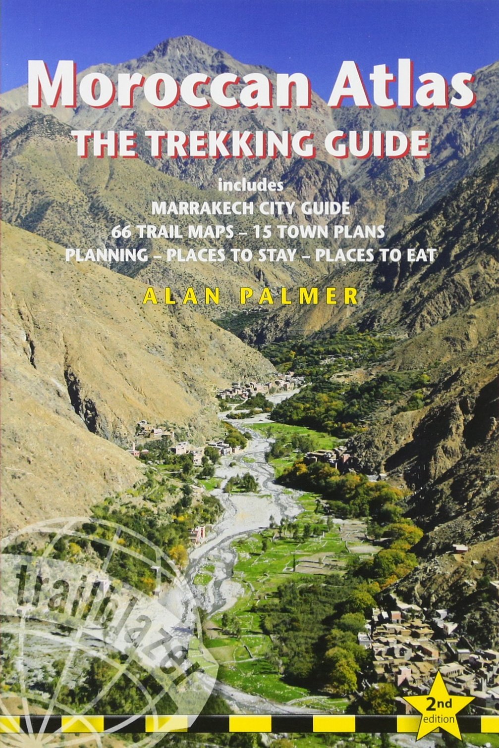
- Moroccan Atlas - The Trekking Guide
- Includes Marrakech City Guide, 50 Trail Maps, 15 Town Plans, Places to Stay, Places to See Lire la suite
- Also available from:
- Bol.com, Netherlands
- Bol.com, Belgium
- De Zwerver, Netherlands
Bol.com
Netherlands
2014
Netherlands
2014
- Moroccan Atlas - The Trekking Guide
- Stretching 1200 miles from the Atlantic port of Agadir east to Tunisia the Atlas form one of the world's great trekking ranges. The High Atlas region in central Morocco is the most dramatic and beautiful section of the entire range. Includes full practical details - getting to Morocco, town guides and maps to Marrakech, Ouarzazate and seven... Lire la suite
Bol.com
Belgium
2014
Belgium
2014
- Moroccan Atlas - The Trekking Guide
- Stretching 1200 miles from the Atlantic port of Agadir east to Tunisia the Atlas form one of the world's great trekking ranges. The High Atlas region in central Morocco is the most dramatic and beautiful section of the entire range. Includes full practical details - getting to Morocco, town guides and maps to Marrakech, Ouarzazate and seven... Lire la suite
De Zwerver
Netherlands
2014
Netherlands
2014
- Wandelgids Moroccan Atlas - the trekking guide Marokko | Trailblazer Guides
- Zeer uitgebreide wandelgids voor een specifiek deel van Marokko: het Atlas-gebergte. Het beschrijft zowel dagtochten als meerdaagse trekkings in detail met schetsmatige kaarten als basis. Van de steden krijg je veel praktische info als verblijf en vervoer. Uitgebreide beschrijvingen om te wandelen in het Atlas gebergte (Marokko) - engelstalige... Lire la suite
Cartes
De Zwerver
Netherlands
Netherlands
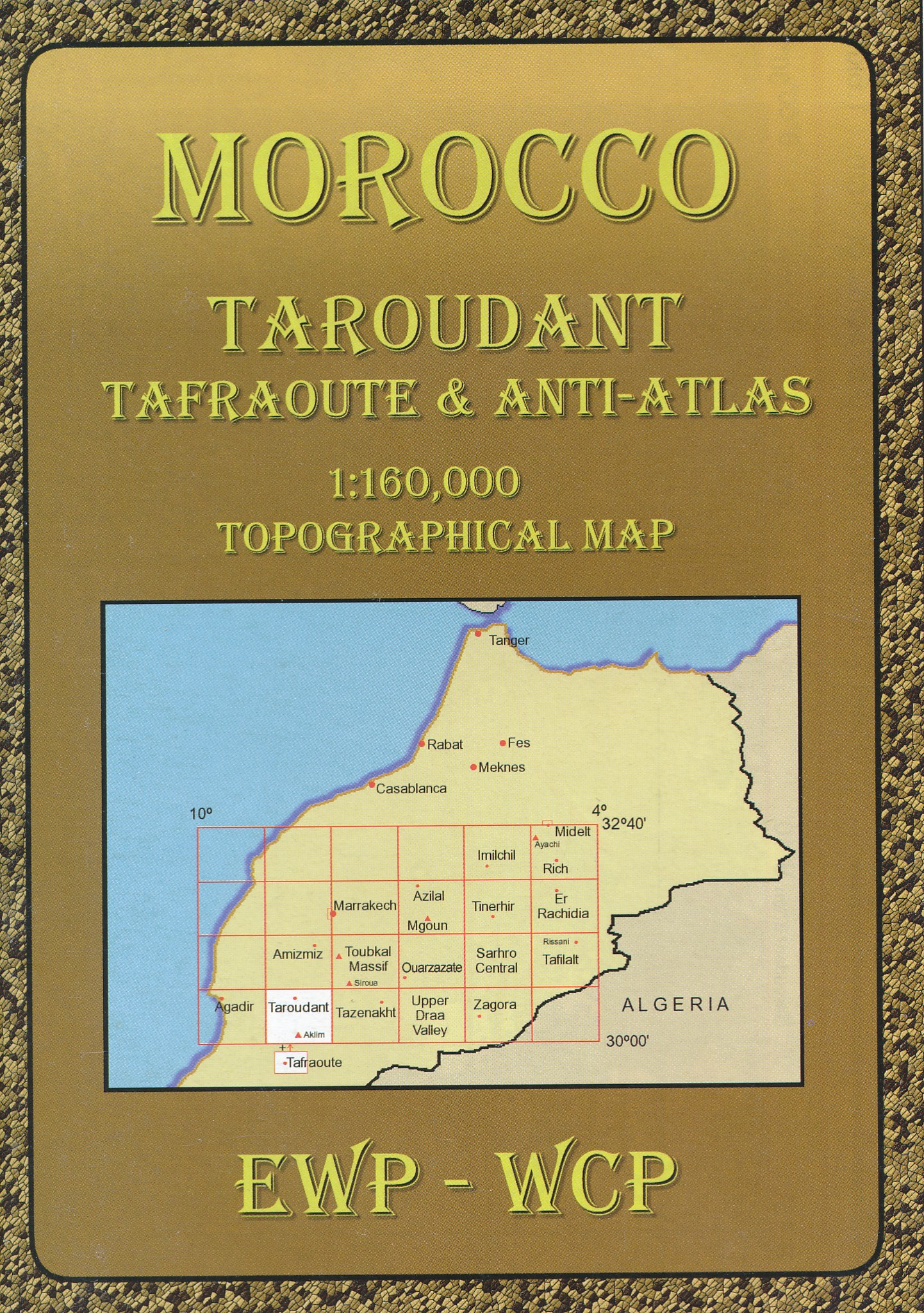
- Wandelkaart HM Taroudant, Tafraoute en Anti-Atlas (Marokko) | EWP
- Deze kaart maakt deel uit van meerdere gedetailleerde topografische kaarten van het Atlas Gebergte en de daaraan grenzende woestijnen. Elke kaart heeft lokale toeristische info op de achterzijde. Hoogte in hoogtelijnen met 40m interval en een aantal punten. Verdere vermelding van terreinsoort, vegetatie, waterpunten, cliffen, duinen, ravijnen,... Lire la suite