
Albanian Alps
Description
Liens
Données
Rapports
Guides et cartes
Hébergement
Organisations
Voyagistes
GPS
Autre
Livres
Bol.com
Netherlands
Netherlands
- A Passion for Theth: Albania's Rugged Shangri-La
- Theth is a small settlement of the Shala Valley in the northern Albanian Alps. As the crow flies, it is not far from the coastal town of Shkodra, but in reality it is a world away. Getting there involves crossing a high mountain pass on a twisty road. Heavy snow blocks the pass from October to May and leaves Theth in splendid isolation,... Lire la suite
- Also available from:
- Bol.com, Belgium
Bol.com
Belgium
Belgium
- A Passion for Theth: Albania's Rugged Shangri-La
- Theth is a small settlement of the Shala Valley in the northern Albanian Alps. As the crow flies, it is not far from the coastal town of Shkodra, but in reality it is a world away. Getting there involves crossing a high mountain pass on a twisty road. Heavy snow blocks the pass from October to May and leaves Theth in splendid isolation,... Lire la suite
Bol.com
Netherlands
Netherlands
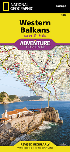
- Western Balkans
- • Waterproof • Tear-Resistant • Travel MapThe Western Balkans region, an adventure playground and rising star of Europe, is loaded with Old World traditions, slow food culture, ancient towns, and rarely visited villages. The area stretches from the Adriatic Sea in the west, up and over mountain ranges, raging rivers, tectonic lakes, steep... Lire la suite
- Also available from:
- Bol.com, Belgium
- De Zwerver, Netherlands
Bol.com
Belgium
Belgium
- Western Balkans
- • Waterproof • Tear-Resistant • Travel MapThe Western Balkans region, an adventure playground and rising star of Europe, is loaded with Old World traditions, slow food culture, ancient towns, and rarely visited villages. The area stretches from the Adriatic Sea in the west, up and over mountain ranges, raging rivers, tectonic lakes, steep... Lire la suite

De Zwerver
Netherlands
Netherlands
- Wegenkaart - landkaart 3327 Adventure Map Western Balkans - Westelijke Balkan | National Geographic
- Travel & Languages Reference Atlases International Books Lire la suite
Cartes

Stanfords
United Kingdom
United Kingdom
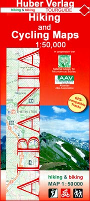
- Tropoja - B. Curri - Valbona Huber Hiking & Biking Map
- Tropoja - B. Curri - Valbona area of northern Albania at 1:50,000 in a series of GPS compatible contoured maps from Huber Verlag showing hiking and cycling routes, climbing sites, tourist accommodation, etc, with detailed descriptions of recommended tours. Overprint for hiking paths extends across the border to Montenegro and Kosovo.... Lire la suite
Stanfords
United Kingdom
United Kingdom
- Vermoshi - Tamare - Razma - Thethi Huber Hiking & Biking Map
- Vermoshi - Tamare - Razma - Thethi area of northern Albania at 1:50,000 in a series of GPS compatible contoured maps from Huber Verlag showing hiking and cycling routes, climbing sites, tourist accommodation, etc. Descriptions cover 16 hiking trails and six cycling routes between 14km and 152km long. Route profiles are provided for most of the... Lire la suite

Stanfords
United Kingdom
United Kingdom
- Vlora Huber Hiking & Biking Map
- Vlora and Environs area of southern Albania at 1:50,000 in a series of GPS compatible contoured maps from Huber Verlag showing hiking and cycling routes, climbing sites, tourist accommodation, etc. Descriptions cover eight cycling routes and five hiking trails, most with route profiles.Maps in this series, prepared in cooperation with the... Lire la suite

Stanfords
United Kingdom
United Kingdom
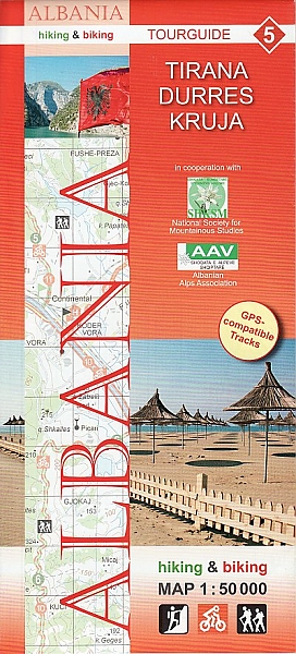
- Tirana - Durrës - Kruja Huber Hiking & Biking Map
- Tirana - Durrës – Kruja area of central Albania at 1:50,000 in a series of GPS compatible contoured maps from Huber Verlag showing hiking and cycling routes, climbing sites, tourist accommodation, etc. Descriptions cover 10 cycling routes and eight hiking trails.Maps in this series, prepared in cooperation with the Albanian Alps Associations... Lire la suite
- Also available from:
- De Zwerver, Netherlands
De Zwerver
Netherlands
Netherlands
- Wandelkaart - Fietskaart 5 Tirana - Durres - Kruja | Huber Verlag
- Tirana - Durrës – Kruja area of central Albania at 1:50,000 in a series of GPS compatible contoured maps from Huber Verlag showing hiking and cycling routes, climbing sites, tourist accommodation, etc. Descriptions cover 10 cycling routes and eight hiking trails.Maps in this series, prepared in cooperation with the Albanian Alps Associations... Lire la suite

Stanfords
United Kingdom
United Kingdom
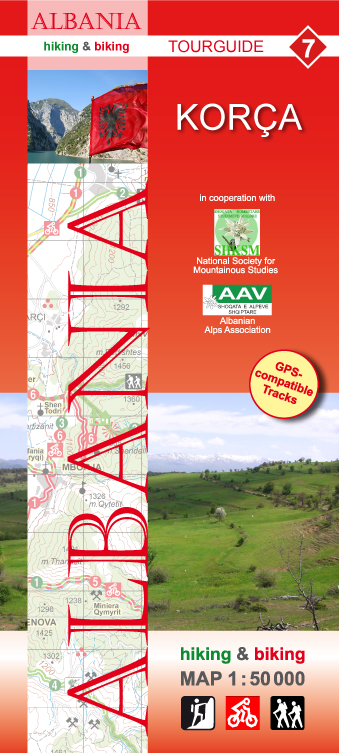
- Korça Huber Hiking & Biking Map
- Korça and Environs area of southern Albania at 1:50,000 in a series of GPS compatible contoured maps from Huber Verlag showing hiking and cycling routes, climbing sites, tourist accommodation, etc. Descriptions cover eight cycling routes and six hiking trails.Maps in this series, prepared in cooperation with the Albanian Alps Associations and... Lire la suite
- Also available from:
- De Zwerver, Netherlands
De Zwerver
Netherlands
Netherlands
- Wandelkaart - Fietskaart 7 Korça | Huber Verlag
- Korça and Environs area of southern Albania at 1:50,000 in a series of GPS compatible contoured maps from Huber Verlag showing hiking and cycling routes, climbing sites, tourist accommodation, etc. Descriptions cover eight cycling routes and six hiking trails.Maps in this series, prepared in cooperation with the Albanian Alps Associations and... Lire la suite

Stanfords
United Kingdom
United Kingdom
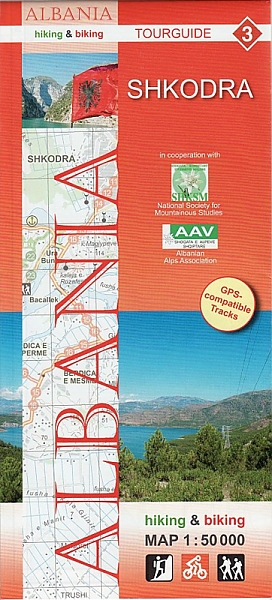
- Shkodra Huber Hiking & Biking Map
- Shkodra and Environs area of northern Albania at 1:50,000 in a series of GPS compatible contoured maps from Huber Verlag showing hiking and cycling routes, climbing sites, tourist accommodation, etc. Descriptions cover 16 cycling routes and one hiking trail, all with route-profiles.Maps in this series, prepared in cooperation with the Albanian... Lire la suite
- Also available from:
- De Zwerver, Netherlands
De Zwerver
Netherlands
Netherlands
- Wandelkaart - Fietskaart 3 Shkodra | Huber Verlag
- Shkodra and Environs area of northern Albania at 1:50,000 in a series of GPS compatible contoured maps from Huber Verlag showing hiking and cycling routes, climbing sites, tourist accommodation, etc. Descriptions cover 16 cycling routes and one hiking trail, all with route-profiles.Maps in this series, prepared in cooperation with the Albanian... Lire la suite

Stanfords
United Kingdom
United Kingdom
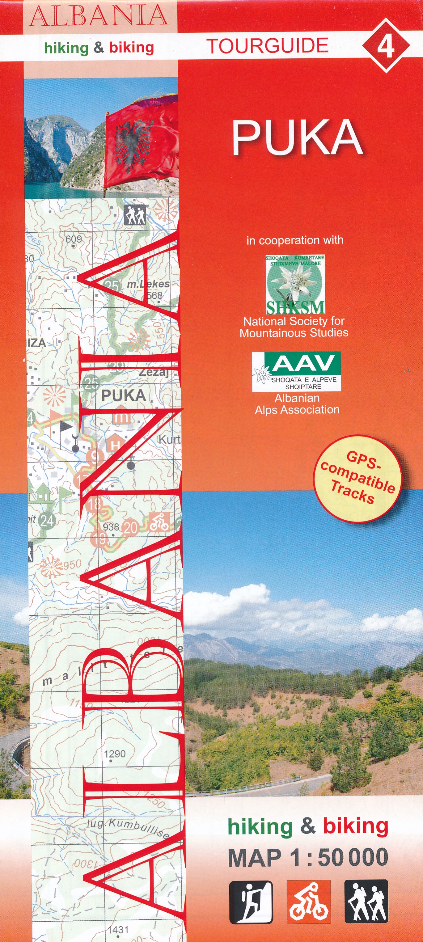
- Puka Huber Hiking & Biking Map
- Puka and Environs area of northern Albania at 1:50,000 in a series of GPS compatible contoured maps from Huber Verlag showing hiking and cycling routes, climbing sites, tourist accommodation, etc. Descriptions cover 24 cycling routes and four hiking trails.Maps in this series, prepared in cooperation with the Albanian Alps Associations and the... Lire la suite
- Also available from:
- De Zwerver, Netherlands
De Zwerver
Netherlands
Netherlands
- Wandelkaart 4 Puka | Huber Verlag
- Puka and Environs area of northern Albania at 1:50,000 in a series of GPS compatible contoured maps from Huber Verlag showing hiking and cycling routes, climbing sites, tourist accommodation, etc. Descriptions cover 24 cycling routes and four hiking trails.Maps in this series, prepared in cooperation with the Albanian Alps Associations and the... Lire la suite

Stanfords
United Kingdom
United Kingdom
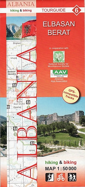
- Elbasan - Berat Huber Hiking & Biking Map
- Elbasan - Berat area of central Albania at 1:50,000 in a series of GPS compatible contoured maps from Huber Verlag showing hiking and cycling routes, climbing sites, tourist accommodation, etc. Descriptions cover 13 cycling routes and five hiking trails.Maps in this series, prepared in cooperation with the Albanian Alps Associations and the... Lire la suite
- Also available from:
- De Zwerver, Netherlands
De Zwerver
Netherlands
Netherlands
- Wandelkaart - Fietskaart 6 Elbasan - Berat | Huber Verlag
- Elbasan - Berat area of central Albania at 1:50,000 in a series of GPS compatible contoured maps from Huber Verlag showing hiking and cycling routes, climbing sites, tourist accommodation, etc. Descriptions cover 13 cycling routes and five hiking trails.Maps in this series, prepared in cooperation with the Albanian Alps Associations and the... Lire la suite

Stanfords
United Kingdom
United Kingdom
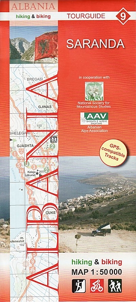
- Saranda Huber Hiking & Biking Map
- Saranda and Environs area of southern Albania at 1:50,000 in a series of GPS compatible contoured maps from Huber Verlag showing hiking and cycling routes, climbing sites, tourist accommodation, etc. Descriptions cover nine cycling routes and four hiking trails.Maps in this series, prepared in cooperation with the Albanian Alps Associations and... Lire la suite
- Also available from:
- De Zwerver, Netherlands
De Zwerver
Netherlands
Netherlands
- Wandelkaart - Fietskaart 9 Saranda | Huber Verlag
- Saranda and Environs area of southern Albania at 1:50,000 in a series of GPS compatible contoured maps from Huber Verlag showing hiking and cycling routes, climbing sites, tourist accommodation, etc. Descriptions cover nine cycling routes and four hiking trails.Maps in this series, prepared in cooperation with the Albanian Alps Associations and... Lire la suite