
Weinviertel
Description
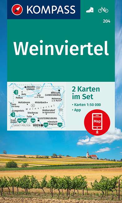
As the name suggests, the Weinviertel (wine quarter) is the primary wine region of Austria. It is a slightly hilly area in the northeast of Austria, bordering on Hungary and the Czech Republic. The E8 / Ostösterreichischer Grenzlandweg traverses this region. Along your way you can feast on typical Austrian wines made from Grüner Veltliner and Zweigelt.
Sentiers de cette région
Liens
Données
Rapports
Guides et cartes
Hébergement
Organisations
Voyagistes
GPS
Autre
Livres
De Zwerver
Netherlands
2021
Netherlands
2021
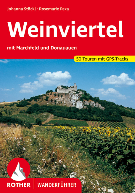
- Wandelgids Weinviertel | Rother Bergverlag
- Uitstekende wandelgids met een groot aantal dagtochten in dal en hooggebergte. Met praktische informatie en beperkt kaartmateriaal! Wandelingen in verschillende zwaarte weergegeven in rood/blauw/zwart Das Weinviertel, zwischen Manhartsberg, Donau und March gelegen, überrascht den Wanderer immer wieder durch eine landschaftliche Vielfalt, wie... Lire la suite
Bol.com
Netherlands
2015
Netherlands
2015
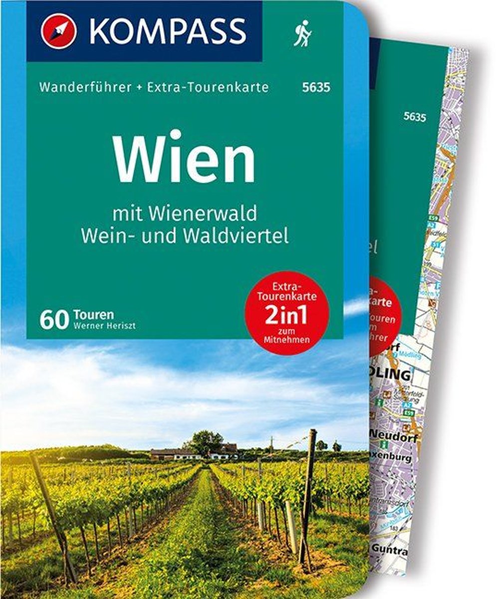
- WF5635 Wenen • Wienerwald • Wein- und Waldviertel Kompass
- Destination:. Der Wienerwald als klassisches Wandergebiet in Wien sowie seiner unmittelbaren Umgebung bietet zahlreiche Wanderrouten, die oft sogar bestens mit Bim und Bus erreichbar sind. Gerade entlang der Thermenlinie bieten die herrlichen Föhrenbestände Genusstouren für die ganze Familie und jede Jahreszeit.. Als Wanderregion bis vor kurzem... Lire la suite
- Also available from:
- Bol.com, Belgium
Bol.com
Belgium
2015
Belgium
2015
- WF5635 Wenen • Wienerwald • Wein- und Waldviertel Kompass
- Destination:. Der Wienerwald als klassisches Wandergebiet in Wien sowie seiner unmittelbaren Umgebung bietet zahlreiche Wanderrouten, die oft sogar bestens mit Bim und Bus erreichbar sind. Gerade entlang der Thermenlinie bieten die herrlichen Föhrenbestände Genusstouren für die ganze Familie und jede Jahreszeit.. Als Wanderregion bis vor kurzem... Lire la suite
De Zwerver
Netherlands
2021
Netherlands
2021
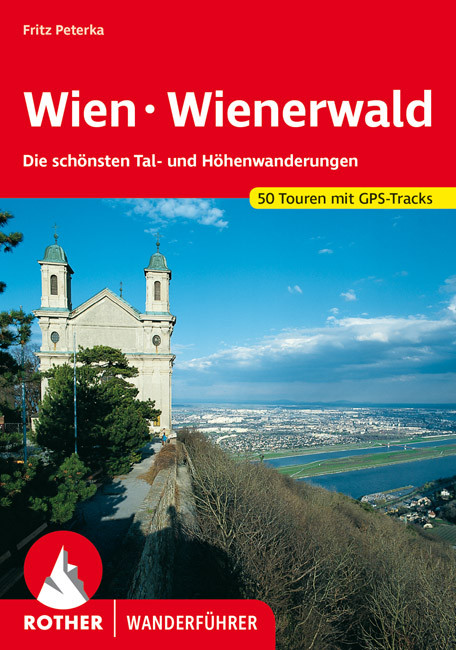
- Wandelgids 102 Wien - Wienerwald | Rother Bergverlag
- Uitstekende wandelgids met een groot aantal dagtochten in dal en hooggebergte. Met praktische informatie en beperkt kaartmateriaal! Wandelingen in verschillende zwaarte weergegeven in rood/blauw/zwart Wien ist anders" kann der Reisende auf den Plakatflächen an den Stadtgrenzen dieser Weltstadt zwischen Orient und Okzident lesen; und in der... Lire la suite
De Zwerver
Netherlands
2023
Netherlands
2023
Cartes

Stanfords
United Kingdom
United Kingdom
- Hohe Wand - Schneebergland - Gutenstein Alps - Piestingtal - Lilienfeld F&B WK012
- Hohe Wand - Piestingtal - Triestingtal - Gölsental - Gutensteier Alpen – Lilienfeld area south-west of Vienna presented at 1:50,000 in a series of contoured and GPS compatible outdoor leisure map from Freytag & Berndt with hiking and cycling routes, mountain huts, campsites and youth hostels, local bus stops, plus other tourist information.To... Lire la suite

Stanfords
United Kingdom
United Kingdom
- Danube-Auen NP - Lobau - Hainburg - Marchegg - Gänserdorf - Bruck a.d. Leitha F&B WK013
- Danube-Auen NP - Lobau - Hainburg - Marchegg - Gänserdorf - Bruck a.d. Leitha area extending eastwards from Vienna to Bratislava presented at 1:50,000 in a series of contoured and GPS compatible outdoor leisure map from Freytag & Berndt with hiking and cycling routes, mountain huts, campsites and youth hostels, local bus stops, plus other... Lire la suite

Stanfords
United Kingdom
United Kingdom
- Wienviertel West - Leiser Berge - Stockerau - Hollabrunn - Laa an der Thaya F&B WK015
- Wienviertel West - Leiser Berge - Stockerau - Hollabrunn - Laa an der Thaya area of north-eastern Austria presented at 1:50,000 in a series of contoured and GPS compatible outdoor leisure map from Freytag & Berndt with hiking and cycling routes, mountain huts, campsites and youth hostels, local bus stops, plus other tourist information.To see... Lire la suite

Stanfords
United Kingdom
United Kingdom
- Wienviertel East - March - Thayatal - Mistelbach F&B WK014
- Wienviertel East - March - Thayatal – Mistelbach area of north-eastern Austria presented at 1:50,000 in a series of contoured and GPS compatible outdoor leisure map from Freytag & Berndt with hiking and cycling routes, mountain huts, campsites and youth hostels, local bus stops, plus other tourist information.To see the list of currently... Lire la suite

Stanfords
United Kingdom
United Kingdom
- Thayatal National Park - Kamptal - Znaim - Retz - Gars am Karp F&B WK073
- Thayatal NP - Znaim - Retz - Gars am Karp area of eastern Austria presented at 1:50,000 in a series of contoured and GPS compatible outdoor leisure map from Freytag & Berndt with hiking and cycling routes, mountain huts, campsites and youth hostels, local bus stops, plus other tourist information.To see the list of currently available titles in... Lire la suite

Stanfords
United Kingdom
United Kingdom
- Transrhodopi - Long distance hiking and biking trail From Trigrad to Ivaylovgrad
- Western Rhodope Mountains at 1:100,000 on a contoured GPS compatible map from Domino extending from just west of the Pirin National Park to Asenovgrad in the north-east. The map is double-sided with a good overlap between the sides. Topography is shown by contours at 50m intervals with relief shading and spot heights, plus colouring for... Lire la suite

Stanfords
United Kingdom
United Kingdom
- Weinviertel Cycling Freytag & Berndt Map
- Weinviertel region of eastern Austria on a detailed road map at 1:100,000 from Freytag & Berndt with numerous cycling routes, indicating unpaved paths, routes with heavy motorized traffic and gradient marking. Symbols mark various types of accommodation, including campsites and youth hostels, bike retail and repair facilities, viewpoints,... Lire la suite

Stanfords
United Kingdom
United Kingdom
- Western Rhodope Mountains Domino Map
- Western Rhodope Mountains at 1:100,000 on a contoured GPS compatible map from Domino extending from just west of the Pirin National Park to Asenovgrad in the north-east. The map is double-sided with a good overlap between the sides. Topography is shown by contours at 50m intervals with relief shading and spot heights, plus colouring for... Lire la suite
- Also available from:
- De Zwerver, Netherlands

De Zwerver
Netherlands
Netherlands
- Wandelkaart - Wegenkaart - landkaart 7 Westelijke Rhodopen - Western Rhodopes | Domino
- Western Rhodope Mountains at 1:100,000 on a contoured GPS compatible map from Domino extending from just west of the Pirin National Park to Asenovgrad in the north-east. The map is double-sided with a good overlap between the sides. Topography is shown by contours at 50m intervals with relief shading and spot heights, plus colouring for... Lire la suite

Stanfords
United Kingdom
United Kingdom
- Stara Planina Central: Zlatitsa to Kalofer Domino Map
- Stara Planina Central: Zlatitsa to Kalofer map at 1:50,000 from Bulgarian publishers Domino, contoured and GPS compatible, with hiking trails, accommodation options including a list of local mountain refuges, etc. The map is double-sided and covers the mountains from just west of Ribaritsa and Zlatitsa eastwards beyond Kalofer to the peak of... Lire la suite
- Also available from:
- De Zwerver, Netherlands

De Zwerver
Netherlands
Netherlands
- Wandelkaart 1 Stara Planina gebergte | Domino
- Stara Planina Central: Zlatitsa to Kalofer map at 1:50,000 from Bulgarian publishers Domino, contoured and GPS compatible, with hiking trails, accommodation options including a list of local mountain refuges, etc. The map is double-sided and covers the mountains from just west of Ribaritsa and Zlatitsa eastwards beyond Kalofer to the peak of... Lire la suite

Stanfords
United Kingdom
United Kingdom
- Stara Planina Central: Uzana to Vratnik Domino Map
- Stara Planina Central: Uzana to Vratnik map at 1:50,000 from Bulgarian publishers Domino, contoured and GPS compatible, with hiking trails, accommodation options including a list of local mountain refuges, etc. The map is double-sided and covers the mountains from just west of the Uzana massif, the geographical centre of Bulgaria, eastwards to... Lire la suite
- Also available from:
- De Zwerver, Netherlands

De Zwerver
Netherlands
Netherlands
- Wandelkaart 2 Stara Planina gebergte | Domino
- Stara Planina Central: Uzana to Vratnik map at 1:50,000 from Bulgarian publishers Domino, contoured and GPS compatible, with hiking trails, accommodation options including a list of local mountain refuges, etc. The map is double-sided and covers the mountains from just west of the Uzana massif, the geographical centre of Bulgaria, eastwards to... Lire la suite

Stanfords
United Kingdom
United Kingdom
- Stara Planina Western: Belogradchik to Berkovita Domino Map
- Stara Planina Western: Belogradchik to Berkovita map at 1:50,000 from Bulgarian publishers Domino, contoured and GPS compatible, with hiking trails, accommodation options including a list of local mountain refuges, etc. The map is double-sided and covers the mountains from the peak of Byala Voda near Belogradchik eastwards to just beyond... Lire la suite
- Also available from:
- De Zwerver, Netherlands

De Zwerver
Netherlands
Netherlands
- Wandelkaart 3 Stara Planina gebergte | Domino
- Stara Planina Western: Belogradchik to Berkovita map at 1:50,000 from Bulgarian publishers Domino, contoured and GPS compatible, with hiking trails, accommodation options including a list of local mountain refuges, etc. The map is double-sided and covers the mountains from the peak of Byala Voda near Belogradchik eastwards to just beyond... Lire la suite

Stanfords
United Kingdom
United Kingdom
- Stara Planina Western: Berkovita to Zlatitsa Domino Map
- Stara Planina Western: Berkovita to Zlatitsa map at 1:50,000 from Bulgarian publishers Domino, contoured and GPS compatible, with hiking trails, accommodation options including a list of local mountain refuges, etc. The map is double-sided and covers the mountains from Varshets (directly north of Sofia) to just beyond Etrepole.Maps in the... Lire la suite
- Also available from:
- De Zwerver, Netherlands

De Zwerver
Netherlands
Netherlands
- Wandelkaart 4 Stara Planina gebergte | Domino
- Stara Planina Western: Berkovita to Zlatitsa map at 1:50,000 from Bulgarian publishers Domino, contoured and GPS compatible, with hiking trails, accommodation options including a list of local mountain refuges, etc. The map is double-sided and covers the mountains from Varshets (directly north of Sofia) to just beyond Etrepole.Maps in the... Lire la suite

Stanfords
United Kingdom
United Kingdom
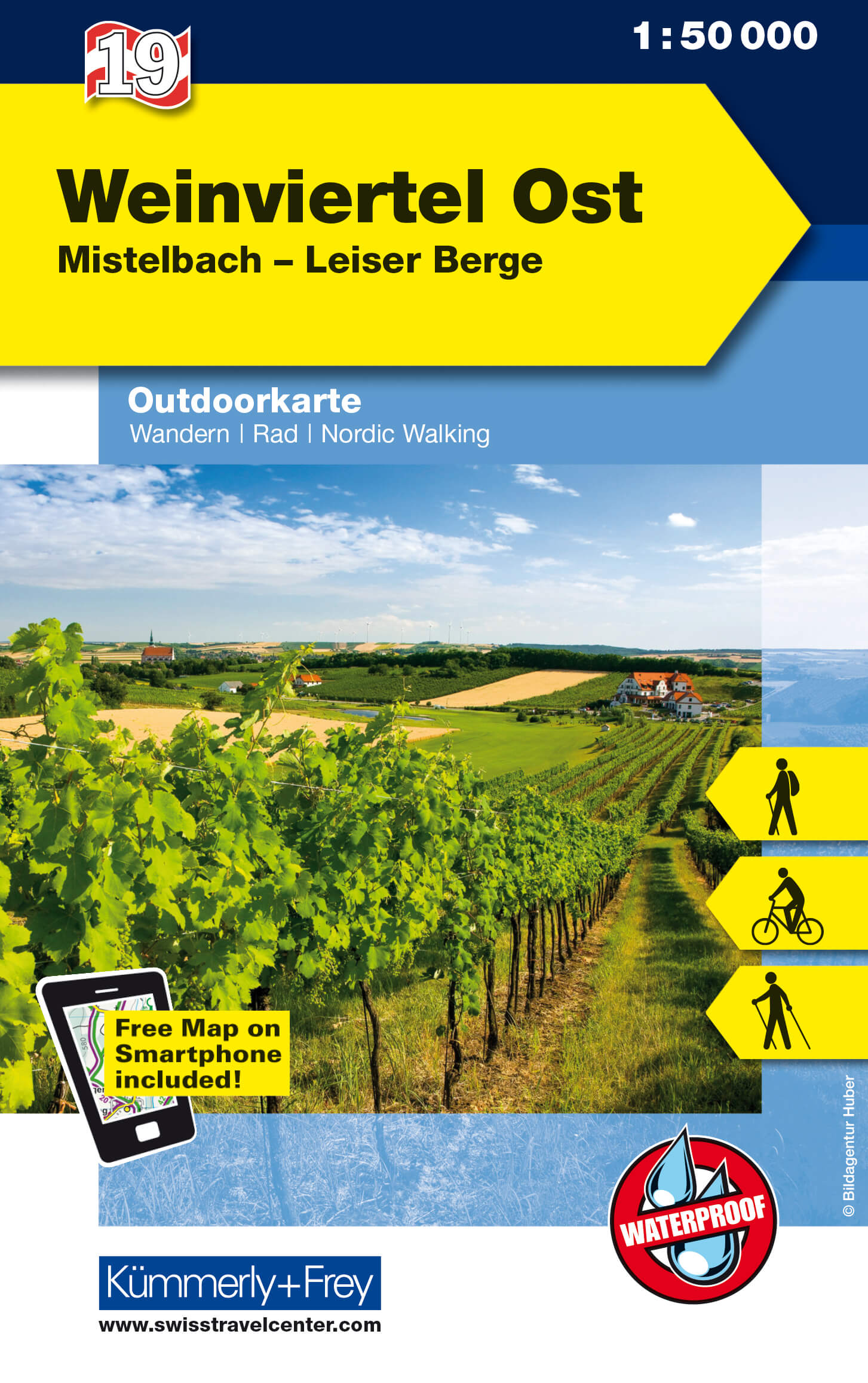
- Weinviertel East K+F Outdoor Map 19
- The eastern part of the Weinviertel region of Austria at 1:35,000 on a GPS compatible, double-sided map from Kümmerly+Frey printed on sturdy, waterproof and tear-resistant synthetic paper; contoured, with hiking, cycling and ski routes, accommodation facilities, locations for other recreational activities, etc.Maps in the K+F recreational... Lire la suite
- Also available from:
- De Zwerver, Netherlands
De Zwerver
Netherlands
Netherlands
- Wandelkaart 19 Outdoorkarte AT Weinviertel Ost | Kümmerly & Frey
- The eastern part of the Weinviertel region of Austria at 1:35,000 on a GPS compatible, double-sided map from Kümmerly+Frey printed on sturdy, waterproof and tear-resistant synthetic paper; contoured, with hiking, cycling and ski routes, accommodation facilities, locations for other recreational activities, etc.Maps in the K+F recreational... Lire la suite

Stanfords
United Kingdom
United Kingdom
- Rila Mountains Domino
- Rila Mountains at 1:50,000 on a large, double-sided, contoured map with GPS waypoints for shelters and chalets, peaks, etc. and highlighting hiking routes. Topography is shown by contours at 50m intervals with additional relief shading and graphics and colouring for scree, single rocks over 5m high, marshlands and pine scrub and forests. An... Lire la suite
- Also available from:
- De Zwerver, Netherlands

De Zwerver
Netherlands
Netherlands
- Wandelkaart 5 Rila gebergte | Domino
- Rila Mountains at 1:50,000 on a large, double-sided, contoured map with GPS waypoints for shelters and chalets, peaks, etc. and highlighting hiking routes. Topography is shown by contours at 50m intervals with additional relief shading and graphics and colouring for scree, single rocks over 5m high, marshlands and pine scrub and forests. An... Lire la suite