
Mönch
Description
- Altitude 4107.00 m
Liens
Données
Rapports
Guides et cartes
Hébergement
Organisations
Voyagistes
GPS
Autre
Livres

The Book Depository
United Kingdom
2018
United Kingdom
2018
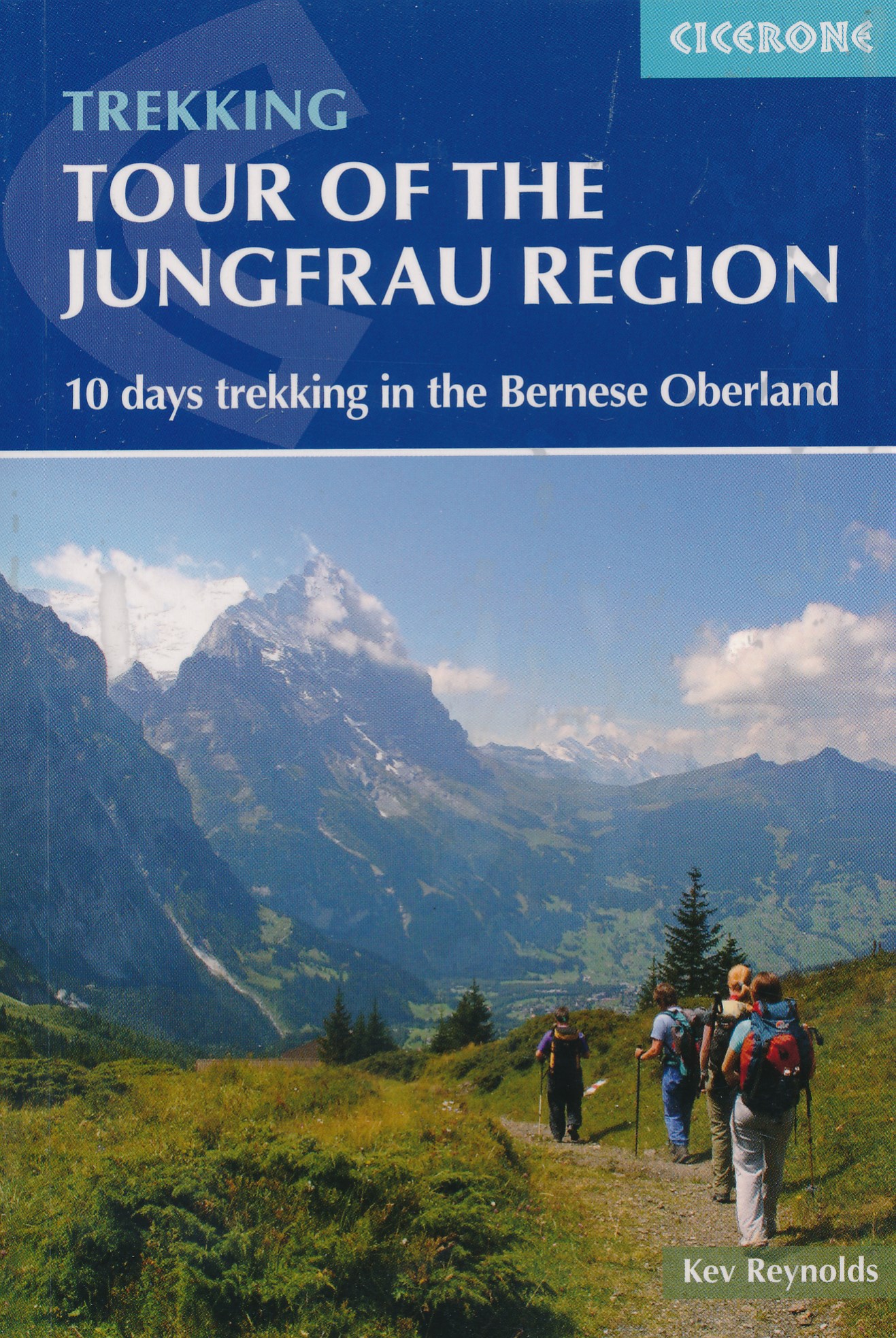
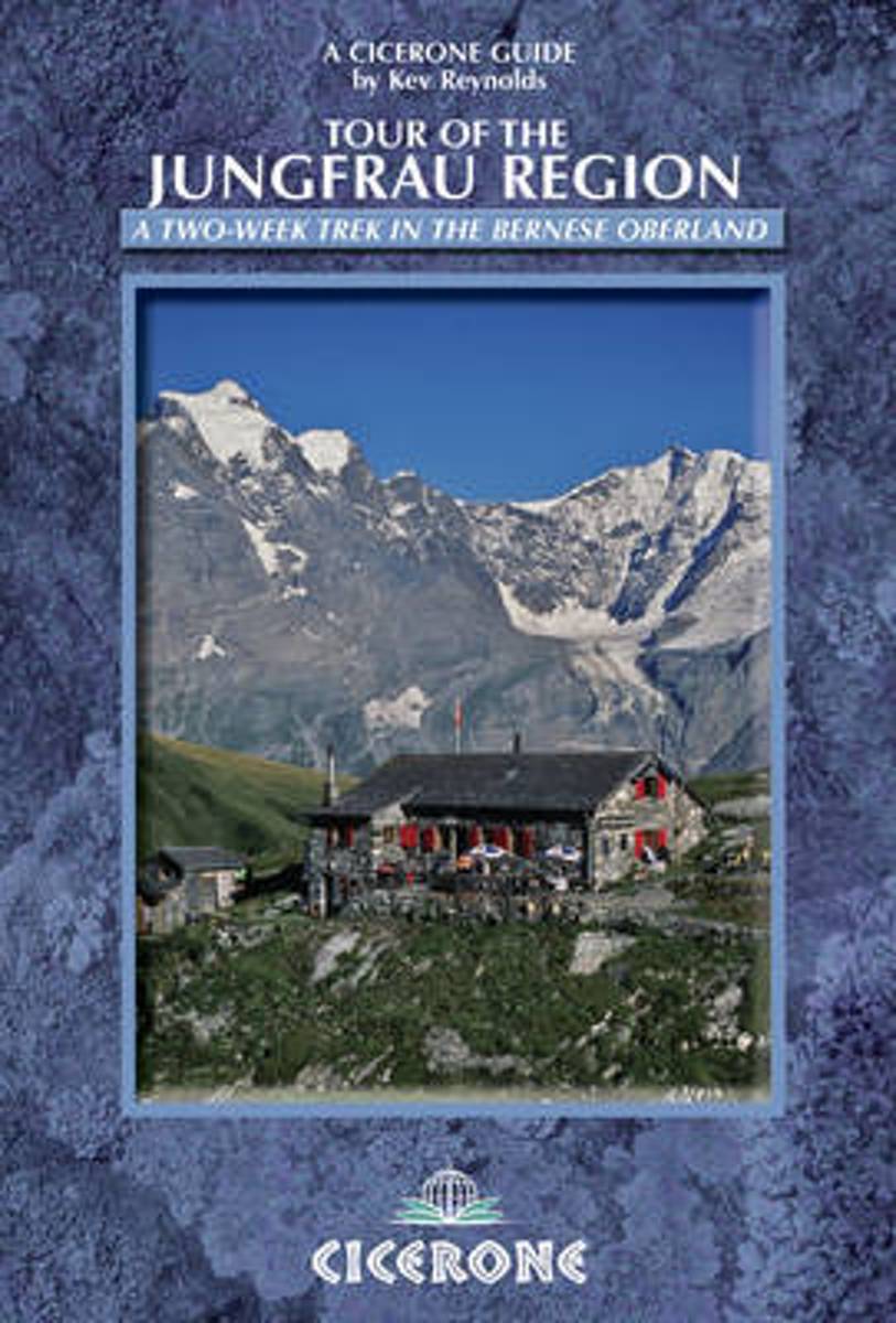
- Tour of the Jungfrau Region
- 10 days trekking in the Bernese Oberland Lire la suite
- Also available from:
- De Zwerver, Netherlands
De Zwerver
Netherlands
2018
Netherlands
2018
- Wandelgids Tour of the Jungfrau Region - Berner Oberland | Cicerone
- The Tour of the Jungfrau Region is described as a clockwise circuit of 111km beginning at Schynige Platte and ending at Wilderswil. It is broken into 10 stages (with alternatives offered), through the Bernese Oberland under the Mönch, Eiger and Jungfrau. With spectacular mountain views, glaciers, lakes and ridges, it is a classic walk. Lire la suite
Bol.com
Netherlands
2012
Netherlands
2012
- Tour of the Jungfrau Region
- The Tour of the Jungfrau Region is described as a clockwise circuit of 111km beginning at Schynige Platte and ending at Wilderswil. It is broken into 10 stages (with alternatives offered), through the Bernese Oberland under the Mönch, Eiger and Jungfrau. With spectacular mountain views, glaciers, lakes and ridges, it is a classic walk. Lire la suite
- Also available from:
- Bol.com, Belgium
Bol.com
Belgium
2012
Belgium
2012
- Tour of the Jungfrau Region
- The Tour of the Jungfrau Region is described as a clockwise circuit of 111km beginning at Schynige Platte and ending at Wilderswil. It is broken into 10 stages (with alternatives offered), through the Bernese Oberland under the Mönch, Eiger and Jungfrau. With spectacular mountain views, glaciers, lakes and ridges, it is a classic walk. Lire la suite
Cartes

Stanfords
United Kingdom
United Kingdom
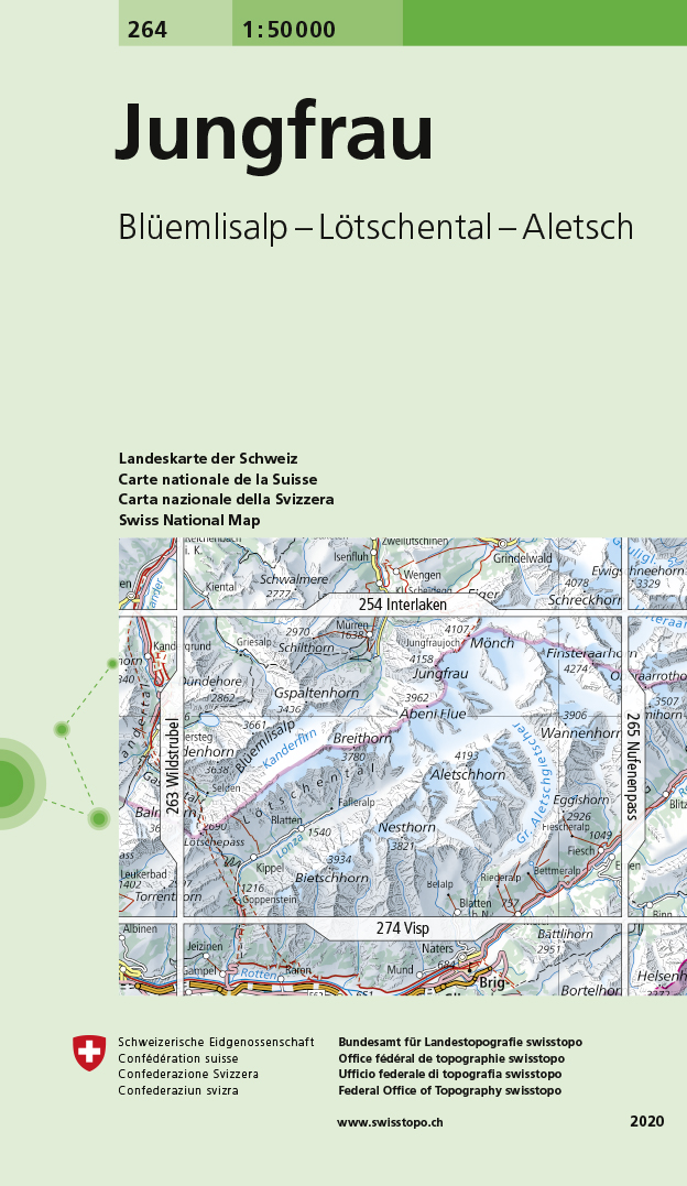
- Jungfrau Swisstopo 264
- Jungfrau, map No. 264, in the standard topographic survey of Switzerland at 1:50,000 from Swisstopo, i.e. without the special overprint highlighting walking trails, local bus stops, etc, presented in Swisstopo’s hiking editions of the 50K survey. With the resort of Mürren at the top of the map, coverage includes the peaks of Mönch and Jungfrau... Lire la suite
- Also available from:
- De Zwerver, Netherlands
De Zwerver
Netherlands
Netherlands
- Wandelkaart - Topografische kaart 264 Jungfrau | Swisstopo
- Jungfrau, map No. 264, in the standard topographic survey of Switzerland at 1:50,000 from Swisstopo, i.e. without the special overprint highlighting walking trails, local bus stops, etc, presented in Swisstopo Lire la suite

Stanfords
United Kingdom
United Kingdom
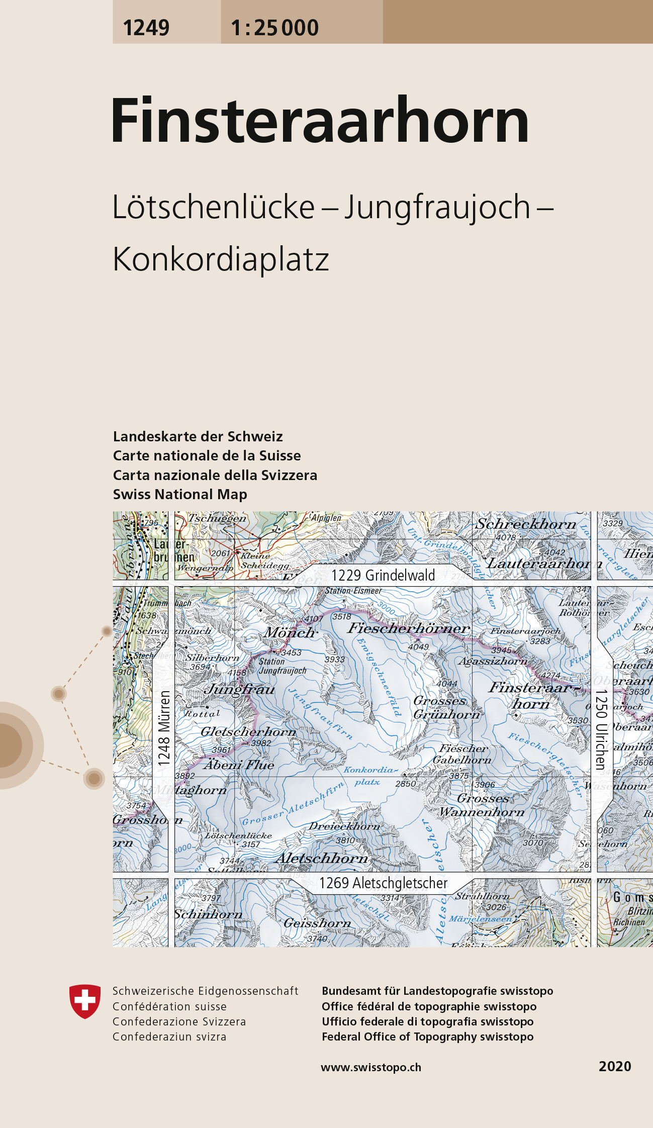
- Finsteraarhorn Swisstopo 1249
- Map No. 1249, Finsteraarhorn, in the topographic survey of Switzerland at 1:25,000 from Swisstopo. Centered on the Konkordiaplatz, the map covers the upper part of the Aletsch Glacier with the peak of Aletschhorn right on its southern edge, and extends north to include the peaks of Jungfrau, Mönch and Chlyne Eiger (i.e not the Eiger itself).... Lire la suite
- Also available from:
- De Zwerver, Netherlands
De Zwerver
Netherlands
Netherlands
- Wandelkaart - Topografische kaart 1249 Finsteraarhorn | Swisstopo
- Map No. 1249, Finsteraarhorn, in the topographic survey of Switzerland at 1:25,000 from Swisstopo. Centered on the Konkordiaplatz, the map covers the upper part of the Aletsch Glacier with the peak of Aletschhorn right on its southern edge, and extends north to include the peaks of Jungfrau, M Lire la suite

Stanfords
United Kingdom
2020
United Kingdom
2020
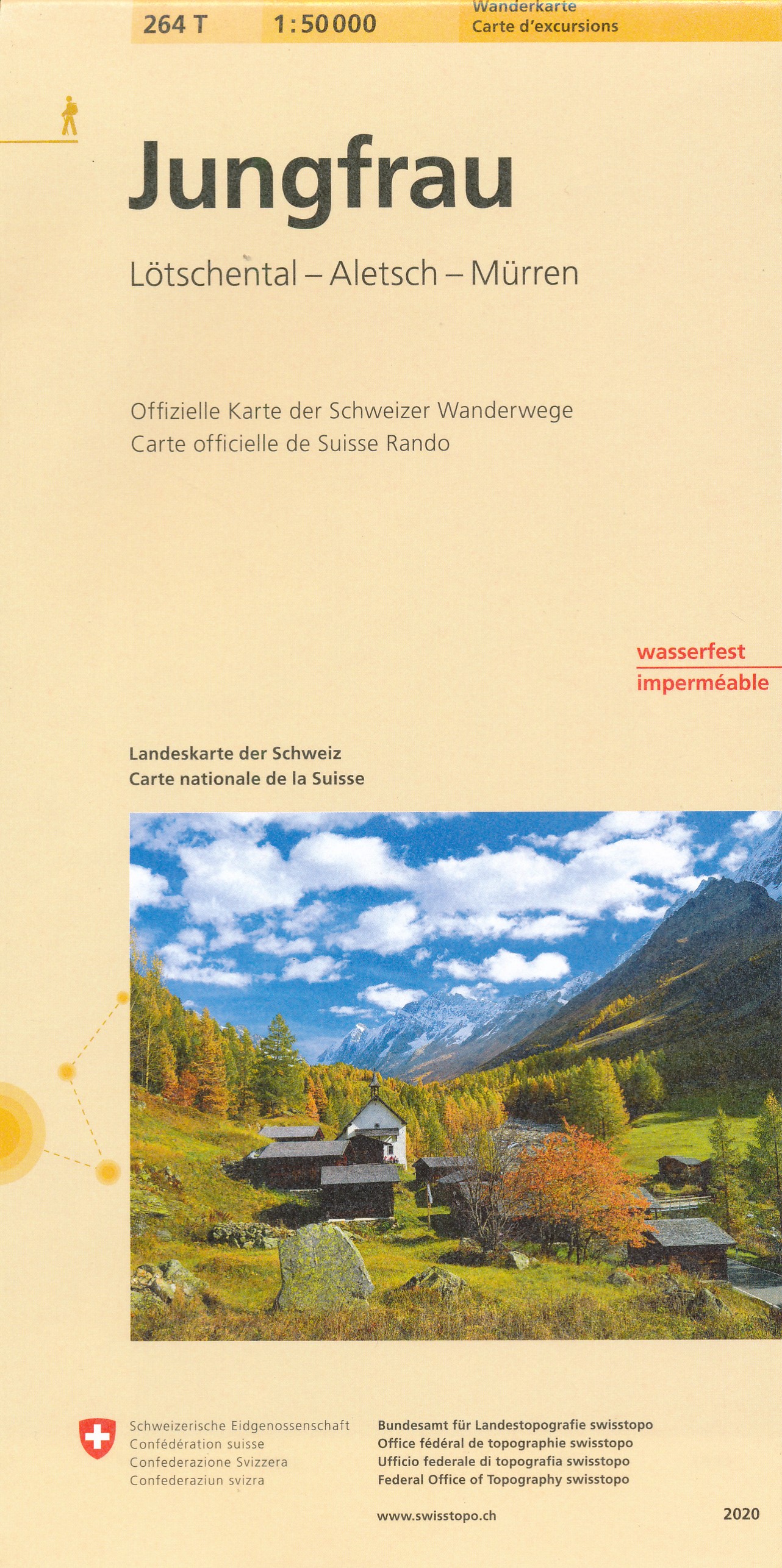
- Jungfrau - Lötschental - Aletsch Swisstopo Hiking 264T
- Jungfrau area, map No. 264T, at 1:50,000 in a special hiking edition of the country’s topographic survey, published by Swisstopo in cooperation with the Swiss Hiking Federation. With the resort of Mürren at the top of the map, coverage includes the peaks of Mönch and Jungfrau with the upper station of the Jungfraujoch Railway, and extends... Lire la suite
- Also available from:
- De Zwerver, Netherlands
De Zwerver
Netherlands
2020
Netherlands
2020
- Wandelkaart 264T Jungfrau | Swisstopo
- Jungfrau area, map No. 264T, at 1:50,000 in a special hiking edition of the country Lire la suite

Stanfords
United Kingdom
United Kingdom
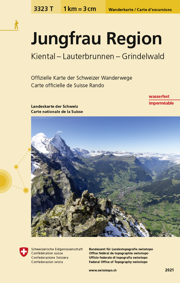
- Jungfrau Region - Kiental - Lauterbrunnen - Grindelwald Swisstopo Hiking 3323T
- Jungfrau Region: Grindelwald - Wengen - Mürren - Kandersteg area of the Bernese Oberland at 1:33,333 on light, waterproof and tear-resistant map No. 3323T published by Swisstopo in cooperation with the Swiss Hiking Federation. Cartography is the same as in Swisstopo’s 50K hiking maps, simply enlarged to 1:33,333 for extra clarity but without... Lire la suite
- Also available from:
- De Zwerver, Netherlands
De Zwerver
Netherlands
Netherlands
- Wandelkaart - Topografische kaart 3323T Jungfrau Region | Swisstopo
- Die wasser- und reissfesten Wanderkarten im handlichen Format. Lire la suite