
Weisshorn
Description
- Altitude 4505.00 m
Liens
Données
Rapports
Guides et cartes
Hébergement
Organisations
Voyagistes
GPS
Autre
Livres

Stanfords
United Kingdom
2019
United Kingdom
2019
- Walkers`s Haute Route: Chamonix to Zermatt: The epic journey between Mont Blanc and the Matterhorn
- An incredible trek between the two most famous mountain towns in the Alps. Travelling from Chamonix in France to Zermatt in Switzerland, you will start at Mont Blanc and finish at the Matterhorn. On the way, pass the largest collection of snowy 4000m summits in the Alps: Mont Blanc, Grand Combin, the Weisshorn, the Zinalrothorn, the Dom, the... Lire la suite
- Also available from:
- The Book Depository, United Kingdom
- De Zwerver, Netherlands

The Book Depository
United Kingdom
2019
United Kingdom
2019
- Walkers's Haute Route: Chamonix to Zermatt
- The epic journey between Mont Blanc and the Matterhorn Lire la suite

De Zwerver
Netherlands
2019
Netherlands
2019
- Wandelgids Walker's Haute Route: Chamonix to Zermatt | Knife Edge Outdoor
- The epic journey between Mont Blanc and the Matterhorn Lire la suite
De Zwerver
Netherlands
2010
Netherlands
2010
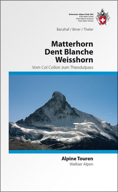
- Wandelgids Alpine Touren Matterhorn - Weisshorn - Dent Blanche | SAC Schweizer Alpenclub
- Wandel- klimgids voor de Walliser Alpen met beschrijvingen van de routes naar toppen van bekende topppen: Bouquetins - Dents de Perroc, Dent Blanche, Grand Cornier, Gable horner - Zinalrothorn , Weisshorn, Diablons - Bella Tola & Matterhorn. Im Gebiet dieses Führers liegen die schönsten und berühmtesten Viertausender der Schweizer Alpen. In der... Lire la suite
Bol.com
Netherlands
2015
Netherlands
2015
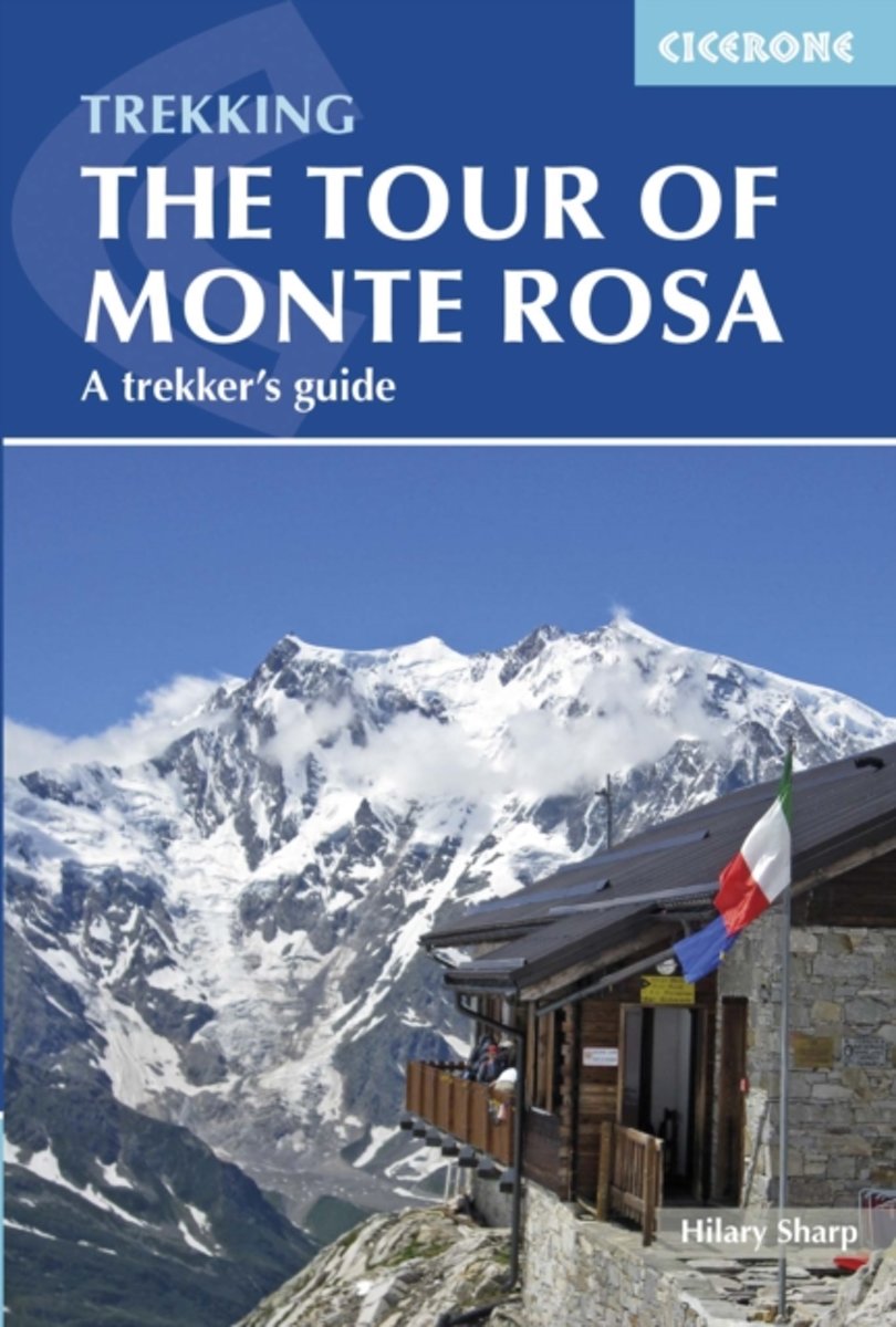
- Tour of Monte Rosa
- The 134km Tour of Monte Rosa is a challenging and very varied trek that takes a high route around the massif, in a circuit that begins and ends in Zermatt. The trek is described in eight stages, but these are not necessarily one-day stages, and some will be more comfortably achieved over two days or more. Realistically you should allow 9-10... Lire la suite
- Also available from:
- Bol.com, Belgium
Bol.com
Belgium
2015
Belgium
2015
- Tour of Monte Rosa
- The 134km Tour of Monte Rosa is a challenging and very varied trek that takes a high route around the massif, in a circuit that begins and ends in Zermatt. The trek is described in eight stages, but these are not necessarily one-day stages, and some will be more comfortably achieved over two days or more. Realistically you should allow 9-10... Lire la suite
Cartes

Stanfords
United Kingdom
United Kingdom
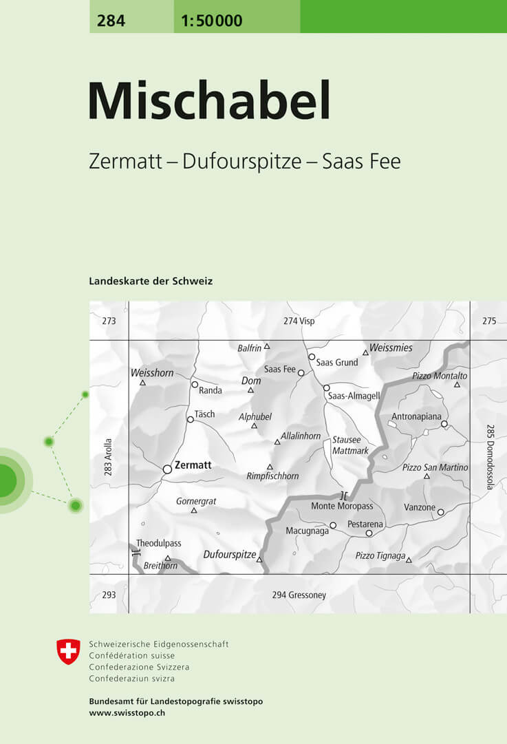
- Mischabel Swisstopo 284
- Mischabel, map No. 284, in the standard topographic survey of Switzerland at 1:50,000 from Swisstopo, i.e. without the special overprint highlighting walking trails, local bus stops, etc, presented in Swisstopo’s hiking editions of the 50K survey. The map covers the southern part of the Mattertal with Zermatt and Randa, the Saastal with Saas... Lire la suite
- Also available from:
- De Zwerver, Netherlands
De Zwerver
Netherlands
Netherlands
- Wandelkaart - Topografische kaart 284 Mischabel | Swisstopo
- Mischabel, map No. 284, in the standard topographic survey of Switzerland at 1:50,000 from Swisstopo, i.e. without the special overprint highlighting walking trails, local bus stops, etc, presented in Swisstopo Lire la suite

Stanfords
United Kingdom
United Kingdom
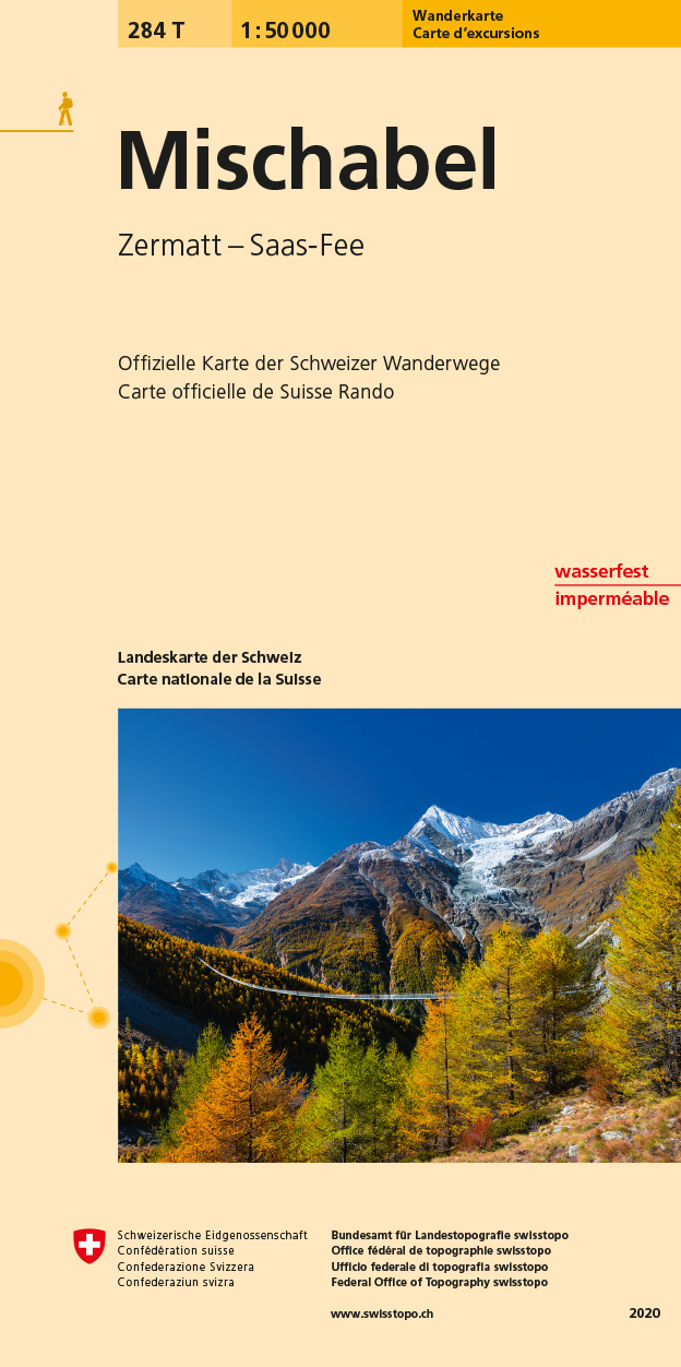
- Mischabel Swisstopo Hiking 284T
- The Michabel range, map No. 284T, at 1:50,000 in a special hiking edition of the country’s topographic survey, published by Swisstopo in cooperation with the Swiss Hiking Federation. The map covers most of the Mischabel range with the southern part of the Mattertal including Zermatt and Randa, the Saastal with Saas Fe, Theodul Pass, Monte Rosa... Lire la suite
- Also available from:
- De Zwerver, Netherlands
De Zwerver
Netherlands
Netherlands
- Wandelkaart 284T Mischabel | Swisstopo
- The Michabel range, map No. 284T, at 1:50,000 in a special hiking edition of the country Lire la suite

Stanfords
United Kingdom
United Kingdom
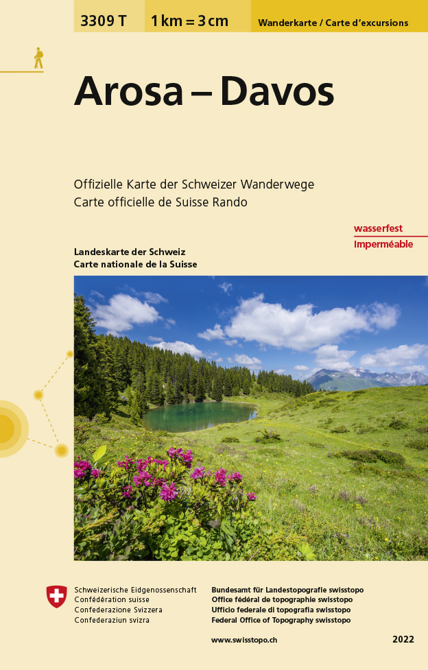
- Arosa - Davos Swisstopo Hiking 3309T
- Arosa - Davos area at 1:33,333 on light, waterproof and tear-resistant map No. 3309T published by Swisstopo in cooperation with the Swiss Hiking Federation. Cartography is the same as in Swisstopo’s 50K hiking maps, simply enlarged to 1:33,333 for extra clarity but without additional information. Coverage includes Klosters, Lenzerheide/Lei and... Lire la suite
- Also available from:
- De Zwerver, Netherlands
De Zwerver
Netherlands
Netherlands
- Wandelkaart - Topografische kaart 3309T Arosa - Davos | Swisstopo
- Een nieuwe serie van de Zwitserse topografische dienst: eindelijk goede wandelkaarten met ingetekende wandelroutes op scheur- en watervast papier. Vooralsnog zijn ze uitgebracht van de populaire wandelgebieden en niet landelijk dekkend (zie overzicht) Op een gedetailleerde schaal van 1:33.333 met als ondergrond de onovertroffen topografische... Lire la suite

Stanfords
United Kingdom
United Kingdom
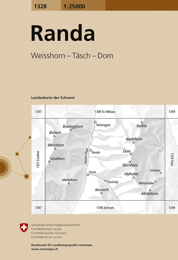
- Randa Swisstopo 1328
- Map No. 1328, Randa, in the topographic survey of Switzerland at 1:25,000 from Swisstopo. The map covers the central section of the Mattertal from just north of Zermatt to Herbriggen, and extends west to include Weisshorn and eastwards across the Mischabel range with Dom to outskirts of Saas Fee.Swiss topographic survey at 1:25,000 covers the... Lire la suite
- Also available from:
- De Zwerver, Netherlands
De Zwerver
Netherlands
Netherlands
- Wandelkaart - Topografische kaart 1328 Randa | Swisstopo
- Map No. 1328, Randa, in the topographic survey of Switzerland at 1:25,000 from Swisstopo. The map covers the central section of the Mattertal from just north of Zermatt to Herbriggen, and extends west to include Weisshorn and eastwards across the Mischabel range with Dom to outskirts of Saas Fee.Swiss topographic survey at 1:25,000 covers the... Lire la suite