
Zinalrothorn
Description
- Altitude 4221.00 m
Liens
Données
Rapports
Guides et cartes
Hébergement
Organisations
Voyagistes
GPS
Autre
Livres

Stanfords
United Kingdom
2019
United Kingdom
2019
- Walkers`s Haute Route: Chamonix to Zermatt: The epic journey between Mont Blanc and the Matterhorn
- An incredible trek between the two most famous mountain towns in the Alps. Travelling from Chamonix in France to Zermatt in Switzerland, you will start at Mont Blanc and finish at the Matterhorn. On the way, pass the largest collection of snowy 4000m summits in the Alps: Mont Blanc, Grand Combin, the Weisshorn, the Zinalrothorn, the Dom, the... Lire la suite
- Also available from:
- The Book Depository, United Kingdom
- De Zwerver, Netherlands

The Book Depository
United Kingdom
2019
United Kingdom
2019
- Walkers's Haute Route: Chamonix to Zermatt
- The epic journey between Mont Blanc and the Matterhorn Lire la suite

De Zwerver
Netherlands
2019
Netherlands
2019
- Wandelgids Walker's Haute Route: Chamonix to Zermatt | Knife Edge Outdoor
- The epic journey between Mont Blanc and the Matterhorn Lire la suite

Bol.com
Netherlands
Netherlands
- Mountain Days at Home and Abroad
- 'Mountain Days at Home and Abroad' is a lively account of the author's adventures in the mountains over a period of some 40 years, starting from the early days when he took part in annual mountain challenges and volunteered as an instructor on various Hill Walking and Climbing courses run by the Scouts from the old railway station at... Lire la suite
- Also available from:
- Bol.com, Belgium
Bol.com
Belgium
Belgium
- Mountain Days at Home and Abroad
- 'Mountain Days at Home and Abroad' is a lively account of the author's adventures in the mountains over a period of some 40 years, starting from the early days when he took part in annual mountain challenges and volunteered as an instructor on various Hill Walking and Climbing courses run by the Scouts from the old railway station at... Lire la suite
Cartes

Stanfords
United Kingdom
United Kingdom
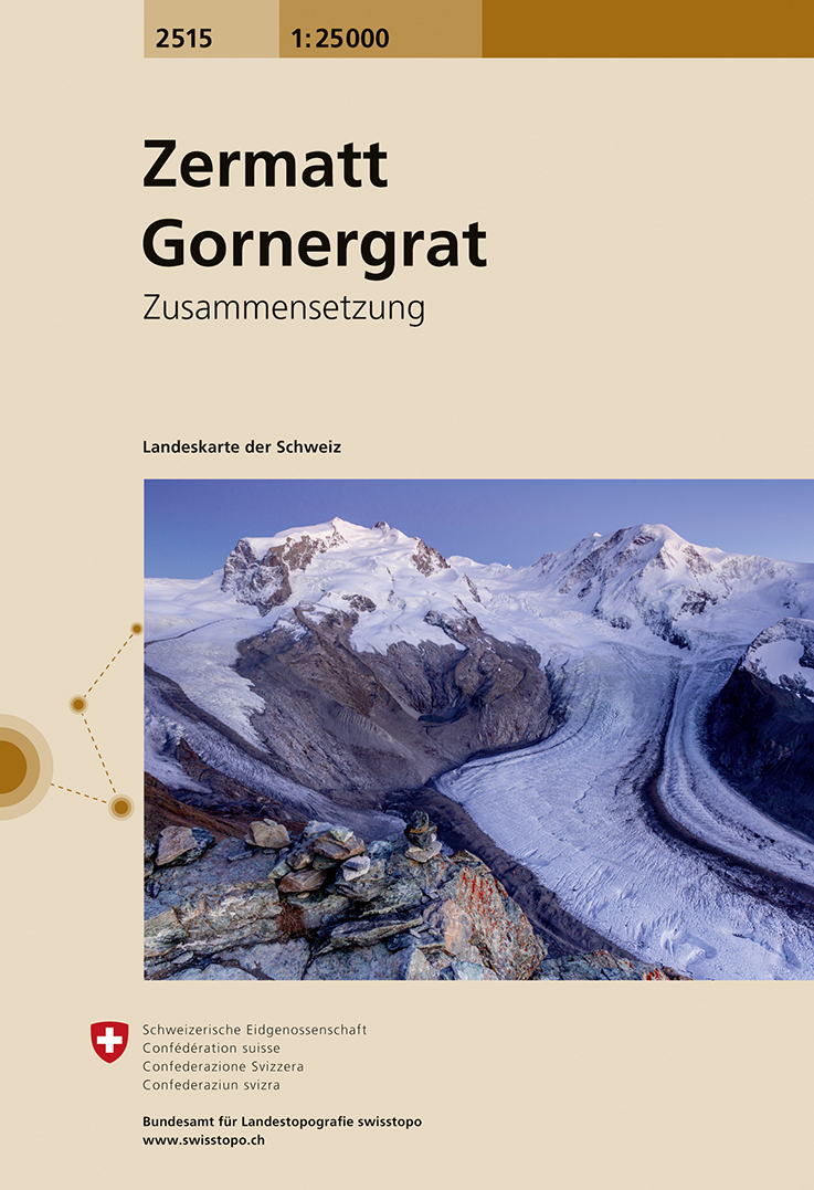
- Zermatt - Gornergrat Swisstopo 2515
- Map No. 2515, Zermatt - Gornergrat, in the topographic survey of Switzerland at 1:25,000 from Swisstopo, covering the upper part of the Mattertal with Täsch and Zermatt and extending south across the peaks (Monte Rosa/Dufourspitze, Breithorn, Theodulpass, Matterhorn and Dents d’Hérens) to Breuil-Cervinia in Italy. Peaks on both sides of the... Lire la suite
- Also available from:
- De Zwerver, Netherlands
De Zwerver
Netherlands
Netherlands
- Wandelkaart - Topografische kaart 2515 Zermatt - Gornergrat | Swisstopo
- Map No. 2515, Zermatt - Gornergrat, in the topographic survey of Switzerland at 1:25,000 from Swisstopo, covering the upper part of the Mattertal with T Lire la suite

Stanfords
United Kingdom
United Kingdom
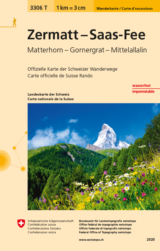
- Zermatt - Saas-Fee - Matterhorn - Gornergrat - Mittelallalin Swisstopo Hiking 3306T
- Zermatt - Saas Fee - Matterhorn - Gornergrat - Mischabel area at 1:33,333 on light, waterproof and tear-resistant map No. 3306T published by Swisstopo in cooperation with the Swiss Hiking Federation. Cartography is the same as in Swisstopo’s 50K hiking maps, simply enlarged to 1:33,333 for extra clarity but without additional information.... Lire la suite
- Also available from:
- De Zwerver, Netherlands
De Zwerver
Netherlands
Netherlands
- Wandelkaart - Topografische kaart 3306T Zermatt - Saas - Fee | Swisstopo
- Een nieuwe serie van de Zwitserse topografische dienst: eindelijk goede wandelkaarten met ingetekende wandelroutes op scheur- en watervast papier. Vooralsnog zijn ze uitgebracht van de populaire wandelgebieden en niet landelijk dekkend (zie overzicht) Op een gedetailleerde schaal van 1:33.333 met als ondergrond de onovertroffen topografische... Lire la suite