
Munros
Description
A popular hobby in the UK is "Munro bagging", the climb of as many Munros as possible. A Munro is a mountain in Scotland over 3000 feet, 914 metres, and the first list was compiled by Sir Hugh Munro in 1891. Currently there are some 290 mountains on this list.
Liens
Données
Rapports
Guides et cartes
Hébergement
Organisations
Voyagistes
GPS
Autre
Livres

Stanfords
United Kingdom
2004
United Kingdom
2004
- Western Highlands
- This guide features 40 circular walks in the mountain country of the West Highlands. The routes in this volume take from the Rough Bounds of Knoydart and the silver sands of Morar to the ridges of Kintail and the ancient forests of Glen Affric, covering all of the Munros and many other great hills. Each walk section contains a detailed route... Lire la suite

Stanfords
United Kingdom
2015
United Kingdom
2015
- Torridon Walking
- Walking in Torridon is a Cicerone guide to 52 day walks of differing grades in this area of the Scottish Highlands, including ascent routes for nine Munros, which will enable you to discover the best of remote Torridon and prepare you to range over heather, grass, rock and marsh, without paths or waymarks. Making Shieldaig its base, the book... Lire la suite

Stanfords
United Kingdom
United Kingdom
- Exploring the Nevis Range and Mamores Scotland: The Complete Guide
- Designed as the most comprehensive guide available for the hill walker exploring the Nevis and Mamore ranges in the Scottish Highlands around Fort William, this book describes in detail the best and most rewarding routes across the area, ranging from peaceful strolls through scenic glens to ascents of the principal Munros (peaks over 3000ft)... Lire la suite

Stanfords
United Kingdom
2019
United Kingdom
2019
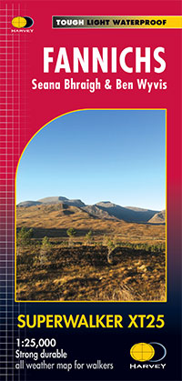
- Fannichs - Seana Bhraigh & Ben Wyvis Harvey Superwalker XT25
- Detailed map for hillwalkers of the Fannichs ridge at the popular 1:25,000 scale. This is an area located to the south of Ullapool and to the west of Dingwall. Includes the munros Sgurr Mor, Beinn Dearg and Seana Bhraigh.Includes an inset of the Munro, Ben Wyvis.Shows 17 Munros, 3 Corbetts and 3 Grahams.100% waterproof Lire la suite
- Also available from:
- The Book Depository, United Kingdom
- De Zwerver, Netherlands

De Zwerver
Netherlands
2019
Netherlands
2019
- Wandelkaart Fannichs Seana Bhraigh & Ben Wyvis | Harvey Maps
- Seana Bhraigh & Ben Wyvis Lire la suite


The Book Depository
United Kingdom
United Kingdom
- Munros and Corbetts Pocket Map
- Discover Scotland's Highest Peaks Lire la suite

The Book Depository
United Kingdom
United Kingdom
- The Ultimate Guide to the Munros
- Central Highlands South Lire la suite

- Also available from:
- De Zwerver, Netherlands

Stanfords
United Kingdom
2011
United Kingdom
2011
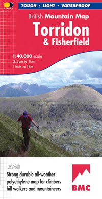
- Torridon & Fisherfield Harvey British Mountain Map XT40
- ”HARVEY British Mountain Maps are a joy to use. The detail and accuracy make them my first choice when I am researching a route or just out on the hills for fun”. Peter Macfarlane, outdoor writer and photographer.Detailed map of the giants of Torridon and the remote hills of Fisherfield on one sheet at 1:40,000 scale.Summit enlargements of... Lire la suite
- Also available from:
- The Book Depository, United Kingdom
- De Zwerver, Netherlands


The Book Depository
United Kingdom
United Kingdom
- The Ultimate Guide to the Munros
- Central Highlands North Lire la suite

The Book Depository
United Kingdom
United Kingdom
- The Ultimate Guide to the Munros
- Vol 5 - Cairngorms North Lire la suite

- Also available from:
- De Zwerver, Netherlands

Stanfords
United Kingdom
2015
United Kingdom
2015
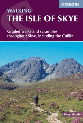
- Isle of Skye - Graded walks and Scrambles throughout the Island
- This guidebook describes 87 of the best walks and scrambles on the Isle of Skye. Not only limited to the popular routes on the Black Cuillin or Skye`s 12 Munros, the guide offers a comprehensive selection of routes in all areas of the island; in Sleat and South-East Skye, Strath, Minginish, Duirinish, Waternish and Trotternish. The routes range... Lire la suite
- Also available from:
- The Book Depository, United Kingdom
- De Zwerver, Netherlands

The Book Depository
United Kingdom
2015
United Kingdom
2015
- The Isle of Skye
- Walks and scrambles throughout Skye, including the Cuillin Lire la suite
De Zwerver
Netherlands
2015
Netherlands
2015
- Wandelgids The Isle of Skye | Cicerone
- Guidebook with 87 walks and scrambles on the Isle of Skye. Walks visit the most awe-inspiring scenery on Skye, including Sleat and South-East Skye, Strath, Minginish, Duirinish, Waternish, Trotternish and the Cuillin. Walks range from coastal walks to Munros with exposure for experienced scramblers. Includes history, geology and local information. Lire la suite

Stanfords
United Kingdom
2021
United Kingdom
2021
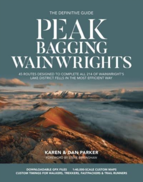
- Peak Bagging: Wainwrights: 45 routes designed to complete all 214 of Wainwright`s Lake District fells in the most efficient way
- Over fifty years ago, renowned British hillwalker and guidebook author Alfred Wainwright described 214 peaks in the English Lake District in his seven-volume illustrated Pictorial Guide to the Lakeland Fells. Like the Munros in Scotland, bagging all the Wainwrights has become a popular and significant challenge for walkers and runners, often... Lire la suite
- Also available from:
- The Book Depository, United Kingdom
- De Zwerver, Netherlands

The Book Depository
United Kingdom
2021
United Kingdom
2021
- Peak Bagging: Wainwrights
- 45 routes designed to complete all 214 of Wainwright's Lake District fells in the most efficient way Lire la suite
De Zwerver
Netherlands
2021
Netherlands
2021
- Wandelgids Peak Bagging | Vertebrate Publishing
- 45 routes designed to complete all 214 of Wainwright's Lake District fells in the most efficient way Lire la suite
Cartes

Stanfords
United Kingdom
United Kingdom
- The Munros - The Complete Collection of Maps
- In this unique and colourful volume, the deep fascination of the Munros is revealed through Harvey`s beautiful and intricate mapping. From the far reaches of Ben Hope to the mysterious Lochnagar, from the extraordinary complexity of the Cuillin Ridge of Skye to the remate A`Mhaighdean, the fearsome ridges of Liathach and the gaunt towering... Lire la suite

Stanfords
United Kingdom
United Kingdom
- Loch Lomond & the Trossachs National Park Outdoor Atlas
- Lomond & the Trossachs National Park in an indexed, A5 size, spiral-bound recreational atlas at 1:40,000 from Harvey Map Services, with additional street plans, overview maps showing local peaks or the transport links, lists of Munros and lochs, etc. Topography is shown by contours at 15m intervals, with additional colouring and/or graphics for... Lire la suite

Stanfords
United Kingdom
United Kingdom
- Two Moors Way Harvey National Trail XT40
- Two Moors Way, a 150km / 93 mile long-distance trail between Lynmouth on the north coast of Devon and Ivybridge near Plymouth, crossing Exmoor and Dartmoor National Parks, presented at 1:40,000 on a light, waterproof and tear-resistant map from Harvey Map Services. The route is shown on six panels.Maps in the Harvey’s series covering Great... Lire la suite

Stanfords
United Kingdom
United Kingdom
- Bob Graham Round in the Lakeland Fells
- Bob Graham Round, a historic 106km / 66 mile circuit across the fells of the Lake District, presented at 1:40,000 on a light, waterproof and tear-resistant map from Harvey Map Services. First completed by Bob Graham in 1932 and now a popular challenge, the route which takes in 42 Lakeland summits is presented on four overlapping panels.Maps in... Lire la suite

Stanfords
United Kingdom
United Kingdom
- Nidderdale Way
- Nidderdale Way, an 85km / 53 mile circular long-distance trail in north Yorkshire, presented at 1:40,000 on a light, waterproof and tear-resistant map from Harvey Map Services.Maps in the Harvey’s series covering Great Britain’s national trails and other long-distance footpaths are printed on light, waterproof and tear-resistant synthetic paper... Lire la suite

Stanfords
United Kingdom
United Kingdom
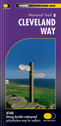
- Cleveland Way Harvey National Trail XT40
- Cleveland Way, established over 40 years ago as Britain’s second National Trail, presented at 1:40,000 on a GPS compatible, light, waterproof and tear-resistant map from Harvey Map Services. The 170km/109 miles route which starts in Helmsley, crosses the North York Moors National Park and sweeps southwards along the coast to Filey, is covered... Lire la suite
- Also available from:
- The Book Depository, United Kingdom
- De Zwerver, Netherlands

The Book Depository
United Kingdom
United Kingdom
- Cleveland Way
- Mooie, duidelijke kaart van de Cleveland Way in Noord-Engeland. Geplastificeerd met veel extra informatie en uitsnedes van de route. Leap forward in technical excellence. Tough, light and 100% waterproof Compact and light - the map itself weighs just 60gms - a third of the weight of a laminated map, and much less bulky. And you can fold or... Lire la suite
De Zwerver
Netherlands
Netherlands
- Wandelkaart Cleveland Way | Harvey Maps
- Mooie, duidelijke kaart van de Cleveland Way in Noord-Engeland. Geplastificeerd met veel extra informatie en uitsnedes van de route. Leap forward in technical excellence. Tough, light and 100% waterproof Compact and light - the map itself weighs just 60gms - a third of the weight of a laminated map, and much less bulky. And you can fold or... Lire la suite

Stanfords
United Kingdom
United Kingdom
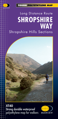
- Shropshire Way Harvey National Trail XT40
- The Shropshire Way, created from hiking trails in the county which can be combined into long-distance routes or circuits, presented at 1:40,000 on a light, waterproof and tear-resistant map from Harvey Map Services. The map presents the heart of Shropshire between Ludlow and Much Wenlock on one large panel, with an inset extending it eastwards... Lire la suite
- Also available from:
- The Book Depository, United Kingdom
- De Zwerver, Netherlands

De Zwerver
Netherlands
Netherlands
- Wandelkaart Shropshire Way | Harvey Maps
- The Shropshire Way, created from hiking trails in the county which can be combined into long-distance routes or circuits, presented at 1:40,000 on a light, waterproof and tear-resistant map from Harvey Map Services. The map presents the heart of Shropshire between Ludlow and Much Wenlock on one large panel, with an inset extending it eastwards... Lire la suite

Stanfords
United Kingdom
United Kingdom
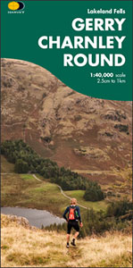
- Gerry Charnley Round in the Lakeland Fells
- Bob Graham Round, a 63km / 38 mile approx. circuit in the fells of the Lake District presented at 1:40,000 on a light, waterproof and tear-resistant map from Harvey Map Services. The circuit, first devised in 1984, includes Scafell and Scafell Pike but provides a shorter alternative to the better known and more challenging Bob Graham Round. The... Lire la suite
- Also available from:
- The Book Depository, United Kingdom
The Book Depository
United Kingdom
United Kingdom
- Gerry Charnley Round
- Bob Graham Round, a 63km / 38 mile approx. circuit in the fells of the Lake District presented at 1:40,000 on a light, waterproof and tear-resistant map from Harvey Map Services. The circuit, first devised in 1984, includes Scafell and Scafell Pike but provides a shorter alternative to the better known and more challenging Bob Graham Round. The... Lire la suite

Stanfords
United Kingdom
2020
United Kingdom
2020
- West Highland Way - Easy-to-use Folding Map and Essential Information
- The 153-kilometre West Highland Way encompasses the variety of Scotland`s wild places. The route, which begins in Milngavie and finishes in Fort William, passes from Glasgow, Scotland`s friendliest city, through lochs and forests, and across wild moors in the shadows of Munros. Offering panoramic views and clear waymarking, it is no wonder this... Lire la suite
- Also available from:
- The Book Depository, United Kingdom
- De Zwerver, Netherlands

The Book Depository
United Kingdom
2020
United Kingdom
2020
- West Highland Way
- Easy-to-use folding map and essential information, with custom itinerary planning for walkers, trekkers, fastpackers and trail runners Lire la suite

De Zwerver
Netherlands
2020
Netherlands
2020
- Wandelkaart West Highland Way | Vertebrate Publishing
- The 153-kilometre West Highland Way encompasses the variety of Scotland`s wild places. The route, which begins in Milngavie and finishes in Fort William, passes from Glasgow, Scotland`s friendliest city, through lochs and forests, and across wild moors in the shadows of Munros. Offering panoramic views and clear waymarking, it is no wonder this... Lire la suite

Stanfords
United Kingdom
2012
United Kingdom
2012
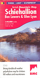
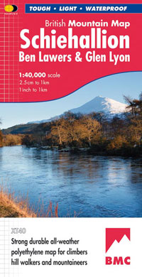
- Schiehallion - Ben Lawers & Glen Lyon Harvey British Mountain Map XT40
- Schiehallion, Ben Lawers and Glen Lyon area at 1:40,000, on a light, waterproof and tear-resistant map from Harvey, with on the reverse an extension to include Ben Chonzie, a geological map of the region, five crag diagrams with route lines/names/grades, plus advice on safely, maps reading etc. Coverage includes 27 Munros, 15 Corbets and 4... Lire la suite
- Also available from:
- The Book Depository, United Kingdom
- De Zwerver, Netherlands
The Book Depository
United Kingdom
2012
United Kingdom
2012
- Schiehallion, Ben Lawers and Glen Lyon
- Schiehallion, Ben Lawers and Glen Lyon area at 1:40,000, on a light, waterproof and tear-resistant map from Harvey, with on the reverse an extension to include Ben Chonzie, a geological map of the region, five crag diagrams with route lines/names/grades, plus advice on safely, maps reading etc. Coverage includes 27 Munros, 15 Corbets and 4... Lire la suite
De Zwerver
Netherlands
2012
Netherlands
2012
- Wandelkaart Schiehallion / Ben Lawers & Glen Lyon | Harvey Maps
- Schiehallion, Ben Lawers and Glen Lyon area at 1:40,000, on a light, waterproof and tear-resistant map from Harvey, with on the reverse an extension to include Ben Chonzie, a geological map of the region, five crag diagrams with route lines/names/grades, plus advice on safely, maps reading etc. Coverage includes 27 Munros, 15 Corbets and 4... Lire la suite

Stanfords
United Kingdom
United Kingdom
- Great Glen Way Harvey National Trail XT40
- Great Glen Way, a 126km/79 miles trail from Fort William along Loch Ness to Inverness, presented at 1:40,000 on a light, waterproof and tear-resistant map from Harvey Map Services. The whole route is covered on four overlapping panels, and includes street plans of Fort William (showing the start/end of the West Highland Way) and Inverness. Map... Lire la suite
- Also available from:
- The Book Depository, United Kingdom
- De Zwerver, Netherlands

The Book Depository
United Kingdom
United Kingdom
- Great Glen Way
- Great Glen Way, a 126km/79 miles trail from Fort William along Loch Ness to Inverness, presented at 1:40,000 on a light, waterproof and tear-resistant map from Harvey Map Services. The whole route is covered on four overlapping panels, and includes street plans of Fort William (showing the start/end of the West Highland Way) and Inverness. Map... Lire la suite

De Zwerver
Netherlands
Netherlands
- Wandelkaart Great Glen Way | Harvey Maps
- Great Glen Way, a 126km/79 miles trail from Fort William along Loch Ness to Inverness, presented at 1:40,000 on a light, waterproof and tear-resistant map from Harvey Map Services. The whole route is covered on four overlapping panels, and includes street plans of Fort William (showing the start/end of the West Highland Way) and Inverness. Map... Lire la suite

Stanfords
United Kingdom
United Kingdom
- The Great Trossachs Path Harvey National Trail XT40
- The Great Trossachs Path, a 48km / 30 mile long spur off the West Highlight Way linking Inversnaid on Lomond with Callander presented at 1:40,000 on a GPS compatible, light, waterproof and tear-resistant map from Harvey Map Services. The route which runs along the shores of Loch Arklet, Loch Katrine, Loch Achray and Loch Venachar and links in... Lire la suite
- Also available from:
- The Book Depository, United Kingdom
- De Zwerver, Netherlands

The Book Depository
United Kingdom
United Kingdom
- The Great Trossachs Path
- and the Great Trossachs Forest Lire la suite

De Zwerver
Netherlands
Netherlands
- Wandelkaart The Great Trossachs Path | Harvey Maps
- The Great Trossachs Path, a 48km / 30 mile long spur off the West Highlight Way linking Inversnaid on Lomond with Callander presented at 1:40,000 on a GPS compatible, light, waterproof and tear-resistant map from Harvey Map Services. The route which runs along the shores of Loch Arklet, Loch Katrine, Loch Achray and Loch Venachar and links in... Lire la suite

Stanfords
United Kingdom
United Kingdom
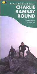
- Charlie Ramsay Round: Ben Nevis, Grey Corries and Mamores
- Charlie Ramsay Round, a route from the Ben Nevis Youth Hostel across the peak itself and 23 more summits including the Grey Corries and Mamores ranges, presented at 1:40,000 on a contoured, GPS compatible map from Harvey Map Services, printed on light, waterproof and tear-resistant paper. Contours are at 15m intervals enhanced by graphic relief... Lire la suite
- Also available from:
- The Book Depository, United Kingdom
The Book Depository
United Kingdom
United Kingdom
- Charlie Ramsay Round
- Charlie Ramsay Round, a route from the Ben Nevis Youth Hostel across the peak itself and 23 more summits including the Grey Corries and Mamores ranges, presented at 1:40,000 on a contoured, GPS compatible map from Harvey Map Services, printed on light, waterproof and tear-resistant paper. Contours are at 15m intervals enhanced by graphic relief... Lire la suite

Stanfords
United Kingdom
United Kingdom
- Rob Roy Way Harvey National Trail XT40
- Rob Roy Way, one of Scotland’s Great Trails from Drymen just north of Glasgow along Loch Tay to Pitlochry on the edge of the Cairngorms National Park presented at 1:40,000 on a light, waterproof and tear-resistant map from Harvey Map Services. The whole route, either 124km/77 miles or 151km/94 miles long depending on which variant one follows,... Lire la suite
- Also available from:
- The Book Depository, United Kingdom
- De Zwerver, Netherlands

The Book Depository
United Kingdom
United Kingdom
- Rob Roy Way
- Mooie, duidelijke kaart van de Rob Roy Way in Schotland. Geplastificeerd met veel extra informatie en uitsnedes van de route. One of Scotland's Great Trails Rob Roy Way is a walk across part of the Southern Highlands of Scotland taking in some of the most beautiful countryside in the UK. Starting from Drymen it goes north east to finish in... Lire la suite

De Zwerver
Netherlands
Netherlands
- Wandelkaart Rob Roy Way | Harvey Maps
- Mooie, duidelijke kaart van de Rob Roy Way in Schotland. Geplastificeerd met veel extra informatie en uitsnedes van de route. One of Scotland's Great Trails Rob Roy Way is a walk across part of the Southern Highlands of Scotland taking in some of the most beautiful countryside in the UK. Starting from Drymen it goes north east to finish in... Lire la suite
Stanfords
United Kingdom
United Kingdom
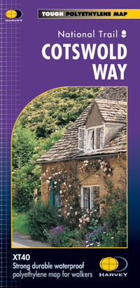
- Cotswold Way Harvey National Trail XT40
- The Cotswold Way, a 164km / 102 mile National Trail from Chipping Campden in the north to Bath in the south, presented at 1:40,000 on a light, waterproof and tear-resistant map from Harvey Map Services. The route is shown on nine panels, with additional small street plans of Chipping Campden and Bath.Maps in the Harvey’s series covering Great... Lire la suite
- Also available from:
- The Book Depository, United Kingdom
- De Zwerver, Netherlands

The Book Depository
United Kingdom
United Kingdom
- Cotswold Way
- The Cotswold Way, a 164km / 102 mile National Trail from Chipping Campden in the north to Bath in the south, presented at 1:40,000 on a light, waterproof and tear-resistant map from Harvey Map Services. The route is shown on nine panels, with additional small street plans of Chipping Campden and Bath.Maps in the Harvey Lire la suite

De Zwerver
Netherlands
Netherlands
- Wandelkaart Cotswold Way | Harvey Maps
- The Cotswold Way, a 164km / 102 mile National Trail from Chipping Campden in the north to Bath in the south, presented at 1:40,000 on a light, waterproof and tear-resistant map from Harvey Map Services. The route is shown on nine panels, with additional small street plans of Chipping Campden and Bath.Maps in the Harvey Lire la suite