
Stanfords
United Kingdom
- Styrian Winelands - Southwest Styria F&B WK411
- Styrian Winelands area south-eastern Austria presented at 1:50,000 in a series of contoured and GPS compatible outdoor leisure map from Freytag & Berndt with hiking and cycling routes, mountain huts, campsites and youth hostels, local bus stops, plus other tourist information. To see the list of currently available titles in this series please... Lire la suite

Stanfords
United Kingdom
- Goms - Aletsch
- Goms - Aletsch area of the Bernese Oberland at 1:50,000 in a series from Hallwag covering Switzerland’s popular hiking regions on light, waterproof and tear-resistant maps highlighting long-distance paths: the nine national routes plus special regional routes, as well as other local hiking trails.Cartography is similar to that used both in... Lire la suite

Stanfords
United Kingdom
- Texelgruppe NP - Merano High Route Kompass 043
- Map No. 043, Texelgruppe NP - Merano High Route, from Kompass, printed on strudy waterproof and tear-resistant plastic paper in a series providing detailed coverage of the Dolomites and Lake Garda area and supplementing their main series of walking maps of Italy at 1:50,000. Maps in this series have a more detailed base and smaller contour... Lire la suite

Stanfords
United Kingdom
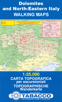
- Val de Peio - Val di Rabbi - Val di Sole Tabacco 048
- Val de Peio - Val di Rabbi - Val di Sole area in a series of Tabacco maps at 1:25,000 covering the Dolomites and the mountains of north-eastern Italy - Stanfords’ most popular coverage for this region, with excellent cartography and extensive overprint for hiking routes and other recreational activities, local bus stops, etc. Additional... Lire la suite

Stanfords
United Kingdom
- Valsugana - Trento - Piné - Levico - Lavarone Kompass 75
- Valsugana - Trento - Piné - Levico – Lavarone area of southern Dolomites on a GPS compatible hiking and recreational map at 1:50,000 from Kompass, printed on durable, waterproof and tear-resistant synthetic paper. On the reverse is a panorama of the Trentino region, extending from Monte Baldo and the northern part of Lake Garda northwards to... Lire la suite

Stanfords
United Kingdom
- Val di Fassa - Dolomiti Fassane Tabacco 06
- Val di Fassa - Dolomiti Fassane area in a series of Tabacco maps at 1:25,000 covering the Dolomites and the mountains of north-eastern Italy - Stanfords’ most popular coverage for this region, with excellent cartography and extensive overprint for hiking routes and other recreational activities, local bus stops, etc. Additional overprint in... Lire la suite

Stanfords
United Kingdom
- South Tyrol - Dolomites 4-Map Set Kompass 699
- Map No. 699, South Tyrol - Dolomites (4-map set) including a panorama map, from Kompass in a series of walking maps of selected areas of Italy at 1:50,000, with hiking routes on a topographic base, various types of accommodation, recreational facilities, places of interest, etc. Kompass are Europe’s largest publishers of walking maps, with... Lire la suite
Stanfords
United Kingdom
- Monti de Valle Aurina / Ahrntaler Berge Kompass 082
- Map No. 082, Monti de Valle Aurina/Ahrntaler Berge , from Kompass in a series providing detailed coverage of the Dolomites and Lake Garda area and supplementing their main series of walking maps of Italy at 1:50,000. Maps in this series have a more detailed base and smaller contour interval than coverage at 1:50,000.*Cartography:* maps at... Lire la suite

Stanfords
United Kingdom

Stanfords
United Kingdom
- Lake Maggiore - Lake Orta - Lake Varese K+F Outdoor Map 8
- Lake Maggiore - Lake Orta - Lake Varese area at 1:50,000 in a series of waterproof and tear-resistant, GPS compatible and contoured recreational maps from Kümmerly + Frey with both local and long-distance hiking and cycling trails, ski routes, sites for other outdoor pursuits, accommodation, bus stops, etc. An inset provides a small road map of... Lire la suite
Stanfords
United Kingdom
- Dolomiti di Braies / Pragser Dolomiten - Marebbe / Ennberg Tabacco 031
- Dolomiti di Braies/Pragser Dolomiten - Marebbe/Ennberg area in a series of Tabacco maps at 1:25,000 covering the Dolomites and the mountains of north-eastern Italy - Stanfords’ most popular coverage for this region, with excellent cartography and extensive overprint for hiking routes and other recreational activities, local bus stops, etc.... Lire la suite

Stanfords
United Kingdom
Stanfords
United Kingdom
- Monte Baldo - Altipiano di Brentonico - Malcesine Kompass 129
- Map No. 129, Monte Baldo, at 1:25,000 on a double-sided map from Kompass, printed on sturdy waterproof and tear-resistant synthetic paper and covering an area to the east of the northern part of Lake Garda.This title is part of a series of Kompass maps providing detailed coverage of the Dolomites and Lake Garda area, supplementing their main... Lire la suite

Stanfords
United Kingdom
- Alpe Veglia and Alpe Devero NP - Valle Antigorio - Val Formazza Kompass 89
- Map No. 89, Domodóssola, from Kompass, printed on waterproof and tear-resistant synthetic paper in a series of walking maps of selected areas of Italy at 1:50,000, with hiking routes on a topographic base, various types of accommodation, recreational facilities, places of interest, etc. Kompass are Europe’s largest publishers of walking maps,... Lire la suite

Stanfords
United Kingdom
- Perugia - Assisi - Città di Castello - Gubbio Kompass 2464
- Perugia - Assisi - Città di Castello – Gubbio area in Umbria and the Marches on a double-sided, GPS compatible hiking and recreational map at 1:50,000 from Kompass on durable, waterproof and tear-resistant synthetic paper. Contours are at 40m intervals, with a 2-km UTM grid. In addition to the region’s numerous local hiking trails and several... Lire la suite