
Stanfords
United Kingdom
- Son Parc - Menorca CNIG Topo 619-3
- Topographic coverage of the Balearic Islands at 1:25,000 published by the Instituto Geográfico Nacional – Centro Nacional de Información Geografica, the country’s civilian survey organization. The maps have contours at 10m intervals and colouring and/or graphics to show different types of vegetation or land use. Boundaries of national parks and... Lire la suite

Stanfords
United Kingdom
- Soller CNIG Topo 670
- Topographic coverage of the Balearic Islands at 1:50,000 in the MTN50 (Mapa Topográfico Nacional) series from the Instituto Geográfico Nacional – Centro Nacional de Información Geografica, the country’s civilian survey organization. The maps have contours at 20m intervals, enhanced by relief shading, plus colouring and/or graphics to show... Lire la suite
Stanfords
United Kingdom
- Cala en Porter 25K Menorca CNIG Topographic Survey Map No. 646-IV
- Topographic coverage of the Balearic Islands at 1:25,000 published by the Instituto Geográfico Nacional – Centro Nacional de Información Geografica, the country’s civilian survey organization. The maps have contours at 10m intervals and colouring and/or graphics to show different types of vegetation or land use. Boundaries of national parks and... Lire la suite
Stanfords
United Kingdom
- Illa de L`Aire CNIG Topo 673
- Topographic coverage of the Balearic Islands at 1:50,000 in the MTN50 (Mapa Topográfico Nacional) series from the Instituto Geográfico Nacional – Centro Nacional de Información Geografica, the country’s civilian survey organization. The maps have contours at 20m intervals, enhanced by relief shading, plus colouring and/or graphics to show... Lire la suite
Stanfords
United Kingdom
- Soller CNIG Topo 670-2
- Topographic coverage of the Balearic Islands at 1:25,000 published by the Instituto Geográfico Nacional – Centro Nacional de Información Geografica, the country’s civilian survey organization. The maps have contours at 10m intervals and colouring and/or graphics to show different types of vegetation or land use. Boundaries of national parks and... Lire la suite
Stanfords
United Kingdom
- Campos CNIG 25K Topographic Map 724-2
- Topographic coverage of the Balearic Islands at 1:25,000 published by the Instituto Geográfico Nacional – Centro Nacional de Información Geografica, the country’s civilian survey organization. The maps have contours at 10m intervals and colouring and/or graphics to show different types of vegetation or land use. Boundaries of national parks and... Lire la suite
Stanfords
United Kingdom
- Manacor CNIG Topographic Map 700-3
- Topographic coverage of the Balearic Islands at 1:25,000 published by the Instituto Geográfico Nacional – Centro Nacional de Información Geografica, the country’s civilian survey organization. The maps have contours at 10m intervals and colouring and/or graphics to show different types of vegetation or land use. Boundaries of national parks and... Lire la suite
Stanfords
United Kingdom
- Sant Joan de Labritja 25K Ibiza CNIG Topographic Survey Map No. 773-III
- Topographic coverage of the Balearic Islands at 1:25,000 published by the Instituto Geográfico Nacional – Centro Nacional de Información Geografica, the country’s civilian survey organization. The maps have contours at 10m intervals and colouring and/or graphics to show different types of vegetation or land use. Boundaries of national parks and... Lire la suite
Stanfords
United Kingdom
- San Antoni de Portmany 25K Ibiza CNIG Topographic Survey Map No. 798-I
- Topographic coverage of the Balearic Islands at 1:25,000 published by the Instituto Geográfico Nacional – Centro Nacional de Información Geografica, the country’s civilian survey organization. The maps have contours at 10m intervals and colouring and/or graphics to show different types of vegetation or land use. Boundaries of national parks and... Lire la suite
Stanfords
United Kingdom
- Ila de Cabrera CNIG Topo 774
- Topographic coverage of the Balearic Islands at 1:50,000 in the MTN50 (Mapa Topográfico Nacional) series from the Instituto Geográfico Nacional – Centro Nacional de Información Geografica, the country’s civilian survey organization. The maps have contours at 20m intervals, enhanced by relief shading, plus colouring and/or graphics to show... Lire la suite
Stanfords
United Kingdom
- Galatzo 25K Mallorca CNIG Topographic Survey Map No. 697-II
- Topographic coverage of the Balearic Islands at 1:25,000 published by the Instituto Geográfico Nacional – Centro Nacional de Información Geografica, the country’s civilian survey organization. The maps have contours at 10m intervals and colouring and/or graphics to show different types of vegetation or land use. Boundaries of national parks and... Lire la suite
Stanfords
United Kingdom
- Inca CNIG Topo 671
- Topographic coverage of the Balearic Islands at 1:50,000 in the MTN50 (Mapa Topográfico Nacional) series from the Instituto Geográfico Nacional – Centro Nacional de Información Geografica, the country’s civilian survey organization. The maps have contours at 20m intervals, enhanced by relief shading, plus colouring and/or graphics to show... Lire la suite
Stanfords
United Kingdom
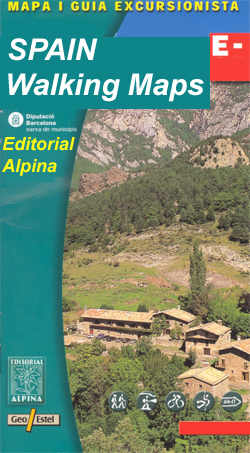
- Serra de Tramuntana Editorial Alpina 4-Map Set
- Mallorca’s Serra de Tramuntana mountains presented by Editorial Alpina at 1:25,000 on a set of two light, waterproof and tear-resistant, contoured and GPS compatible, double-sided maps with an overprint for local hiking trails, GR221 long-distance route, sites for various outdoor activities, accommodation options, etc. Coverage extends from... Lire la suite
Stanfords
United Kingdom
- Es Grau 25K Menorca CNIG Topographic Survey Map No. 647-I
- Topographic coverage of the Balearic Islands at 1:25,000 published by the Instituto Geográfico Nacional – Centro Nacional de Información Geografica, the country’s civilian survey organization. The maps have contours at 10m intervals and colouring and/or graphics to show different types of vegetation or land use. Boundaries of national parks and... Lire la suite
Stanfords
United Kingdom
- Sant Miguel de Balansat CNIG Topo 722
- Topographic coverage of the Balearic Islands at 1:50,000 in the MTN50 (Mapa Topográfico Nacional) series from the Instituto Geográfico Nacional – Centro Nacional de Información Geografica, the country’s civilian survey organization. The maps have contours at 20m intervals, enhanced by relief shading, plus colouring and/or graphics to show... Lire la suite