
Stanfords
United Kingdom
- Cap de Creus Park Natural Editorial Alpina
- Cap de Creus Natural Park on the Costa Brava at 1:25,000 on a contoured and GPS compatible map from Editorial Alpina, plus a booklet which includes English language descriptions several recommended hiking trails, accommodation details, etc.Topography is presented by contours at10m intervals with relief shading and plenty of spot heights, plus... Lire la suite

Stanfords
United Kingdom
- Lamego
- Topographic survey of Portugal at 1:100,000 from the Instituto Geográfico Português, the country’s civilian survey organisation. The maps have contours at 50m intervals and in addition to the standard features shown on topographic mapping at this scale also indicate various types of vegetation (vineyards, olive groves, etc). Each sheet covers... Lire la suite
- Also available from:
- Stanfords, United Kingdom
- Stanfords, United Kingdom
» Click to open
Stanfords
United Kingdom
- Lamego
- Topographic survey of Portugal at 1:50,000 from the Instituto Geográfico Português, the country’s civilian survey organisation. The maps have contours at 25m intervals and in addition to the standard features shown on topographic mapping at this scale also indicate various types of vegetation (vineyards, olive groves, etc). Each sheet covers an... Lire la suite

Stanfords
United Kingdom
- Lamego
- Topographic survey of Portugal at 1:50,000 from the Instituto Geográfico do Exército, the country’s military survey organisation. The maps have contours at 20m intervals and in addition to the standard features shown on topographic mapping at this scale also indicate various types of terrain or vegetation (sand, terraces, rocks, woodlands,... Lire la suite

Stanfords
United Kingdom
- Leiria
- Topographic survey of Portugal at 1:50,000 from the Instituto Geográfico do Exército, the country’s military survey organisation. The maps have contours at 20m intervals and in addition to the standard features shown on topographic mapping at this scale also indicate various types of terrain or vegetation (sand, terraces, rocks, woodlands,... Lire la suite
Stanfords
United Kingdom
- Mertola
- Topographic survey of Portugal at 1:100,000 from the Instituto Geográfico Português, the country’s civilian survey organisation. The maps have contours at 50m intervals and in addition to the standard features shown on topographic mapping at this scale also indicate various types of vegetation (vineyards, olive groves, etc). Each sheet covers... Lire la suite
Stanfords
United Kingdom
- Mertola
- Topographic survey of Portugal at 1:50,000 from the Instituto Geográfico Português, the country’s civilian survey organisation. The maps have contours at 25m intervals and in addition to the standard features shown on topographic mapping at this scale also indicate various types of vegetation (vineyards, olive groves, etc). Each sheet covers an... Lire la suite
Stanfords
United Kingdom
- Portos
- Topographic survey of Portugal at 1:50,000 from the Instituto Geográfico do Exército, the country’s military survey organisation. The maps have contours at 20m intervals and in addition to the standard features shown on topographic mapping at this scale also indicate various types of terrain or vegetation (sand, terraces, rocks, woodlands,... Lire la suite
Stanfords
United Kingdom
- Marvao
- Topographic survey of Portugal at 1:50,000 from the Instituto Geográfico Português, the country’s civilian survey organisation. The maps have contours at 25m intervals and in addition to the standard features shown on topographic mapping at this scale also indicate various types of vegetation (vineyards, olive groves, etc). Each sheet covers an... Lire la suite
- Also available from:
- Stanfords, United Kingdom
- Stanfords, United Kingdom
» Click to openStanfords
United Kingdom
- Marvao
- Topographic survey of Portugal at 1:100,000 from the Instituto Geográfico Português, the country’s civilian survey organisation. The maps have contours at 50m intervals and in addition to the standard features shown on topographic mapping at this scale also indicate various types of vegetation (vineyards, olive groves, etc). Each sheet covers... Lire la suite
Stanfords
United Kingdom
- Marvao
- Topographic survey of Portugal at 1:50,000 from the Instituto Geográfico do Exército, the country’s military survey organisation. The maps have contours at 20m intervals and in addition to the standard features shown on topographic mapping at this scale also indicate various types of terrain or vegetation (sand, terraces, rocks, woodlands,... Lire la suite
Stanfords
United Kingdom
- Santiago do Cacem
- Topographic survey of Portugal at 1:100,000 from the Instituto Geográfico Português, the country’s civilian survey organisation. The maps have contours at 50m intervals and in addition to the standard features shown on topographic mapping at this scale also indicate various types of vegetation (vineyards, olive groves, etc). Each sheet covers... Lire la suite
Stanfords
United Kingdom
- Santiago do Cacem
- Topographic survey of Portugal at 1:50,000 from the Instituto Geográfico do Exército, the country’s military survey organisation. The maps have contours at 20m intervals and in addition to the standard features shown on topographic mapping at this scale also indicate various types of terrain or vegetation (sand, terraces, rocks, woodlands,... Lire la suite

Stanfords
United Kingdom
- Cuba
- Topographic survey of Portugal at 1:50,000 from the Instituto Geográfico Português, the country’s civilian survey organisation. The maps have contours at 25m intervals and in addition to the standard features shown on topographic mapping at this scale also indicate various types of vegetation (vineyards, olive groves, etc). Each sheet covers an... Lire la suite

Stanfords
United Kingdom
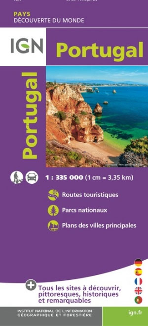
- Portugal IGN POR01
- Topographic survey of France at 1:25,000 in IGN`s excellent TOP25 / Série Bleue series. All the maps are GPS compatible, with a 1km UTM grid plus latitude and longitude lines at 5’ intervals. Contours are at 5m intervals except for mountainous areas where the maps have contours at 10m intervals, vividly enhanced by hill shading and graphics for... Lire la suite
Stanfords
United Kingdom
- Villa Real de Santo Antonio
- Topographic survey of Portugal at 1:50,000 from the Instituto Geográfico Português, the country’s civilian survey organisation. The maps have contours at 25m intervals and in addition to the standard features shown on topographic mapping at this scale also indicate various types of vegetation (vineyards, olive groves, etc). Each sheet covers an... Lire la suite
Stanfords
United Kingdom
- Braga
- Topographic survey of Portugal at 1:100,000 from the Instituto Geográfico Português, the country’s civilian survey organisation. The maps have contours at 50m intervals and in addition to the standard features shown on topographic mapping at this scale also indicate various types of vegetation (vineyards, olive groves, etc). Each sheet covers... Lire la suite
- Also available from:
- Stanfords, United Kingdom
- Stanfords, United Kingdom
» Click to openStanfords
United Kingdom
- Braga
- Topographic survey of Portugal at 1:50,000 from the Instituto Geográfico Português, the country’s civilian survey organisation. The maps have contours at 25m intervals and in addition to the standard features shown on topographic mapping at this scale also indicate various types of vegetation (vineyards, olive groves, etc). Each sheet covers an... Lire la suite
Stanfords
United Kingdom
- Braga
- Topographic survey of Portugal at 1:50,000 from the Instituto Geográfico do Exército, the country’s military survey organisation. The maps have contours at 20m intervals and in addition to the standard features shown on topographic mapping at this scale also indicate various types of terrain or vegetation (sand, terraces, rocks, woodlands,... Lire la suite
Stanfords
United Kingdom
Stanfords
United Kingdom
- Mirandela
- Topographic survey of Portugal at 1:50,000 from the Instituto Geográfico Português, the country’s civilian survey organisation. The maps have contours at 25m intervals and in addition to the standard features shown on topographic mapping at this scale also indicate various types of vegetation (vineyards, olive groves, etc). Each sheet covers an... Lire la suite
Stanfords
United Kingdom
- Mirandela
- Topographic survey of Portugal at 1:50,000 from the Instituto Geográfico do Exército, the country’s military survey organisation. The maps have contours at 20m intervals and in addition to the standard features shown on topographic mapping at this scale also indicate various types of terrain or vegetation (sand, terraces, rocks, woodlands,... Lire la suite

Stanfords
United Kingdom
- Vinhais
- Topographic survey of Portugal at 1:50,000 from the Instituto Geográfico do Exército, the country’s military survey organisation. The maps have contours at 20m intervals and in addition to the standard features shown on topographic mapping at this scale also indicate various types of terrain or vegetation (sand, terraces, rocks, woodlands,... Lire la suite
Stanfords
United Kingdom
- Guarda
- Topographic survey of Portugal at 1:100,000 from the Instituto Geográfico Português, the country’s civilian survey organisation. The maps have contours at 50m intervals and in addition to the standard features shown on topographic mapping at this scale also indicate various types of vegetation (vineyards, olive groves, etc). Each sheet covers... Lire la suite
Stanfords
United Kingdom
- Guarda
- Topographic survey of Portugal at 1:50,000 from the Instituto Geográfico Português, the country’s civilian survey organisation. The maps have contours at 25m intervals and in addition to the standard features shown on topographic mapping at this scale also indicate various types of vegetation (vineyards, olive groves, etc). Each sheet covers an... Lire la suite