Mariazeller Wege - 6
Description
- Name Mariazeller Wege - 6 (WWW06)
- Distance de sentier 1,014 km, 630 milles
- Durée en jours 50 jours
- Fin de sentier Mariazell
- Classement Traildino MW, Marche modérée, sentier de randonnée
- Classement Traversée de montagne T1, Randonnée
Mariazeller Wege, 1014 km, Weitwanderweg 6
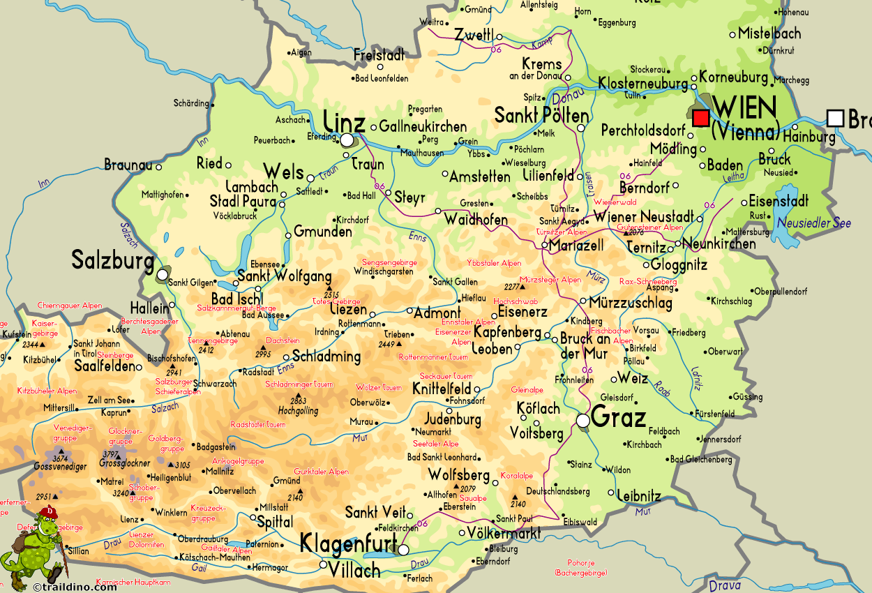
Mariazell is a traditional pilgrimage destination in Austria. Different century old routes radiate from this village to the corners of Austria and even beyond. So, long distance trail 6 is not one long trail, but consists of many shorter ones, clockwise:
- Salzburger Mariazellerweg, 310 km
- Oberösterreichischer Mariazellerweg, starting in Linz, 175 km
- Niederösterreichischer Mariazellerweg, starting in Nebelstein, 255 km
- Wiener Mariazellerweg, starting in Wien, 125 km
- Burgenländischer Mariazellerweg, starting in Eisenstadt, 145 km
- Steirischer Mariazellerweg, starting in Eibiswald and alternatives from Voaru Stift and Pöllauberg, 215 km
- Kärntner Mariazellerweg, starting in Klagenfurt till Eibiswald, 135 km, continuing as Steirischer Mariazellerweg to Mariazell
The tracks and small roads do not venture out into high Alpine lands. Even so, they do pass along many pilgrimage sites in mountain villages and on mountain passes. These trails combine elements of religiosity and history with pastoral country.
You will find more pilgrimage roads in Austria. Like the Via Sacra, a alternative to the Wiener Mariazellerweg, starting in Bratislava and leading to Mariazell. Then there also is the Gründerweg, starting in St. Lambrecht and leading to Mariazell.
Carte
Liens
Données
Rapports
Guides et cartes
Hébergement
Organisations
Voyagistes
GPS
Autre
Livres

Netherlands
- WF5640 Mariazeller Land und Mostviertel Kompass
- zahlr. Touren mit Top-Routenkarten und HöhenprofilenDe Kompass wandelgids + kaart geeft een overzicht van alle wandelroutes in het gebied met nauwkeurige routeaanwijzingen en hoogteaanduidingen, De extra grote kaart, schaal 1:35 000, is ideaal om van te voren uw route uit te stippelen en om onderweg te gebruiken • naast de bekende bestemmingen,... Lire la suite
- Also available from:
- Bol.com, Belgium

Belgium
- WF5640 Mariazeller Land und Mostviertel Kompass
- zahlr. Touren mit Top-Routenkarten und HöhenprofilenDe Kompass wandelgids + kaart geeft een overzicht van alle wandelroutes in het gebied met nauwkeurige routeaanwijzingen en hoogteaanduidingen, De extra grote kaart, schaal 1:35 000, is ideaal om van te voren uw route uit te stippelen en om onderweg te gebruiken • naast de bekende bestemmingen,... Lire la suite
Cartes

United Kingdom
- Zirbitzkogel-Grebenzen Nature Park – Murau – Sölkpass F&B WK211
- Zirbitzkogel NP - Grebenzen - Murau - Solkpass area of the Austrian Alps presented at 1:50,000 in a series of contoured and GPS compatible outdoor leisure map from Freytag & Berndt with hiking and cycling routes, mountain huts, campsites and youth hostels, local bus stops, plus other tourist information.To see the list of currently available... Lire la suite


