
GR10 - Traversée des Pyrénées
Description
- Name GR10 - Traversée des Pyrénées (GR10)
- Distance de sentier 866 km, 538 milles
- Durée en jours 58 jours
- Début de sentier Hendaye
- Fin de sentier Banyuls-sur-Mer
- Classement Traildino SW, Marche fatigante, sentier de montagne
- Classement Traversée de montagne T2, randonnée en montagne


GR10, Hendaye (Atlantique) - Banyuls-sur-Mer (Mediterranean) through the Pyrenees, 866 km, 7 weeks
Few trails have the magic sound the GR10 has. Crossing the Pyrenees from west to east is a major accomplishment and a life-time experience. The GR20 in Corsica may be the most difficult of the Grand Randonnées; some passages are tricky indeed. The GR10 however, is hard to complete in one go. In the Pyrenees all the valleys are perpendicular to the main ridge, which means you have to go up and down, from one valley to the other. Therefore, thru-hiking the GR10 is hard.
There are those who believe in the Alps and others who believe in the Pyrenees. They rarely agree. The Pyrenees are greener, softer, lonesome, the proponents would advocate. Okay, but you get soaked all summer, the opponents would argue.
The Pyrenees are build from solid granite and some limestone in the west. You will find out yourself when scrambling these large boulders, hurting your knees with too large steps to take. Ice has had a prominent influence - although nowadays barely a glacier is left: many beautifully situated lakes, large and small, ornament the high altitudes.
Another feature are the dense forests the hiker crosses. In them, dead villages are quit common. Once, large populations lived here. But they left. With them sheep flocks and brown bears. Bears have been reintroduced, but with mixed success and support.
Hiking the path is facilitated by the many Gîtes d'Étappe in the small villages. Often, small shops still cater for the necessary provisions. Many cabanes, or bothies, still survive. Do not expect any luxury however, though company from mice is common. Tourism boomed in many parts, especially the Nature Parks, but is completely absent elsewhere.
Note the Pyrenees have many smaller, often circular trails, or variants to the GR10, often no less attractive. Note also that an even harder trail exists: the Haute Randonnée Pyrénéenne, following the main ridge. This HRP requires some mountaineering skills and can be undertaken from july onwards. The GR10 is by and large safe. On the Spanish side the GR11 explores some of the better parts of these mountains. The Spanish side gets much less rain. On the other side, the trail here is probably harder than the French side.
Carte


Liens
Données
Rapports
Guides et cartes
Hébergement
Organisations
Voyagistes
GPS
Autre
Livres

United Kingdom
2018
- Val d`Azun à pied ST10
- Val d`Azun à pied, FFRP topo-guide Ref. No. ST10, with 18 day walks of varying length and difficulty in the French Pyrenees south-west of Argelès-Gazost, plus a tour which includes part of the GR10 long-distance footpaths. Each walk is presented on a separate colour extract from IGN’s topographic survey of France at 1:25,000 and/or 1:50,000,... Lire la suite

United Kingdom
2020
- Tour du Larzac, Templier - Hospitalier - Entre causses et vallées GR71C/GR71D
- Tour du Larzac - Templier et Hospitalier, FFRP topoguide Ref. No. 710, covering the 195kms of hiking circuits along the GR71C and GR71D south of Millau in the Causse du Larzac, plus 13 local day walks. Current edition of this title was published in December 2015.ABOUT THE FFRP (Fédération française de la randonnée pédestre) TOPOGUIDES:... Lire la suite

United Kingdom
- GR3: Les Monts du Forez FFRP Topo-guide No. 334
- Les Monts du Forez, FFRP topoguide Ref. No. 334, covering in all 259kms along the GR3 and its variant, with additional descriptions of 21 day walks in the region. Current edition of this title was published in April 2016.ABOUT THE FFRP (Fédération française de la randonnée pédestre) TOPOGUIDES: published in a handy A5 paperback format, the... Lire la suite
United Kingdom
2020
- Les Abers - le Chemin de Phares GR34/GR34F
- Les Abers - le chemin de phares, FFRP topoguide Ref. no. 347, covering the coastal route in north-western Brittany between Morlaix, Brest, and le Fau, plus 4 walks on the Ile d`Ouessant. Current edition of this title was published in September 2017.Between Morlaix and Brest, where the sea has dug deep furrows in the land. More than 20 days of... Lire la suite

United Kingdom
2021
- Also available from:
- De Zwerver, Netherlands


- Also available from:
- De Zwerver, Netherlands


United Kingdom
2021

- Also available from:
- De Zwerver, Netherlands

Netherlands
2022
- Wandelgids Pyrenean Haute Route - a high level trail, Pyreneeën HRP | Cicerone
- Guidebook to trekking the Pyrenean Haute Route, which zigzags across the Franco-Spanish border, staying close to the main ridge in the highest and most spectacular central Pyrenees. It covers 750km with over 40km of ascent, so is suitable for experienced mountain walkers only. The largely unwaymarked route is presented in 45 stages. Lire la suite

United Kingdom
- Vignemale - Valle de Bujaruelo Editorial Alpina
- Cross-border area of the Pyrenees at 1:25,000 on a contoured and GPS compatible map covering on the Spanish side the valleys of Bujaruelo and Ara with the western section of the Ordesa National Park and the Ordesa Valley, and within France extending from the Vignemale Massif to Gavarnie, plus a Spanish/French booklet with recommendations for... Lire la suite
- Also available from:
- The Book Depository, United Kingdom
- De Zwerver, Netherlands

United Kingdom
- Vignemale - Valle de Bujaruelo
- Cross-border area of the Pyrenees at 1:25,000 on a contoured and GPS compatible map covering on the Spanish side the valleys of Bujaruelo and Ara with the western section of the Ordesa National Park and the Ordesa Valley, and within France extending from the Vignemale Massif to Gavarnie, plus a Spanish/French booklet with recommendations for... Lire la suite

Netherlands
- Wandelkaart 06 Vignemale - Valle de Bujaruelo | Editorial Alpina
- Cross-border area of the Pyrenees at 1:25,000 on a contoured and GPS compatible map covering on the Spanish side the valleys of Bujaruelo and Ara with the western section of the Ordesa National Park and the Ordesa Valley, and within France extending from the Vignemale Massif to Gavarnie, plus a Spanish/French booklet with recommendations for... Lire la suite

United Kingdom
2019
- Shorter Treks in the Pyrenees
- 7 great one and two week circular treks Lire la suite
- Also available from:
- De Zwerver, Netherlands

Netherlands
2019
- Wandelgids Shorter Treks in the Pyrenees | Cicerone
- Guidebook detailing seven circular treks of 4-12 days in the beautiful Pyrenees. The varied routes cover both sides of the French-Spanish border and include both the High Pyrenees and the lower, more gentle mountains of the Basque Country and Catalonia. Variants are suggested for those wishing to shorten or extend the treks. Lire la suite


United Kingdom
2021
- Also available from:
- De Zwerver, Netherlands
Netherlands
2023
Netherlands
2012
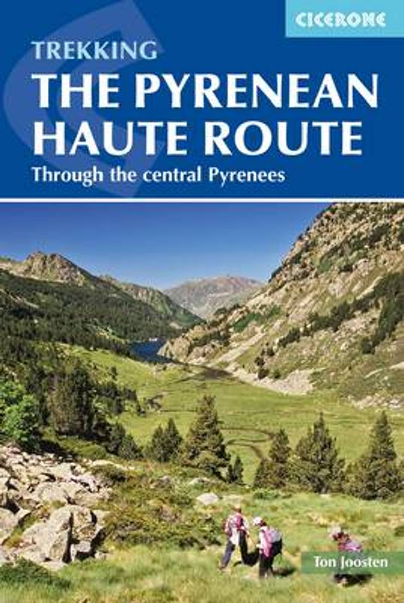
- The Pyrenean Haute Route
- The Pyrenean High-Level Route is probably the most beautiful, spectacular and challenging trek in the Pyrenees. Unlike the GR10 and GR11, the trek from Hendaye to Banyuls-sur-Mer crosses the French Spanish border many times, exploring both sides of the mountain range and staying as close as possible to the main ridge of the Pyrenees. The 800km... Lire la suite
- Also available from:
- Bol.com, Belgium
Belgium
2012
- The Pyrenean Haute Route
- The Pyrenean High-Level Route is probably the most beautiful, spectacular and challenging trek in the Pyrenees. Unlike the GR10 and GR11, the trek from Hendaye to Banyuls-sur-Mer crosses the French Spanish border many times, exploring both sides of the mountain range and staying as close as possible to the main ridge of the Pyrenees. The 800km... Lire la suite
Cartes

United Kingdom
- Pays Basque West Rando Editions 1 SUPERCEDED
- The westernmost section of the French Pyrenees between the Atlantic coast and St-Jean-Pied-de-Port on a contoured and GPS compatible map at 1:50,000 from Rando Editions with topographic base provided by the IGN, highlighting local and long-distance hiking trails, cycle and mountain bike routes, etc. Coverage along the Atlantic coast starts at... Lire la suite
United Kingdom
2016
- Sur les Traces des Cathares GR107 FR et ES Plus de 10 Jours de Randonnee: FFR.1097: 2016
- Sur les traces des Cathares, Le Chemin des Bonshommes GR 10 Topo Guide FFRP ref 1097 Hiking guide for the French Pyrenees with description of a multi-day hike of 220 km for 10 days hiking through the Cathar country from Foix, Ariege along Andorra to Berga ( Pyrenees France and Spain).French-speaking hiking guide. Excellent description with... Lire la suite

United Kingdom
- Pyrenees Western
- Pyrénées Ouest map from the IGN at 1:200,000, with excellent presentation of the terrain through contours and vivid relief shading, plenty of names of topographic features, long-distance GR hiking routes, places of interest, etc. The map is designed to provide convenient coverage of the western and central part of the Pyrenees, extending across... Lire la suite

United Kingdom
- Pyrenees Eastern
- Pyrénées Ouest map from the IGN at 1:200,000, with excellent presentation of the terrain through contours and vivid relief shading, plenty of names of topographic features, long-distance GR hiking routes, places of interest, etc. The map is designed to provide convenient coverage of the western and central part of the Pyrenees, extending across... Lire la suite

United Kingdom
- Béarn - Aspe - Ossau - Pyrenees National Park Rando Editions 3
- French Pyrenees of the Béarn region, from Tardets-Sorholus to the western part of the Pyrenees National Park including the Ossau and Balaïtous massifs, on a contoured and GPS compatible map at 1:50,000 from Rando Editions with topographic base provided by the IGN, highlighting local and long-distance hiking trails, cycle and mountain bike... Lire la suite
- Also available from:
- The Book Depository, United Kingdom
- De Zwerver, Netherlands

United Kingdom
- Bearn - Aspe - Ossau - Pyrenees NP
- Uitstekende wandelkaart met veel toeristische informatie en bijzonder gedetailleerd. Wandelroute en hutten / campings zijn ingetekend, met hoogtelijnen. Andere dorpen op deze kaart: Etsaut - Col du Somport - Fabrèges - Col du Pourtalet - la Pierre Saint Martin - Arette - Arudy - Laruns - Arrens Marsous - Argelès Gazost (Frankrijk - Pyreneeen)... Lire la suite

Netherlands
- Wandelkaart 03 Béarn - Bearn | Rando Editions
- Uitstekende wandelkaart met veel toeristische informatie en bijzonder gedetailleerd. Wandelroute en hutten / campings zijn ingetekend, met hoogtelijnen. Andere dorpen op deze kaart: Etsaut - Col du Somport - Fabrèges - Col du Pourtalet - la Pierre Saint Martin - Arette - Arudy - Laruns - Arrens Marsous - Argelès Gazost (Frankrijk - Pyreneeen)... Lire la suite

United Kingdom
- Canigou-Garrotxa Rando Editions 10
- Canigou Massif and the surrounding region of the French Pyrenees on a contoured and GPS compatible map at 1:50,000 from Rando Editions with topographic base provided by the IGN, highlighting local and long-distance hiking trails, mountain biking routes, etc. Topography is vividly presented by contours at 20m intervals enhanced by shading and... Lire la suite
- Also available from:
- The Book Depository, United Kingdom
- De Zwerver, Netherlands


United Kingdom
2020
- Tour et travers�es du Massif des Bauges GR96/GRP
- Tours et Traversées du Massif des Bauges, FFRP topoguide Ref. no. 902, covering 500kms of routes in the French Alps between Annecy, Aix-les-Bains, Chambéry and Albertville. Current edition of this title was published in May 2015.ABOUT THE FFRP (Fédération française de la randonnée pédestre) TOPOGUIDES: published in a handy A5 paperback format,... Lire la suite

United Kingdom
2021
- Le long des ch�teaux de la Loire GR3/GR3B
- Le long des Châteaux de la Loire, FFRP topoguide Ref. No. 333, covering 552km route along the Loire from Bonny-sur-Loire across Orléans, Blois and Tours to Angers. Current edition of this title was published in May 2018.The Loire is world famous for its castles and gardens, now classified as World Heritage by UNESCO. The site of the Loire... Lire la suite

United Kingdom
- Haut-Jura / Alpes du Nord
- Pyrénées Ouest map from the IGN at 1:200,000, with excellent presentation of the terrain through contours and vivid relief shading, plenty of names of topographic features, long-distance GR hiking routes, places of interest, etc. The map is designed to provide convenient coverage of the western and central part of the Pyrenees, extending across... Lire la suite

United Kingdom
- Alpes du Sud
- Pyrénées Ouest map from the IGN at 1:200,000, with excellent presentation of the terrain through contours and vivid relief shading, plenty of names of topographic features, long-distance GR hiking routes, places of interest, etc. The map is designed to provide convenient coverage of the western and central part of the Pyrenees, extending across... Lire la suite

United Kingdom
- Haute-Ariége Rando Editions 7
- The Haute-Ariége region of the French Pyrenees, from Foix to Pica d`Estats and the Col de Puymorens, on a contoured and GPS compatible map at 1:50,000 from Rando Editions with topographic base provided by the IGN, highlighting local and long-distance hiking trails, etc. Topography is vividly presented by contours at 20m intervals enhanced by... Lire la suite
- Also available from:
- De Zwerver, Netherlands

Netherlands
- Wandelkaart 07 Haute Ariege | Rando Editions
- Itinéraires de rando, infos culturelles, touristiques et sportives, gîtes, refuges : toutes ces infos sont disponibles sur cette carte à cheval sur France et Espagne. Lire la suite
Netherlands
2016
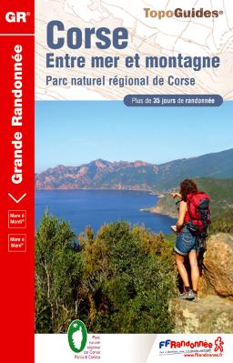
- Corse entre mer et montagne PNR
- Ces six itinéraires vont conduiront d'une côte à l'autre de la Corse (Mare a mare) ou vous feront longer le trait de côte en faisant des incursions dans la montagne toute proche (Mare e Monti). Moins exigeants que le GR&... Lire la suite
- Also available from:
- Bol.com, Belgium
Belgium
2016
- Corse entre mer et montagne PNR
- Ces six itinéraires vont conduiront d'une côte à l'autre de la Corse (Mare a mare) ou vous feront longer le trait de côte en faisant des incursions dans la montagne toute proche (Mare e Monti). Moins exigeants que le GR&... Lire la suite

United Kingdom
- Pays Basque East Rando Editions 2
- Western Pyrenees in France from the peaks of Iguzuki and Iparla, across St-Jean-Pied-de-Port and Larrau, to Pic d’Anie on a contoured and GPS compatible map at 1:50,000 from Rando Editions with topographic base provided by the IGN, highlighting local and long-distance hiking trails, cycle and mountain bike routes, etc. Topography is vividly... Lire la suite
- Also available from:
- De Zwerver, Netherlands

Netherlands
- Wandelkaart 02 Pays Basque Est | Rando Editions
- Uitstekende wandelkaart met veel toeristische informatie en bijzonder gedetailleerd. Wandelroutes en GR paden en hutten / campings zijn ingetekend, met hoogtelijnen. Andere dorpen op deze kaart: Arrette - la Pierre St. Martin - St. Jean Pied de Port (Frankrijk - Pyreneeen) Versant français et espagnol : Barétous; Soule, Basse-Navarre, vallée... Lire la suite

United Kingdom
- Cerdagne-Capcir Rando Editions 8
- The Cerdagne-Capcir region of the French Pyrenees, from Ax-les Thermes to Font Romeu and Bourg-Madame, on a contoured and GPS compatible map at 1:50,000 from Rando Editions with topographic base provided by the IGN, highlighting local and long-distance hiking trails, etc. Topography is vividly presented by contours at 20m intervals enhanced by... Lire la suite
- Also available from:
- De Zwerver, Netherlands

Netherlands
- Wandelkaart 08 Cerdagne Capcir | Rando Editions
- Uitstekende wandelkaart met veel toeristische informatie en bijzonder gedetailleerd. Wandelroute en hutten / campings zijn ingetekend, met hoogtelijnen. Andere dorpen op deze kaart: Ax les Thermes - Massif de l'Aston - Canillo - Soldeu - Mérens les Vals - Porté Puymorens - Mijanès - Puyvalador - Olette - Mont Louis - Font Romeu - Núria -... Lire la suite

United Kingdom
- Luchon Rando Editions 5
- The Luchon region of the French Pyrenees, around St.Gaudens, the Louron Valley and Bagnères-de-Luchon, on a contoured and GPS compatible map at 1:50,000 from Rando Editions with topographic base provided by the IGN, highlighting local and long-distance hiking trails, cycle and mountain bike routes, etc. Topography is vividly presented by... Lire la suite
- Also available from:
- De Zwerver, Netherlands

Netherlands
- Wandelkaart 05 Luchon | Rando Editions
- Uitstekende wandelkaart met veel toeristische informatie en bijzonder gedetailleerd. Wandelroute en hutten / campings zijn ingetekend, met hoogtelijnen. Andere dorpen op deze kaart: Col d'Aspin - Barbazan - Aspet - le Pla d'Adet - St. Lary Soulan - Val Louran - Col de Peyresourde - Bagnères de Luchon (Frankrijk - Pyreneeen). Carte topographique... Lire la suite