
Euskadi
Description

Carte

Sentiers de cette région
- GR1 Sendero Histórico, Senda TransversalGPX
- GR11 Sendero PirenaicoGPX
- GR12 Sendero de Euskal HerriaGPX
- GR120 Ruta de los Tres TemplosGPX
- GR121 Vuelta a GipuzcoaGPX
- GR123 Vuelta a BizkaiaGPX
- GR13 Cañada Real de los RoncalesesGPX
- GR20 Vuelta a Aralar, Aralarko BiraGPX
- GR21 Camino Ignaciano, Ruta IgnacianaGPX
- GR229 Ruta MikeldiGPX
- GR25 Vuelta a la Llanada Alavesa a Pie de MonteGPX
- GR34 Donostia - ArantzazuGPX
- GR35 Camino de la TrashumanciaGPX
- GR38 Ruta del Vino y del PescadoGPX
- GR9 Navarra y EuskadiGPX
- GR98 Vuelta a la Reserva de la Biosfera de Urdaibai
- GR99 Sendero del EbroGPX
Liens
Données
Rapports
Guides et cartes
Hébergement
Organisations
Voyagistes
GPS
Autre
Livres

Stanfords
United Kingdom
United Kingdom
- DK Eyewitness Northern Spain
- Explore wild mountain terrain, vibrant cities and romantic coastline.Whether you want to trek the dramatic peaks of the Picos de Europa, appreciate contemporary art at Museo Guggenheim or hop from bar to bar in the side streets of San Sebastian, your DK Eyewitness travel guide makes sure you experience all that Northern Spain has to offer.Our... Lire la suite

Stanfords
United Kingdom
United Kingdom
- DK Eyewitness Northern Spain
- Your journey starts here. Featuring DK`s much-loved maps and illustrations, walks and information, plus all new, full-colour photography, this 100% updated guide to Northern Spain brings you the best of this stunning Spanish region in a brand-new, lightweight format. What`s inside? - full-colour photography, hand-drawn illustrations, and maps... Lire la suite

Stanfords
United Kingdom
2017
United Kingdom
2017
- Le PNR du Haute-Jura à pied PN15
- Le Parc du Haute-Jura à pied, FFRP topo-guide Ref. No. PN15, with 41 day walks of varying length and difficulty in the French Jura, plus several two- to seven-days long tours including a section of GR9. Each day walk is presented on a separate colour extract from IGN’s topographic survey of France at 1:25,000, with its description... Lire la suite

Stanfords
United Kingdom
2020
United Kingdom
2020
- Les Abers - le Chemin de Phares GR34/GR34F
- Les Abers - le chemin de phares, FFRP topoguide Ref. no. 347, covering the coastal route in north-western Brittany between Morlaix, Brest, and le Fau, plus 4 walks on the Ile d`Ouessant. Current edition of this title was published in September 2017.Between Morlaix and Brest, where the sea has dug deep furrows in the land. More than 20 days of... Lire la suite

Stanfords
United Kingdom
2016
United Kingdom
2016
- Pyrenees: Car Tours and Walks
- Pyrenees is the Sunflower Landscapes guide to exploring the best walking and touring possibilities in the mountain range. The guide covers a range of routes including walks in Vilajuiga, Pedraforca, the Anisclo Canyon and Roncesvalles. A double-sided, fold-out touring map at the back of the book gives an overview of the region and the locations... Lire la suite

Stanfords
United Kingdom
2019
United Kingdom
2019
- Cote d`Emeraude - Les Chemins du Mont-Saint-Michel GR34/GR37
- Côte d`Emeraude: Les Chemins du Mont-St-Michel, FFRP topoguide Ref. no. 345, covering in all 636km of GR routes in western Brittany: the coastal path between Mont-St-Michel, St-Malo and St-Brieuc, plus circuits linking Rennes with the coast. Current edition of this title was published in March 2019 ABOUT THE FFRP (Fédération française de la... Lire la suite
Stanfords
United Kingdom
2019
United Kingdom
2019
- La Grande Traversee du Jura GR5/GR9/GTJ
- La Grande Travesée du Jura, FFRP topoguide Ref. no. 512, covering the GTJ along the Jura Mountains in France from Nommay to Culoz, plus several variants off the main route including parts of the GR5 and GR9 – in all 509kms of hiking trails. Current edition of this title was published in March 2017.The GR509 offers hikers a path punctuated by... Lire la suite
Stanfords
United Kingdom
2020
United Kingdom
2020
- La Cote de Cornouaille GR34
- GR34: La Côte de Cornouaille, FFRP topo-guide ref. no. 348, one of the titles from an extensive series of light, high quality, A5 paperback guides to the Sentiers de Grande Randonnée, the GR routes, a dense network of long-distance footpaths across the French countryside. Each topo-guide covers either a circular route, or part of a longer path.... Lire la suite

Stanfords
United Kingdom
2017
United Kingdom
2017
- Sentiers de St- Jacques via le Puy - Moissac to Roncevaux GR65
- Continuation and end of the Puy road, through Quercy, Béarn and Basque Country. More than 15 days of hiking.Chemins de St- Jacques: Moissac - Roncevaux (Roncesvalles), FFRP topoguide Ref. no. 653, covering the last, 345-km long section of the Way of St. James in France along the GR65 between Le Puy-en-Velay to the Spanish border. Current... Lire la suite

Stanfords
United Kingdom
United Kingdom
- Les Chemins de St-Jacques au Pays Basque
- Les Chemins de St-Jacques au Pays Basque covers two routes of the Way of St James in the Basque country: le Chemin de Baztán and le Chemin de Saint-Palais á la côte. The former links Bayonne, Saint-Jean de Luz and Urdax, extending south to Pamplona; the latter links Sare to Saint Palais via Esplette. This is one of the titles in a series of... Lire la suite

Stanfords
United Kingdom
2015
United Kingdom
2015
- GR9/GR96/GRP: Tours et Traversées de Chartreuse FFRP Topo-guide No. 903
- Tours et Traversées de Chartreuse, FFRP topoguide Ref. no. 903, covering 385kms of routes along the GR9 and GR96 in the northern part of the French Alps between Culoz, Chambéry and Grenoble. Current edition of this title was published in May 2015.ABOUT THE FFRP (Fédération française de la randonnée pédestre) TOPOGUIDES: published in a handy A5... Lire la suite
Stanfords
United Kingdom
2019
United Kingdom
2019
- Corse entre Mer et Montagne
- Corse entre Mer et Montagne, FFRP topoguide Ref. No. 065, covering various trails across the mountains of Corsica which provide shorter and/or easier alternatives to the popular but longer and more strenuous GR20. Current edition of this title was published in April 2016.ABOUT THE FFRP (Fédération française de la randonnée pédestre) TOPOGUIDES:... Lire la suite
Stanfords
United Kingdom
2019
United Kingdom
2019
- Côte de Granit rose - Trégor morlaisien GR34/GR34A,B,D/GR380
- Côte de Granit rose - Trégor morlaisien, FFRP topoguide Ref. no. 346, covering 608kms of routes along the northern coast of Brittany between Saint-Brieuc and Morlaix, including inland circuits. Current edition of this title was published in May 2018.Pink Granite Coast and Bruyères coast: you are in Armor. It is the ”country by the sea”, with... Lire la suite
Stanfords
United Kingdom
2019
United Kingdom
2019
- A Travers la Montagne Corse - PNR de Corse GR20
- À Travers la Montagne Corse, FFRP topoguide Ref. No. 067, covering one of Europe’s most popular and demanding long-distance hiking walking trails, the 200km/125 miles-long high-level route across the mountains of Corsica. Current edition of this title was published in March 2014.To see other titles in this series please click on the series... Lire la suite
Stanfords
United Kingdom
United Kingdom
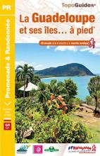
- La Guadeloupe et ses îles à pied
- La Guadeloupe et ses îles à pied, FFRP topo-guide Ref. No. D971, with 49 day walks of varying length and difficulty, plus coverage of the 65km-long GR1 across the mountains of the Basse Terre. The day walks include two on Marie-Galante, one on La Désirade, and two on Les Saintes islands. Each walk is presented on a separate colour extract from... Lire la suite
- Also available from:
- The Book Depository, United Kingdom

The Book Depository
United Kingdom
United Kingdom
- Guadeloupe & ses iles a pied
- La Guadeloupe et ses îles à pied, FFRP topo-guide Ref. No. D971, with 49 day walks of varying length and difficulty, plus coverage of the 65km-long GR1 across the mountains of the Basse Terre. The day walks include two on Marie-Galante, one on La Désirade, and two on Les Saintes islands. Each walk is presented on a separate colour extract from... Lire la suite
Cartes

Stanfords
United Kingdom
United Kingdom
- Ordesa - Monte Perdido National Park Editorial Alpina 2-Map Set
- Ordesa and Monte Perdido National Park at 1:25,000 in a set of two GPS compatible recreational maps in an extensive and very popular series from Editorial Alpina, providing more detailed coverage of this popular hiking area.Contours are at 10m intervals, with relief shading and vegetation colouring. An overprint highlights waymarked PR hiking... Lire la suite

Stanfords
United Kingdom
United Kingdom
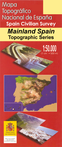
- Noarre CNIG Topo 150
- Topographic coverage of mainland Spain at 1:50,000 in the MTN50 (Mapa Topográfico Nacional) series from the Centro Nacional de Información Geografica, the country’s civilian survey organization. The maps have contours at 20m intervals, enhanced by relief shading, plus colouring and/or graphics to show different types of terrain, vegetation or... Lire la suite

Stanfords
United Kingdom
United Kingdom
- Cabezón de la Sal CNIG Topo 57
- Topographic coverage of mainland Spain at 1:50,000 in the MTN50 (Mapa Topográfico Nacional) series from the Centro Nacional de Información Geografica, the country’s civilian survey organization. The maps have contours at 20m intervals, enhanced by relief shading, plus colouring and/or graphics to show different types of terrain, vegetation or... Lire la suite

Stanfords
United Kingdom
United Kingdom
- Andorra la Vella CNIG Topo 183
- Topographic coverage of mainland Spain at 1:50,000 in the MTN50 (Mapa Topográfico Nacional) series from the Centro Nacional de Información Geografica, the country’s civilian survey organization. The maps have contours at 20m intervals, enhanced by relief shading, plus colouring and/or graphics to show different types of terrain, vegetation or... Lire la suite

Stanfords
United Kingdom
United Kingdom
- Castañar de Ibor CNIG Topo 681
- Topographic coverage of mainland Spain at 1:50,000 in the MTN50 (Mapa Topográfico Nacional) series from the Centro Nacional de Información Geografica, the country’s civilian survey organization. The maps have contours at 20m intervals, enhanced by relief shading, plus colouring and/or graphics to show different types of terrain, vegetation or... Lire la suite

Stanfords
United Kingdom
United Kingdom
- Güejar Sierra CNIG Topo 1027
- Topographic coverage of mainland Spain at 1:50,000 in the MTN50 (Mapa Topográfico Nacional) series from the Centro Nacional de Información Geografica, the country’s civilian survey organization. The maps have contours at 20m intervals, enhanced by relief shading, plus colouring and/or graphics to show different types of terrain, vegetation or... Lire la suite

Stanfords
United Kingdom
United Kingdom
- Llano CNIG Topo 978
- Topographic coverage of mainland Spain at 1:50,000 in the MTN50 (Mapa Topográfico Nacional) series from the Centro Nacional de Información Geografica, the country’s civilian survey organization. The maps have contours at 20m intervals, enhanced by relief shading, plus colouring and/or graphics to show different types of terrain, vegetation or... Lire la suite

Stanfords
United Kingdom
United Kingdom
- Bedmar CNIG Topo 948
- Topographic coverage of mainland Spain at 1:50,000 in the MTN50 (Mapa Topográfico Nacional) series from the Centro Nacional de Información Geografica, the country’s civilian survey organization. The maps have contours at 20m intervals, enhanced by relief shading, plus colouring and/or graphics to show different types of terrain, vegetation or... Lire la suite

Stanfords
United Kingdom
United Kingdom
- La Pobla de Lillet CNIG Topo 255
- Topographic coverage of mainland Spain at 1:50,000 in the MTN50 (Mapa Topográfico Nacional) series from the Centro Nacional de Información Geografica, the country’s civilian survey organization. The maps have contours at 20m intervals, enhanced by relief shading, plus colouring and/or graphics to show different types of terrain, vegetation or... Lire la suite

Stanfords
United Kingdom
United Kingdom
- Irun CNIG Topo 40-41
- Topographic coverage of mainland Spain at 1:50,000 in the MTN50 (Mapa Topográfico Nacional) series from the Centro Nacional de Información Geografica, the country’s civilian survey organization. The maps have contours at 20m intervals, enhanced by relief shading, plus colouring and/or graphics to show different types of terrain, vegetation or... Lire la suite

Stanfords
United Kingdom
United Kingdom
- Yerba de Basa CNIG Topo 210
- Topographic coverage of mainland Spain at 1:50,000 in the MTN50 (Mapa Topográfico Nacional) series from the Centro Nacional de Información Geografica, the country’s civilian survey organization. The maps have contours at 20m intervals, enhanced by relief shading, plus colouring and/or graphics to show different types of terrain, vegetation or... Lire la suite

Stanfords
United Kingdom
United Kingdom
- Horta de Sant Joan CNIG Topo 496
- Topographic coverage of mainland Spain at 1:50,000 in the MTN50 (Mapa Topográfico Nacional) series from the Centro Nacional de Información Geografica, the country’s civilian survey organization. The maps have contours at 20m intervals, enhanced by relief shading, plus colouring and/or graphics to show different types of terrain, vegetation or... Lire la suite

Stanfords
United Kingdom
United Kingdom
- Mazarron CNIG Topo 976
- Topographic coverage of mainland Spain at 1:50,000 in the MTN50 (Mapa Topográfico Nacional) series from the Centro Nacional de Información Geografica, the country’s civilian survey organization. The maps have contours at 20m intervals, enhanced by relief shading, plus colouring and/or graphics to show different types of terrain, vegetation or... Lire la suite

Stanfords
United Kingdom
United Kingdom
- Mira CNIG Topo 665
- Topographic coverage of mainland Spain at 1:50,000 in the MTN50 (Mapa Topográfico Nacional) series from the Centro Nacional de Información Geografica, the country’s civilian survey organization. The maps have contours at 20m intervals, enhanced by relief shading, plus colouring and/or graphics to show different types of terrain, vegetation or... Lire la suite
Stanfords
United Kingdom
United Kingdom
- Santa Coloma de Farners CNIG Topo 333
- Topographic coverage of mainland Spain at 1:50,000 in the MTN50 (Mapa Topográfico Nacional) series from the Centro Nacional de Información Geografica, the country’s civilian survey organization. The maps have contours at 20m intervals, enhanced by relief shading, plus colouring and/or graphics to show different types of terrain, vegetation or... Lire la suite