
Alaska
Description
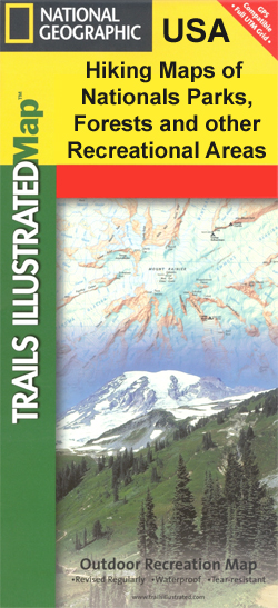
Alaska is a state in the far northwest. Very remote wilderness, often only reachable by plane. A large part lies above the Arctic Circle. Abundant wildlife.
Denali is the best known national park in Alaska, with America's highest mountain, Mount McKinley, 20,300 feet. Good place for backcountry hiking (no trails).
Backcountry hiking is also the way to explore the other great parks, like Glacier Bay and Gates of the Arctic. The Tongass National Forest and Chugach Sate Park offer hiking trails.
Carte

Sentiers de cette état
Liens
Données
Rapports
Guides et cartes
Hébergement
Organisations
Voyagistes
GPS
Autre
Livres

Stanfords
United Kingdom
United Kingdom
- Travelling Solo
- Solo travellers can tallor a vacation to their individual tastes, energies, and timetable; go wherever they wish; do exactly what they want to do; and meet fascinating people of all ages and all walks of life along the way. Ideas and advice for more than 250trips for solo travellers - each as varied as the ages, budgets, tastes, and interests... Lire la suite

Stanfords
United Kingdom
2020
United Kingdom
2020
- DK Eyewitness Alaska
- Adventure awaits in the Arctic corner of the worldWhether you want to spot grizzly bears in Denali National Park, uncover the traditions of Alaska`s Native groups or race along the scenic Haines Highway, your DK Eyewitness travel guide makes sure you experience all that Alaska has to offer.Epic in scale and wild to the core, Alaska beckons with... Lire la suite

Stanfords
United Kingdom
United Kingdom
- DK Eyewitness USA
- Spectacular scenery, vibrant cities and captivating culture - welcome to the USA.Whether you want to hike in breathtaking Yosemite National Park, take a road trip from coast to coast or sample southern soul food in the Deep South, your DK Eyewitness travel guide makes sure you experience all that the USA has to offer.Dramatic and diverse, the... Lire la suite

Stanfords
United Kingdom
United Kingdom
- Carbondale CO
- Map No. 143, Carbondale, CO, in an extensive series of GPS compatible, contoured hiking maps of USA’s national and state parks or forests and other popular recreational areas. Cartography based on the national topographic survey, with additional tourist information.The maps, with most titles now printed on light, waterproof and tear-resistant... Lire la suite

Stanfords
United Kingdom
United Kingdom
- Cache La Poudre - Big Thompson CO
- Map No. 101, Cache La Poudre - Big Thompson, CO, in an extensive series of GPS compatible, contoured hiking maps of USA’s national and state parks or forests and other popular recreational areas. Cartography based on the national topographic survey, with additional tourist information.The maps, with most titles now printed on light, waterproof... Lire la suite

Stanfords
United Kingdom
United Kingdom
- Lake Mead National Recreation Area NV/AZ
- Map No. 204, Lake Mead National Recreation Area on the borderof Arizona and Nevada, at 1:166,800 in an extensive series of GPS compatible, contoured hiking maps of USA’s national and state parks or forests and other popular recreational areas. Cartography based on the national topographic survey, with additional tourist information.The maps,... Lire la suite

Stanfords
United Kingdom
United Kingdom
- Tahoe National Forest - Yuba & American Rivers CA
- Map No. 804, Tahoe National Forest: Yuba and American Rivers, CA, in an extensive series of GPS compatible, contoured hiking maps of USA’s national and state parks or forests and other popular recreational areas. Cartography based on the national topographic survey, with additional tourist information.The maps, with most titles now printed on... Lire la suite

Stanfords
United Kingdom
United Kingdom
- Los Padres National Forest East CA
- Map No. 812, Los Padres National Forest East, CA, in an extensive series of GPS compatible, contoured hiking maps of USA’s national and state parks or forests and other popular recreational areas. Cartography based on the national topographic survey, with additional tourist information.The maps, with most titles now printed on light, waterproof... Lire la suite

Stanfords
United Kingdom
United Kingdom
- South Holston and Watauga Lakes - Cherokee and Pisgah National Forest TN/NC
- Map No. 783, Cherokee and Pisgah National Firest: South Holston and Watauga Lakesin Tennessee, at 1:63,360 in an extensive series of GPS compatible, contoured hiking maps of USA’s national and state parks or forests and other popular recreational areas. Cartography based on the national topographic survey, with additional tourist... Lire la suite

Stanfords
United Kingdom
United Kingdom
- Yampa - Gore Pass CO NGS Trails Illustrated Map 119
- Map No. 119, Yampa - Gore Pass in Colorado, in an extensive series of GPS compatible, contoured hiking maps of USA’s national and state parks or forests and other popular recreational areas. Cartography based on the national topographic survey, with additional tourist information.The maps, with most titles now printed on light, waterproof and... Lire la suite

Stanfords
United Kingdom
United Kingdom
- Buffalo National River West AR
- Map No. 232, Buffalo National River West, AR, in an extensive series of GPS compatible, contoured hiking maps of USA’s national and state parks or forests and other popular recreational areas. Cartography based on the national topographic survey, with additional tourist information.The maps, with most titles now printed on light, waterproof and... Lire la suite

Stanfords
United Kingdom
United Kingdom
- Longs Peak - Bear Lake / Wild Basin - Rocky Mountains National Park CO
- Map No. 301, Longs Peak, CO, in an extensive series of GPS compatible, contoured hiking maps of USA’s national and state parks or forests and other popular recreational areas. Cartography based on the national topographic survey, with additional tourist information.The maps, with most titles now printed on light, waterproof and tear-resistant... Lire la suite

Stanfords
United Kingdom
United Kingdom
- Breckenridge - Tennessee Pass CO
- Map No. 109, Breckenridge - Tennessee Pass area in Colorado in an extensive series of GPS compatible, contoured hiking maps of USA’s national and state parks or forests and other popular recreational areas. Cartography based on the national topographic survey, with additional tourist information.The maps, with most titles now printed on light,... Lire la suite

Stanfords
United Kingdom
United Kingdom
- Virgin Islands National Park
- Map No. 236, Virgin Islands National Park, in an extensive series of GPS compatible, contoured hiking maps of USA’s national and state parks or forests and other popular recreational areas. Cartography based on the national topographic survey, with additional tourist information.The maps, with most titles now printed on light, waterproof and... Lire la suite

Stanfords
United Kingdom
United Kingdom
- Black Hills North - Black Hills National Forest SD NGS Trails Illustrated Map 751
- Map No. 751, Black Hills National Forest, Northeast in South Dakota at 1:53,000 in an extensive series of GPS compatible, contoured hiking maps of USA’s national and state parks or forests and other popular recreational areas. Cartography based on the national topographic survey, with additional tourist information.The maps, with most titles... Lire la suite
Cartes

Stanfords
United Kingdom
United Kingdom
- Badlands National Park SD
- Map No. 239, Badlands National Park, SD, in an extensive series of GPS compatible, contoured hiking maps of USA’s national and state parks or forests and other popular recreational areas. Cartography based on the national topographic survey, with additional tourist information.The maps, with most titles now printed on light, waterproof and... Lire la suite

Stanfords
United Kingdom
United Kingdom
- Grand Gulch Plateau UT
- Map No. 706, Grand Gulch, UT, in an extensive series of GPS compatible, contoured hiking maps of USA’s national and state parks or forests and other popular recreational areas. Cartography based on the national topographic survey, with additional tourist information.The maps, with most titles now printed on light, waterproof and tear-resistant... Lire la suite

Stanfords
United Kingdom
United Kingdom
- San Rafael Swell UT
- Map No. 712, San Rafael Swell, UT, in an extensive series of GPS compatible, contoured hiking maps of USA’s national and state parks or forests and other popular recreational areas. Cartography based on the national topographic survey, with additional tourist information.The maps, with most titles now printed on light, waterproof and... Lire la suite

Stanfords
United Kingdom
United Kingdom
- Hahns Peak - Steamboat Lake CO
- Map No. 116, Hahns Peak - Steamboat Lake in Colorado, at 1:40.680 in an extensive series of GPS compatible, contoured hiking maps of USA’s national and state parks or forests and other popular recreational areas. Cartography based on the national topographic survey, with additional tourist information.The maps, with most titles now printed on... Lire la suite

Stanfords
United Kingdom
United Kingdom
- Lassen Volcanic National Park CA
- Map No. 268, Lassen Volcanic National Park in California at 1:50,000, part of an extensive series of GPS compatible, contoured hiking maps of USA’s national and state parks or forests and other popular recreational areas. Cartography, based on the national topographic survey, has extensive additional tourist information.The maps, printed on... Lire la suite

Stanfords
United Kingdom
United Kingdom
- Fish Lake - Manti UT
- Map No. 707, Fish Lake - Capitol Reef are un Utah at 1:90,000 in an extensive series of GPS compatible, contoured hiking maps of USA’s national and state parks or forests and other popular recreational areas. Cartography based on the national topographic survey, with additional tourist information.The maps, with most titles now printed on... Lire la suite

Stanfords
United Kingdom
United Kingdom
- Glacier National Park - Two Medicine MT
- Map No. 315, Glacier National Park: Two Medicine, MT, in an extensive series of GPS compatible, contoured hiking maps of USA’s national and state parks or forests and other popular recreational areas. Cartography based on the national topographic survey, with additional tourist information.The maps, with most titles now printed on light,... Lire la suite
Stanfords
United Kingdom
United Kingdom
- Kenai NWR - Chugach National Forest AK
- Map No. 760, Kenai NWR/Chugach National Forest, AK, in an extensive series of GPS compatible, contoured hiking maps of USA’s national and state parks or forests and other popular recreational areas. Cartography based on the national topographic survey, with additional tourist information.The maps, with most titles now printed on light,... Lire la suite
Stanfords
United Kingdom
United Kingdom
- Allegheny National Forest
- Map No. 739, Allegheny National Forest South in Pennsylvania at 1:70,000, in an extensive series of GPS compatible, contoured hiking maps of USA’s national and state parks or forests and other popular recreational areas. Cartography is based on the national topographic survey, with additional tourist information.The maps, with most titles now... Lire la suite

Stanfords
United Kingdom
United Kingdom
- Salida - St Elmo - Shavano Peak CO
- Map No. 130, Salida - St Elmo - Shavano Peak in Colorado, at 1:40,680 in an extensive series of GPS compatible, contoured hiking maps of USA’s national and state parks or forests and other popular recreational areas. Cartography based on the national topographic survey, with additional tourist information.The maps, with most titles now printed... Lire la suite

Stanfords
United Kingdom
United Kingdom
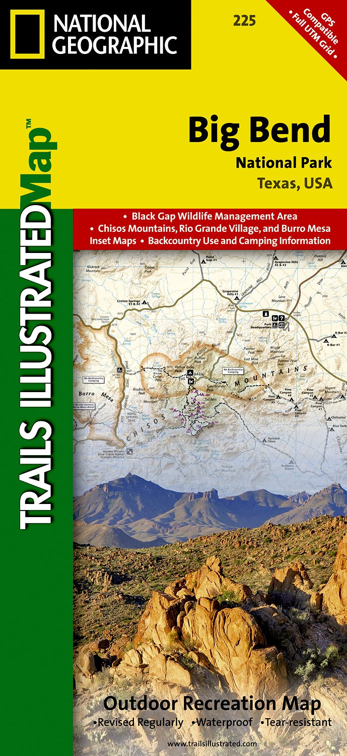
- Big Bend National Park TX NGS Trails Illustrated Map 225
- Map No. 225, Big Bend National Park, TX, in an extensive series of GPS compatible, contoured hiking maps of USA’s national and state parks or forests and other popular recreational areas. Cartography based on the national topographic survey, with additional tourist information.The maps, with most titles now printed on light, waterproof and... Lire la suite
- Also available from:
- The Book Depository, United Kingdom
- De Zwerver, Netherlands

The Book Depository
United Kingdom
United Kingdom
- Big Bend National Park
- Trails Illustrated National Parks Lire la suite
De Zwerver
Netherlands
Netherlands
- Wandelkaart - Topografische kaart 225 Big Bend National Park | National Geographic
- Prachtige geplastificeerde kaart van het nationaal park. Met alle recreatieve voorzieningen als campsites, maar ook met topografische details en wandelroutes ed. Door uitgekiend kleurgebruik zeer prettig in gebruik. Scheur en watervast! Beautiful waterproof, tear-resistant, topographic map. The map includes Big Bend National Park, Portions of... Lire la suite

Stanfords
United Kingdom
United Kingdom
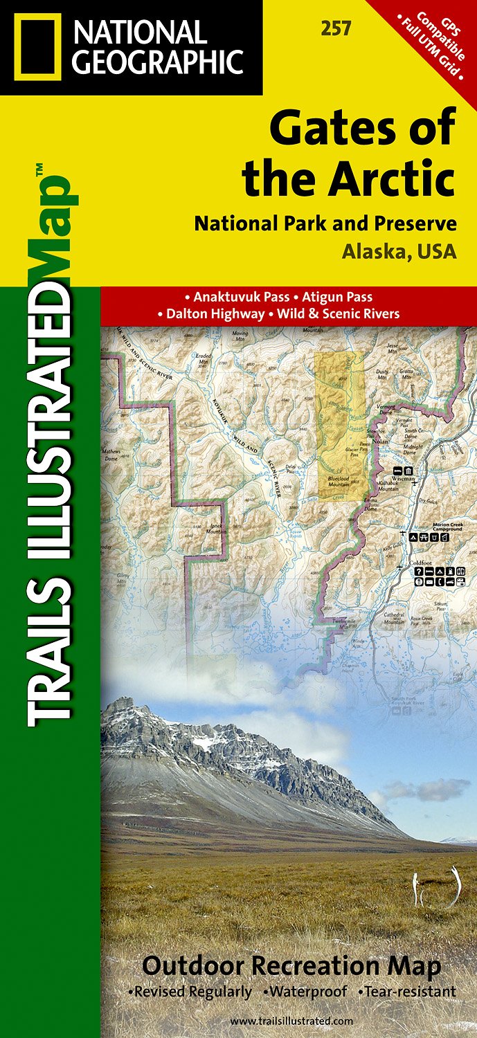
- Gates of the Arctic AK
- Map No. 257, Gates of the Arctic, AK, in an extensive series of GPS compatible, contoured hiking maps of USA’s national and state parks or forests and other popular recreational areas. Cartography based on the national topographic survey, with additional tourist information.The maps, with most titles now printed on light, waterproof and... Lire la suite
- Also available from:
- The Book Depository, United Kingdom
- De Zwerver, Netherlands

De Zwerver
Netherlands
Netherlands
- Wandelkaart - Topografische kaart 257 Trails Illustrated Gates of the Arctic National Park & Preserve | National Geographic
- Prachtige geplastificeerde kaart van het nationaal park. Met alle recreatieve voorzieningen als campsites, maar ook met topografische details en wandelroutes ed. Door uitgekiend kleurgebruik zeer prettig in gebruik. Scheur en watervast! This Trails Illustrated map for Gates of the Arctic National Park and Preserve and surrounding area in... Lire la suite

Stanfords
United Kingdom
United Kingdom
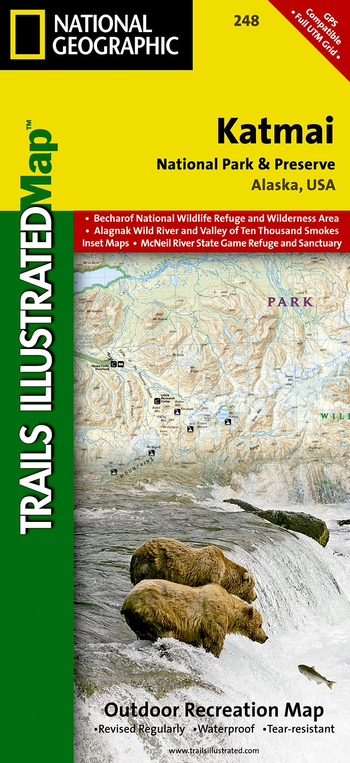
- Katmai National Park and Preserve AK
- Map No. 248, Katmai National Park and Preserve, AK, in an extensive series of GPS compatible, contoured hiking maps of USA’s national and state parks or forests and other popular recreational areas. Cartography based on the national topographic survey, with additional tourist information.The maps, with most titles now printed on light,... Lire la suite
- Also available from:
- The Book Depository, United Kingdom
- De Zwerver, Netherlands

The Book Depository
United Kingdom
United Kingdom
- Katmai National Park And Preserve
- Trails Illustrated National Parks Lire la suite
De Zwerver
Netherlands
Netherlands
- Wandelkaart - Topografische kaart 248 Katmai National Park & Preserve | National Geographic
- Prachtige geplastificeerde kaart van het nationaal park. Met alle recreatieve voorzieningen als campsites, maar ook met topografische details en wandelroutes ed. Door uitgekiend kleurgebruik zeer prettig in gebruik. Scheur en watervast! This two-sided map includes Katmai National Park and Wilderness in its entirety, Becharof National Wildlife... Lire la suite

Stanfords
United Kingdom
United Kingdom
- Logan - Bear River Range UT/ID
- Map No. 700, Logan - Bear River Range in Utah at 1:75,000, part of an extensive series of GPS compatible, contoured hiking maps of USA’s national and state parks or forests and other popular recreational areas. Cartography, based on the national topographic survey, has extensive additional tourist information.The maps, printed on light,... Lire la suite
- Also available from:
- The Book Depository, United Kingdom


Stanfords
United Kingdom
United Kingdom
- Old Faithful - Yellowstone National Park SW WY/MT
- Map No. 302, Yellowstone SW: Old Faithful, WY/MT, in an extensive series of GPS compatible, contoured hiking maps of USA’s national and state parks or forests and other popular recreational areas. Cartography based on the national topographic survey, with additional tourist information.The maps, with most titles now printed on light, waterproof... Lire la suite
- Also available from:
- The Book Depository, United Kingdom
- De Zwerver, Netherlands

The Book Depository
United Kingdom
United Kingdom
- Yellowstone Sw/old Faithful
- Trails Illustrated National Parks Lire la suite

De Zwerver
Netherlands
Netherlands
- Wandelkaart - Topografische kaart 302 Old Faithful, Yellowstone National Park SW | National Geographic
- Prachtige geplastificeerde kaart van het bekende nationaal park. Met alle recreatieve voorzieningen als campsites, maar ook met topografische details en wandelroutes ed. Door uitgekiend kleurgebruik zeer prettig in gebruik. Scheur en watervast! Beautiful waterproof and tear-resistant topographical hiking map of a well-loved National Park, with... Lire la suite