
Kentucky
Description
The central state of Kentucky offers good hiking in the Daniel Boone National Forest, with mountains and many natural beauties like canyons, sandstone cliffs, lakes, creeks and waterfalls.
Two fine trails here are the Sheltowee Trace Trail, 269 miles, and the Jenny Wiley Trail, 180 miles. Through Kentucky run part of the American Discovery Trail and the Great Eastern Trail.
Carte

Sentiers de cette état
Liens
Données
Rapports
Guides et cartes
Hébergement
Organisations
Voyagistes
GPS
Autre
Livres

Stanfords
United Kingdom
United Kingdom
- Spuntino: Comfort Food (New York Style)
- Hidden behind rust-coloured frontage in the bustling heart of London`s Soho, Spuntino is the epitome of New York`s vibrant restaurant scene. After bringing the bacari of Venice to the backstreets of the British capital at his critically acclaimed restaurant POLPO, Russell Norman scoured the scruffiest and quirkiest boroughs of the Big Apple to... Lire la suite

Stanfords
United Kingdom
United Kingdom
- DK Eyewitness Travel Guide New York City
- Whether you want to visit the iconic Empire State Building, take a leisurely stroll through Central Park, or sample the sublime cocktails in East Village, your DK Eyewitness travel guide makes sure you experience all that New York City has to offer.Dynamic and diverse, New York City is bursting at the seams with unmissable sights,... Lire la suite

Stanfords
United Kingdom
United Kingdom
- DK Eyewitness Seville and Andalucia
- Discover diverse landscapes, romantic cities and vibrant traditions.Whether you want to tour the magical Moorish palace of Alhambra, learn the art of tapas bar hopping in Granada or spot wildlife at Parque Nacional de Donana, your DK Eyewitness travel guide makes sure you experience all that Seville and Andalucia have to offer.With undulating... Lire la suite

Stanfords
United Kingdom
United Kingdom
- DK Eyewitness Travel Guide Canada
- DK Eyewitness travel guides: award-winning guidebooksDiscover Canada with this essential travel guide, designed to help you create your own unique trip and to transport you to this incredible country before you`ve even packed your case - marvel at the magnificent thundering waterfalls of Niagara Falls, hike through spectacular scenery in Banff... Lire la suite

Stanfords
United Kingdom
United Kingdom
- DK Eyewitness Venice and the Veneto
- Welcome to this enchanting corner of ItalyWhether you want to wander around a magical maze of canals, sample delicious cuisine, ramble through majestic mountains or relive fascinating history, your DK Eyewitness travel guide makes sure you experience all that Venice and the Veneto have to offer.The jewel of the Veneto, Venice is a dreamlike... Lire la suite

Stanfords
United Kingdom
United Kingdom
- Tenerife 8/2012 – REMOVED FROM WEBSITE BECAUSE OF DISTRIBUTION PROBLEMS
- About this series:Landmark Visitors Guides present the reader with a detailed, wide-ranging, and easy-to-read overview of an area, making them not only useful guides while on a trip, but also an ideal way to get acquainted with an area before you go.Each guide offers a wide array of information on history & culture, local colour & character,... Lire la suite

Stanfords
United Kingdom
United Kingdom
- Barry Loser and the Trouble With Pets
- The eleventh book in this Roald Dahl Funny Prize-winning series. Perfect for fans of `Diary of a Wimpy Kid`, `Dog Man`, Tom Gates and Pamela Butchart. As far back as Barry can remember, he`s always wanted a sausage dog. They`re like two of his favourite things (sausages and dogs) squidged together! Who cares if they bark the whole time, do poos... Lire la suite

Stanfords
United Kingdom
2013
United Kingdom
2013
- Tenerife: Car Tours and Walks
- Tenerife is the Sunflower Landscapes guide to exploring the best walking and touring possibilities on the island. The guide covers a range of routes including trips around Orotava Valley and Las Canadas, the North-west and the Anaga Peninsula. A double-sided, fold-out touring map of Corfu gives an overview of the island and the locations of... Lire la suite
Stanfords
United Kingdom
United Kingdom
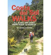
- Costa Del Sol Walks
- Full-color guide to thirty-four walks all within a short distance from the coast, from Nerja to Manilva. With easy-to-follow route notes, full-color maps and clear instructions on how to get to the start of each walk. Lire la suite

Stanfords
United Kingdom
United Kingdom
- DK Eyewitness Travel Guide Thailand
- Your journey starts here. Featuring DK`s much-loved maps and illustrations, walks and information, plus all new, full-colour photography, this 100% updated guide to Thailand brings you the best of this beautiful country in a brand-new, lightweight format.What`s inside? - full-colour photography, hand-drawn illustrations, and maps throughout-... Lire la suite

Stanfords
United Kingdom
United Kingdom
- DK Eyewitness Travel Guide Ireland
- DK Eyewitness travel guides: award-winning guidebooksDiscover Ireland with this essential travel guide to this great island, designed to help you create your own unique trip and to transport you there before you`ve even packed your case - step back in time at Newgrange and other ancient sites across the country, explore the legendary Giant`s... Lire la suite

Stanfords
United Kingdom
2015
United Kingdom
2015
- Northern Portugal Sunflower Landscape Guide
- Northern Portugal is the Sunflower Landscapes guide to exploring the best walking and touring possibilities in the region. The guide covers a range of routes including walks in the Serra de Arga region, Sao Miguel, Brufe, Boucas Donas and the Vilar-Avelar circuit. A fold-out touring map at the back of the book shows an overview of northern... Lire la suite

Stanfords
United Kingdom
United Kingdom
- Rick Steves Mediterranean Cruise Ports (Fifth Edition)
- Set sail and dive into Europe`s magnificent port cities with Rick Steves Mediterranean Cruise Ports! Inside you`ll find:*Rick`s expert advice on making the most of your time on a cruise and experiencing each city, with thorough coverage of 23 ports of call*Practical travel strategies including how to choose and book your cruise, adjusting to... Lire la suite

Stanfords
United Kingdom
United Kingdom
- Azores Tour & Trail Super-Durable Map
- For the best adventures, use the best map. Azores Tour & Trail Super-Durable Map is the most detailed, accurate, toughest, large scale map of these 9 islands that you can buy. Super-Durable Maps now come with a 2 year adventurous use wear and tear guarantee, see Discovery Walking Guides website for details. 1:60,000 scale for each island, Sao... Lire la suite

Stanfords
United Kingdom
United Kingdom
- DK Eyewitness Greece, Athens and the Mainland 7/5/20
- Discover ancient worlds in a spectacular landscape Whether you want to explore the awe inspiring Acropolis, relax on the unspoiled beaches of the Mani archipelago or simply indulge in deliciously fresh Greek food, your DK Eyewitness travel guide makes sure you experience all that Greece has to offer.From the ancient wonders of Delphi and... Lire la suite
Cartes

Stanfords
United Kingdom
United Kingdom
- Salpa Bhanjyang - Baksila
- Salpa Bhanjyang - Baksila, sheet no. 2786-12, in the topographic survey of Nepal at 1:50,000 published by the Nepali Government in the late 1990s and early 2000s and produced from remote sensing data by Finnish cartographers as part of that country’s international aid program. The maps cover 15’ x 15’ quadrangles.IMPORTANT – PLEASE NOTE BEFORE... Lire la suite
Stanfords
United Kingdom
United Kingdom
- Gurjakhani
- Gurjakhani, sheet no. 2883-05, in the topographic survey of Nepal at 1:50,000 published by the Nepali Government in the late 1990s and early 2000s and produced from remote sensing data by Finnish cartographers as part of that country’s international aid program. The maps cover 15’ x 15’ quadrangles.IMPORTANT – PLEASE NOTE BEFORE ORDERING:... Lire la suite
Stanfords
United Kingdom
United Kingdom
- Lantan (2885 15)
- Upper Langtang Valley, sheet no. 2885-15, in the topographic survey of Nepal at 1:50,000 published by the Nepali Government in the late 1990s and early 2000s and produced from remote sensing data by Finnish cartographers as part of that country’s international aid program. The maps cover 15’ x 15’ quadrangles.IMPORTANT – PLEASE NOTE BEFORE... Lire la suite
Stanfords
United Kingdom
United Kingdom
- Dhime
- Dhime, sheet no. 2882-01, in the topographic survey of Nepal at 1:50,000 published by the Nepali Government in the late 1990s and early 2000s and produced from remote sensing data by Finnish cartographers as part of that country’s international aid program. The maps cover 15’ x 15’ quadrangles.IMPORTANT – PLEASE NOTE BEFORE ORDERING:... Lire la suite
Stanfords
United Kingdom
United Kingdom
- Arughat
- Arughat, sheet no. 2884-16, in the topographic survey of Nepal at 1:50,000 published by the Nepali Government in the late 1990s and early 2000s and produced from remote sensing data by Finnish cartographers as part of that country’s international aid program. The maps cover 15’ x 15’ quadrangles.IMPORTANT – PLEASE NOTE BEFORE ORDERING:... Lire la suite
Stanfords
United Kingdom
United Kingdom
- Martadi
- Martadi, sheet no. 2981-10, in the topographic survey of Nepal at 1:50,000 published by the Nepali Government in the late 1990s and early 2000s and produced from remote sensing data by Finnish cartographers as part of that country’s international aid program. The maps cover 15’ x 15’ quadrangles.IMPORTANT – PLEASE NOTE BEFORE ORDERING:... Lire la suite
Stanfords
United Kingdom
United Kingdom
- Lapchegau
- Lapchgau, sheet no. 2886-13, in the topographic survey of Nepal at 1:50,000 published by the Nepali Government in the late 1990s and early 2000s and produced from remote sensing data by Finnish cartographers as part of that country’s international aid program. The maps cover 15’ x 15’ quadrangles.IMPORTANT – PLEASE NOTE BEFORE ORDERING:... Lire la suite
Stanfords
United Kingdom
United Kingdom
- Europe High 5 Edition Road Atlas
- The first physical atlas with direct access to useful additional information from the InternetThe entirety of Europe on 432 pages in a scale of 1:800,000 clearly presented, including lots more travel information:- Road Companion (roadmaps) in a scale of 1:800,000, inclusive of the High 5 - Edition app technology for calling up additional travel... Lire la suite
Stanfords
United Kingdom
United Kingdom
- Bahundada
- Bahundada, sheet no. 2884-10, in the topographic survey of Nepal at 1:50,000 published by the Nepali Government in the late 1990s and early 2000s and produced from remote sensing data by Finnish cartographers as part of that country’s international aid program. The maps cover 15’ x 15’ quadrangles.IMPORTANT – PLEASE NOTE BEFORE ORDERING:... Lire la suite
Stanfords
United Kingdom
United Kingdom
- Nepal Survey 1:25,000 Sheet 2883 11D (Patichaur)
- Koban, sheet no. 2883-07, in the topographic survey of Nepal at 1:50,000 published by the Nepali Government in the late 1990s and early 2000s and produced from remote sensing data by Finnish cartographers as part of that country’s international aid program. The maps cover 15’ x 15’ quadrangles.IMPORTANT – PLEASE NOTE BEFORE ORDERING:... Lire la suite
Stanfords
United Kingdom
United Kingdom
- Jomson
- Jomson, sheet no. 2883-03, in the topographic survey of Nepal at 1:50,000 published by the Nepali Government in the late 1990s and early 2000s and produced from remote sensing data by Finnish cartographers as part of that country’s international aid program. The maps cover 15’ x 15’ quadrangles.IMPORTANT – PLEASE NOTE BEFORE ORDERING:... Lire la suite
Stanfords
United Kingdom
United Kingdom
- Hongu Khola - Chheskam
- Hongu Khola - Chheskam, sheet no. 2786-08, in the topographic survey of Nepal at 1:50,000 published by the Nepali Government in the late 1990s and early 2000s and produced from remote sensing data by Finnish cartographers as part of that country’s international aid program. The maps cover 15’ x 15’ quadrangles.IMPORTANT – PLEASE NOTE BEFORE... Lire la suite
Stanfords
United Kingdom
United Kingdom
- Bhijer
- Bhijer, sheet no. 2982-12, in the topographic survey of Nepal at 1:50,000 published by the Nepali Government in the late 1990s and early 2000s and produced from remote sensing data by Finnish cartographers as part of that country’s international aid program. The maps cover 15’ x 15’ quadrangles.IMPORTANT – PLEASE NOTE BEFORE ORDERING:... Lire la suite
Stanfords
United Kingdom
United Kingdom
- Somdan
- Somdan, sheet no. 2885-13, in the topographic survey of Nepal at 1:50,000 published by the Nepali Government in the late 1990s and early 2000s and produced from remote sensing data by Finnish cartographers as part of that country’s international aid program. The maps cover 15’ x 15’ quadrangles.IMPORTANT – PLEASE NOTE BEFORE ORDERING:... Lire la suite
Stanfords
United Kingdom
United Kingdom
- Dhaina
- Dhaina, sheet no. 2981-08, in the topographic survey of Nepal at 1:50,000 published by the Nepali Government in the late 1990s and early 2000s and produced from remote sensing data by Finnish cartographers as part of that country’s international aid program. The maps cover 15’ x 15’ quadrangles.IMPORTANT – PLEASE NOTE BEFORE ORDERING:... Lire la suite