
Great Eastern Trail
Description
- Name Great Eastern Trail (GET)
- Distance de sentier 2,575 km, 1,600 milles
- Durée en jours 170 jours
- Classement Traildino SW, Marche fatigante, sentier de montagne
- Classement Traversée de montagne T2, randonnée en montagne
 GET, 1600 miles (2575 km)
Hiking trail from Alabama to New York, in the eastern States, along the Appalachian Mountains. The proposed length is 1600 miles (2575 km) or even 2000 miles. The GET should get the pressure off the AT. Currently, many local organisations are working together to get a deffinite route proposal. Under construction.
Carte


Liens
Données
Rapports
Guides et cartes
Hébergement
Organisations
Voyagistes
GPS
Autre
Livres

Stanfords
United Kingdom
United Kingdom
- DK Eyewitness California
- Dreamin` of California?Whether you want to hike to the waterfalls in Yosemite National Park, tour a winery in Napa or ride a classic cable car in San Francisco, your DK Eyewitness travel guide makes sure you experience all that California has to offer.California`s dramatic landscape has inspired generations of artists and explorers - from... Lire la suite

Stanfords
United Kingdom
United Kingdom
- DK Eyewitness Travel Guide Ireland
- DK Eyewitness travel guides: award-winning guidebooksDiscover Ireland with this essential travel guide to this great island, designed to help you create your own unique trip and to transport you there before you`ve even packed your case - step back in time at Newgrange and other ancient sites across the country, explore the legendary Giant`s... Lire la suite

Stanfords
United Kingdom
United Kingdom
- DK Eyewitness Ireland
- Small but spectacular, the Emerald Isle dazzles from coast to coast.Whether you`re seeking the surreal beauty of the Giant`s Causeway, the historic halls of Trinity College or the perfect pub to enjoy a pint of Guinness, your DK Eyewitness travel guide makes sure you experience all that Ireland has to offer.Small but spectacular, the Emerald... Lire la suite

Stanfords
United Kingdom
United Kingdom
- DK Eyewitness Switzerland
- Discover Switzerland - a country small in size, but big on experience.Whether you want to hit the slopes, join the Swiss in their national pastime of hut-to-hut hiking, or take a scenic railway journey to remember, your DK Eyewitness travel guide makes sure you experience all that Switzerland has to offer.Full of magical sights and exhilarating... Lire la suite

Stanfords
United Kingdom
United Kingdom
- Azores Tour & Trail Super-Durable Map
- For the best adventures, use the best map. Azores Tour & Trail Super-Durable Map is the most detailed, accurate, toughest, large scale map of these 9 islands that you can buy. Super-Durable Maps now come with a 2 year adventurous use wear and tear guarantee, see Discovery Walking Guides website for details. 1:60,000 scale for each island, Sao... Lire la suite

Stanfords
United Kingdom
United Kingdom
- Rural London
- London is a wonderful city, but sometimes the hustle and bustle, noise and grime, can get too much and you feel the need for some peace and quiet, clean air and nature. But there`s no need to flee to the countryside, as London has so many surprisingly `rural` areas and activities to offer. With everything from beautiful gardens and country... Lire la suite

Stanfords
United Kingdom
United Kingdom
- Urban Rambles: 20 Glorious Walks Through English Cities
- An illustrated city walking guide like no other. Whether you`re a city-dweller who wants to explore your home turf, or a keen country walker who likes the idea of trying something different, or a discerning weekend breaker who wants to get under the skin of a city in a day or two, Urban Rambles is the book to inspire you to get out and explore... Lire la suite

Stanfords
United Kingdom
United Kingdom
- DK Eyewitness Germany
- Discover Germany - a haven for art aficionados and outdoor enthusiasts alike.Whether you want to hike the Bavarian Alps, discover health resorts and beautiful beaches on the Baltic coast, or seek out the coolest districts in Berlin, your DK Eyewitness travel guide makes sure you experience all that Germany has to offer.Synonymous with art and... Lire la suite

Stanfords
United Kingdom
United Kingdom
- DK Eyewitness USA 7/5/20
- Spectacular scenery, vibrant cities and captivating culture - welcome to the USA.Whether you want to hike in breathtaking Yosemite National Park, take a road trip from coast to coast or sample southern soul food in the Deep South, your DK Eyewitness travel guide makes sure you experience all that the USA has to offer. A nation of sublime... Lire la suite

Stanfords
United Kingdom
United Kingdom
- DK Eyewitness Southwest USA and National Parks
- The Southwest USA is a state of unmissable national parks, cities and sights.Whether you want to be awed by the spectacular sight of the Grand Canyon, learn about indigenous culture at Canyon de Chelly, or test your luck in glittering Las Vegas, your DK Eyewitness travel guide makes sure you experience all that Southwest USA has to... Lire la suite
Stanfords
United Kingdom
United Kingdom
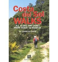
- Costa Del Sol Walks
- Full-color guide to thirty-four walks all within a short distance from the coast, from Nerja to Manilva. With easy-to-follow route notes, full-color maps and clear instructions on how to get to the start of each walk. Lire la suite

Stanfords
United Kingdom
2020
United Kingdom
2020
- DK Eyewitness Chile and Easter Island
- Venture to Chile - a diverse landscape of vibrant towns and natural wondersWhether you want to hike the spectacular peaks of Torres del Paine, go stargazing in San Pedro de Atacama or relax with world-class wine in the Central Valley, your DK Eyewitness travel guide makes sure you experience all that Chile and Easter Island have to offer.... Lire la suite

Stanfords
United Kingdom
2013
United Kingdom
2013
- Tenerife: Car Tours and Walks
- Tenerife is the Sunflower Landscapes guide to exploring the best walking and touring possibilities on the island. The guide covers a range of routes including trips around Orotava Valley and Las Canadas, the North-west and the Anaga Peninsula. A double-sided, fold-out touring map of Corfu gives an overview of the island and the locations of... Lire la suite

Stanfords
United Kingdom
United Kingdom
- Rick Steves Pocket Munich & Salzburg (Second Edition)
- Make the most of every day and every dollar with Rick Steves! This colorful, compact guidebook is perfect for spending a week or less in Munich and Salzburg: City walks and tours: Five detailed self-guided walks including a Munich city walk, Nymphenburg Palace tour, Sound of Music tour, and more Rick`s strategic advice on what`s worth your time... Lire la suite

Stanfords
United Kingdom
2015
United Kingdom
2015
- Northern Portugal Sunflower Landscape Guide
- Northern Portugal is the Sunflower Landscapes guide to exploring the best walking and touring possibilities in the region. The guide covers a range of routes including walks in the Serra de Arga region, Sao Miguel, Brufe, Boucas Donas and the Vilar-Avelar circuit. A fold-out touring map at the back of the book shows an overview of northern... Lire la suite
Cartes
Stanfords
United Kingdom
United Kingdom
- Europe High 5 Edition Road Atlas
- The first physical atlas with direct access to useful additional information from the InternetThe entirety of Europe on 432 pages in a scale of 1:800,000 clearly presented, including lots more travel information:- Road Companion (roadmaps) in a scale of 1:800,000, inclusive of the High 5 - Edition app technology for calling up additional travel... Lire la suite

Stanfords
United Kingdom
United Kingdom
- Takagau
- Takagau, sheet no. 2882-08, in the topographic survey of Nepal at 1:50,000 published by the Nepali Government in the late 1990s and early 2000s and produced from remote sensing data by Finnish cartographers as part of that country’s international aid program. The maps cover 15’ x 15’ quadrangles.IMPORTANT – PLEASE NOTE BEFORE ORDERING:... Lire la suite
Stanfords
United Kingdom
United Kingdom
- Yanma
- Yamna, sheet no. 2787-04, in the topographic survey of Nepal at 1:50,000 published by the Nepali Government in the late 1990s and early 2000s and produced from remote sensing data by Finnish cartographers as part of that country’s international aid program. The maps cover 15’ x 15’ quadrangles.IMPORTANT – PLEASE NOTE BEFORE ORDERING:... Lire la suite
Stanfords
United Kingdom
United Kingdom
- Rachuli
- Rachuli, sheet no. 2981-16, in the topographic survey of Nepal at 1:50,000 published by the Nepali Government in the late 1990s and early 2000s and produced from remote sensing data by Finnish cartographers as part of that country’s international aid program. The maps cover 15’ x 15’ quadrangles.IMPORTANT – PLEASE NOTE BEFORE ORDERING:... Lire la suite
Stanfords
United Kingdom
United Kingdom
- Tiptala Bhañjyan
- Tiptala Bhanjyan, sheet no. 2787-03, in the topographic survey of Nepal at 1:50,000 published by the Nepali Government in the late 1990s and early 2000s and produced from remote sensing data by Finnish cartographers as part of that country’s international aid program. The maps cover 15’ x 15’ quadrangles.IMPORTANT – PLEASE NOTE BEFORE ORDERING:... Lire la suite
Stanfords
United Kingdom
United Kingdom
- Philim
- Philim, sheet no. 2884-12, in the topographic survey of Nepal at 1:50,000 published by the Nepali Government in the late 1990s and early 2000s and produced from remote sensing data by Finnish cartographers as part of that country’s international aid program. The maps cover 15’ x 15’ quadrangles.IMPORTANT – PLEASE NOTE BEFORE ORDERING:... Lire la suite
Stanfords
United Kingdom
United Kingdom
- Lamjun Himal
- Lamjun Himal, sheet no. 2884-09, in the topographic survey of Nepal at 1:50,000 published by the Nepali Government in the late 1990s and early 2000s and produced from remote sensing data by Finnish cartographers as part of that country’s international aid program. The maps cover 15’ x 15’ quadrangles.IMPORTANT – PLEASE NOTE BEFORE ORDERING:... Lire la suite
Stanfords
United Kingdom
United Kingdom
- Taplejung
- Taplejung, sheet no. 2787-11, in the topographic survey of Nepal at 1:50,000 published by the Nepali Government in the late 1990s and early 2000s and produced from remote sensing data by Finnish cartographers as part of that country’s international aid program. The maps cover 15’ x 15’ quadrangles.IMPORTANT – PLEASE NOTE BEFORE ORDERING:... Lire la suite
Stanfords
United Kingdom
United Kingdom
- Tinje
- Tinje, sheet no. 2983-10, in the topographic survey of Nepal at 1:50,000 published by the Nepali Government in the late 1990s and early 2000s and produced from remote sensing data by Finnish cartographers as part of that country’s international aid program. The maps cover 15’ x 15’ quadrangles.IMPORTANT – PLEASE NOTE BEFORE ORDERING:... Lire la suite
Stanfords
United Kingdom
United Kingdom
- Lukla - Salleri
- Lukla - Salleri, sheet no. 2786-07, in the topographic survey of Nepal at 1:50,000 published by the Nepali Government in the late 1990s and early 2000s and produced from remote sensing data by Finnish cartographers as part of that country’s international aid program. The maps cover 15’ x 15’ quadrangles.IMPORTANT – PLEASE NOTE BEFORE ORDERING:... Lire la suite

Stanfords
United Kingdom
United Kingdom
- Barcelona High 5 Edition Street Plan
- The first water-resistant “Comfort Map“ with direct access to useful additional information from the InternetBarcelona in a scale of 1:20,000 including detailed presentation of the old town in a scale of 1:11,000 presented on a practical map; inclusive of the High 5 Edition app technology for calling up additional travel information and many... Lire la suite
Stanfords
United Kingdom
United Kingdom
- Sisne
- Sisne, sheet no. 2883-03, in the topographic survey of Nepal at 1:50,000 published by the Nepali Government in the late 1990s and early 2000s and produced from remote sensing data by Finnish cartographers as part of that country’s international aid program. The maps cover 15’ x 15’ quadrangles.IMPORTANT – PLEASE NOTE BEFORE ORDERING:... Lire la suite
Stanfords
United Kingdom
United Kingdom
- Barhabise
- Barhabise, sheet no. 2785-04, in the topographic survey of Nepal at 1:50,000 published by the Nepali Government in the late 1990s and early 2000s and produced from remote sensing data by Finnish cartographers as part of that country’s international aid program. The maps cover 15’ x 15’ quadrangles.IMPORTANT – PLEASE NOTE BEFORE ORDERING:... Lire la suite
Stanfords
United Kingdom
United Kingdom
- Kolti
- Kolti, sheet no. 2981-07 in the topographic survey of Nepal at 1:50,000 published by the Nepali Government in the late 1990s and early 2000s and produced from remote sensing data by Finnish cartographers as part of that country’s international aid program. The maps cover 15’ x 15’ quadrangles.IMPORTANT – PLEASE NOTE BEFORE ORDERING:... Lire la suite
Stanfords
United Kingdom
United Kingdom
- Topkegola
- Topkegola, sheet no. 2787-07, in the topographic survey of Nepal at 1:50,000 published by the Nepali Government in the late 1990s and early 2000s and produced from remote sensing data by Finnish cartographers as part of that country’s international aid program. The maps cover 15’ x 15’ quadrangles.IMPORTANT – PLEASE NOTE BEFORE ORDERING:... Lire la suite