
Stanfords
United Kingdom
- Preston Past and Present
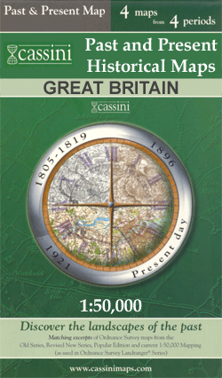
- Preston in the Cassini Past and Present map series which covers town and cities of England and Wales and offers a unique way of tracing their history and expansion by showing four different periods of their development using Ordnance Survey mapping from the mid-19th century, the late 19th century, the 1920s and the present day. Coverage... Lire la suite

Stanfords
United Kingdom
- Bedford and Huntingdon 1805-1920 (3-map set)
- Map No. 153, Bedford and Huntingdon 1805-1920 (3-map set), in the Cassini Historical Series of old Ordnance Survey mapping of England and Wales at 1:50,000 in a format designed to offer a convenient comparison with the present day coverage from the OS, and most locations in three different editions. Old historical maps have been combined so... Lire la suite
Stanfords
United Kingdom
- Taunton and Lyme Regis 1899-1900
- Map No. 193, Taunton and Lyme Regis 1899-1900, in the Cassini Historical Series of old Ordnance Survey mapping of England and Wales at 1:50,000 in a format designed to offer a convenient comparison with the present day coverage from the OS, and most locations in three different editions. Old historical maps have been combined so that the sheet... Lire la suite

Stanfords
United Kingdom
- Coventry and Kenilworth Past and Present
- Coventry and Kenilworth in the Cassini Past and Present map series which covers town and cities of England and Wales and offers a unique way of tracing their history and expansion by showing four different periods of their development using Ordnance Survey mapping from the mid-19th century, the late 19th century, the 1920s and the present day.... Lire la suite
Stanfords
United Kingdom
- Sheffield and Huddersfield 1840-1925 (3-map set)
- Map No. 110, Sheffield and Huddersfield 1840-1925 (3-map set), in the Cassini Historical Series of old Ordnance Survey mapping of England and Wales at 1:50,000 in a format designed to offer a convenient comparison with the present day coverage from the OS, and most locations in three different editions. Old historical maps have been combined so... Lire la suite
Stanfords
United Kingdom
- St David`s and Haverfordwest / Tyddewi a Hwlffordd 1922-1923
- Map No. 157, St David`s and Haverfordwest / Tyddewi a Hwlffordd 1922-1923, in the Cassini Historical Series of old Ordnance Survey mapping of England and Wales at 1:50,000 in a format designed to offer a convenient comparison with the present day coverage from the OS, and most locations in three different editions. Old historical maps have been... Lire la suite
Stanfords
United Kingdom
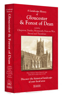
- Gloucester and the Forest of Dean 1818-1919 (3-map set)
- Map No. 162, Gloucester and the Forest of Dean 1818-1919 (3-map set), in the Cassini Historical Series of old Ordnance Survey mapping of England and Wales at 1:50,000 in a format designed to offer a convenient comparison with the present day coverage from the OS, and most locations in three different editions. Old historical maps have been... Lire la suite
Stanfords
United Kingdom
- Land`s End and Isles of Scilly 1900
- Map No. 203, Land`s End and Isles of Scilly 1900, in the Cassini Historical Series of old Ordnance Survey mapping of England and Wales at 1:50,000 in a format designed to offer a convenient comparison with the present day coverage from the OS, and most locations in three different editions. Old historical maps have been combined so that the... Lire la suite
Stanfords
United Kingdom
- Walsall and Sutton Coldfield Past and Present
- Walsall and Sutton Coldfield in the Cassini Past and Present map series which covers town and cities of England and Wales and offers a unique way of tracing their history and expansion by showing four different periods of their development using Ordnance Survey mapping from the mid-19th century, the late 19th century, the 1920s and the present... Lire la suite
Stanfords
United Kingdom
- Mansfield and Worksop 1824-1924 (3-map set)
- Map No. 120, Mansfield and Worksop 1824-1924 (3-map set), in the Cassini Historical Series of old Ordnance Survey mapping of England and Wales at 1:50,000 in a format designed to offer a convenient comparison with the present day coverage from the OS, and most locations in three different editions. Old historical maps have been combined so that... Lire la suite
Stanfords
United Kingdom
- Denbigh & Colwyn Bay / Dinbych a Bae Colwyn 1921-1924
- Map No. 116, Denbigh and Colwyn Bay / Dinbych a Bae Colwyn 1921-1924, in the Cassini Historical Series of old Ordnance Survey mapping of England and Wales at 1:50,000 in a format designed to offer a convenient comparison with the present day coverage from the OS, and most locations in three different editions. Old historical maps have been... Lire la suite

Stanfords
United Kingdom
- North York Moors West AA Walker`s Map 19
- The western part of the North York Moors at 1:25,000 in a series of Walker’s Maps published by the AA with the cartography from the Ordnance Survey’s Explorer series. The map is double-sided and coverage includes North York Moors National Park, Middlesbrough, Salturn-by-the-Sea, Guisboroughm Stokesley, Castleton, Seave Green, Hutton-le-Hole,... Lire la suite
Stanfords
United Kingdom
- Aberystwyth and Machynlleth 1901-1903
- Map No. 135, Aberystwyth and Machynlleth 1901-1903, in the Cassini Historical Series of old Ordnance Survey mapping of England and Wales at 1:50,000 in a format designed to offer a convenient comparison with the present day coverage from the OS, and most locations in three different editions. Old historical maps have been combined so that the... Lire la suite
Stanfords
United Kingdom
- Presteigne and Hay-on-Wye / Llanandras a’r Gelli Gandryll 1900-1903
- Map No. 148, Presteigne and Hay-on-Wye / Llanandras a’r Gelli Gandryll 1900-1903, in the Cassini Historical Series of old Ordnance Survey mapping of England and Wales at 1:50,000 in a format designed to offer a convenient comparison with the present day coverage from the OS, and most locations in three different editions. Old historical maps... Lire la suite
Stanfords
United Kingdom
- Derby and Burton upon Trent 1834-1921 (3-map set)
- Map No. 128, Derby and Burton upon Trent 1834-1921 (3-map set), in the Cassini Historical Series of old Ordnance Survey mapping of England and Wales at 1:50,000 in a format designed to offer a convenient comparison with the present day coverage from the OS, and most locations in three different editions. Old historical maps have been combined... Lire la suite