Stanfords
United Kingdom
- E3 Arquipelago de Madeira
- Plans included:Porto Santo (1:25 000)Porto de Recreio da Calheta (1:6250)Funchal (1:10 000)Água de Pena (1:5000)Porto de Machico (1:7500)Quinta do Lorde (1:5000)Ponta de São Lourenço (1:30 000)Enseada da Doca (Isla Deserta Grande) (1:25 000)Selvagem Grande (1:30 000)Selvagem Pequena (1:30 000)On this edition the chart specification has been... Lire la suite

Stanfords
United Kingdom
- Mulde Valley Cycle Route - Erzgebirge to Dessau Bikeline Map-Guide
- Mulde Valley Cycle Route, a 383-km long cycle route across Thuringia along the valley of the Mulde from the Erzgebirge mountains to the Elbe at Dessau, presented by the Verlag Esterbauer in a guide with maps at 1:75,000 showing the route and its variants. Extensive information is conveyed by symbols, indicating road surface, campsites and other... Lire la suite

Stanfords
United Kingdom
- Czechia Shocart 50K Tourist Atlas
- Czech Republic Tourist Atlas from Shocart with over 600 pages of contoured mapping at an exceptionally detailed scale of 1:50,000 with hiking and cycling trails, presented in an A4 ring-binder with a hard slipcase. Each page is removable so coverage can be easily assembled for just selected parts of the country, or individual pages used on... Lire la suite

Stanfords
United Kingdom
De Zwerver
Netherlands

De Zwerver
Netherlands

Stanfords
United Kingdom
- Stara Planina Central: Uzana to Vratnik Domino Map
- Stara Planina Central: Uzana to Vratnik map at 1:50,000 from Bulgarian publishers Domino, contoured and GPS compatible, with hiking trails, accommodation options including a list of local mountain refuges, etc. The map is double-sided and covers the mountains from just west of the Uzana massif, the geographical centre of Bulgaria, eastwards to... Lire la suite

De Zwerver
Netherlands
- Wandelkaart 2 Stara Planina gebergte | Domino
- Stara Planina Central: Uzana to Vratnik map at 1:50,000 from Bulgarian publishers Domino, contoured and GPS compatible, with hiking trails, accommodation options including a list of local mountain refuges, etc. The map is double-sided and covers the mountains from just west of the Uzana massif, the geographical centre of Bulgaria, eastwards to... Lire la suite
De Zwerver
Netherlands

Stanfords
United Kingdom
- Stara Planina Western: Belogradchik to Berkovita Domino Map
- Stara Planina Western: Belogradchik to Berkovita map at 1:50,000 from Bulgarian publishers Domino, contoured and GPS compatible, with hiking trails, accommodation options including a list of local mountain refuges, etc. The map is double-sided and covers the mountains from the peak of Byala Voda near Belogradchik eastwards to just beyond... Lire la suite

De Zwerver
Netherlands
- Wandelkaart 3 Stara Planina gebergte | Domino
- Stara Planina Western: Belogradchik to Berkovita map at 1:50,000 from Bulgarian publishers Domino, contoured and GPS compatible, with hiking trails, accommodation options including a list of local mountain refuges, etc. The map is double-sided and covers the mountains from the peak of Byala Voda near Belogradchik eastwards to just beyond... Lire la suite

Stanfords
United Kingdom
De Zwerver
Netherlands
- Wandelkaart 407 Krušné hory - Chomutovsko - Erzgebirge | Shocart
- Gedetailleerde deelkaart van Tsjechie met daarop naast vele topografische details ook ingetekende wandelroutes, hutten en andere toeristische bezienswaardigheden. Voor de wandelaar zijn de routes en bijvoorbeeld hoogtelijnen van belang. Goed kleurgebruik en legenda in meerdere talen. Als wandelkaart of fietskaart dan ook prima te gebruiken Lire la suite

Stanfords
United Kingdom
- Stara Planina Western: Berkovita to Zlatitsa Domino Map
- Stara Planina Western: Berkovita to Zlatitsa map at 1:50,000 from Bulgarian publishers Domino, contoured and GPS compatible, with hiking trails, accommodation options including a list of local mountain refuges, etc. The map is double-sided and covers the mountains from Varshets (directly north of Sofia) to just beyond Etrepole.Maps in the... Lire la suite

De Zwerver
Netherlands
- Wandelkaart 4 Stara Planina gebergte | Domino
- Stara Planina Western: Berkovita to Zlatitsa map at 1:50,000 from Bulgarian publishers Domino, contoured and GPS compatible, with hiking trails, accommodation options including a list of local mountain refuges, etc. The map is double-sided and covers the mountains from Varshets (directly north of Sofia) to just beyond Etrepole.Maps in the... Lire la suite
De Zwerver
Netherlands
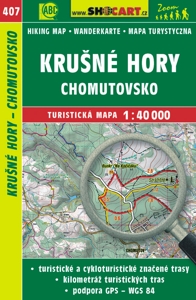
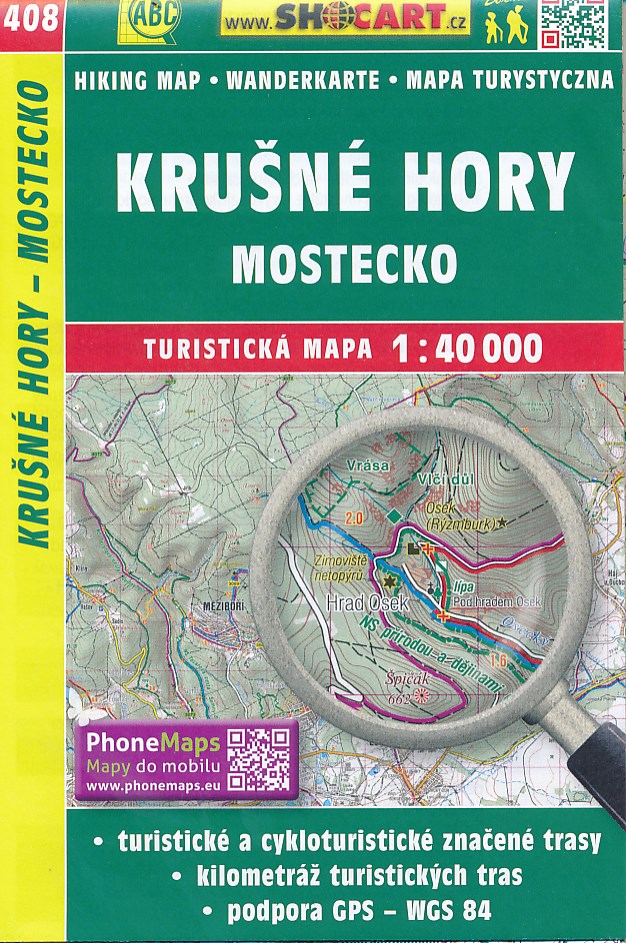
- Wandelkaart 408 Krušné hory - Mostecko - Erzgebirge, Brüx | Shocart
- Gedetailleerde deelkaart van Tsjechie met daarop naast vele topografische details ook ingetekende wandelroutes, hutten en andere toeristische bezienswaardigheden. Voor de wandelaar zijn de routes en bijvoorbeeld hoogtelijnen van belang. Goed kleurgebruik en legenda in meerdere talen. Als wandelkaart of fietskaart dan ook prima te gebruiken Lire la suite

Stanfords
United Kingdom
- Strandzha Mountains: Burgas to the Turkish Border Domino Map
- Strandzha Mountains in the south-eastern corner of Bulgaria between Burgas to the Turkish border on a contoured and GPS compatible map from Domino showing local hiking trails and highlighting various interesting sites, with three more detailed enlargements at 1:25,000. Most place names are in both Latin and Cyrillic alphabet; map legend... Lire la suite

De Zwerver
Netherlands
- Wandelkaart Strandzha - Bulgarije | Domino
- Strandzha Mountains in the south-eastern corner of Bulgaria between Burgas to the Turkish border on a contoured and GPS compatible map from Domino showing local hiking trails and highlighting various interesting sites, with three more detailed enlargements at 1:25,000. Most place names are in both Latin and Cyrillic alphabet; map legend... Lire la suite

De Zwerver
Netherlands
- Wandelkaart Sredna Gora - Bulgarije | Domino
- Pirin Mountains at 1:50,000 on a large, double-sided, contoured map with GPS waypoints for shelters and chalets, peaks, etc. and highlighting hiking routes. Topography is shown by contours at 40m intervals with additional relief shading and graphics and colouring for sandstone stacks, single rocks over 5m high, marshlands and different types of... Lire la suite