Stanfords
United Kingdom
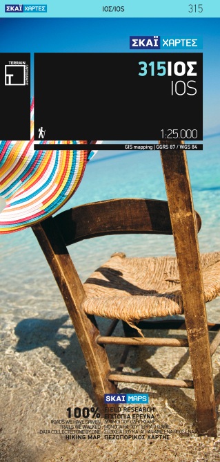
- Ios Terrain Editions 315
- Greek island of Ios on a light, waterproof and tear-resistant, contoured and GPS compatible map at 1:25,000 from Terrain Editions, with on the reverse descriptions of seven selected hiking trails. All place names are shown in both Greek and Latin alphabet. Map legend and all the text include English.Maps of the Greek islands from Terrain... Lire la suite
De Zwerver
Netherlands
- Wandelkaart 315 Ios | Terrain maps
- Ios at 1:25,000 on a contoured, GPS compatible hiking map published by Terrain Cartography group together with Skai Maps, and printed on light, waterproof and tear-resistant Polyart plastic paper, with extensive tourist information.Topography is very well presented by contours, enhanced by spot heights, subtle relief shading and additional... Lire la suite

Stanfords
United Kingdom
- Kimolos & Polyaigos 25K Terrain Editions Pocket Map
- Greek islands of Kimolos and Polyaigos in the Cyclades on a contoured and GPS compatible pocket map at 1:25,000 from Terrain Editions. On the reverse are descriptions of two hiking trails on Kimolos and general notes on its history, sights, nature, etc, plus photos. All place names are shown in both Greek and Latin alphabet. Map legend and all... Lire la suite

Stanfords
United Kingdom
- Lefkada Anavasi 9.1
- Lefkada / Lefkas in the Ionian Islands on light, a waterproof and tear-resistant, contoured and GPS compatible map at 1:40.000 from Anavasi, with on the reverse a street plan of the Lefkada Town, recommendations for hiking trails, general notes about the island, etc. Coverage includes the near-by island of Meganisi and part of the adjoining... Lire la suite

Stanfords
United Kingdom
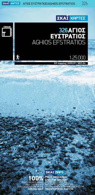
- Aghios Efstratios Terrain Editions 326
- Aghios Efstratios island in the northern Aegean Sea on a light, waterproof and tear-resistant, contoured and GPS compatible map at 1:20,000 from Terrain Editions with extensive tourist information. All place names are shown in both Greek and Latin alphabet. Map legend and all the text include English.Maps of the Greek islands from Terrain... Lire la suite
De Zwerver
Netherlands
- Wandelkaart 326 Aghios Efstratios | Terrain maps
- Aghios Efstratios at 1:20,000 on a contoured, GPS compatible hiking map published by Terrain Cartography group together with Skai Maps, and printed on light, waterproof and tear-resistant Polyart plastic paper, with extensive tourist information.Topography is very well presented by contours, enhanced by spot heights, subtle relief shading and... Lire la suite

Stanfords
United Kingdom
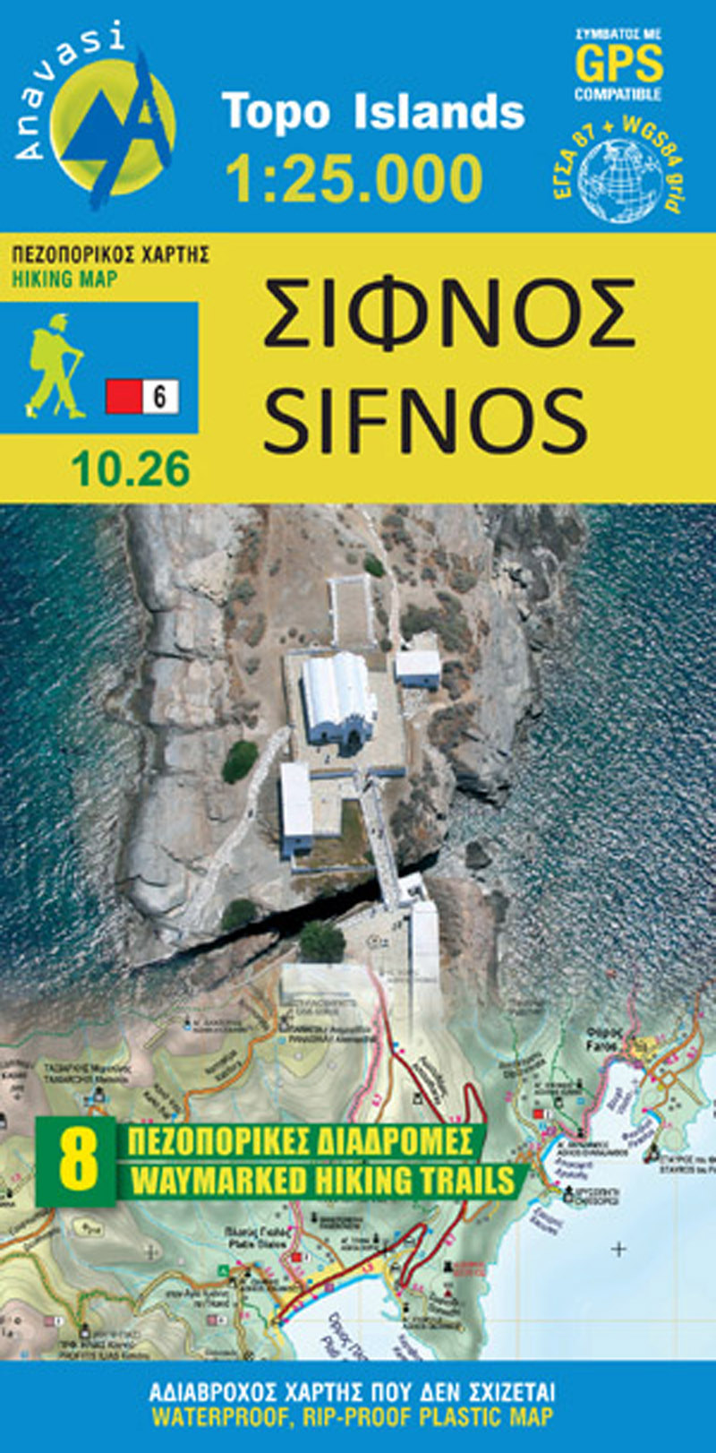
- Sifnos Anavasi 10.26
- Sifnos in the Cyclades on light, a waterproof and tear-resistant, contoured and GPS compatible map at 1:25,000 from Anavasi for exploring the island on foot or by car, highlighting eight recommended hiking trails, plus descriptions of 11 most interesting locations on Sifnos.Landscape is vividly shown by contours at 20m with altitude colouring,... Lire la suite
De Zwerver
Netherlands
- Wandelkaart 10.26 Sifnos | Anavasi
- Sifnos in the Cyclades on light, a waterproof and tear-resistant, contoured and GPS compatible map at 1:25,000 from Anavasi for exploring the island on foot or by car, highlighting eight recommended hiking trails, plus descriptions of 11 most interesting locations on Sifnos.Landscape is vividly shown by contours at 20m with altitude colouring,... Lire la suite

Stanfords
United Kingdom
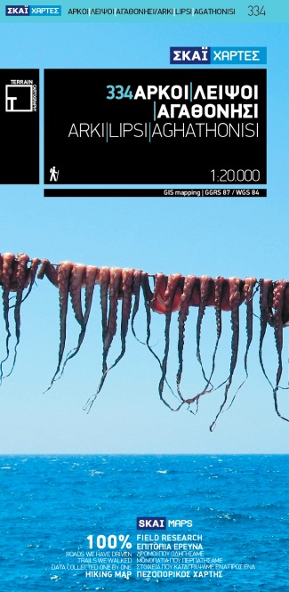
- Arki - Lipsi - Aghathonisi Terrain Editions 334
- Greek islands of Arki (Arkoi), Lipsi and Aghathonisi on a light, waterproof and tear-resistant, contoured and GPS compatible map at 1:20,000 from Terrain Editions. On the reverse are notes about the three islands, illustrated with colour photos. All place names are shown in both Greek and Latin alphabet. Map legend and all the text include... Lire la suite
De Zwerver
Netherlands
- Wandelkaart 334 Arki - Lipsi - Aghathonisi | Terrain maps
- Arki (Arkoi), Lipsi and Aghathonisi at 1:20,000 on a contoured, GPS compatible hiking map published by Terrain Cartography group together with Skai Maps, and printed on light, waterproof and tear-resistant Polyart plastic paper, with extensive tourist information.Topography is very well presented by contours, enhanced by spot heights, subtle... Lire la suite

Stanfords
United Kingdom
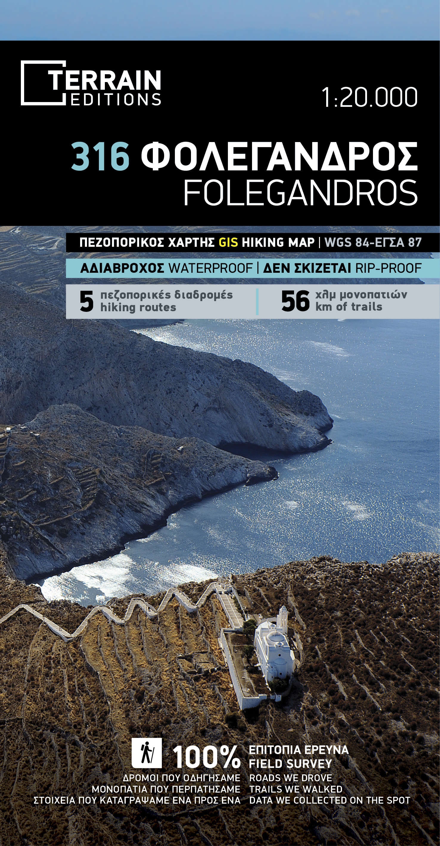
- Folegandros Terrain Editions 316
- Folegandros on a light, waterproof and tear-resistant, contoured and GPS compatible map at 1:20,000 from Terrain Editions, with a large street plan of the Hora of Folegandros at 1:2,000 annotated with various facilities. On the reverse is general information about the island, plus descriptions of eight hiking trails. All place names are shown... Lire la suite
De Zwerver
Netherlands
- Wandelkaart 316 Folegandros | Terrain maps
- Folegandros on a light, waterproof and tear-resistant, contoured and GPS compatible map at 1:20,000 from Terrain Editions, with a large street plan of the Hora of Folegandros at 1:2,000 annotated with various facilities. On the reverse is general information about the island, plus descriptions of eight hiking trails. All place names are shown... Lire la suite

Stanfords
United Kingdom
- Chios - Psara - Inouses Anavasi 10.31
- Chios with Oinousses on a light, waterproof and tear-resistant, contoured and GPS compatible map at 1:60,000 published by Anavasi, with the nearby island of Psara shown on the reverse at 1:40,000. Plus street maps of the town on Chios and of the historic Kampos area near the island’s airport.Landscape is vividly presented by contours at 20m... Lire la suite

Stanfords
United Kingdom
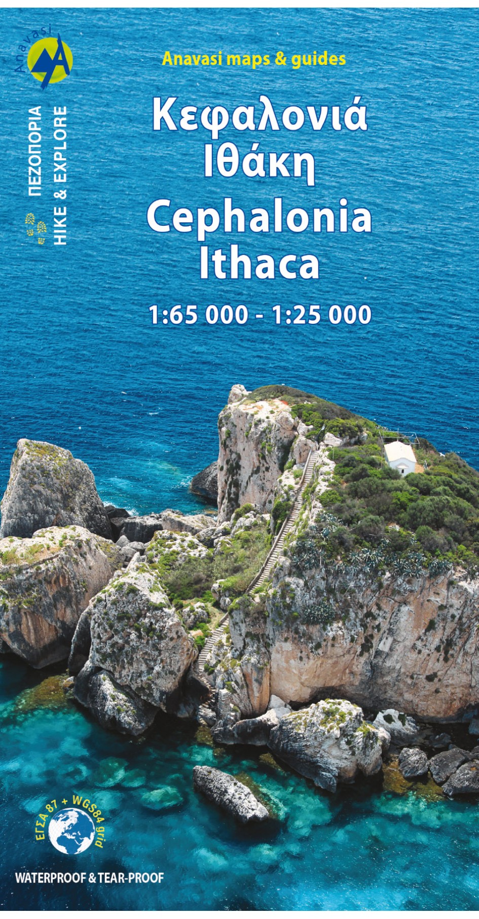
- Cephalonia / Kefalonia - Ithaca Anavasi 9.3
- Kefalonia at 1:65,000 with Ithaca at 1:25,000 on a contoured, GPS compatible double-sided map from Anavasi, with recommended hiking trails on both islands and printed on light, waterproof and tear-resistant plastic paper. On one side are both islands at 1:65,000, with an enlargement of Ithaca at 1:25,000 shown on the reverse. Topography is... Lire la suite

Stanfords
United Kingdom
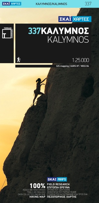
- Kalymnos Terrain Editions 337
- Greek island of Kalymnos on a light, waterproof and tear-resistant, contoured and GPS compatible map at 1:25,000 from Terrain Editions, with a street plan of Kalymnos Town (Pothia) at 1:3,500. The reverse side includes information on the island’s rock climbing sites, plus descriptions of 13 specially selected hiking trails. All place names are... Lire la suite
De Zwerver
Netherlands
- Wandelkaart 337 Kalymnos | Terrain maps
- Kalymnos at 1:25,000 on a contoured, GPS compatible hiking map published by Terrain Cartography group together with Skai Maps, and printed on light, waterproof and tear-resistant Polyart plastic paper, with extensive tourist information.Topography is very well presented by contours, enhanced by spot heights, subtle relief shading and additional... Lire la suite

Stanfords
United Kingdom
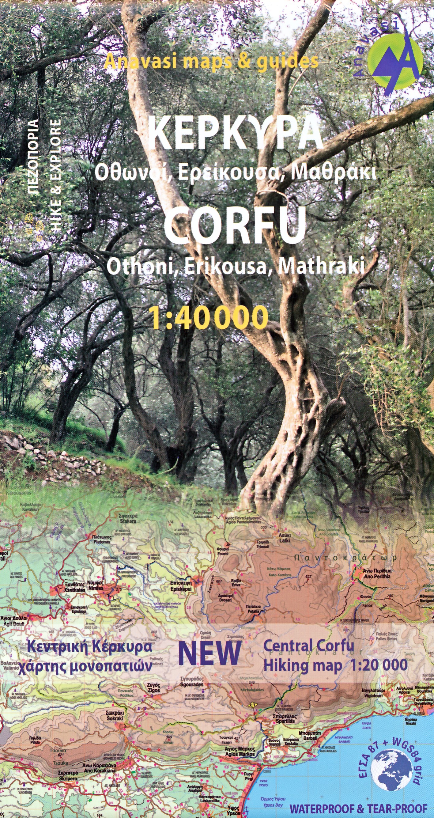
- Corfu - Othoni - Erikouse - Mathraki Anavasi 9.4
- Corfu on a handy size, light, waterproof and tear-resistant, contoured and GPS compatible map at 1:40,000 from Anavasi, highlighting the course of the Corfu Trail across the whole length of the island. The map is double-sided with a narrow overlap between the sides.Landscape is shown by contours at 50m with hill shading and spot heights. The... Lire la suite

Stanfords
United Kingdom
- Syros Anavasi 10.22
- Syros in the Cyclades on light, a waterproof and tear-resistant, contoured and GPS compatible map at 1:20,000 from Anavasi for exploring the island on foot or by car. On the reverse is a street plan of Ermoupoli / Hermoupolis showing various facilities and places of interest, plus contact details for various accommodation options.Landscape of... Lire la suite

Stanfords
United Kingdom
- Astypalaea / Astypalaia Terrain Editions 330
- Astypalaea on a light, waterproof and tear-resistant, contoured and GPS compatible map at 1:25,000 from Terrain Editions, with street plan of the Hora of Astypalaea at 1:4,000. The reverse side includes information on the island`s main rock climbing site with details of its 22 climbing routes, giving height, the number of bolts and the grades.... Lire la suite

Stanfords
United Kingdom
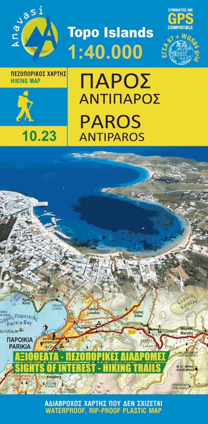
- Paros - Antiparos Anavasi 10.23
- Paros at 1:40,000 on a light, waterproof and tear-resistant, contoured and GPS-compatible map from Anavasi with English language descriptions of best sights. Topography is very clearly presented by contours at 20m intervals enhanced by relief shading and altitude colouring. The map indicates dirt roads in poor condition and shows locations of... Lire la suite
De Zwerver
Netherlands
- Wandelkaart 10.23 Paros | Anavasi
- Paros at 1:40,000 on a light, waterproof and tear-resistant, contoured and GPS-compatible map from Anavasi with English language descriptions of best sights. Topography is very clearly presented by contours at 20m intervals enhanced by relief shading and altitude colouring. The map indicates dirt roads in poor condition and shows locations of... Lire la suite

Stanfords
United Kingdom
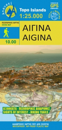
- Aigina / Aegina Anavasi 10.00
- Aegina at 1:25,000 on light, waterproof and tear-resistant, GPS compatible and contoured map from Anavasi, with on the reverse a simplified map of the island for sightseeing and recommended hiking trails.On one side is a contoured map of the island (interval 20m), with additional altitude colouring and shading. All place names are in both Greek... Lire la suite
De Zwerver
Netherlands
- Wandelkaart 10.00 Aigina | Anavasi
- Aegina at 1:25,000 on light, waterproof and tear-resistant, GPS compatible and contoured map from Anavasi, with on the reverse a simplified map of the island for sightseeing and recommended hiking trails.On one side is a contoured map of the island (interval 20m), with additional altitude colouring and shading. All place names are in both Greek... Lire la suite