Stanfords
United Kingdom
- Lanzo - Viù - Chialamberto - Locana 25K IGC Map No. 110
- Lanzo - Viù - Chialamberto - Locana – Cirié – Basse Valli di Lanzo area at 1:25,000 in a series of contoured, GPS compatible walking maps from the Turin based Istituto Geografico Centrale, highlighting hiking trails including long-distance routes, ski routes and alpine accommodation. Maps in this series have contours at 25m intervals, enhanced... Lire la suite

Stanfords
United Kingdom
- Val Pellice
- Val Pellice area of the Italian Alps presented at 1:25,000 in a series of large, contoured and GPS compatible walking maps from Fraternali Editore, printed on light, waterproof and tear-resistant synthetic paper. Maps in this series have topography shown by contour lines at 5m intervals with relief shading, spot heights, and colouring and/or... Lire la suite

Stanfords
United Kingdom
- Valle Maira l`Escursionista Editore
- Valle Maira, at 1:25,000 on a waterproof and tear-resistant, double-sided, contoured and GPS-compatible map from the Istituto Geografico Adriatico with an overprint highlighting numerous local and long-distance hiking trails, including the GTA (Grande Traversata delle Alpi). The map shows various types of accommodation (huts and refuges, B&Bs,... Lire la suite

Stanfords
United Kingdom
- Val Brembana - Valsassina - Le Grigne: Lecco - Bergamo 50K IGC Map No. 22
- Val Brembana - Valsassina - Le Grigne area including Lecco and Bergamo in a series contoured hiking maps at 1:50,000 with local trails, long-distance footpaths, mountain accommodation, etc. from the Turin based Istituto Geografico Centrale.Maps in this series have contours at 50m intervals, enhanced by shading and graphic relief. An overprint... Lire la suite

Stanfords
United Kingdom

Stanfords
United Kingdom
- Gran Paradiso - Valle d`Aosta - Valle del`Orco Kompass 86
- Gran Paradiso - Valle d`Aosta area of the Italian Alps on a GPS compatible hiking and recreational map at 1:50,000 from Kompass on durable, waterproof and tear-resistant synthetic paper. Coverage includes Cogne, Valgrisenche, Val di Rhèmes, Valsavarenche, Valle Soana and Val dell’Orco, as well as a section of the GTA – Grande Travesata delle... Lire la suite

Stanfords
United Kingdom
- Domodossola - Val Formazza 50K IGC Map No. 11
- Domodossola - Val Formazza area of the Italian Alps in a series contoured hiking maps at 1:50,000 with local trails, long-distance footpaths, mountain accommodation, etc. from the Turin based Istituto Geografico Centrale.Maps in this series have contours at 50m intervals, enhanced by shading and graphic relief. An overprint highlights local... Lire la suite

Stanfords
United Kingdom
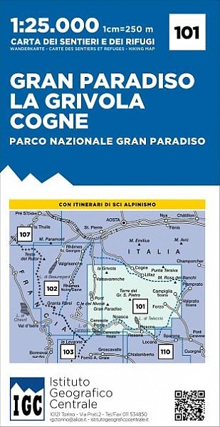
- Gran Paradiso - La Grivola - Cogne IGC 101
- Gran Paradiso - La Grivola - Cogne area of the Italian Alps at 1:25,000 in a series of contoured, GPS compatible walking maps from the Turin based Istituto Geografico Centrale, highlighting hiking trails including long-distance routes, ski routes and alpine accommodation. Maps in this series have contours at 25m intervals, enhanced by shading... Lire la suite

Stanfords
United Kingdom
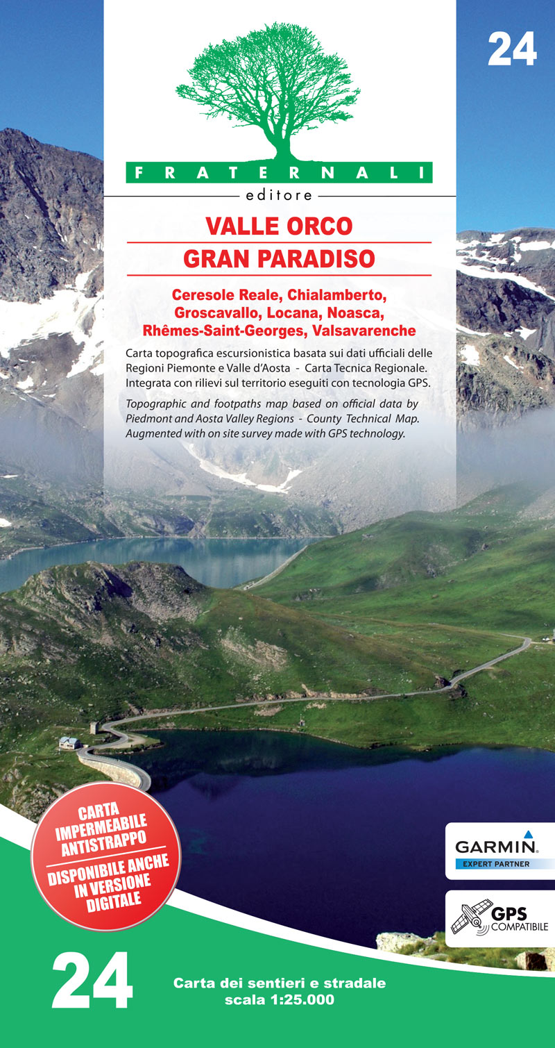
- Valle Orco - Gran Paradiso
- Valli di Lanzo in the Italian Alps presented at 1:25,000 in a series of large, contoured and GPS compatible walking maps from Fraternali Editore, printed on light, waterproof and tear-resistant synthetic paper. Maps in this series have topography shown by contour lines at 5m intervals with relief shading, spot heights, and colouring and/or... Lire la suite
De Zwerver
Netherlands
- Wandelkaart 24 Valle Orco, Gran Paradiso | Fraternali Editore
- Valli di Lanzo in the Italian Alps presented at 1:25,000 in a series of large, contoured and GPS compatible walking maps from Fraternali Editore, printed on light, waterproof and tear-resistant synthetic paper. Maps in this series have topography shown by contour lines at 5m intervals with relief shading, spot heights, and colouring and/or... Lire la suite

Stanfords
United Kingdom
- Ivrea - Biela - Lower Aosta Valley 50K IGC Map No. 9
- Ivrea - Biela - Lower Aosta Valley area in a series contoured hiking maps at 1:50,000 with local trails, long-distance footpaths, mountain accommodation, etc. from the Turin based Istituto Geografico Centrale. Maps in this series have contours at 50m intervals, enhanced by shading and graphic relief. An overprint highlights local footpaths and... Lire la suite

Stanfords
United Kingdom
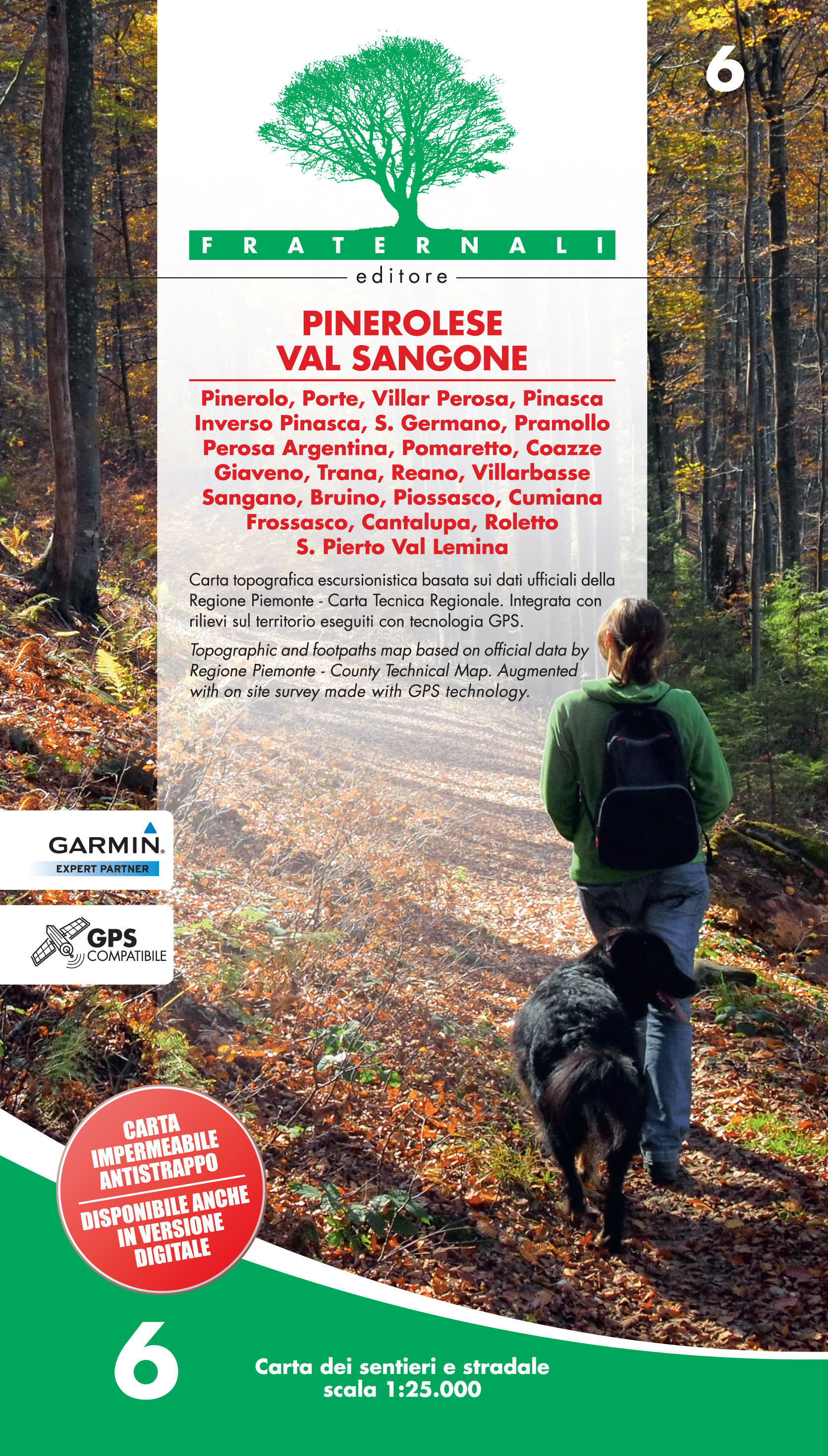
- Pinerolese - Val Sangone Fraternali Editore 06
- Pinerolese - Val Sangone area of the Italian Alps presented at 1:25,000 in a series of large, contoured and GPS compatible walking maps from Fraternali Editore, printed on light, waterproof and tear-resistant synthetic paper. Maps in this series have topography shown by contour lines at 5m intervals with relief shading, spot heights, and... Lire la suite
De Zwerver
Netherlands
- Wandelkaart 06 Pinerolese - Val Sangone | Fraternali Editore
- Gebied: Pinerolo, Porte, Villar Perosa, Pinasca, Inverso Pinasca, S. Germano, Pramollo, Perosa Argentina, Pomaretto, Coazze, Giaveno, Trana, Reano, Villarbasse, Sangano, Bruino, Piossasco, Cumiana, Frossasco, Cantalupa, Roletto, S. Pietro Val Lemina. Een uitstekende wandelkaart van de westkant van Italie waar tot voor kort geen echt goede... Lire la suite

Stanfords
United Kingdom
- Il Cuneese: Cuneo - Saluzzo - Carmagnola 75K IGC Map No. 24
- Il Cuneese area of Piedmont, including Cuneo, Saluzzo and Carmagnola, at 1:75,000 in a series contoured hiking maps with local trails, long-distance footpaths, mountain accommodation, etc. from the Turin based Istituto Geografico Centrale. This title also includes an overprint showing cycle routes.Maps in this series have contours at 50m... Lire la suite

Stanfords
United Kingdom
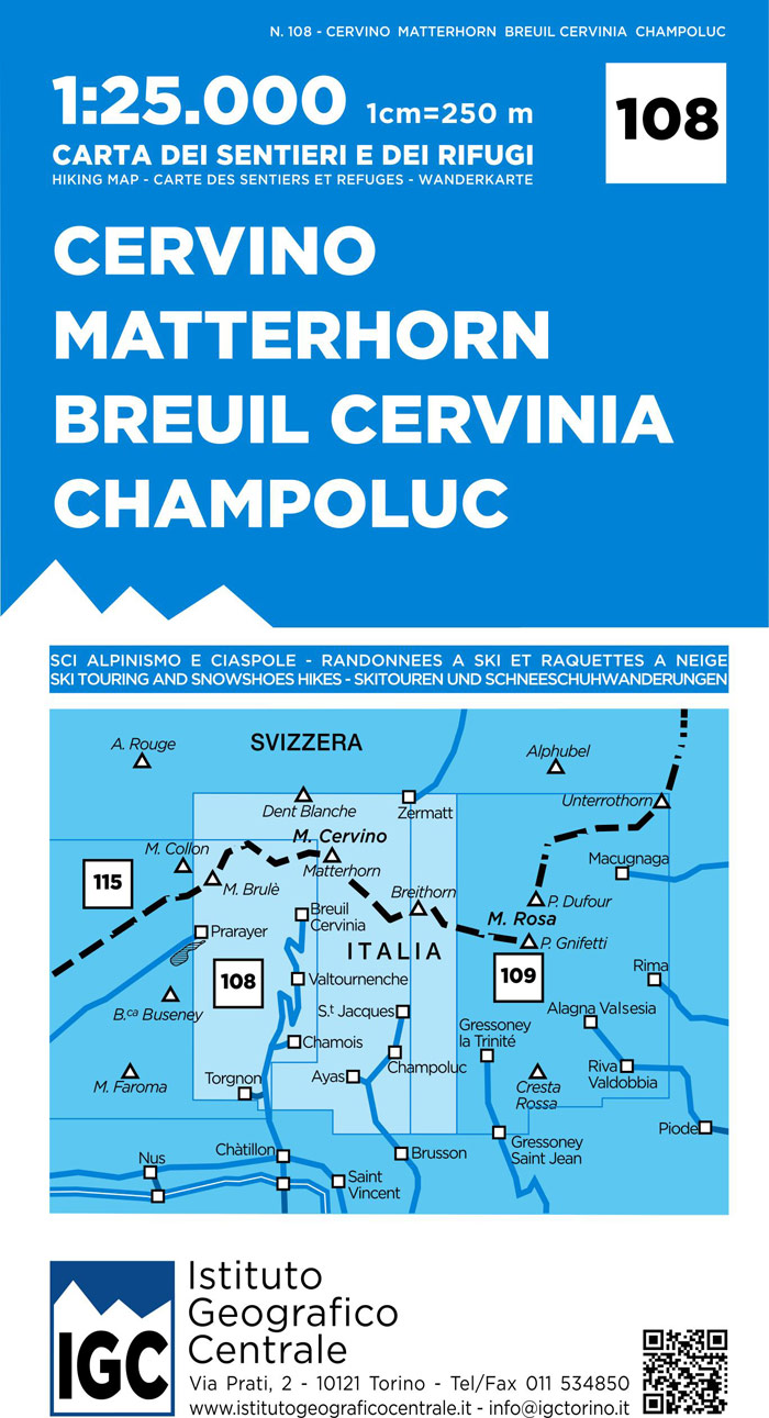
- Matterhorn / Cervino - Breuil Cervinia - Champoluc IGC 108
- Matterhorn/M. Cervino - Breuil-Cervinia - Champoluc area at 1:25,000 in a series of contoured, GPS compatible walking maps from the Turin based Istituto Geografico Centrale, highlighting hiking trails including long-distance routes, ski routes and alpine accommodation. Maps in this series have contours at 25m intervals, enhanced by shading and... Lire la suite

Stanfords
United Kingdom
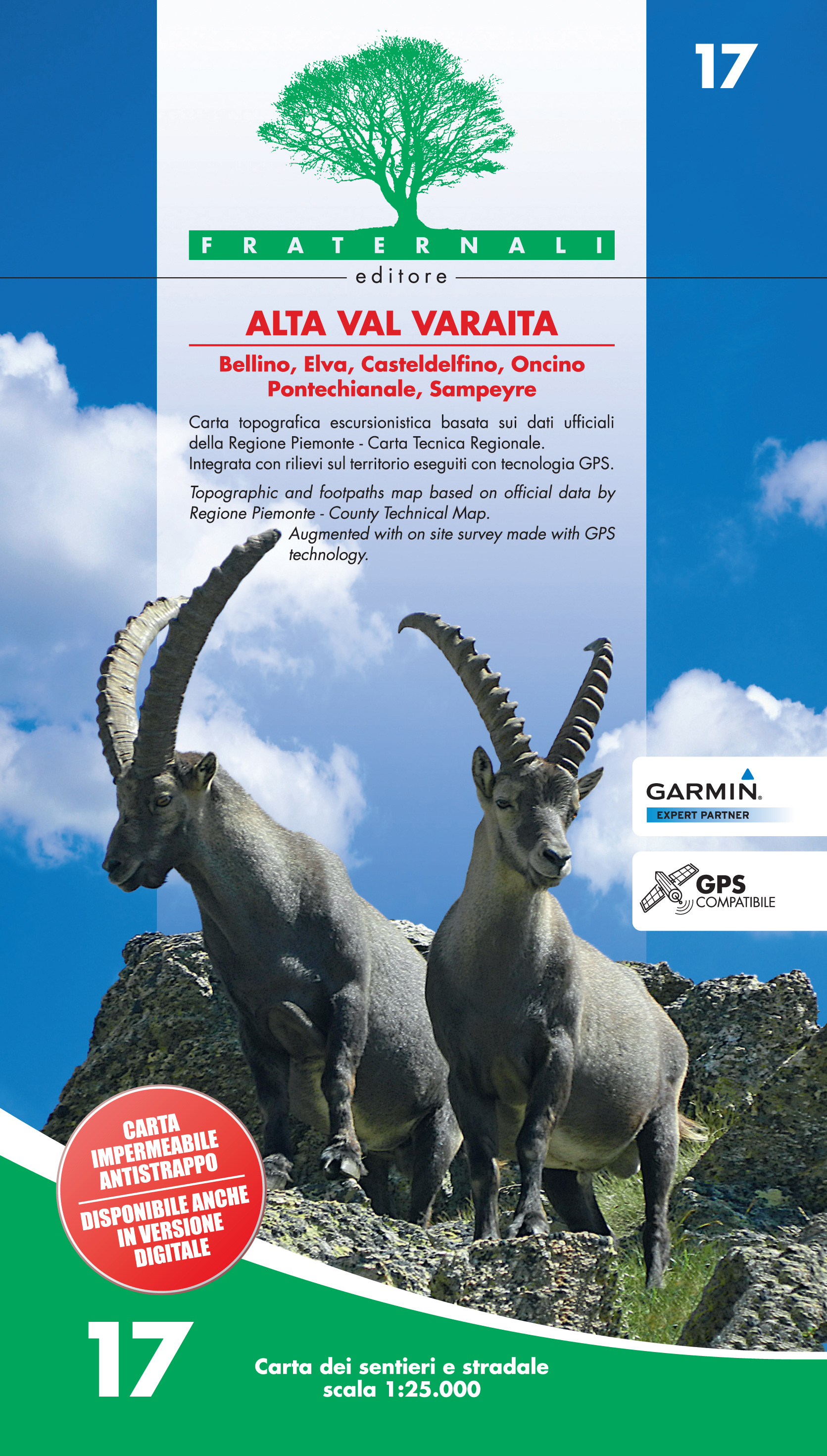
- Alta Val Varaita
- Alta Val Varaita in the Italian Alps presented at 1:25,000 in a series of large, contoured and GPS compatible walking maps from Fraternali Editore, printed on light, waterproof and tear-resistant synthetic paper. Maps in this series have topography shown by contour lines at 5m intervals with relief shading, spot heights, and colouring and/or... Lire la suite
De Zwerver
Netherlands
- Wandelkaart 17 Alta Val Varaita | Fraternali Editore
- Alta Val Varaita in the Italian Alps presented at 1:25,000 in a series of large, contoured and GPS compatible walking maps from Fraternali Editore, printed on light, waterproof and tear-resistant synthetic paper. Maps in this series have topography shown by contour lines at 5m intervals with relief shading, spot heights, and colouring and/or... Lire la suite

Stanfords
United Kingdom
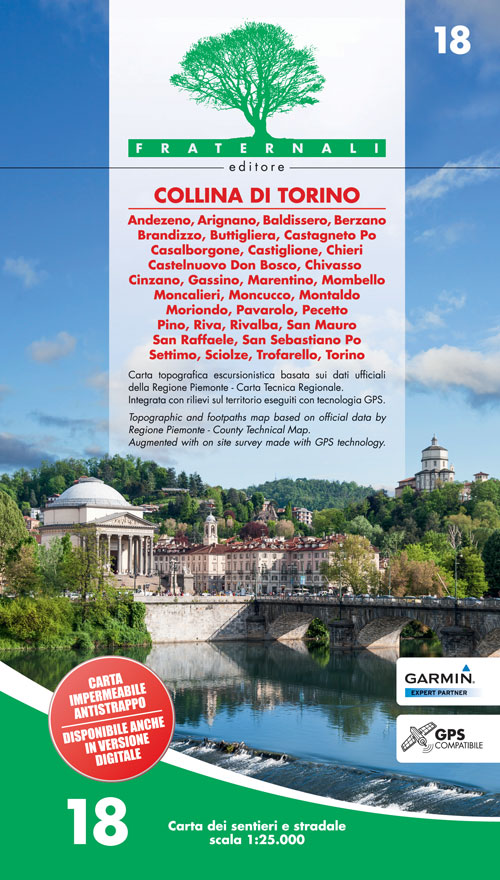
- Collina di Torino
- Collina di Torino, the hills east of Turin, presented at 1:25,000 in a series of large, contoured and GPS compatible walking maps from Fraternali Editore, printed on light, waterproof and tear-resistant synthetic paper. Maps in this series have topography shown by contour lines at 5m intervals with relief shading, spot heights, and colouring... Lire la suite
De Zwerver
Netherlands
- Wandelkaart 18 Collina de Torino | Fraternali Editore
- Collina di Torino, the hills east of Turin, presented at 1:25,000 in a series of large, contoured and GPS compatible walking maps from Fraternali Editore, printed on light, waterproof and tear-resistant synthetic paper. Maps in this series have topography shown by contour lines at 5m intervals with relief shading, spot heights, and colouring... Lire la suite