
Allemagne
Description

If ever any country takes pride in its romantic legacy, it must be Germany. Put on your hiking boots and headphones and enter the realm of Wagner, Brahms and Schumann, walking through the land of Rhine and Danube, of traditional half-timbered houses, mighty castles and ancient taverns serving excellent food and wine. Most popular hiking destinations are the Black Forest in the southwest, Alsace-Lorraine on the border with France, Bavaria in the south, and forested Thüringen and Harz in central Germany. But there is more to explore. Try an autumn clad Swabian Alb for instance, or spring on the northern island of Rügen.
Not surprisingly, Germany counts over 200 long distance hiking trails, all waymarked and well documented. Walk any European long distance trail, except E2 and E7, and you will pass through Germany! Even if not spectacular in terms of altitude, the varying landscapes can be truly wild and offer wonderful panorama's.
On the negative side, bear in mind that Germany is a modern country. Forests and farmland are exploited efficiently and can be pretty boring.
There are no real difficulties and you can go any time of the year, but higher up snow can make walking difficult in wintertime (and create good opportunities for cross country skiing). Finding food and lodging is never an issue, as mountain huts, hotels, inns and private rooms (Zimmer frei) abound, as do campsites.
Interesting is the current tendency in the country to "certify" trails if they comply to a list of standards. The effect is that some trails get much more attention than other trails. They get the predicate "Premiumweg" or get elected the most beautiful trail of the country. Of course, this does NOT mean that other trails are less interesting. The effect, however, is that while new trails are created, old trails gradually disappear.
Carte

Sentiers
- 66 Seen RegionalparkrouteGPX
- Aar HöhenwegGPX
- AhornwegGPX
- Ahr-Venn-WegGPX
- AhrtalwegGPX
- AlemannenwegGPX
- Alpen Weitwanderweg
- Alsenztal Wanderweg
- Alsterwanderweg GPX
- Altmühltal PanoramawegGPX
- ArminiuswegGPX
- AusoniuswegGPX
- Badener Weg
- BaierwegGPX
- Barbarossaweg GPX
- BöhmwegGPX
- Bückebergweg
- Bodensee RundwegGPX
- BonifatiuswegGPX
- BorgmannwegGPX
- Breisgauer WeinwegGPX
- Burgen WanderwegGPX
- BurgensteigGPX
- BurgenwegGPX
- Burgenweg Bergstrasse
- Burgenweg Kulturhistorische Wanderweg
- Burgundenweg
- BurgwaldpfadGPX
- ButjadingerwegGPX
- Christine Kochweg GPX
- Deutsche WeinstrasseGPX
- Dichter Musiker MalerwegGPX
- Diemelsteig
- Donau-ZollernalbwegGPX
- DonauberglandwegGPX
- DonausteigGPX
- DreiländerwegGPX
- E1GPX
- E10GPX
- E11GPX
- E3GPX
- E4GPX
- E5GPX
- E6GPX
- E8GPX
- E9GPX
- Eder HöhenwegGPX
- EggewegGPX
- EhmsenwegGPX
- EifelsteigGPX
- Elb Höhenweg
- Elbe-Weser-WanderwegGPX
- ElisabethpfadGPX
- EmmerwegGPX
- Ems-Hase-Hunte-ElsewegGPX
- Ems-HuntewegGPX
- Ems-JadewegGPX
- EmswegGPX
- Erft-Lieser-Mosel-Weg GPX
- ErzwegGPX
- EselswegGPX
- Europäische Wasserscheideweg
- FörsterwegGPX
- Feengrotten-KyffhäuserwegGPX
- FrankenwegGPX
- Frankenweg (Schwäbischer Albverein)GPX
- Frankenweg Odenwald
- Frankfurter GrünGürtel Rundwanderweg
- Frau HollepfadGPX
- Fränkischer GebirgswegGPX
- Fränkischer Rotwein WanderwegGPX
- FreudenthalwegGPX
- FuldahöhenwegGPX
- GäurandwegGPX
- Görlitz-Greiz
- GeestwegGPX
- Gernsbacher RundeGPX
- GlasschleifererwegGPX
- GoethewegGPX
- GoldsteigGPX
- GR128 - VlaanderenrouteGPX
- GR15 - AE - Ardennes-EifelGPX
- GR5GPX
- GR56 - Hautes Fagnes - EifelGPX
- Graf EngelbertwegGPX
- GunthersteigGPX
- Hainleite-WanderwegGPX
- Handelsweg
- HansawegGPX
- HanseatenwegGPX
- Hansjakobweg I (Kleiner Hansjakobweg)GPX
- Hansjakobweg II (Großer Hansjakobweg)GPX
- Harzer BaudensteigGPX
- Harzer HexenstiegGPX
- Hærvejen - OchsenwegGPX
- Höhenweg Fichtelgebirge
- Höhenweg Steinwaldweg
- HünenwegGPX
- Heilbronner HöhenwegGPX
- HerkuluswegGPX
- HermannshöhenGPX
- HermannswegGPX
- Hessenweg 1GPX
- Hessenweg 10GPX
- Hessenweg 11GPX
- Hessenweg 2GPX
- Hessenweg 3GPX
- Hessenweg 4GPX
- Hessenweg 5GPX
- Hessenweg 6GPX
- Hessenweg 7GPX
- Hessenweg 8GPX
- Hessenweg 9GPX
- Heuberg-AllgäuwegGPX
- HochrhönerGPX
- Hochrhein HöhenwegGPX
- HohenzollernwegGPX
- Hotzenwald QuerwegGPX
- Hunsrück Höhenweg
- Jacobspad LimburgGPX
- JadewegGPX
- Jagtsteig
- JakobswegGPX
- Jakobsweg Breisach - Cluny
- Jakobsweg im Elsass
- Jakobsweg Waldshut-Vézelay
- Josef-Schramm-Weg GPX
- Jubiläumsweg BodenseekreisGPX
- JurasteigGPX
- Kaiser OttowegGPX
- KaiserwegGPX
- Kammweg Erzgebirge-VogtlandGPX
- Kandel HöhenwegGPX
- Karl-Kaufmann-WegGPX
- KarolingerwegGPX
- KarstwanderwegGPX
- KölnpfadGPX
- König LudwigwegGPX
- KellerwaldsteigGPX
- Kelten ErlebniswegGPX
- KlötziestiegGPX
- Kocher Jagst Trail
- KrönungswegGPX
- KunigundenwegGPX
- KyffhäuserwegGPX
- Lahn Dill BerglandpfadGPX
- Lahn WanderwegGPX
- LahnhöhenwegGPX
- Lausitzer SchlangeGPX
- LönspfadGPX
- LöwenwegGPX
- Lech Höhenweg
- LechwegGPX
- LieserpfadGPX
- Limes WanderwegGPX
- LulluspfadGPX
- LutherwegGPX
- Maas-NiederrheinpadGPX
- Main-Donau-BodenseewegGPX
- Main-Neckar-RheinwegGPX
- Main-WerrawegGPX
- Maintal Höhenringweg
- MalerwegGPX
- Markgräfler Wiwegli
- MarskramerpadGPX
- MatthiaswegGPX
- MaximilianswegGPX
- MärchenlandwegGPX
- Mühlen WanderwegGPX
- MühlensteigGPX
- MühlenwegGPX
- Mühlenweg am WiehengebirgeGPX
- Müritz NationalparkwegGPX
- Medebacher BergwegGPX
- MittelwegGPX
- Mosel-OurwegGPX
- MoselhöhenwegGPX
- MoselsteigGPX
- Muldental WanderwegGPX
- MurgleiterGPX
- Nahe HöhenwegGPX
- NaturparkwegGPX
- Natursteig SiegGPX
- NibelungensteigGPX
- NibelungenwegGPX
- NiederrheinwegGPX
- NoaberpadGPX
- Nord-Ostsee-WanderwegGPX
- NordwaldkammwegGPX
- North Sea TrailGPX
- NurtschwegGPX
- Oberallgäuer RundwanderwegGPX
- Oberlausitzer BergwegGPX
- Ortenauer WeinpfadGPX
- Ostfriesland WanderwegGPX
- Ostsee-SaaletalsperrenGPX
- OstwegGPX
- Oude IJssel-Rijnpad
- PandurensteigGPX
- PankewegGPX
- Panoramaweg Baden-BadenGPX
- Panoramaweg SchwarzatalGPX
- Panoramaweg TaubertalGPX
- Pfälzer WeinsteigGPX
- Pickerweg
- PlackwegGPX
- PrälatenwegGPX
- Querweg Freiburg-BodenseeGPX
- Querweg Gengenbach-Alpirsbach
- Querweg Lahr-RottweilGPX
- Querweg Schwarzwald-Kaiserstuhl-RheinGPX
- Römerkanal WanderwegGPX
- Rügen Rundwanderweg
- Rügener Küsten Streckentour
- Remstal HöhenwegGPX
- RenchtalsteigGPX
- RennsteigGPX
- RennwegGPX
- Rhön HöhenwegGPX
- Rhein-Kyll-WegGPX
- Rhein-Rureifel-Weg GPX
- RheinauenwegGPX
- RheinburgenwegGPX
- Rheingauer Riesling Routen
- RheinhöhenwegGPX
- RheinsteigGPX
- Rhine-Meuse Trail
- Romantische StrasseGPX
- RothaarsteigGPX
- RothaarwegGPX
- Rotwein WanderwegGPX
- Ruhr HöhenwegGPX
- Rund um MagdeburgGPX
- RunenwegGPX
- Ruppiner Land-Rundwanderweg
- Saale-Orla-WegGPX
- Saar-HunsrücksteigGPX
- Saarland RundwanderwegGPX
- Santiago de Compostela Pilgrims WayGPX
- Sauerland WaldrouteGPX
- Sächsischer Wein WanderwegGPX
- SchinderhannespfadGPX
- Schlei-Eider-ElbeGPX
- SchluchtensteigGPX
- SchusterachtGPX
- Schwarzwald Nordrand WegGPX
- Schwarzwald-Jura-Bodensee-WegGPX
- Schwarzwald-Schwäbische Alb-Allgäu-WegGPX
- Schwäbisch Allgäuer WanderwegGPX
- Schwäbische Alb Hauptwanderweg 5
- Schwäbische Alb-Südrand-WegGPX
- Schwäbische-Alb-Nordrand-WegGPX
- Schwäbische-Alb-Oberschwaben-WegGPX
- Schweriner See Rundtour
- SeensteigGPX
- Selketalstieg
- Siegerland HöhenringGPX
- SigwardswegGPX
- Sintfeld HöhenwegGPX
- SironawegGPX
- SoonwaldsteigGPX
- SpessartwegGPX
- SponheimerwegGPX
- StörtebekerwegGPX
- Steigerwald PanoramawegGPX
- StormarnwegGPX
- Strandvogt-Törn
- Stromberg-Schwäbischer Waldweg
- StudentenpfadGPX
- TalsperrenwegGPX
- Talsperrenweg Zeulenroda
- Taunus HöhenwegGPX
- Taunus-Rhön-WegGPX
- TöddenwegGPX
- Templar Trail
- ThüringenwegGPX
- Traumpfad München-VenedigGPX
- UplandsteigGPX
- Urwaldsteig EderseeGPX
- Via AlpinaGPX
- Via BalticaGPX
- Via Claudia AugustaGPX
- Via Colonensis
- Vogelsberger Vulkansteig
- Vogtland PanoramawegGPX
- Vulkanring VogelsbergGPX
- VulkanwegGPX
- Wanderweg der Deutschen EinheitGPX
- Weg der FreundschaftGPX
- Weinwanderweg Rhein-NaheGPX
- Wendland RundwegGPX
- WeserberglandwegGPX
- WesergebirgswegGPX
- WesterwaldsteigGPX
- Westfalen WanderwegGPX
- Westpfalz WanderwegGPX
- WestwegGPX
- Westweg FichtelgebirgeGPX
- WildbahnGPX
- Wildnis TrailGPX
- WillibrorduswegGPX
- Winterberger HochtourGPX
- WittekindswegGPX
- WupperwegGPX
- ZeugenbergrundeGPX
- Zittau-WernigerodeGPX
- Zschopautal WanderwegGPX
- ZweitälersteigGPX
Régions
- Alfelder Bergland
- Allgäuer Alpen
- Alps
- Ammergauer Alpen
- Arnsberger Wald
- Bayerische Voralpen
- Bayerischer Wald
- Berchtesgadener Alpen
- Bergisches land
- Bodensee
- Bregenzerwald
- Burgwald
- Chiemgauer Alpen
- Eifel
- Elbsandsteingebirge
- Elstergebirge
- Erzgebirge
- Estergebirge
- Fichtelgebirge
- Frankenwald
- Fränkische Alb
- Fränkische Schweiz
- Gladenbacher Bergland
- Haardt
- Habichtswald
- Harz
- Hautes Fagnes
- Hohenloher Ebene
- Hoher Meissner
- Hunsrück
- Kaiserstuhl
- Karwendel
- Kaufunger Wald
- Kellerwald
- Knüll
- Kyffhäuser
- Lausitzer Bergland
- Lüneburger Heide
- Leinebergland
- Lennegebirge
- Lipper Bergland
- Mangfallgebirge
- München
- Mecklenburgische Seenplatte
- Mosel
- Munsterland
- Naturpark Rheinland
- Nordpfälzer Bergland
- Oberpfälzer Wald
- Odenwald
- Ostfriesland
- Pfälzerwald
- Rügen
- Rhön
- Rheingau
- Rothaargebirge
- Ruhrgebiet
- Saalhauser Berge
- Sauerland
- Sächsische Schweiz
- Schwarzwald
- Schwäbische Alb
- Siebengebirge
- Solling
- Soonwald
- Spessart
- Spreewald
- Steigerwald
- Steinernes Meer
- Sylt
- Tannheimer Bergen
- Taunus
- Teutoburgerwald
- Thüringer Schiefergebirge
- Thüringer Wald
- Vogelsberg
- Vogtland
- Welzheimer Wald
- Wesergebirge
- Westerwald
- Wetterstein
- Wiehengebirge
- Zittauer Gebirge
Etats
Montagnes


Liens
Données
Rapports
Guides et cartes
Hébergement
Organisations
Voyagistes
GPS
Autre
Livres

United Kingdom
- Fischland - Darß - Kühlungsborn 50K Kümmerly + Frey Map No. 13
- Fischland - Darß - Kühlungsborn area along the Baltic coast of Germany at 1:50,000 from Kümmerly+Frey in a series GPS compatible, double-sided maps printed on durable, waterproof and tear-resistant plastic paper; contoured, with hiking and cycle routes, other recreational activities, etc.Maps in this series are at a scale of either 1:50,000 or... Lire la suite

United Kingdom
- Erzegebirge - Klingenthal - Altenberg - Fichtelberg - Oberwiesenthal - Seiffen 50K Kümmerly + Frey Map No. 48
- Erzegebirge - Klingenthal - Altenberg - Fichtelberg – Oberwiesenthal - Seiffen region of Germany at 1:50,000 from Kümmerly+Frey in a series GPS compatible, double-sided maps printed on durable, waterproof and tear-resistant plastic paper; contoured, with hiking and cycle routes, other recreational activities, etc.Maps in this series are at a... Lire la suite

United Kingdom
- Müritz National Park - Waren - Plauer See - Neusterlitz K+F Outdoor Map 16
- Müritz Lake - Neusterlitz area of eastern Germany’s lake district at 1:50,000 from Kümmerly+Frey in a series GPS compatible, double-sided maps printed on durable, waterproof and tear-resistant plastic paper; contoured, with hiking and cycle routes, other recreational activities, etc. An inset extends coverage to the Wolin Island in Poland.Maps... Lire la suite

United Kingdom
- Ausseerland - Ennstal - Tauplitz Kompass 68
- Map No. 68, Ausseerland, from Kompass, printed on waterproof and tear-resistant synthetic paper in a series of walking maps of selected areas of Germany at 1:50,000, with hiking routes on a topographic base, various types of accommodation, recreational facilities, places of interest, etc. Kompass are Europe’s largest publishers of walking maps,... Lire la suite

United Kingdom
- Pfälzerwald (Palatinate Forest) 50K Kümmerly + Frey Map No. 24
- Pfälzerwald, the Palatinate Forest south of Kaiserslautern, at 1:35,000 from Kümmerly+Frey in a series GPS compatible, double-sided maps printed on durable, waterproof and tear-resistant plastic paper; contoured, with hiking and cycle routes, other recreational activities, etc. Maps in this series are at a scale of either 1:50,000 or 1:35,000.... Lire la suite

United Kingdom
- Württemberg Winelands Cycle Route (360km) Bikeline Map/Guide
- Württemberg Winelands Cycle Route, a 360-km long cycle trail from Rottenburg on the Neckar across the Tauber Valley to Niederstetten, presented by the Verlag Esterbauer in guide with maps at 1:50,000 showing the route and its variants. Extensive information is conveyed by symbols, indicating road surface, campsites and other accommodation,... Lire la suite

United Kingdom
- Germany Munich Travel Guide 2023
- Your 7-Day Guide to the City's Best Attractions Lire la suite

United Kingdom
- Germany Birds
- A Folding Pocket Guide to Familiar Species Lire la suite

United Kingdom
- Turning to Nature in Germany
- Hiking, Nudism, and Conservation, 1900-1940 Lire la suite
Netherlands
2021
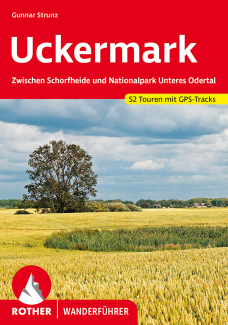
- Wandelgids Uckermark | Rother Bergverlag
- De Rother wandelgidsen beschrijven zeer goed de wandelingen in specifieke gebieden. In de gids vindt men kaarten, routebeschrijvingen en de nodige praktische informatie om van de wandelingen/trekkings een geslaagde onderneming te maken. Verwunschene Landschaften, stille Seen, tiefdunkle Wälder; kleine Dörfchen – nur gut eine Autostunde vom... Lire la suite
Netherlands
2012
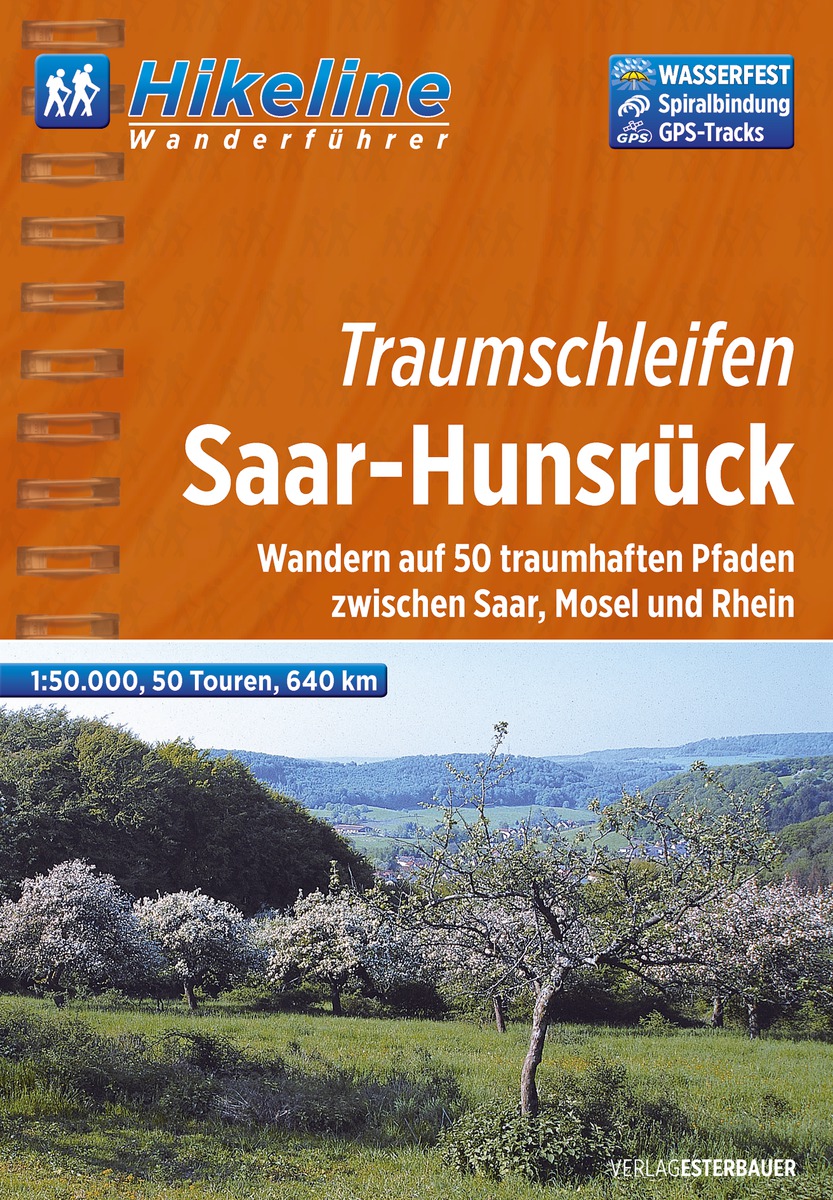
- Wandelgids Hikeline Traumschleifen Saar-Hunsrück | Esterbauer
- Handzame gids met een goede beschrijving van een groot aantal dagtochten in dit gebied. De gids is in spiraalbinding en elke pagina is op scheur- en watervast papier gedrukt. Daar is echt over nagedacht! Der rund 2.000Quadratkilometer große Naturpark Saar-Hunsrück wurde 1980 gegründet und liegt in den Bundesländern Rheinland-Pfalz und Saarland.... Lire la suite
Netherlands
2021
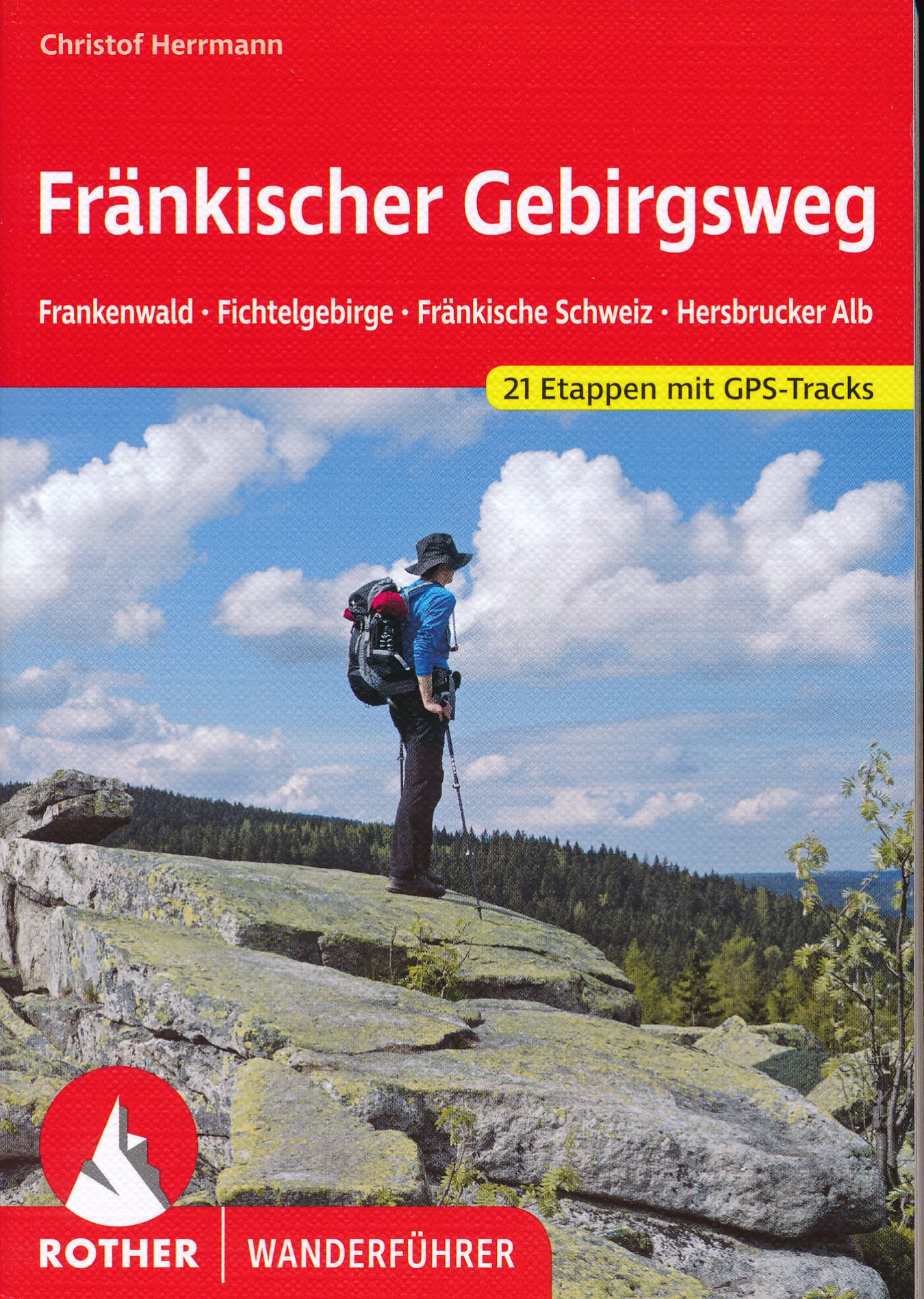
- Wandelgids Fränkischer Gebirgsweg | Rother Bergverlag
- 160 Seiten mit 85 Farbabbildungen, 21 Höhenprofile, 21 Wanderkärtchen im Maßstab 1:100.000, eine Übersichtskarte im Maßstab 1:700.000, GPS-Tracks zum Download Ausgezeichnet als »Qualitätsweg Wanderbares Deutschland«! Vom Frankenwald über das Fichtelgebirge und die Fränkische Schweiz zum Nürnberger Land – der Fränkische Gebirgsweg zählt zu den... Lire la suite
Netherlands
2021
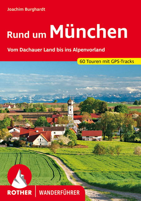
- Wandelgids Rund um München | Rother Bergverlag
- De Rother wandelgidsen beschrijven zeer goed de wandelingen in specifieke gebieden. In de gids vindt men kaarten, routebeschrijvingen en de nodige praktische informatie om van de wandelingen/trekkings een geslaagde onderneming te maken. Raus aus der Stadt und direkt hinein ins Wandervergnügen – ohne weite Anfahrt und ohne aufwändige Planung!... Lire la suite

Netherlands
- Situation und Wandel des Wirtschaftsjournalismus in Europa
- Um das aktuelle globale oder nationale Wirtschaftsgeschehen verfolgen zu können, ist der Wirtschaftsjournalismus als Informationsbeschaffungsquelle unumgänglich. Die umfassende Beschäftigung mit Wirtschaftsmeldungen erzeugt ein Verständnis für gesamtwirtschaftliche Veränderungen und deren ökonomische oder auch gesellschaftliche Folgen. Auf der... Lire la suite
- Also available from:
- Bol.com, Belgium
Belgium
- Situation und Wandel des Wirtschaftsjournalismus in Europa
- Um das aktuelle globale oder nationale Wirtschaftsgeschehen verfolgen zu können, ist der Wirtschaftsjournalismus als Informationsbeschaffungsquelle unumgänglich. Die umfassende Beschäftigung mit Wirtschaftsmeldungen erzeugt ein Verständnis für gesamtwirtschaftliche Veränderungen und deren ökonomische oder auch gesellschaftliche Folgen. Auf der... Lire la suite
Netherlands
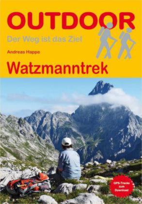
2016
- Wandelgids Watzmanntrek | Conrad Stein Verlag
- Compacte Duitstalige wandelgids van de Watzmanntrek in nationaal park Berchtesgaden, met routebeschrijving, schematische kaartjes en overnachtingsadressen. Der Nationalpark Berchtesgaden mit dem berühmten Watzmann und dem Königssee gilt als eine der schönsten Bergregionen in ganz Europa. Der Watzmanntrek erschließt das Gebiet auf einer... Lire la suite
Cartes

United Kingdom
- Bohemian Forest - Mühlviertel - Lipno Dam F&B WK262
- Bohemian Forest - Mühlviertel - Moldau/Vltava Reservoir area straddling the border of Austria, Czech Republic and Germany presented at 1:50,000 in a series of contoured and GPS compatible outdoor leisure map from Freytag & Berndt with hiking and cycling routes, mountain huts, campsites and youth hostels, local bus stops, plus other tourist... Lire la suite

United Kingdom
- Märkischer Kreis - Ebbegebirge
- Märkischer Kreis - Ebbegebirge (No. 749), a detailed, GPS compatible map at 1:50,000 from Kompass with local and long-distance footpaths, cycling routes, accommodation, etc, printed on durable, waterproof and tear-resistant synthetic paper.KOMPASS HIKING & RECREATIONAL MAPS:This title is part of an extensive series covering Austria, much of... Lire la suite

United Kingdom
- Frosch Cycle Tour: North-Eastern Saxony (274km) Bikeline Map/Guide
- Frosch Cycle Tour, a cycling circuit of 274 kilometres across the landscape of heath and 1000 ponds in the north-eastern Saxony to the chorus of frogs, presented by the Verlag Esterbauer in a guide with maps at 1:50,000 showing the route and its variants. Extensive information is conveyed by symbols, indicating road surface, campsites and other... Lire la suite

United Kingdom
- Lahn Valley Cycle Route - from Source to Rhine Bikeline Map-Guide
- Lahn Valley Cycle Route, a 247km long cycle route from the source to the Rhine presented by the Verlag Esterbauer in a guide with maps at 1:50,000 showing the route and its variants. Extensive information is conveyed by symbols, indicating road surface, campsites and other accommodation, repair workshops, recreational facilities, places of... Lire la suite

United Kingdom
- Tannheimer Berge - Köllenspitze - Gaishorn
- Tannheimer Berge - Köllenspitze - Gaishorn area, map No. BY 5, in a series of highly detailed, GPS compatible hiking maps at 1:25,000 of the German Alps, published by the Deutscher Alpenverein, the German Alpine Club, with cartography of the German topographic survey from the Bavarian state survey organization. The maps use the survey’s... Lire la suite

United Kingdom
- Peace of Westphalia Cycle Tour: Osnabrück - Münster (202km) Bikelie Map/Guide
- Peace of Westphalia Cycle Tour, a 202-km long cycle route to celebrate the peace treaties signed in 1648 by the Protestants who met in Osnabrück and the Catholics gathered in Münster, presented by the Verlag Esterbauer in guide with maps at 1:50,000 showing the route and its variants. Extensive information is conveyed by symbols, indicating... Lire la suite

United Kingdom
- Lower Bavarian Spa Triangle: Bad Füssing - Bad Griesbach - Bad Birnbach Kompass 0200
- Lower Bavarian Spa Triangle (also called the Rott Valley Spa Triangle) in Bavaria around the towns of Bad Füssing, Bad Griesbach and Bad Birnbach, on a detailed, contoured and GPS compatible maps at 1:25,000 from Kompass with local and long-distance footpaths, cycling routes, accommodation, etc, printed on durable, waterproof and tear-resistant... Lire la suite

United Kingdom
- Saar-Hunsrück Nature Park East
- The eastern part of the Saar-Hunsrück Nature Park on a GPS compatible, topographic recreational map at 1:50,000 from the survey organizations of Rhineland-Palatinate and Saarland with cartography identical to the standard topographic survey of Germany but with additional extensive overprint highlighting local and long-distance hiking trails,... Lire la suite

United Kingdom
- Rhine Cycle Route 4 - Cologne to Hoek van Holland Bikeline Map-Guide
- The Rhine Cycle Route Part 4 – a 442-km long section from Cologne to the North Sea presented by Verlag Esterbauer in a guide with maps at 1:75,000 showing the route and its variants. Extensive information is conveyed by symbols, indicating road surface, campsites and other accommodation, repair workshops, recreational facilities, places of... Lire la suite

United Kingdom
- Oberstaufen - Westallgäu - Adelegg - Lindenberg - Isny - Wangen K+F Outdoor Map 55
- Oberstaufen - Westallgäu - Adelegg - Lindenberg - Isny – Wangen area of the German Alps at 1:35,000 from Kümmerly+Frey in a series GPS compatible, double-sided maps printed on durable, waterproof and tear-resistant plastic paper; contoured, with hiking and cycle routes, other recreational activities, etc.Maps in this series are at a scale of... Lire la suite

United Kingdom
2022
- Teutoburg Forest K+F Outdoor Map 45
- Teutoburg Forest in northern Germany at 1:50,000 from Kümmerly+Frey in a series GPS compatible, double-sided maps printed on durable, waterproof and tear-resistant plastic paper; contoured, with hiking and cycle routes, other recreational activities, etc.Maps in this series are at a scale of either 1:50,000 or 1:35,000. Contour interval varies... Lire la suite

United Kingdom
- Danube Cycle Route Part 1: Donaueschingen to Passau ENGLISH Ed.
- The Danube Cycle Route Part 1– its first 580-km long section across Germany from Donaueschingen to Passau on the Austrian border – in an English language edition of Verlag Esterbauers’ Bikeline series, with detailed mapping at 1:50,000 highlighting the route and its variants, street plans for main cities, and extensive information conveyed by... Lire la suite

United Kingdom
- Saar-Hunsrück Nature Park (2-map set)
- Saar-Hunsrück Nature Park on a set of two GPS compatible, topographic recreational maps at 1:50,000 from the survey organizations of Rhineland-Palatinate and Saarland with cartography identical to the standard topographic survey of Germany but with additional extensive overprint highlighting local and long-distance hiking trails, cycle routes,... Lire la suite

United Kingdom
- Hase-Emms Cycle Tour Bikeline Map-Guide
- The Hase - Emms Cycle Tour, a 332-km long circuit linking Meppen and Osnabrück, presented by the Verlag Esterbauer in a guide with maps at 1:50,000 showing the route and its variants. Extensive information is conveyed by symbols, indicating road surface, campsites and other accommodation, repair workshops, recreational facilities, places of... Lire la suite
United Kingdom
- Oder-Neisse Cycle Route Bikeline Map-Guide
- Oder-Neisse Cycle Route, a 630-km long cycle route from the source of the Neisse in the Czech Republic to the Baltic with variants on both the German and the Polish side of the two rivers, presented by the Verlag Esterbauer in a guide with maps at 1:75,000 showing the route and its variants. Extensive information is conveyed by symbols,... Lire la suite