
Scottish Highlands
Description
The entire northern and western part of Scotland, including the islands. This is set apart of the southern and eastern part of Scotland, traditionally referred to as the Lowlands. The divide
Sentiers de cette région
Liens
Données
Rapports
Guides et cartes
Hébergement
Organisations
Voyagistes
GPS
Autre
Livres

Stanfords
United Kingdom
United Kingdom
- Exploring the Nevis Range and Mamores Scotland: The Complete Guide
- Designed as the most comprehensive guide available for the hill walker exploring the Nevis and Mamore ranges in the Scottish Highlands around Fort William, this book describes in detail the best and most rewarding routes across the area, ranging from peaceful strolls through scenic glens to ascents of the principal Munros (peaks over 3000ft)... Lire la suite

Stanfords
United Kingdom
United Kingdom
- DK Eyewitness Great Britain
- Discover Great Britain - a beautiful land rich in culture and history. Whether you want to go wild swimming in the Fairy Pools of Skye, take a windswept walk along the Jurassic Coast, or scale the heights of Snowdonia, your DK Eyewitness travel guide makes sure you experience all that Great Britain has to offer.From the jagged peaks of the... Lire la suite

Stanfords
United Kingdom
2019
United Kingdom
2019
- West Highland Way: Glasgow to Fort William
- Fully revised 7th edition. The West Highland Way passes through some of the most spectacular scenery in all of Britain. From the outskirts of Glasgow it winds for 96 miles (154.5km) along the wooded banks of Loch Lomond, across the wilderness of Rannoch Moor, over the mountains above Glencoe to a dramatic finish passing Ben Nevis - Britain`s... Lire la suite

Stanfords
United Kingdom
United Kingdom
- Dog-Friendly Weekends: 50 breaks in Britain for you and your dog
- Dog-friendly Weekends is the first all-encompassing, practical and inspirational guidebook to dog-friendly holidays in Britain. Not only does it cover dog-friendly accommodation and pubs, but most importantly, each chapter offers a well-rounded weekend away, with recommendations on attractions where the dog is allowed and great walks for all... Lire la suite
Stanfords
United Kingdom
United Kingdom
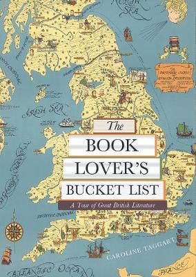
- The Book Lover`s Bucket List: A Tour of Great British Literature
- Exploring the gardens, monuments, museums, and churches with walks both urban and rural, from the Bronte parsonage in Haworth to Zadie Smith`s North London and Shakespeare`s Stratford, `The Book Lover`s Bucket List` takes you through some 100 wonderfully described literary sites and landscapes, complete with colour destination photographs and... Lire la suite

Stanfords
United Kingdom
United Kingdom
- Walks The Trossachs
- Last rewalked and updated 2010, Walks The Trossachs & East Loch Lomond including Killin & Tyndrum covers one of the most popular walking districts in Scotland (much of it now a National Park). Its hills, lochs, glens and woodlands provide an enormous range of routes within a small area. The 40 walks featured range from 0.5 miles to 15 miles... Lire la suite

Stanfords
United Kingdom
United Kingdom
- DK Eyewitness Great Britain
- Three unique nations interwoven into a rich cultural tapestry, this small island has huge character.Whether you want to tour elegant stately homes, marvel at prehistoric wonders or take a windswept walk along cliff-top paths, your DK Eyewitness travel guide makes sure you experience all that Great Britain has to offer.From the jagged peaks of... Lire la suite

Stanfords
United Kingdom
2015
United Kingdom
2015
- Torridon Walking
- Walking in Torridon is a Cicerone guide to 52 day walks of differing grades in this area of the Scottish Highlands, including ascent routes for nine Munros, which will enable you to discover the best of remote Torridon and prepare you to range over heather, grass, rock and marsh, without paths or waymarks. Making Shieldaig its base, the book... Lire la suite

Stanfords
United Kingdom
United Kingdom
- Cambridge, Newmarket & Saffron Walden OS Landranger Active Map 154 (waterproof)
- Parts of Cambridgeshire, Suffolk and Essex with Cambridge, Newmarket and Saffron Walden, including part of the E2 European Long-distance path, on a waterproof and tear-resistant OS Active version of map No. 154 from the Ordnance Survey’s Landranger series at 1:50,000, with contoured and GPS compatible topographic mapping plus tourist... Lire la suite

Stanfords
United Kingdom
United Kingdom
- Crieff, Comrie & Glen Artney - Strathearn & Auchterarder OS Explorer Active Map OL47 (waterproof)
- Crieff, Comrie and Glen Artney area of the Scottish Highlands on a detailed topographic and GPS compatible map No. OL47, waterproof version, from the Ordnance Survey’s 1:25,000 Explorer series. Coverage includes a section of the Loch Lomond and The Trossachs National Park along the Keltie Water, the River Earn (Cormie to St Fillans) National... Lire la suite

Stanfords
United Kingdom
United Kingdom
- Bury St Edmunds, Sudbury & Stowmarket OS Landranger Active Map 155 (waterproof)
- Suffolk around Bury St Edmunds, Sudbury and Stowmarket, including part of the E2 European Long-distance path, on a waterproof and tear-resistant OS Active version of map No. 155 from the Ordnance Survey’s Landranger series at 1:50,000, with contoured and GPS compatible topographic mapping plus tourist information.MOBILE DOWNLOADS: As well as... Lire la suite

Stanfords
United Kingdom
United Kingdom
- Ben Lawers & Glen Lyon - Loch Tay, Killin & Kenmore OS Explorer Active Map OL48 (waterproof)
- Ben Lawyers and Glen Lyon area of the Scottish Highlands on a detailed topographic and GPS compatible map OL48, waterproof version, from the Ordnance Survey’s 1:25,000 Explorer series. Coverage includes part of the Loch Rannoch and Glen Lyon National Scenic Area, 22 Munro peaks including An Stuc, Carn Gorm, Meall Glas and Sgiath Chuil, Loch Tay... Lire la suite

Stanfords
United Kingdom
United Kingdom
- Cheltenham, Cirencester & Stow-on-the-Wold OS Landranger Active Map 163 (waterproof)
- Cheltenham and Cirencester area, including sections of the Thames Path, the Cotswold Way and the E2 European Long-distance Path, on a waterproof and tear-resistant OS Active version of map No. 163 from the Ordnance Survey’s Landranger series at 1:50,000, with contoured and GPS compatible topographic mapping plus tourist information.MOBILE... Lire la suite

Stanfords
United Kingdom
United Kingdom
- Oxford, Chipping Norton & Bicester OS Landranger Active Map 164 (waterproof)
- Oxford area, including sections of the Thames Path and the E2 European Long-distance Path, on a waterproof and tear-resistant OS Active version of map No. 164 from the Ordnance Survey’s Landranger series at 1:50,000, with contoured and GPS compatible topographic mapping plus tourist information.MOBILE DOWNLOADS: As well as the physical edition... Lire la suite

Stanfords
United Kingdom
United Kingdom
- Maidstone, Royal Tunbridge Wells, Sevenoaks & Tonbridge OS Landranger Active Map 188 (waterproof)
- Maidstone, Tunbridge Wells and the High Weald area, including a section of the North Downs Way / E2 European Long-distance Path, on a waterproof and tear-resistant OS Active version of map No. 188 from the Ordnance Survey’s Landranger series at 1:50,000, with contoured and GPS compatible topographic mapping plus tourist information.MOBILE... Lire la suite
Cartes

Stanfords
United Kingdom
United Kingdom
- Ben Venue - Loch Ard Forest & the Trossachs Harvey Superwalker
- Ben Venue: Loch Ard Forest and the Trossachs area of the Scottish Highlands at 1:25,000 on a waterproof and tear-resistant map from Harvey Map Services in their Superwalker series.Maps in Harvey’s Superwalker series have contours at 15m intervals, with additional graphics for various types of terrain (crags, large boulders, scattered rocks) and... Lire la suite

Stanfords
United Kingdom
United Kingdom
- Luxembourg North
- One of two topographic survey maps of Luxembourg at 1:50,000, with contours at 10-metres intervals and additional relief shading. An overprint highlights long-distance footpaths, including the GR5 (E-2), cycle routes, and various places of interest, including campsites. The map covers an area of approximately 53 x 43 km / 33 x 27 miles. Map... Lire la suite
Stanfords
United Kingdom
United Kingdom
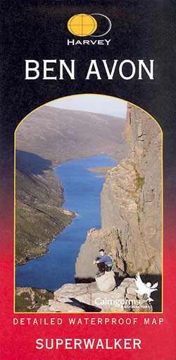
- Ben Avon Harvey Superwalker XT25
- Ben Avon area of the Scottish Highlands at 1:25,000 on a waterproof and tear-resistant map from Harvey Map Services in their Superwalker series. Maps in Harvey’s Superwalker series have contours at 15m intervals, with additional graphics for various types of terrain (crags, large boulders, scattered rocks) and colouring for different kinds of... Lire la suite

Stanfords
United Kingdom
United Kingdom
- Luxembourg South
- One of two topographic survey maps of Luxembourg at 1:50,000, with contours at 10-metres intervals and additional relief shading. An overprint highlights long-distance footpaths, including the GR5 (E-2), cycle routes, and various places of interest, including campsites. The map covers an area of approximately 53 x 43 km / 33 x 27 miles. Map... Lire la suite

Stanfords
United Kingdom
United Kingdom
- Ben Lawers and Schiehallion Harvey Superwalker XT25
- Ben Lawers area of the Scottish Highlands with the peak of Schiehallion at 1:25,000 on a waterproof and tear-resistant map from Harvey Map Services in their Superwalker series. The map is double-sided, with a small overlap between the sides, and coverage extends from Kinloch Rannoch and Loch Rannoch in the north to Killin and Loch Tay in the... Lire la suite

Stanfords
United Kingdom
United Kingdom
- Glen Coe - Glen Etive & Black Mount Harvey Superwalker XT25
- Glen Coe area of the Scottish Highlands, including Glen Etive and Black Mount, at 1:25,000 on a light, waterproof and tear-resistant map from Harvey Map Services in their Superwalker series. The map is double-sided, with an overlap between the sides, and extends from Loch leven, Kinlochmore and the Blackwater Reservoir southwards to Loch Etive... Lire la suite

Stanfords
United Kingdom
United Kingdom
- Great Glen Way Harvey National Trail XT40
- Great Glen Way, a 126km/79 miles trail from Fort William along Loch Ness to Inverness, presented at 1:40,000 on a light, waterproof and tear-resistant map from Harvey Map Services. The whole route is covered on four overlapping panels, and includes street plans of Fort William (showing the start/end of the West Highland Way) and Inverness. Map... Lire la suite
- Also available from:
- The Book Depository, United Kingdom
- De Zwerver, Netherlands

The Book Depository
United Kingdom
United Kingdom
- Great Glen Way
- Great Glen Way, a 126km/79 miles trail from Fort William along Loch Ness to Inverness, presented at 1:40,000 on a light, waterproof and tear-resistant map from Harvey Map Services. The whole route is covered on four overlapping panels, and includes street plans of Fort William (showing the start/end of the West Highland Way) and Inverness. Map... Lire la suite

De Zwerver
Netherlands
Netherlands
- Wandelkaart Great Glen Way | Harvey Maps
- Great Glen Way, a 126km/79 miles trail from Fort William along Loch Ness to Inverness, presented at 1:40,000 on a light, waterproof and tear-resistant map from Harvey Map Services. The whole route is covered on four overlapping panels, and includes street plans of Fort William (showing the start/end of the West Highland Way) and Inverness. Map... Lire la suite

Stanfords
United Kingdom
United Kingdom
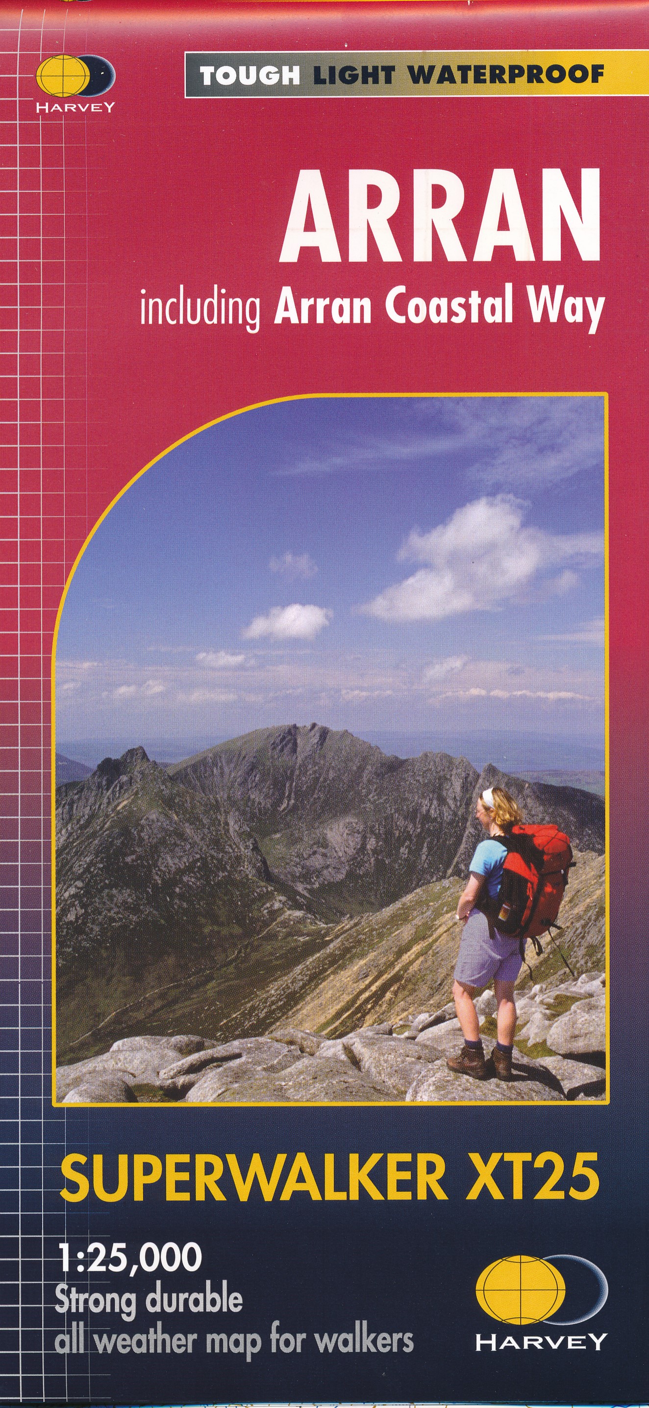
- Arran - incl. Arran Coastal Way Harvey Superwalker XT25 Map
- The Scottish island of Arran at 1:25,000 on a double-sided, a waterproof and tear-resistant, GPS compatible map from Harvey Map Services in their Superwalker series, with highlighting for the Arran Coastal Way and with a list of archaeological and historical sites. The map divides the island east/west, with a good overlap between the sides. The... Lire la suite
- Also available from:
- The Book Depository, United Kingdom
- De Zwerver, Netherlands

De Zwerver
Netherlands
Netherlands
- Wandelkaart Arran including Arran Coastal Way | Harvey Maps
- The Scottish island of Arran at 1:25,000 on a double-sided, a waterproof and tear-resistant, GPS compatible map from Harvey Map Services in their Superwalker series, with highlighting for the Arran Coastal Way and a list of archaeological and historical sites. The map divides the island east/west, with a good overlap between the sides. The... Lire la suite

Stanfords
United Kingdom
United Kingdom
- The West Highland Way - 95 Mile Route Between Milngavie and Fort William
- The West Highland Way waterproof map from Footprint is a map-guide to the 95 mile (153km) route between Milngavie and Fort William. The mapping is based on Ordnance Survey data at a scale of 1:40,000, with compact and concise information for walkers. Lire la suite
- Also available from:
- The Book Depository, United Kingdom
- De Zwerver, Netherlands

The Book Depository
United Kingdom
United Kingdom
- The West Highland Way (Footprint Map)
- A Footprint Map-Guide to the 95 Mile Route Between Milngavie and Fort William Lire la suite

De Zwerver
Netherlands
Netherlands
- Wandelkaart The West Highland Way | Footprint maps
- The West Highland Way waterproof map from Footprint is a map-guide to the 95 mile (153km) route between Milngavie and Fort William. The mapping is based on Ordnance Survey data at a scale of 1:40,000, with compact and concise information for walkers. Lire la suite
Stanfords
United Kingdom
2010
United Kingdom
2010
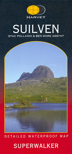
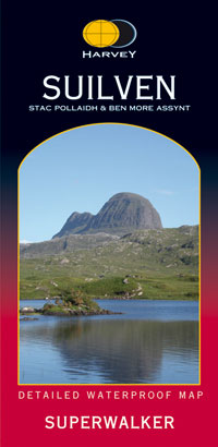
- Suilven Harvey Superwalker
- The Suilven area of Scottish Highlands at 1:25,000 on a waterproof and tear-resistant map from Harvey Map Services in their Superwalker series. Coverage extends from Loch Inver and Loch Assynt in the north southwards to Loch Lurgainn, Cam Loch and Ledmore Junction in the south, and includes Stac Pollaidh, Cùl Mòr and Ben More Assynt.Maps in... Lire la suite
- Also available from:
- The Book Depository, United Kingdom
- De Zwerver, Netherlands

De Zwerver
Netherlands
2010
Netherlands
2010
- Wandelkaart Suilven / Stac Pollaidh & Ben More Assynt harve | Harvey Maps
- The Suilven area of Scottish Highlands at 1:25,000 on a waterproof and tear-resistant map from Harvey Map Services in their Superwalker series. Coverage extends from Loch Inver and Loch Assynt in the north southwards to Loch Lurgainn, Cam Loch and Ledmore Junction in the south, and includes Stac Pollaidh, C Lire la suite

Stanfords
United Kingdom
United Kingdom
- Rob Roy Way Harvey National Trail XT40
- Rob Roy Way, one of Scotland’s Great Trails from Drymen just north of Glasgow along Loch Tay to Pitlochry on the edge of the Cairngorms National Park presented at 1:40,000 on a light, waterproof and tear-resistant map from Harvey Map Services. The whole route, either 124km/77 miles or 151km/94 miles long depending on which variant one follows,... Lire la suite
- Also available from:
- The Book Depository, United Kingdom
- De Zwerver, Netherlands

The Book Depository
United Kingdom
United Kingdom
- Rob Roy Way
- Mooie, duidelijke kaart van de Rob Roy Way in Schotland. Geplastificeerd met veel extra informatie en uitsnedes van de route. One of Scotland's Great Trails Rob Roy Way is a walk across part of the Southern Highlands of Scotland taking in some of the most beautiful countryside in the UK. Starting from Drymen it goes north east to finish in... Lire la suite

De Zwerver
Netherlands
Netherlands
- Wandelkaart Rob Roy Way | Harvey Maps
- Mooie, duidelijke kaart van de Rob Roy Way in Schotland. Geplastificeerd met veel extra informatie en uitsnedes van de route. One of Scotland's Great Trails Rob Roy Way is a walk across part of the Southern Highlands of Scotland taking in some of the most beautiful countryside in the UK. Starting from Drymen it goes north east to finish in... Lire la suite

Stanfords
United Kingdom
2020
United Kingdom
2020
- West Highland Way - Easy-to-use Folding Map and Essential Information
- The 153-kilometre West Highland Way encompasses the variety of Scotland`s wild places. The route, which begins in Milngavie and finishes in Fort William, passes from Glasgow, Scotland`s friendliest city, through lochs and forests, and across wild moors in the shadows of Munros. Offering panoramic views and clear waymarking, it is no wonder this... Lire la suite
- Also available from:
- The Book Depository, United Kingdom
- De Zwerver, Netherlands

The Book Depository
United Kingdom
2020
United Kingdom
2020
- West Highland Way
- Easy-to-use folding map and essential information, with custom itinerary planning for walkers, trekkers, fastpackers and trail runners Lire la suite

De Zwerver
Netherlands
2020
Netherlands
2020
- Wandelkaart West Highland Way | Vertebrate Publishing
- The 153-kilometre West Highland Way encompasses the variety of Scotland`s wild places. The route, which begins in Milngavie and finishes in Fort William, passes from Glasgow, Scotland`s friendliest city, through lochs and forests, and across wild moors in the shadows of Munros. Offering panoramic views and clear waymarking, it is no wonder this... Lire la suite

Stanfords
United Kingdom
2013
United Kingdom
2013
- South Loch Ness Trail Harvey National Trail XT40
- The South Loch Ness Trail, a 45km / 28 mile long hiking route from Loch Tarff near Fort Augustus on the southern tip of Loch Ness to Torbreck on the outskirts of Inverness at 1:40,000 on GPS compatible, light, waterproof and tear-resistant map from Harvey Map Services. The map also highlights the course of the Trail of the 7 Lochs, an 80km / 50... Lire la suite
- Also available from:
- The Book Depository, United Kingdom
- De Zwerver, Netherlands

The Book Depository
United Kingdom
2013
United Kingdom
2013
- South Loch Ness Trail
- The South Loch Ness Trail, a 45km / 28 mile long hiking route from Loch Tarff near Fort Augustus on the southern tip of Loch Ness to Torbreck on the outskirts of Inverness at 1:40,000 on GPS compatible, light, waterproof and tear-resistant map from Harvey Map Services. The map also highlights the course of the Trail of the 7 Lochs, an 80km / 50... Lire la suite

De Zwerver
Netherlands
2013
Netherlands
2013
- Wandelkaart South Loch Ness Trail | Harvey Maps
- The South Loch Ness Trail, a 45km / 28 mile long hiking route from Loch Tarff near Fort Augustus on the southern tip of Loch Ness to Torbreck on the outskirts of Inverness at 1:40,000 on GPS compatible, light, waterproof and tear-resistant map from Harvey Map Services. The map also highlights the course of the Trail of the 7 Lochs, an 80km / 50... Lire la suite

Stanfords
United Kingdom
2018
United Kingdom
2018
- East Highland Way Harvey National Trail XT40
- East Highland Way, a 132km / 82 miles trail on a light, waterproof and tear-resistant map at 1:40,000 from Harvey Map Services presenting the route accompanied by extensive additional tourist information. The route links Fort Williams, the northern point of the West Highland Way and the southern point of the Great Glen Way, with Aviemore, the... Lire la suite
- Also available from:
- The Book Depository, United Kingdom
- De Zwerver, Netherlands

The Book Depository
United Kingdom
2018
United Kingdom
2018
- East Highland Way
- East Highland Way, a 132km / 82 miles trail on a light, waterproof and tear-resistant map at 1:40,000 from Harvey Map Services presenting the route accompanied by extensive additional tourist information. The route links Fort Williams, the northern point of the West Highland Way and the southern point of the Great Glen Way, with Aviemore, the... Lire la suite

De Zwerver
Netherlands
2018
Netherlands
2018
- Wandelkaart East Highland Way | Harvey Maps
- East Highland Way, a 132km / 82 miles trail on a light, waterproof and tear-resistant map at 1:40,000 from Harvey Map Services presenting the route accompanied by extensive additional tourist information. The route links Fort Williams, the northern point of the West Highland Way and the southern point of the Great Glen Way, with Aviemore, the... Lire la suite
Stanfords
United Kingdom
United Kingdom
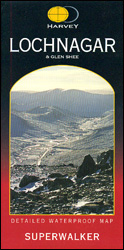
- Lochnagar & Glen Shee Harvey Superwalker
- Lochnagar and Glen Shee area of the Scottish Highlands at 1:25,000 on a waterproof and tear-resistant map from Harvey Map Services in their Superwalker series. Coverage includes the Glenshee Ski Centre and Loch Muick.Maps in Harvey’s Superwalker series have contours at 15m intervals, with additional graphics for various types of terrain (crags,... Lire la suite
- Also available from:
- The Book Depository, United Kingdom
