
Scotland
Description
Carte


Sentiers de cette état
- Annandale WayGPX
- Arran Coastal WayGPX
- Borders Abbeys WayGPX
- Cape Wrath TrailGPX
- Cateran TrailGPX
- Cowal WayGPX
- Dava WayGPX
- E2GPX
- Fife Coastal PathGPX
- Great Glen WayGPX
- Highland High Way
- John Muir WayGPX
- Kintyre WayGPX
- Lairig Ghru
- Lands End to John o'GroatsGPX
- Mary Queen of Scots WayGPX
- Moray Coast TrailGPX
- Moray Way
- North Sea TrailGPX
- River Ayr WayGPX
- Rob Roy WayGPX
- Saint Cuthbert's WayGPX
- Scottish Coast to Coast
- Sir Walter Scott Way
- Southern Upland WayGPX
- Speyside WayGPX
- West Highland WayGPX
- West Island WayGPX
Liens
Données
Rapports
Guides et cartes
Hébergement
Organisations
Voyagistes
GPS
Autre
Livres

Stanfords
United Kingdom
2015
United Kingdom
2015
- Torridon Walking
- Walking in Torridon is a Cicerone guide to 52 day walks of differing grades in this area of the Scottish Highlands, including ascent routes for nine Munros, which will enable you to discover the best of remote Torridon and prepare you to range over heather, grass, rock and marsh, without paths or waymarks. Making Shieldaig its base, the book... Lire la suite

Stanfords
United Kingdom
United Kingdom
- DK Eyewitness Scotland
- Small but spectacular, Scotland offers bucket-list experiences in abundance.Whether you want to explore the ramparts of Edinburgh Castle, adventure through breathtaking Highland landscapes or sample the finest local produce washed down by ancient malts, your DK Eyewitness travel guide makes sure you experience all that Scotland has to... Lire la suite

Stanfords
United Kingdom
United Kingdom
- Walker`s Britain in a Box: Third Expanded Edition
- WALKS FOR EVERYONEMost are easy half-day circular routes, but a few are more challenging. Some are two-day walks on folding four-page cards, ideal for a short walking break.TRANSPARENT SLEEVE PROVIDEDIf it rains, read the card through the transparent plastic sleeve.CHARMING PLACES TO STAYWalks near charming places to stay, some offering onward... Lire la suite

Stanfords
United Kingdom
2011
United Kingdom
2011
- Skye & The Western Isles
- Skye & the Western Isles is a fully revised new edition of the only comprehensive guide to Scotland`s Western Isles, which include Skye, Lewis, Harris, Uist, Iona, Jura, Islay and Arran. These enchanting islands reward the visitor with a rich variety of terrain and wildlife from the stark beauty of the Cuillin mountains of Skye to the raging... Lire la suite

Stanfords
United Kingdom
United Kingdom
- Britain`s Best Coastal Walks
- Accompanied by beautiful colour photography, ”Britain`s Best Coastal Walks” celebrates the varied treasures to be found on the coastlines of England, Wales and Scotland. Andrew McCloy has devised 15 two- to three-day walks along sections of Britain`s most famous coastal paths, which are shown on clear and detailed maps. His commentaries focus... Lire la suite

Stanfords
United Kingdom
2019
United Kingdom
2019
- West Highland Way: Glasgow to Fort William
- Fully revised 7th edition. The West Highland Way passes through some of the most spectacular scenery in all of Britain. From the outskirts of Glasgow it winds for 96 miles (154.5km) along the wooded banks of Loch Lomond, across the wilderness of Rannoch Moor, over the mountains above Glencoe to a dramatic finish passing Ben Nevis - Britain`s... Lire la suite

Stanfords
United Kingdom
United Kingdom
- Sherlock Holmes Walk
- Step back in time and explore the London of Sherlock Holmes and Dr Watson. It is 1895 — a time of Hansom cabs rattling along cobbled streets, foggy lanes and gas-lit alleys, a romantic yet sinister London at the height of her Imperial greatness. Each site that is visited on this Walk has a major literary connection with our two heroes and their... Lire la suite

Stanfords
United Kingdom
United Kingdom
- Explore Aviemore - Rothiemurchus - Glenmore - Boat of Garten - Inshriach Forest
- Aviemore and its environs, including Rothiemurchus, Glenmore, Boat of Garten and Inshriach Forest on a light, waterproof and tear-resistant, contoured and GPS compatible map at 1:35,000 from Footprint Walks, designed to highlight best local routes for walkers, trail runners and mountain bikers.On one side is a map of the whole area around... Lire la suite

Stanfords
United Kingdom
United Kingdom
- Exploring the Nevis Range and Mamores Scotland: The Complete Guide
- Designed as the most comprehensive guide available for the hill walker exploring the Nevis and Mamore ranges in the Scottish Highlands around Fort William, this book describes in detail the best and most rewarding routes across the area, ranging from peaceful strolls through scenic glens to ascents of the principal Munros (peaks over 3000ft)... Lire la suite

Stanfords
United Kingdom
United Kingdom
- Pilgrimage: The Great Pilgrim Routes of Britain and Europe
- Shortlisted for a 2018 Edward Stanford Travel Writing Award.Ten historic pilgrim routes of Western Europe, inspiration for today`s long distance walker. Pilgrimage in Europe is thriving on a massive scale. In 1990 the cathedral at Santiago de Compostela recorded less than 5000 pilgrims: today that figure is at least 200,000 a year. Author Derry... Lire la suite

Stanfords
United Kingdom
2003
United Kingdom
2003
- Skye 360:Walking the Coastline of Skye
- One long walk divided into lots of short walks taking you all the way round Skye`s rugged coastline. Skye`s plethora of peninsulas and sea-lochs contain awesome cliffs, remote beaches, storm tossed sea-stacks, natural arches, ancient duns, romantic castles, poignant Clearance settlements, tidal islands and idyllic secluded corners. If you want... Lire la suite

Stanfords
United Kingdom
United Kingdom
- Scotland The Best: New and Fully Updated 13th Edition
- The true Scot`s insider`s guide to the very best Scotland has to offer. Fully revised and updated in Pete Irvine`s own unique style, the 13th edition includes over 2000 recommendations for every type of adventure.Trusted for over 20 years, this fully comprehensive and independent guide to Scotland gives you only the very best recommendations,... Lire la suite

Stanfords
United Kingdom
United Kingdom
- Isles at the Edge of the Sea
- Rising off the western seaboard of mainland Scotland are hundreds of islands; hidden worlds. Beginning on Arran, Jonny Muir sets out to explore these places with a single ambition: to reach the faraway St Kilda archipelago; the islands at the edge of the world. On the way he attempts to find his inner peace on Holy Island, takes part in a... Lire la suite

Stanfords
United Kingdom
2020
United Kingdom
2020
- Hadrian`s Wall Path
- Trailblazer British Walking Guide, two-way edition with routes re-walked from Bowness-on-Solway to Wallsend (Newcastle) and Wallsend (Newcastle) to Bowness-on-Solway. All-in-one guide to walking Hadrian`s Wall Path National Trail. Hadrian`s Wall Path, 84 miles from end to end, follows the course of northern Europe`s largest surviving Roman... Lire la suite

Stanfords
United Kingdom
2004
United Kingdom
2004
- Western Highlands
- This guide features 40 circular walks in the mountain country of the West Highlands. The routes in this volume take from the Rough Bounds of Knoydart and the silver sands of Morar to the ridges of Kintail and the ancient forests of Glen Affric, covering all of the Munros and many other great hills. Each walk section contains a detailed route... Lire la suite
Cartes

Stanfords
United Kingdom
United Kingdom
- Scotland Michelin Regional 501 WATERPROOF
- Scotland at 1:400,000 on an indexed touring map from Michelin - laminated version - particularly good for indentifying scenic routes. The whole country is shown on one side of the map, with coverage extending south to include Newcastle and most of the Lake District. Enlargement show the Glasgow area (1:200,000) and main roads across Edinburgh... Lire la suite


Stanfords
United Kingdom
United Kingdom
- Two Moors Way Harvey National Trail XT40
- Two Moors Way, a 150km / 93 mile long-distance trail between Lynmouth on the north coast of Devon and Ivybridge near Plymouth, crossing Exmoor and Dartmoor National Parks, presented at 1:40,000 on a light, waterproof and tear-resistant map from Harvey Map Services. The route is shown on six panels.Maps in the Harvey’s series covering Great... Lire la suite

Stanfords
United Kingdom
United Kingdom
- London
- London at 1:50,00 with mapping from the Ordnance Survey’s Landranger series published by Cassini to add to their extensive coverage of the city on historical maps reflecting different periods in its development. Unlike the Landranger series which splits the city east/west, the Cassini version is centred on Charing Cross and covers most of the... Lire la suite

Stanfords
United Kingdom
United Kingdom
- Britain Philip`s Navigator Road Atlas FLEXI-BOUND
- PHILIP`S NAVIGATOR ROAD ATLASES - THE UK`S BEST-SELLING ROAD ATLASES.`A map that beats all others` The Daily Telegraph`Scale, accuracy and clarity are without parallel` Driving Magazine`No.1 in the UK for clear maps` Independent research surveyThe No.1 Choice of Road Atlas for the serious motorist.Special feature: Truckstop breakfasts -... Lire la suite
Stanfords
United Kingdom
United Kingdom
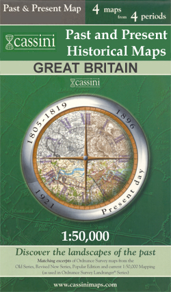
- Edinburgh 1857-1869
- Edinburgh 1857-1869 map from Cassini reproducing old Ordnance Survey mapping of Scotland presented in a format designed to offer a convenient comparison with the present day coverage from the OS.Old maps have been combined so that the sheet lines correspond to the current Landranger series map No. 66 and are reproduced with the scale changed... Lire la suite

Stanfords
United Kingdom
United Kingdom
- Bob Graham Round in the Lakeland Fells
- Bob Graham Round, a historic 106km / 66 mile circuit across the fells of the Lake District, presented at 1:40,000 on a light, waterproof and tear-resistant map from Harvey Map Services. First completed by Bob Graham in 1932 and now a popular challenge, the route which takes in 42 Lakeland summits is presented on four overlapping panels.Maps in... Lire la suite

Stanfords
United Kingdom
United Kingdom
- Britain Philip`s Navigator Trucker`s Road Atlas A3 SPIRAL-BOUND
- THE UK`S BEST-SELLING ROAD ATLAS. `A map that beats all others` The Daily Telegraph `Scale, accuracy and clarity are without parallel` Driving Magazine `No.1 in the UK for clear maps` Independent research survey The No.1 Choice of Road Atlas for the serious motorist. - Scale: 1.5 miles to 1 inch = 1:100,000 (Northern Scotland: 3 miles to 1 inch... Lire la suite

Stanfords
United Kingdom
United Kingdom
- Scotland Michelin Regional 501
- Scotland at 1:400,000 on an indexed touring map from Michelin - paper version - particularly good for indentifying scenic routes. The whole country is shown on one side of the map, with coverage extending south to include Newcastle and most of the Lake District. Enlargement show the Glasgow area (1:200,000) and main roads across Edinburgh... Lire la suite

Stanfords
United Kingdom
United Kingdom
- Nidderdale Way
- Nidderdale Way, an 85km / 53 mile circular long-distance trail in north Yorkshire, presented at 1:40,000 on a light, waterproof and tear-resistant map from Harvey Map Services.Maps in the Harvey’s series covering Great Britain’s national trails and other long-distance footpaths are printed on light, waterproof and tear-resistant synthetic paper... Lire la suite

Stanfords
United Kingdom
United Kingdom
- Isle of Wight AA Walker`s Map 16
- Isle of Wight at 1:25,000 in a series of Walker’s Maps published by the AA with the cartography from the Ordnance Survey’s Explorer series. The map is double-sided and coverage includes The Solent and part of the mainland with ferry connections from Portsmouth and Lymington.Maps in the AA Walker’s series are identical to the OS Explorer maps... Lire la suite
Stanfords
United Kingdom
United Kingdom
- Edinburgh 1905-1907
- Edinburgh 1905-1907 map from Cassini reproducing old Ordnance Survey mapping of Scotland presented in a format designed to offer a convenient comparison with the present day coverage from the OS.Old maps have been combined so that the sheet lines correspond to the current Landranger series map No. 66 and are reproduced with the scale changed... Lire la suite

Stanfords
United Kingdom
United Kingdom
- Barnard Castle & Richmond - Teesdale OS Landranger 92 ACTIVE
- Waterproof and tear-resistant OS Active version of map No. 92 from the Ordnance Survey’s Landranger series at 1:50,000, with contoured and GPS compatible topographic mapping plus tourist information.MOBILE DOWNLOADS: As well as the physical edition of the map, each Landranger title now includes a code for downloading after purchase its digital... Lire la suite

Stanfords
United Kingdom
United Kingdom
- Lyme Bay 25K AA/OS Walker`s Map No. 11
- Lyme Bay at 1:25,000 in a series of Walker’s Maps published by the AA with the cartography from the Ordnance Survey’s Explorer series. Coverage includes Lyme Regis, Axmouth, Seaton, Shute, Axminster, Yarcombe, Chard, Crewkerne, Mosterton, Beaminster, Bridport, West Bay, etc.Maps in the AA Walker’s series are identical to the OS Explorer maps... Lire la suite
Stanfords
United Kingdom
United Kingdom
- Edinburgh 1926-1928
- Edinburgh 1926-1928 map from Cassini reproducing old Ordnance Survey mapping of Scotland presented in a format designed to offer a convenient comparison with the present day coverage from the OS.Old maps have been combined so that the sheet lines correspond to the current Landranger series map No. 66 and are reproduced with the scale changed... Lire la suite