
Kent
Description
County in southeastern England. Well known are the white cliffs of Dover. Hikers especially enjoy the North Downs chalk hills. Quite a few long distance trails can be found in Kent. The High Weald offers good walking.
Sentiers de cette région
Liens
Données
Rapports
Guides et cartes
Hébergement
Organisations
Voyagistes
GPS
Autre
Livres

Stanfords
United Kingdom
United Kingdom
- Kent - Kiddiwalks
- This work includes twenty circular walks designed for children and family groups which explore the flora and fauna, wildlife and history of the local countryside. It contains maps and photographs. Lire la suite

Stanfords
United Kingdom
United Kingdom
- A Dog on the Downs: An Appreciation of a Unique Part of Kent`s North Downs
- Inspired by Maryanne Grant Traylen`s daily walks with her dog, and by the moments of beauty afforded by living between sea and Down, A Dog on the Downs evokes the North Kent countryside in its different moods, seasons and weathers, combined with a narrative that invokes a sense of the geology and history that has shaped the landscape. Black dog... Lire la suite

Stanfords
United Kingdom
2021
United Kingdom
2021
- DK Eyewitness England`s South Coast
- Windswept cliffs, breathtaking beaches, and vibrant cities: welcome to the stunning south of England.Whether you want to relax on the sandy shores of Cornwall, wander around London`s famous museums or browse vintage shops in Brighton, your DK Eyewitness travel guide makes sure you experience all that this region has to offer.England`s South... Lire la suite


Stanfords
United Kingdom
United Kingdom
- Teashop Walks in Kent
- The perfect way to explore Kent is with a scenic circular walk followed by tea and cake, and the tea rooms in this book are the perfect places to start or finish your adventure. All have been carefully selected for their individual character - there`s one in a lighthouse, one with a collection of 8,000 teapots and several in historic buildings.... Lire la suite

Stanfords
United Kingdom
United Kingdom
- Canterbury - Margate - Ramsgate A-Z Street Atlas
- This A-Z map of Canterbury, Margate and Ramsgate is a full colour street atlas which also includes a places of interest guide. The publication features 41 pages of street mapping which extends to include:Faversham, Whitstable, Herne Bay, Birchington, Westgate on Sea, Broadstairs, SandwichThere are also large scale city/town centre maps of... Lire la suite

Stanfords
United Kingdom
United Kingdom
- A Journey Through South-East England: Broadstairs to Lewes
- A Journey Through South-East England:Broadstairs to Lewes follows Brian`s latest walking adventures through the South-East of England. Brian has previously walked over 1,000 miles for his last two walking companion guide books, Finding My Place and Walking My Patch. In this book, Brian shares the details of four complex walks: Broadstairs to... Lire la suite

Stanfords
United Kingdom
United Kingdom
- A Journey Through South-East England: Lewes to Woolwich
- A Journey Through South-East England: Lewes to Woolwich follows on from Brian`s previous journey through South-East England from Broadstairs to Lewes. This journey of around 100 miles, being part two of a mammoth trek through Kent and East Sussex, was also achieved just before his 70th birthday. In this book, Brian shares his experiences of... Lire la suite

Stanfords
United Kingdom
United Kingdom
- North York Moors Western OS Explorer Active Map OL26 (waterproof)
- The western part of the North York Moors National Park on a detailed topographic and GPS compatible map OL26, waterproof version, from the Ordnance Survey’s 1:25,000 Explorer series. Coverage extends from Ampleforth in the south northwards to Saltburn-by-the-Sea, and from Ingleby Arncliffe to Danby, Castleton and Hutton-le-Hole, and includes... Lire la suite


Stanfords
United Kingdom
2015
United Kingdom
2015
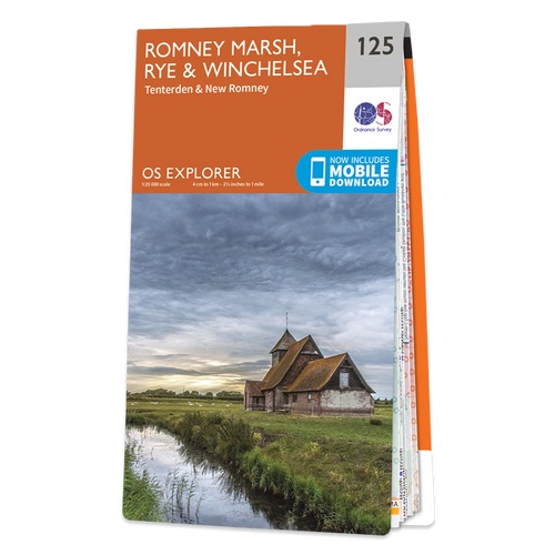
- Romney Marsh - Rye, Winchelsea, Tenterden & New Romney OS Explorer Map 125 (paper)
- Romney Marsh, Rye, Winchelsea, Tenterden and New Romney area on a detailed topographic and GPS compatible map No. 125, paper version, from the Ordnance Survey’s 1:25,000 Explorer series.MOBILE DOWNLOADS: this title and all the other OS Explorer maps include a code for downloading after purchase the digital version onto your smartphone or tablet... Lire la suite
- Also available from:
- The Book Depository, United Kingdom
- De Zwerver, Netherlands

De Zwerver
Netherlands
2015
Netherlands
2015

- Also available from:
- De Zwerver, Netherlands


Stanfords
United Kingdom
United Kingdom
- The Kent Ramblers Guide to Three River Valley Walks in West Kent: Darent Valley Path, Eden Valley Walk, Medway Valley Walk
- Darent Valley Path, Eden Valley Walk, Medway Valley Walk Lire la suite
- Also available from:
- The Book Depository, United Kingdom

The Book Depository
United Kingdom
United Kingdom
- The Kent Ramblers Guide to Three River Valley Walks in West Kent
- Darent Valley Path, Eden Valley Walk, Medway Valley Walk Lire la suite

Stanfords
United Kingdom
2016
United Kingdom
2016
- North York Moors Western OS Explorer Map OL26 (paper)
- The western part of the North York Moors National Park on a detailed topographic and GPS compatible map OL26, paper version, from the Ordnance Survey’s 1:25,000 Explorer series. Coverage extends from Ampleforth in the south northwards to Saltburn-by-the-Sea, and from Ingleby Arncliffe to Danby, Castleton and Hutton-le-Hole, and includes... Lire la suite
- Also available from:
- The Book Depository, United Kingdom
- De Zwerver, Netherlands


De Zwerver
Netherlands
2016
Netherlands
2016

Stanfords
United Kingdom
2017
United Kingdom
2017
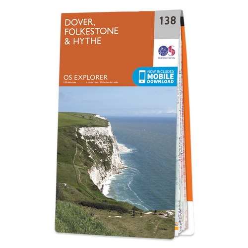
- Dover, Folkestone & Hythe OS Explorer Map 138 (paper)
- Dover, Folkestone and Hythe area on a detailed topographic and GPS compatible map No. 138, paper version, from the Ordnance Survey’s 1:25,000 Explorer series.MOBILE DOWNLOADS: this title and all the other OS Explorer maps include a code for downloading after purchase the digital version onto your smartphone or tablet for viewing on the OS... Lire la suite
- Also available from:
- The Book Depository, United Kingdom
- De Zwerver, Netherlands

De Zwerver
Netherlands
2017
Netherlands
2017
Cartes

Stanfords
United Kingdom
United Kingdom
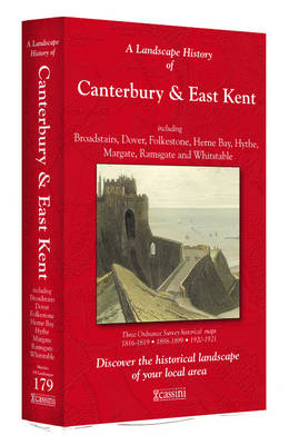
- Canterbury and East Kent 1816-1819
- Map No. 179, Canterbury and East Kent 1816-1819, in the Cassini Historical Series of old Ordnance Survey mapping of England and Wales at 1:50,000 in a format designed to offer a convenient comparison with the present day coverage from the OS, and most locations in three different editions. Old historical maps have been combined so that the... Lire la suite

Stanfords
United Kingdom
United Kingdom
- North Downs Way A-Z Adventure Atlas
- North Downs Way Adventure Atlas at 1:25,000 in a series of handy A5 size Adventure Atlases from Geographers` A-Z Map Company with cartography from the Ordnance Survey’s Explorer series. The route from Farnham to Dover is presented with the alternative final sections, either via Canterbury or via Folkestone. To see other titles in this series... Lire la suite
Stanfords
United Kingdom
United Kingdom
- Canterbury and East Kent 1920-1921
- Map No. 179, Canterbury and East Kent 1920-1921, in the Cassini Historical Series of old Ordnance Survey mapping of England and Wales at 1:50,000 in a format designed to offer a convenient comparison with the present day coverage from the OS, and most locations in three different editions. Old historical maps have been combined so that the... Lire la suite
Stanfords
United Kingdom
United Kingdom
- Canterbury and East Kent 1898-1899
- Map No. 179, Canterbury and East Kent 1898-1899, in the Cassini Historical Series of old Ordnance Survey mapping of England and Wales at 1:50,000 in a format designed to offer a convenient comparison with the present day coverage from the OS, and most locations in three different editions. Old historical maps have been combined so that the... Lire la suite
Stanfords
United Kingdom
United Kingdom
- Canterbury and East Kent 1816-1921 (3-map set)
- Map No. 179, Canterbury and East Kent 1816-1921 (3-map set), in the Cassini Historical Series of old Ordnance Survey mapping of England and Wales at 1:50,000 in a format designed to offer a convenient comparison with the present day coverage from the OS, and most locations in three different editions. Old historical maps have been combined so... Lire la suite

Stanfords
United Kingdom
United Kingdom
- Luxembourg North
- One of two topographic survey maps of Luxembourg at 1:50,000, with contours at 10-metres intervals and additional relief shading. An overprint highlights long-distance footpaths, including the GR5 (E-2), cycle routes, and various places of interest, including campsites. The map covers an area of approximately 53 x 43 km / 33 x 27 miles. Map... Lire la suite

Stanfords
United Kingdom
2017
United Kingdom
2017
- South Downs Way A-Z Adventure Atlas
- The South Downs Way at 1:25,000 in a series of handy A5 size Adventure Atlases from Geographers` A-Z Map Company with cartography from the Ordnance Survey’s Explorer series. The atlas shows the whole course of this national trail from Winchester to Eastbourne, with the variants via the Beachy Head and the Seven Sisters, or via Jevington.To see... Lire la suite

Stanfords
United Kingdom
United Kingdom
- Luxembourg South
- One of two topographic survey maps of Luxembourg at 1:50,000, with contours at 10-metres intervals and additional relief shading. An overprint highlights long-distance footpaths, including the GR5 (E-2), cycle routes, and various places of interest, including campsites. The map covers an area of approximately 53 x 43 km / 33 x 27 miles. Map... Lire la suite


Stanfords
United Kingdom
United Kingdom
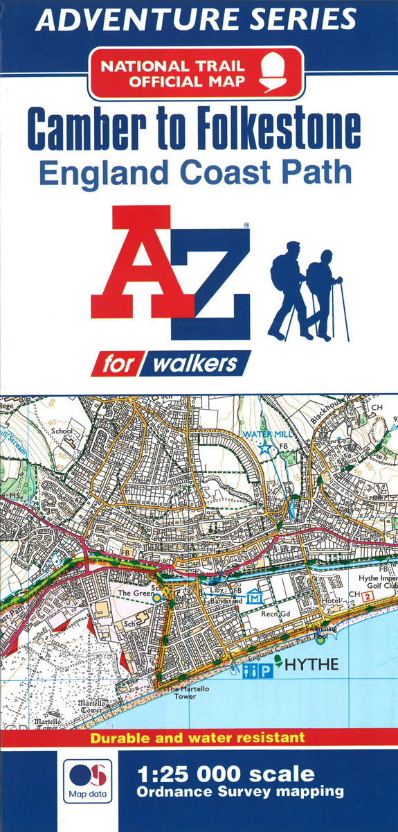
- England Coast Path - Camber to Folkestone Adventure Map
- The A-Z Adventure Series of maps combines the best of OS and A-Z, creating the perfect companion for walkers, off-road cyclists, horse riders and anyone wishing to explore the great outdoors.This official Camber to Folkestone Adventure Map section of the England Coast Path, a new National Trail around England`s coast. More than just a path, it... Lire la suite
- Also available from:
- Bol.com, Netherlands
- Bol.com, Belgium
Bol.com
Netherlands
Netherlands
- England Coast Path Camber to Folkestone Adventure Map
- The A-Z Adventure Series of maps combines the best of OS and A-Z, creating the perfect companion for walkers, off-road cyclists, horse riders and anyone wishing to explore the great outdoors.This official Camber to Folkestone Adventure Map section of the England Coast Path, a new National Trail around England`s coast. More than just a path, it... Lire la suite
Bol.com
Belgium
Belgium
- England Coast Path Camber to Folkestone Adventure Map
- The A-Z Adventure Series of maps combines the best of OS and A-Z, creating the perfect companion for walkers, off-road cyclists, horse riders and anyone wishing to explore the great outdoors.This official Camber to Folkestone Adventure Map section of the England Coast Path, a new National Trail around England`s coast. More than just a path, it... Lire la suite
De Zwerver
Netherlands
2022
Netherlands
2022
Bol.com
Netherlands
Netherlands
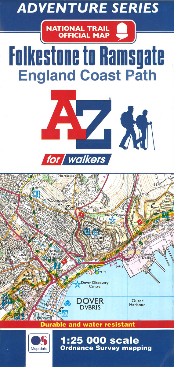
- England Coast Path Folkestone to Ramsgate Adventure Map
- The A-Z Adventure Series of maps combines the best of OS and A-Z, creating the perfect companion for walkers, off-road cyclists, horse riders and anyone wishing to explore the great outdoors.This official Folkestone to Ramsgate Adventure Map section of the England Coast Path, a new National Trail around England`s coast. More than just a path,... Lire la suite
- Also available from:
- Bol.com, Belgium
Bol.com
Belgium
Belgium
- England Coast Path Folkestone to Ramsgate Adventure Map
- The A-Z Adventure Series of maps combines the best of OS and A-Z, creating the perfect companion for walkers, off-road cyclists, horse riders and anyone wishing to explore the great outdoors.This official Folkestone to Ramsgate Adventure Map section of the England Coast Path, a new National Trail around England`s coast. More than just a path,... Lire la suite
De Zwerver
Netherlands
2023
Netherlands
2023

Stanfords
United Kingdom
2018
United Kingdom
2018
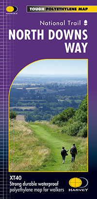
- North Downs Way Harvey National Trail XT40
- The whole of the North Downs Way, a 246km / 153 miles National Trail between Dover and Farnham, on a light, waterproof and tear-resistant map at 1:40,000 from Harvey Map Services presenting the route accompanied by extensive additional tourist information. This new edition published in autumn 2013 replaces the publishers’ previous coverage of... Lire la suite
- Also available from:
- De Zwerver, Netherlands
De Zwerver
Netherlands
2018
Netherlands
2018
- Wandelkaart North Downs Way | Harvey Maps
- The whole of the North Downs Way, a 246km / 153 miles National Trail between Dover and Farnham, on a light, waterproof and tear-resistant map at 1:40,000 from Harvey Map Services presenting the route accompanied by extensive additional tourist information. This new edition published in autumn 2013 replaces the publishers Lire la suite