Northumberland
Description
Quiet district in North East England. Low at the coast, hilly inland. Hiking is good along the coast path, in the Cheviot Hills bordering with Scotland, on the Pennine Way, and a few other trails.
Sentiers de cette région
Liens
Données
Rapports
Guides et cartes
Hébergement
Organisations
Voyagistes
GPS
Autre
Livres

Stanfords
United Kingdom
2019
United Kingdom
2019
- Pennine Way: Edale to Kirk Yetholm
- Britain`s best-known National Trail winds for 256 miles through three National Parks - the Peak District, Yorkshire Dales and Northumberland. This is the 5th edition. This superb footpath showcases Britain`s finest upland scenery, while touching the literary landscape of the Bronte family and Roman history along Hadrian`s Wall. *138 large-scale... Lire la suite

Stanfords
United Kingdom
United Kingdom
- DK Eyewitness Great Britain
- Discover Great Britain - a beautiful land rich in culture and history. Whether you want to go wild swimming in the Fairy Pools of Skye, take a windswept walk along the Jurassic Coast, or scale the heights of Snowdonia, your DK Eyewitness travel guide makes sure you experience all that Great Britain has to offer.From the jagged peaks of the... Lire la suite

Stanfords
United Kingdom
United Kingdom
- 100 Walks in Northumberland
- “100 walks in Northumberland” is an omnibus of local walks, with 100 route descriptions of circular walks from 3 to 12 miles.About this seriesNeatly laid-out walking guides, with one walk per double-page spread. The walks are mostly short and circular, arranged in ascending order of length. At the top of each entry is a brief summary of the... Lire la suite

Stanfords
United Kingdom
United Kingdom
- Pilgrimage: The Great Pilgrim Routes of Britain and Europe
- Shortlisted for a 2018 Edward Stanford Travel Writing Award.Ten historic pilgrim routes of Western Europe, inspiration for today`s long distance walker. Pilgrimage in Europe is thriving on a massive scale. In 1990 the cathedral at Santiago de Compostela recorded less than 5000 pilgrims: today that figure is at least 200,000 a year. Author Derry... Lire la suite

Stanfords
United Kingdom
United Kingdom
- Yorkshire Coast Path: A guide to walking 120 miles of magnificent coastline from Redcar to the Humber
- The Yorkshire coastline is the second most visited tourist destination in England - so why no walking guide to its entire length? The Trail Guides published by, for example, Aurum, and other walking publishers like Cicerone, sell steady numbers of guides to the Northumberland Coast Path, let alone National Trails like the South-West Coast Path.... Lire la suite

Stanfords
United Kingdom
United Kingdom


- Also available from:
- De Zwerver, Netherlands


The Book Depository
United Kingdom
United Kingdom
- Northumberland Walks
- You Take the High Road with Alternative Routes to Suit All Abilities Lire la suite

- Also available from:
- De Zwerver, Netherlands


- Also available from:
- De Zwerver, Netherlands


Stanfords
United Kingdom
2016
United Kingdom
2016
- The Pennine Way: The Path, the People, the Journey
- This book presents a portrait of the Pennine Way, Britain`s oldest and best known long-distance footpath, tracing its remarkable history through the experiences of walkers past and present. As Andrew McCloy walks the 268-mile route from the Derbyshire Peak District to the Scottish borders, he discovers how the Pennine Way set a benchmark for... Lire la suite
- Also available from:
- The Book Depository, United Kingdom

The Book Depository
United Kingdom
2016
United Kingdom
2016
- The Pennine Way - the Path, the People, the Journey
- A portrait of the The Pennine Way, Britain's oldest and best known long-distance footpath, stretching for 268 miles from the Derbyshire Peak District to the Scottish Borders. It charts the path's remarkable history, and walkers past and present relate their experiences of this commanding, exhilarating and complex path. Lire la suite

The Book Depository
United Kingdom
United Kingdom
Cartes

Stanfords
United Kingdom
United Kingdom
- Luxembourg North
- One of two topographic survey maps of Luxembourg at 1:50,000, with contours at 10-metres intervals and additional relief shading. An overprint highlights long-distance footpaths, including the GR5 (E-2), cycle routes, and various places of interest, including campsites. The map covers an area of approximately 53 x 43 km / 33 x 27 miles. Map... Lire la suite

Stanfords
United Kingdom
United Kingdom
- Luxembourg South
- One of two topographic survey maps of Luxembourg at 1:50,000, with contours at 10-metres intervals and additional relief shading. An overprint highlights long-distance footpaths, including the GR5 (E-2), cycle routes, and various places of interest, including campsites. The map covers an area of approximately 53 x 43 km / 33 x 27 miles. Map... Lire la suite

Stanfords
United Kingdom
United Kingdom
- Cycling the Reivers Route: Coast to coast through wild Northumberland`s border country
- As the wildest of the northern coast-to-coast cycle routes, the Reivers Route explores the rich Border Reiving history of northern England and the Scottish Borders. Travelling 173 mile (280km) from Whitehaven to Tynemouth, this four-day cycle tour takes in the Cumbrian coast, northern Lake District, Northumberland National Park and North... Lire la suite

The Book Depository
United Kingdom
2016
United Kingdom
2016
- Yorkshire Dales South & Western
- Southern and western area of the Yorkshire Dales on a detailed topographic and GPS compatible map OL2, paper version, from the Ordnance Survey`s 1:25,000 Explorer series. Coverage includes Wharfedale with Grassington and Hebden, the upper part of the Ribblesdale with Settle and Horton, Yorkshire’s Three Peaks area of Whernside, Ingleborough and... Lire la suite
- Also available from:
- De Zwerver, Netherlands

De Zwerver
Netherlands
2016
Netherlands
2016
- Wandelkaart - Topografische kaart OL02 OS Explorer Map Yorkshire Dales - Southern & Western Area | Ordnance Survey
- Southern and western area of the Yorkshire Dales on a detailed topographic and GPS compatible map OL2, paper version, from the Ordnance Survey`s 1:25,000 Explorer series. Coverage includes Wharfedale with Grassington and Hebden, the upper part of the Ribblesdale with Settle and Horton, Yorkshire’s Three Peaks area of Whernside, Ingleborough and... Lire la suite

The Book Depository
United Kingdom
United Kingdom
- Yorkshire Dales South & Western
- Southern and western area of the Yorkshire Dales on a detailed topographic and GPS compatible map OL2, waterproof version, from the Ordnance Survey`s 1:25,000 Explorer series. Coverage includes Wharfedale with Grassington and Hebden, the upper part of the Ribblesdale with Settle and Horton, Yorkshire’s Three Peaks area of Whernside,... Lire la suite

The Book Depository
United Kingdom
2015
United Kingdom
2015
- Peak District North
- The northern part of the Peak District at 1:25,000 on a light, waterproof and tear-resistant, GPS compatible, double-sided map from Harvey Map Services in their Superwalker series. Coverage extends from Marsden and Holmbridge in the north to beyond Glossop in the south, and includes the Bottoms / Valehouse / Rhodeswood / Torside / Woodhead... Lire la suite
- Also available from:
- De Zwerver, Netherlands

De Zwerver
Netherlands
2015
Netherlands
2015
- Wandelkaart Peak District Noord | Harvey Maps
- The northern part of the Peak District at 1:25,000 on a light, waterproof and tear-resistant, GPS compatible, double-sided map from Harvey Map Services in their Superwalker series. Coverage extends from Marsden and Holmbridge in the north to beyond Glossop in the south, and includes the Bottoms / Valehouse / Rhodeswood / Torside / Woodhead... Lire la suite

The Book Depository
United Kingdom
2015
United Kingdom
2015
- Peak District Central XT25
- The central part of the Peak District at 1:25,000 on a light, waterproof and tear-resistant, GPS compatible, double-sided map from Harvey Map Services in their Superwalker series. Coverage extends from west of New Mills and Whaley Bridge in the west to Sheffield and from the Derwent Reservoir in the north to Buxton, and includes... Lire la suite

The Book Depository
United Kingdom
United Kingdom
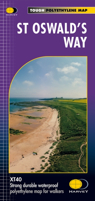
- St Oswald's Way
- Mooie, duidelijke kaart van de St Oswald's Way Noord-Engeland. Geplastificeerd met veel extra informatie en uitsnedes van de route. From Holy Island to Heavenfield, the 97 mile St Oswald's Way links some of the places associated with St Oswaldwho was the King of Northumbria in the early 7th century. The route runs through the... Lire la suite

De Zwerver
Netherlands
2020
Netherlands
2020
- Fietskaart Yorkshire Dales Touring / Nidderdale Area of NB | Harvey Maps
- Yorkshire Dales on a road map at 1:100,000 from Harvey Map Services with several enlargements showing main roads across local towns, plus descriptions of interesting locations, advice on public transport, etc. The map shows the Dales region with altitude colouring to indicate the region Lire la suite
De Zwerver
Netherlands
2022
Netherlands
2022
De Zwerver
Netherlands
2022
Netherlands
2022
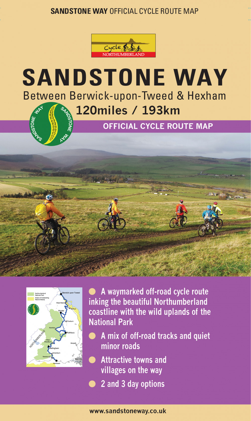
- Fietskaart Sandstone Way - Northumberland Cycle Route Map | Northern Heritage Services
- Sandstone Way Cycle Route between Berwick-upon-Tweed and Hexham shown on a 1:50,000 map from Northern Heritage. The 192kms/120 mile route is highlighted on four map panels with topography indicated by altitude colouring in bands of 50m; each panel also has a route profile. Information for the Sandstone Way includes mile markers (plus every... Lire la suite

De Zwerver
Netherlands
2014
Netherlands
2014
- Fietskaart Dales Noord | Harvey Maps
- The northern part of the Yorkshire Dales on a waterproof and tear-resistant, contoured and GPS compatible map at 1:40,000 from Harvey Map Services showing local right of way paths, long-distance hiking routes, off road cycling routes, etc.Topography is shown by contours at 15m intervals, with spot heights plus colouring and graphics to show... Lire la suite
De Zwerver
Netherlands
2020
Netherlands
2020
Bol.com
Netherlands
2017
Netherlands
2017
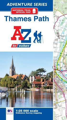
- Thames Path Adventure Atlas
- The A-Z Adventure series features the accuracy and quality of Ordnance Survey`s Explorer mapping in a convenient book, therefore eliminating the need to fold and re-fold a large sheet map to the desired area. OS Explorer is Ordnance Survey`s most detailed mapping at a scale of 1:25 000 showing public rights of way, open access land, national... Lire la suite
- Also available from:
- Bol.com, Belgium
Bol.com
Belgium
2017
Belgium
2017
- Thames Path Adventure Atlas
- The A-Z Adventure series features the accuracy and quality of Ordnance Survey`s Explorer mapping in a convenient book, therefore eliminating the need to fold and re-fold a large sheet map to the desired area. OS Explorer is Ordnance Survey`s most detailed mapping at a scale of 1:25 000 showing public rights of way, open access land, national... Lire la suite
Plus de cartes …