
Gran Paradiso
Description
Carte

Liens
Données
Rapports
Guides et cartes
Hébergement
Organisations
Voyagistes
GPS
Autre
Livres

Stanfords
United Kingdom
United Kingdom
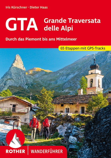
- GTA Grande Traversata delle Alpi - long-distance Route across the Italian Alps Rother Guide
- GTA - Grande Traversata delle Alpi, one of Italy’s most popular long-distance trails, described state-by-stage in a detailed pocket guide from Bergverlag Rother, specialist in hiking guides to numerous locations across Europe. The guide takes as its starting point Alpe di Cruina in Switzerland, crossing over to Italy across the Griespass. The... Lire la suite
- Also available from:
- The Book Depository, United Kingdom

The Book Depository
United Kingdom
United Kingdom
- GTA - Grande Traversata delle Alpi walking g.
- Through the Piedmont to the Mediterranean. 65 Stages. With GPS - Tracks Lire la suite
De Zwerver
Netherlands
2022
Netherlands
2022
- Wandelgids GTA - Grande Traversata delle Alpi Durch das Piemont bis ans Mittelmeer | Rother Bergverlag
- Uitstekende wandelgids met beschrijving van de Grande Traversata delle Alpi. Met praktische informatie en beperkt kaartmateriaal! Wandelingen in verschillende zwaarte weergegeven in rood/blauw/zwart. Die Grande Traversata delle Alpi, kurz GTA, führt mit gewaltiger 4000er-Kulisse vom Nufenenpass an der Schweizer Grenze auf alten Saumwegen durch... Lire la suite

The Book Depository
United Kingdom
2010
United Kingdom
2010
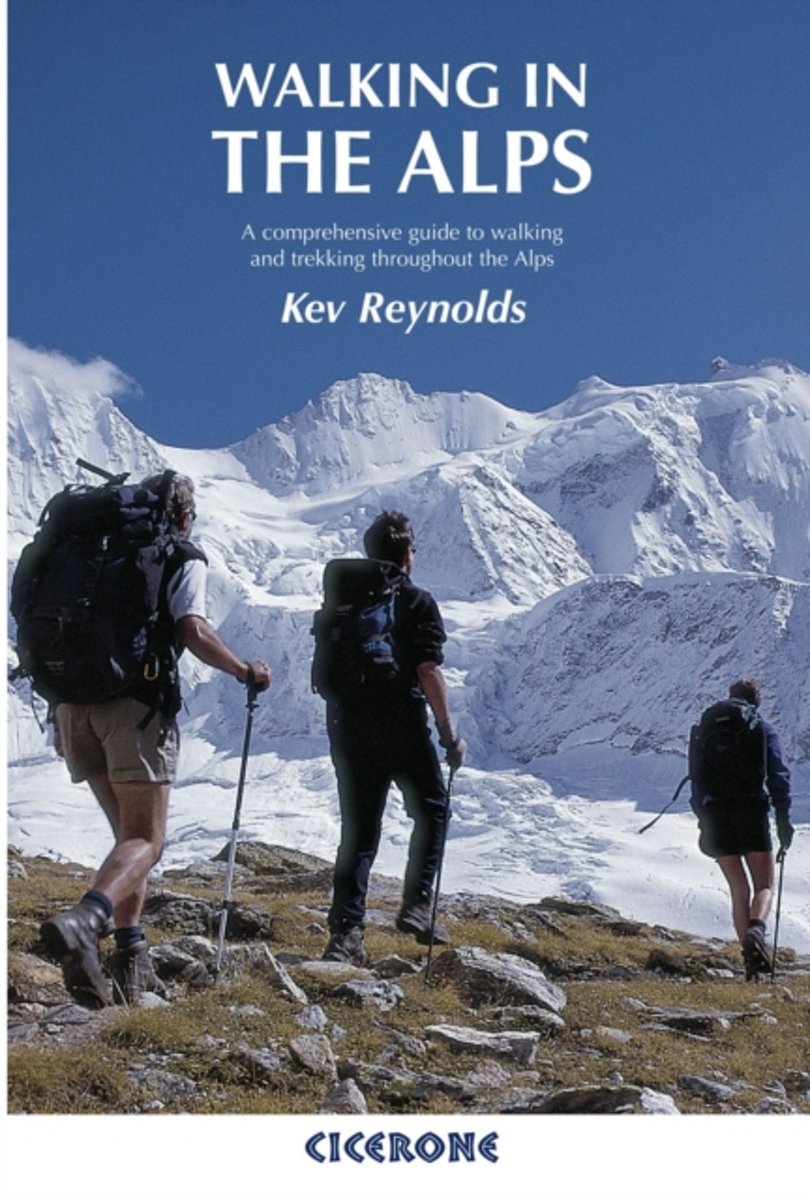
- Walking in the Alps
- A comprehensive guide to walking and trekking throughout the Alps Lire la suite
- Also available from:
- Bol.com, Netherlands
- Bol.com, Belgium
- De Zwerver, Netherlands
Bol.com
Netherlands
2010
Netherlands
2010
- Walking in the Alps
- The second edition of this classic guidebook by Kev Reynolds on walking and trekking in the Alps. This book is a definitive guide to the many thousands of possible routes, with a geographical span that ranges from the Maritime Alps of southern France to the Julians of Slovenia, from Italy's Gran Paradiso to the little-known Turnitzer Alps of... Lire la suite
Bol.com
Belgium
2010
Belgium
2010
- Walking in the Alps
- The second edition of this classic guidebook by Kev Reynolds on walking and trekking in the Alps. This book is a definitive guide to the many thousands of possible routes, with a geographical span that ranges from the Maritime Alps of southern France to the Julians of Slovenia, from Italy's Gran Paradiso to the little-known Turnitzer Alps of... Lire la suite

De Zwerver
Netherlands
2010
Netherlands
2010
- Wandelgids Walking in the Alps | Cicerone
- Second edition of this classic Kev Reynolds guidebook on walking and trekking in the Alps. Suggests many thousands of possible routes, and covers the range from the Maritime Alps of southern France to the Julian Alps of Slovenia. Walks vary from undemanding to long and tough, and everything in between. Lire la suite

The Book Depository
United Kingdom
2018
United Kingdom
2018
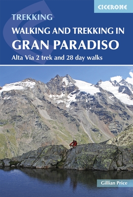
- Walking and Trekking in the Gran Paradiso
- Alta Via 2 trek and 28 day walks Lire la suite
- Also available from:
- Bol.com, Netherlands
- Bol.com, Belgium
Bol.com
Netherlands
2018
Netherlands
2018
- Walking and Trekking in the Gran Paradiso
- A guidebook to walking in the Gran Paradiso National Park in the Italian Alps, describing the 12-stage Alta Via 2 trek between Courmayeur and Chardonnay, and 28 walks ranging from 2 to 33km, as well as suggestions for combining routes into long-distance hikes. The Gran Paradiso sits in the Valle d'Aosta, in northwestern Italy, a region verging... Lire la suite
Bol.com
Belgium
2018
Belgium
2018
- Walking and Trekking in the Gran Paradiso
- A guidebook to walking in the Gran Paradiso National Park in the Italian Alps, describing the 12-stage Alta Via 2 trek between Courmayeur and Chardonnay, and 28 walks ranging from 2 to 33km, as well as suggestions for combining routes into long-distance hikes. The Gran Paradiso sits in the Valle d'Aosta, in northwestern Italy, a region verging... Lire la suite
De Zwerver
Netherlands
2018
Netherlands
2018
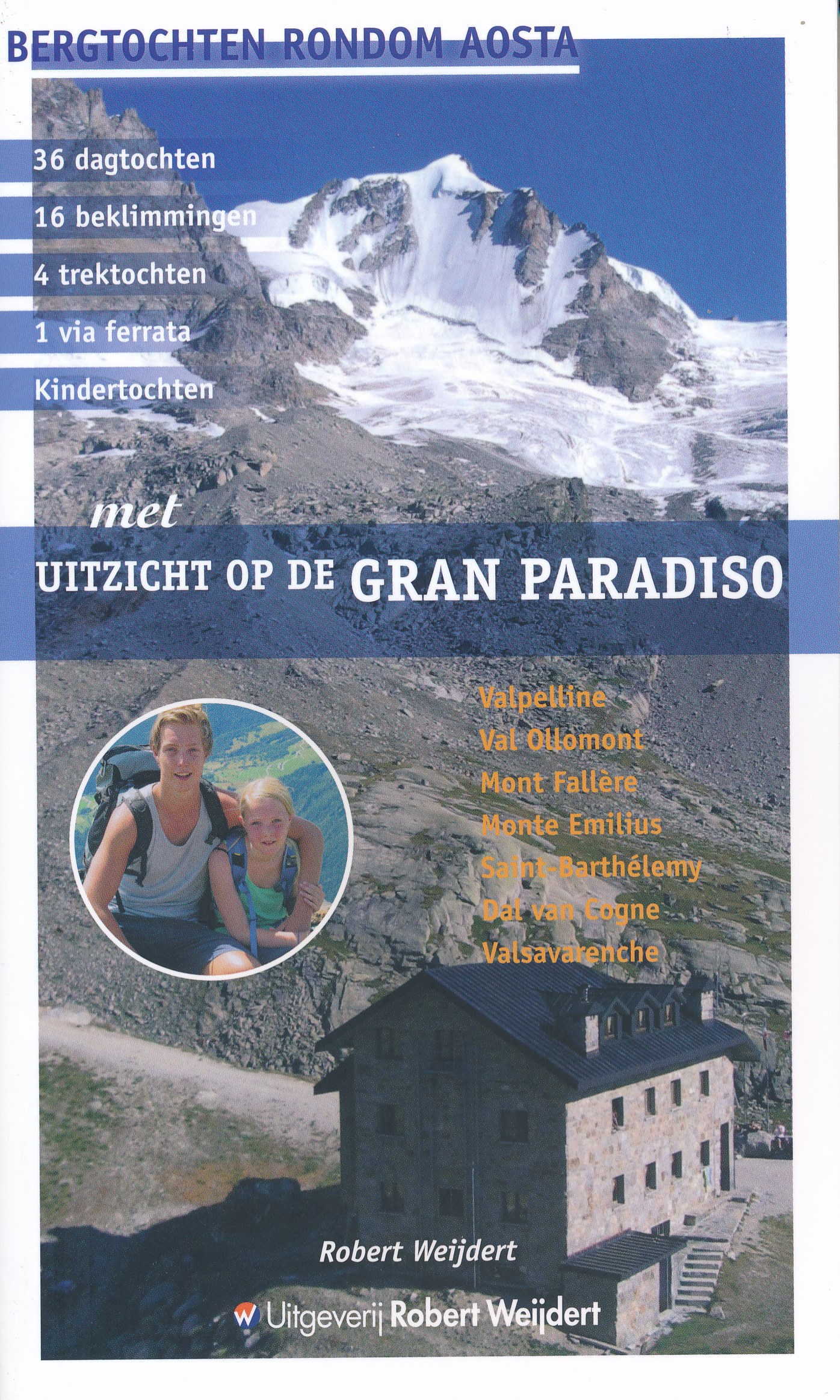
- Wandelgids Met uitzicht op de Gran Paradiso | Robert Weijdert
- 36 dagtochten - 16 beklimmingen - 4 trektochten - 1 via ferrata - kindertochten Met uitzicht op de Gran Paradiso. Zo heet de nieuwe berggids van Robert Weijdert, redacteur van Bergen Magazine. In deze gids zijn de interessantste bergwandelingen en lichtalpiene beklimmingen rond de hoofdplaats Aosta bijeengebracht met de Gran Paradiso als... Lire la suite

The Book Depository
United Kingdom
2011
United Kingdom
2011
- Trekking in the Alps
- An inspirational guidebook to 20 classic treks in the Alps. As well as introducing new hiking areas in the Alps, classics such as the Tour of Mont Blanc, and Chamonix to Zermatt are included. Trekking in the Alps is immensely satisfying, and this book celebrates the rich and scenic diversity for which this great mountain range is renowned. Lire la suite
- Also available from:
- Bol.com, Netherlands
- Bol.com, Belgium
- De Zwerver, Netherlands

Bol.com
Netherlands
2011
Netherlands
2011
- Trekking in the Alps
- An inspirational guide to the delights of Alpine multi-day hikes. With 20 hikes described, including classics such as the Tour of Mont Blanc and the Tour of the Vanoise as well as new multi-day routes like the Traverse of the Slovenian Alps, this guide celebrates the rich scenic diversity for which the Alps are renowned.The eight talented... Lire la suite
Bol.com
Belgium
2011
Belgium
2011
- Trekking in the Alps
- An inspirational guide to the delights of Alpine multi-day hikes. With 20 hikes described, including classics such as the Tour of Mont Blanc and the Tour of the Vanoise as well as new multi-day routes like the Traverse of the Slovenian Alps, this guide celebrates the rich scenic diversity for which the Alps are renowned.The eight talented... Lire la suite

De Zwerver
Netherlands
2019
Netherlands
2019
- Wandelgids Trekking in the Alps | Cicerone
- An inspirational guidebook to 20 classic treks in the Alps. As well as introducing new hiking areas in the Alps, classics such as the Tour of Mont Blanc, and Chamonix to Zermatt are included. Trekking in the Alps is immensely satisfying, and this book celebrates the rich and scenic diversity for which this great mountain range is renowned. Lire la suite
Bol.com
Netherlands
Netherlands
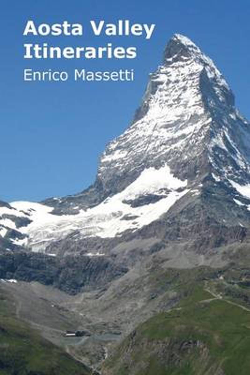
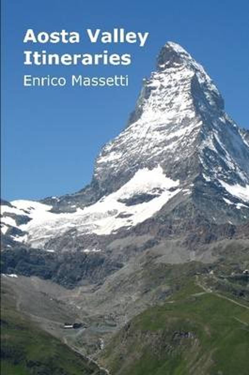
- Aosta Valley Itineraries
- This guide covers visits to the mountain region of Aosta Valley, with description of several itineraries to visit the valley. The locations covered are the city of Aosta, the lower valley with its castles, a visit to Cogne and the Gran Paradiso Park, a visit to Morgex, La Thuille and the Piccolo San Bernardo Pass, one to Courmayeur, one to... Lire la suite
- Also available from:
- Bol.com, Belgium
Bol.com
Belgium
Belgium
- Aosta Valley Itineraries
- This guide covers visits to the mountain region of Aosta Valley, with description of several itineraries to visit the valley. The locations covered are the city of Aosta, the lower valley with its castles, a visit to Cogne and the Gran Paradiso Park, a visit to Morgex, La Thuille and the Piccolo San Bernardo Pass, one to Courmayeur, one to... Lire la suite
De Zwerver
Netherlands
2024
Netherlands
2024
- Wandelgids 07 Aostatal - Gran Paradiso | Rother Bergverlag
- Uitstekende wandelgids met een groot aantal dagtochten in dal en hooggebergte. Met praktische informatie en beperkt kaartmateriaal! Wandelingen in verschillende zwaarte weergegeven in rood/blauw/zwart. Eingefaßt von den höchsten Bergen der Alpen – wie Mont Blanc, Monte Rosa und Matterhorn im Norden – sowie der Gran-Paradiso-Gruppe im Süden,... Lire la suite
Bol.com
Netherlands
Netherlands
- Aosta Valley Itineraries
- Valle d'Aosta is a vertical region, you might say, and not just in the physical sense, for the many high peaks that surround it (including Mont Blanc, the highest mountain in Europe at 4,807 meters), but also for the surprising concentration, in a region of such reduced dimensions, of so many natural splendors, of so many monuments, of so much... Lire la suite
- Also available from:
- Bol.com, Belgium
Bol.com
Belgium
Belgium
- Aosta Valley Itineraries
- Valle d'Aosta is a vertical region, you might say, and not just in the physical sense, for the many high peaks that surround it (including Mont Blanc, the highest mountain in Europe at 4,807 meters), but also for the surprising concentration, in a region of such reduced dimensions, of so many natural splendors, of so many monuments, of so much... Lire la suite
De Zwerver
Netherlands
2013
Netherlands
2013
- Wandelgids - Klimgids - Klettersteiggids Gran Paradiso | Rother Bergverlag
- Für Wanderer, Bergsteiger und Kletterer. 7. Auflage. Lire la suite
Bol.com
Netherlands
Netherlands
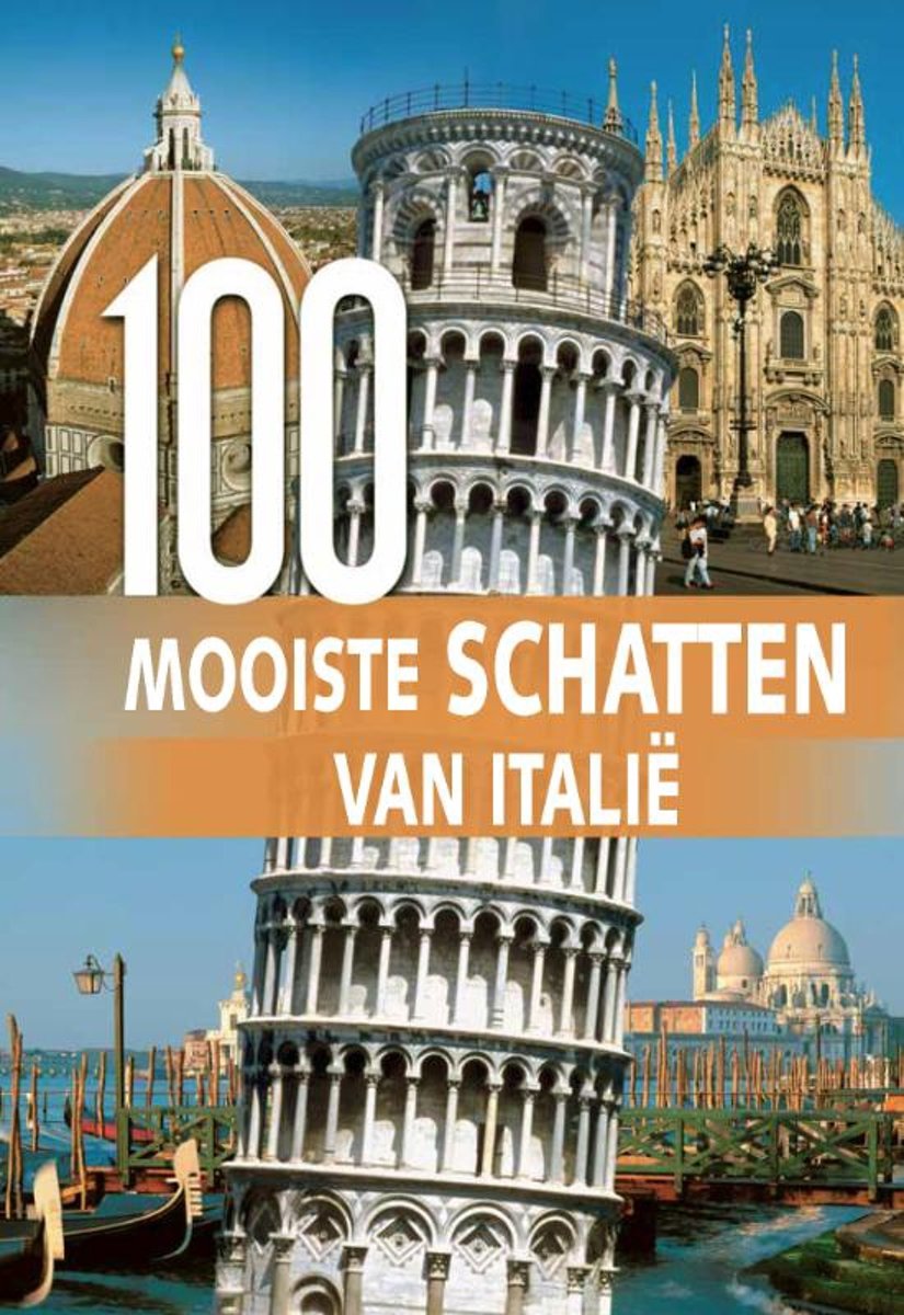
- 100 Mooiste schatten van Italie
- Hoewel 'mooi' erg subjectief is, zal niemand ontkennen dat Itali steden en landschappen met een tijdloze, betoverende schoonheid heeft. De 100 mooiste reisdoelen uitkiezen was echter niet makkelijk. Enerzijds zijn er zo veel prachtige plekjes om uit te kiezen en anderzijds moet er geografisch en cultureel een enorm gevarieerd gebied worden... Lire la suite
- Also available from:
- Bol.com, Belgium
Bol.com
Belgium
Belgium
- 100 Mooiste schatten van Italie
- Hoewel 'mooi' erg subjectief is, zal niemand ontkennen dat Itali steden en landschappen met een tijdloze, betoverende schoonheid heeft. De 100 mooiste reisdoelen uitkiezen was echter niet makkelijk. Enerzijds zijn er zo veel prachtige plekjes om uit te kiezen en anderzijds moet er geografisch en cultureel een enorm gevarieerd gebied worden... Lire la suite

The Book Depository
United Kingdom
2014
United Kingdom
2014
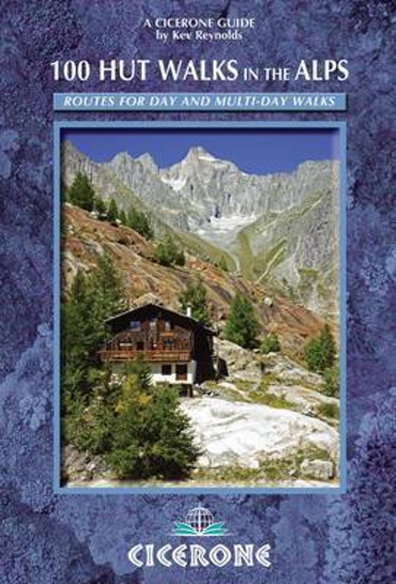
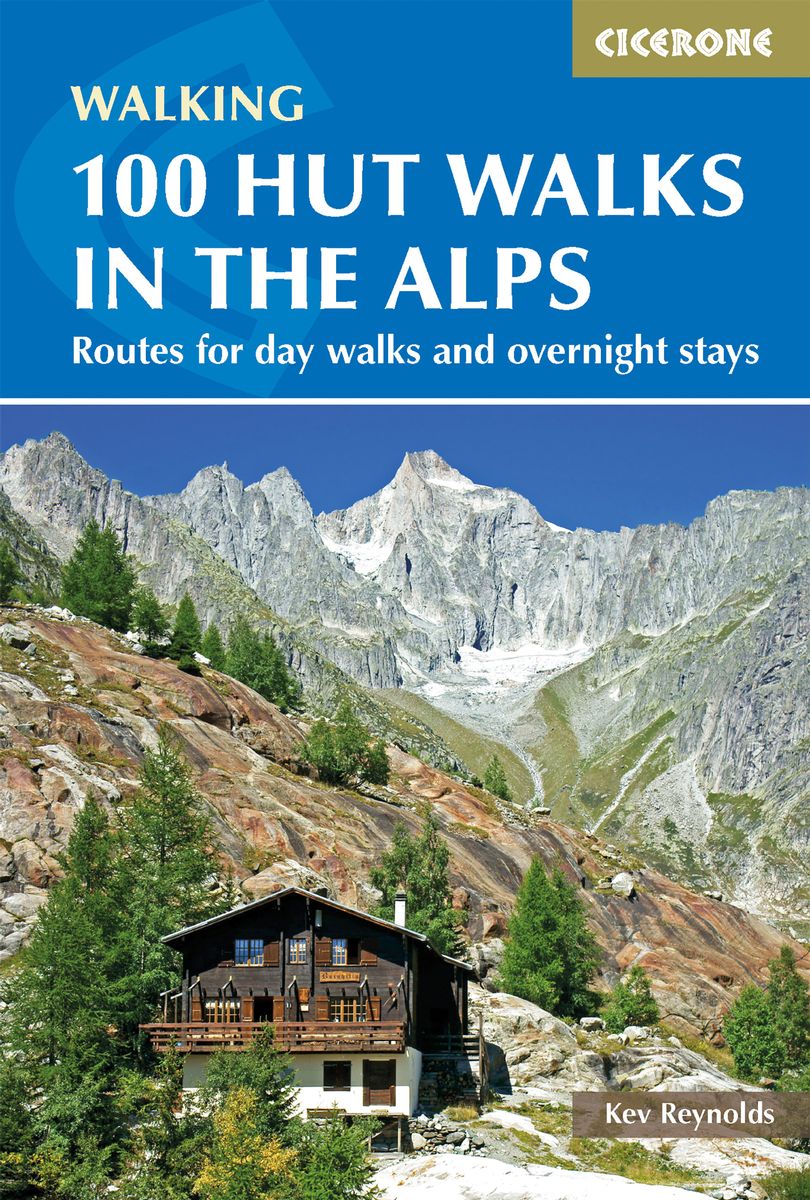
- 100 Hut Walks in the Alps
- Routes for day walks and overnight stays in France, Switzerland, Italy, Austria and Slovenia Lire la suite
- Also available from:
- Bol.com, Netherlands
- Bol.com, Belgium
- De Zwerver, Netherlands
Bol.com
Netherlands
2014
Netherlands
2014
- 100 Hut Walks in the Alps
- This popular guidebook by Alpine expert Kev Reynolds describes 100 routes to suit Alpine walkers of all abilities, with suggestions for some hut-to-hut tours. The routes are grouped, first under the individual country, and covers France, Switzerland, Italy, Austria and Slovenia. Then arranged by specific Alpine districts enabling you to put... Lire la suite
Bol.com
Belgium
2014
Belgium
2014
- 100 Hut Walks in the Alps
- This popular guidebook by Alpine expert Kev Reynolds describes 100 routes to suit Alpine walkers of all abilities, with suggestions for some hut-to-hut tours. The routes are grouped, first under the individual country, and covers France, Switzerland, Italy, Austria and Slovenia. Then arranged by specific Alpine districts enabling you to put... Lire la suite
De Zwerver
Netherlands
2018
Netherlands
2018
- Wandelgids 100 Hut Walks In The Alps | Cicerone
- This guidebook has route descriptions for 100 day walks to suit alpine walkers of all abilities, with suggestions for some hut-to-hut tours. These routes take you through breathtaking scenery in the Maritime Alps, Julian Alps, Gran Paradiso, the Turnitzer Alps, Bernese Oberland, the Kitzbuheler Alps and the Dolomites of South Tirol. Lire la suite
Bol.com
Netherlands
Netherlands
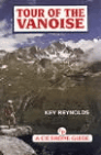
- Tour of the Vanoise
- This book is a guide to a 10-12 day circuit of one of the finest of all mountain areas in France - the Vanoise Alps. Easily accessible by train or bus from Chambery and Grenoble, the Vanoise National Park neighbours that of the Gran Paradiso in Italy, with Mont Blanc to the north and the Ecrins to the south. The Tour of the Vanoise explores... Lire la suite
- Also available from:
- Bol.com, Belgium
Bol.com
Belgium
Belgium
- Tour of the Vanoise
- This book is a guide to a 10-12 day circuit of one of the finest of all mountain areas in France - the Vanoise Alps. Easily accessible by train or bus from Chambery and Grenoble, the Vanoise National Park neighbours that of the Gran Paradiso in Italy, with Mont Blanc to the north and the Ecrins to the south. The Tour of the Vanoise explores... Lire la suite
Bol.com
Netherlands
Netherlands
- GRAN PARADISO LONG DISTANCE WALKS ING
- The Gran Paradiso is well known to continental walkers, but it is unusual to encounter any British walkers there. This guide has been written to show what is possible. An in-depth introduction describes many facets of the Valdotain hill country and deals with the differences likely to be found between walking in the UK and the Alps. The Via... Lire la suite
- Also available from:
- Bol.com, Belgium
Bol.com
Belgium
Belgium
- GRAN PARADISO LONG DISTANCE WALKS ING
- The Gran Paradiso is well known to continental walkers, but it is unusual to encounter any British walkers there. This guide has been written to show what is possible. An in-depth introduction describes many facets of the Valdotain hill country and deals with the differences likely to be found between walking in the UK and the Alps. The Via... Lire la suite
Cartes

Stanfords
United Kingdom
United Kingdom
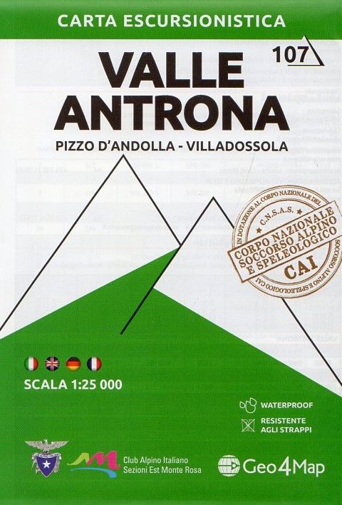
- Valle Antrona - Pizzo d`Andolla - Villadossola Geo4Map 7
- 1:25,000 hiking map to Valle Antrona centred on Antronapiana, including Pizzo d`Andolla, Villadossola and Pieve Vergonte. Published in association with the CAI, the Italian Alpine Club, who are responsible for the trails. Trails are marked on the map. The key information and more detailed information on the rear of the sheet are in Italian,... Lire la suite
- Also available from:
- De Zwerver, Netherlands
De Zwerver
Netherlands
Netherlands
- Wandelkaart 107 Valle Antrona - Pizzo d'Andolla - Villadossola | Geo4Map
- 1:25,000 hiking map to Valle Antrona centred on Antronapiana, including Pizzo d`Andolla, Villadossola and Pieve Vergonte. Published in association with the CAI, the Italian Alpine Club, who are responsible for the trails. Trails are marked on the map. The key information and more detailed information on the rear of the sheet are in Italian,... Lire la suite

Stanfords
United Kingdom
United Kingdom
- Matterhorn / M. Cervino - Monte Rosa IGC 5
- The Italian side of the Matterhorn and Monte Rosa, with coverage extending from Zermatt to Aosta, in a series contoured hiking maps at 1:50,000 with local trails, long-distance footpaths, mountain accommodation, etc. from the Turin based Istituto Geografico Centrale. Maps in this series have contours at 50m intervals, enhanced by shading and... Lire la suite
- Also available from:
- De Zwerver, Netherlands

De Zwerver
Netherlands
Netherlands
- Wandelkaart 05 Cervino Matterhorn e Monte Rosa | IGC - Istituto Geografico Centrale
- Matterhorn/M.Cervino and Monte Rosa, map no. 5, in a series contoured hiking maps at 1:50,000 with local trails, long-distance footpaths, mountain accommodation, etc. from the Turin based Istituto Geografico Centrale covering the Italian Alps and Piedmont, the lakes and northern Lombardy, and the Italian Riviera.The maps have contours at 50m... Lire la suite

Stanfords
United Kingdom
United Kingdom
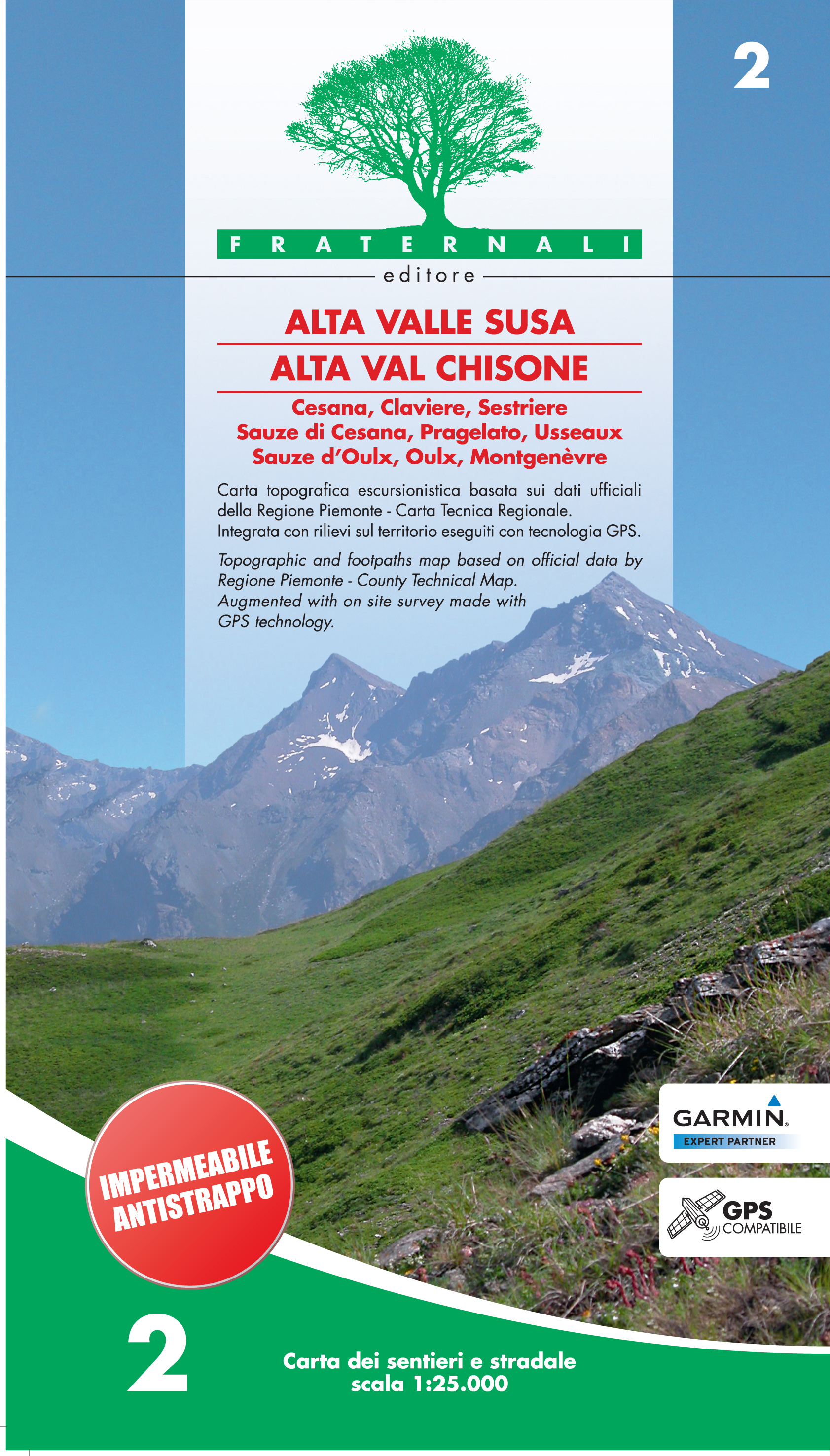
- Alta Valle Susa - Alta Val Chisone Fraternali Editore 02
- Alta Val Chisone in the Italian Alps presented at 1:25,000 in a series of large, contoured and GPS compatible walking maps from Fraternali Editore, printed on light, waterproof and tear-resistant synthetic paper. Maps in this series have topography shown by contour lines at 5m intervals with relief shading, spot heights, and colouring and/or... Lire la suite
- Also available from:
- De Zwerver, Netherlands
De Zwerver
Netherlands
Netherlands
- Wandelkaart 02 Alta Valle Susa - Alta Val Chisone | Fraternali Editore
- Alta Val Chisone in the Italian Alps presented at 1:25,000 in a series of large, contoured and GPS compatible walking maps from Fraternali Editore, printed on light, waterproof and tear-resistant synthetic paper. Maps in this series have topography shown by contour lines at 5m intervals with relief shading, spot heights, and colouring and/or... Lire la suite

Stanfords
United Kingdom
United Kingdom
- Turin - Pinerolo - Lower Susa Valley 50K IGC Map No. 17
- Turin - Pinerolo - Lower Susa Valley area of Piedmont in a series contoured hiking maps at 1:50,000 with local trails, long-distance footpaths, mountain accommodation, etc. from the Turin based Istituto Geografico Centrale.Maps in this series have contours at 50m intervals, enhanced by shading and graphic relief. An overprint highlights local... Lire la suite
- Also available from:
- De Zwerver, Netherlands

De Zwerver
Netherlands
Netherlands
- Wandelkaart 17 Torino, Pinerolo e Bassa val di Susa | IGC - Istituto Geografico Centrale
- Turin - Pinerolo - Lower Susa Valley, map no. 17, in a series contoured hiking maps at 1:50,000 with local trails, long-distance footpaths, mountain accommodation, etc. from the Turin based Istituto Geografico Centrale covering the Italian Alps and Piedmont, the lakes and northern Lombardy, and the Italian Riviera.The maps have contours at 50m... Lire la suite

Stanfords
United Kingdom
United Kingdom
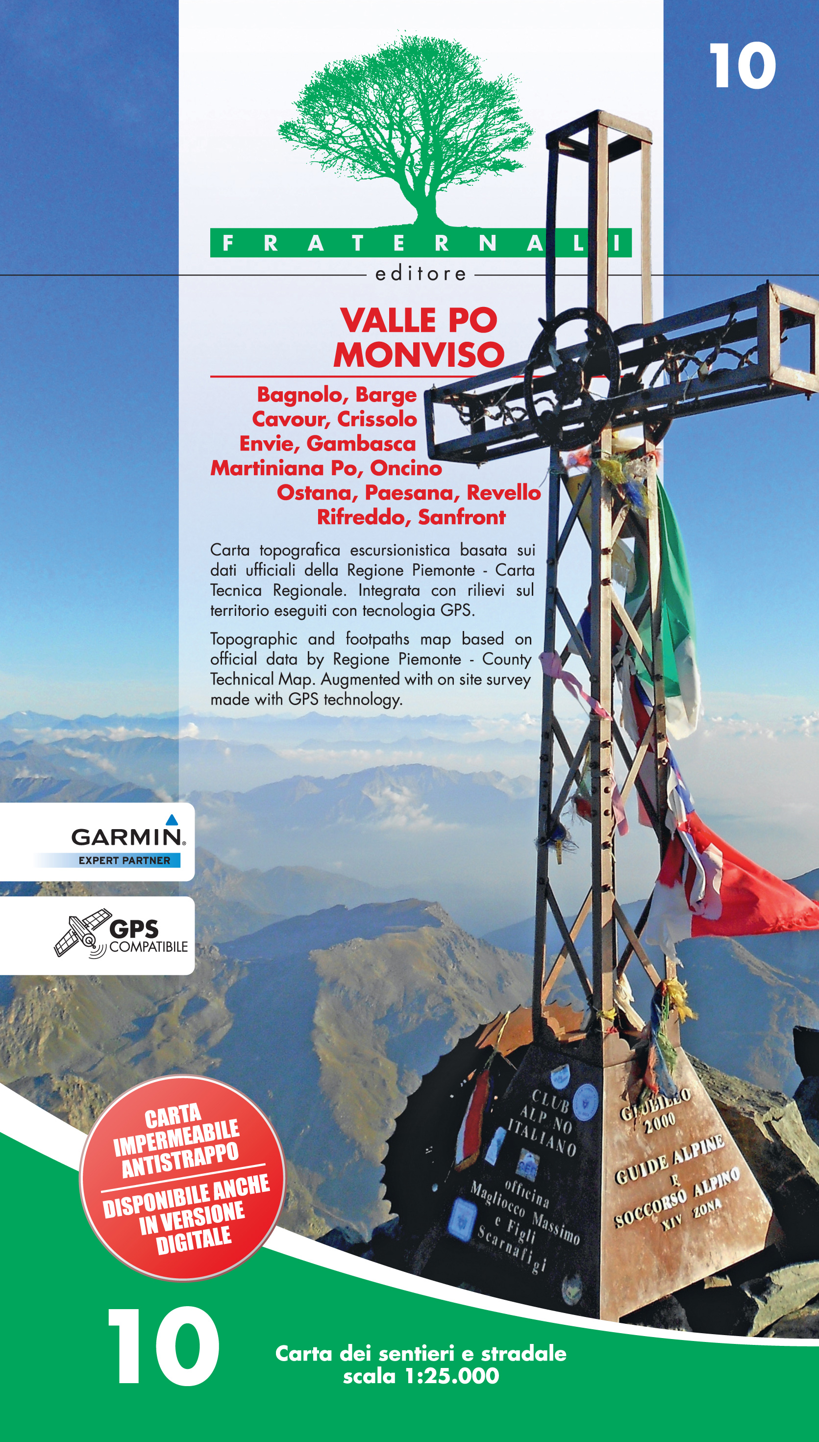
- Valle Po - Monviso - Monte Bracco
- Valle Po - Monviso - Monte Bracco area of the Italian Alps presented at 1:25,000 in a series of large, contoured and GPS compatible walking maps from Fraternali Editore, printed on light, waterproof and tear-resistant synthetic paper. Maps in this series have topography shown by contour lines at 5m intervals with relief shading, spot heights,... Lire la suite
- Also available from:
- De Zwerver, Netherlands
De Zwerver
Netherlands
Netherlands
- Wandelkaart 10 Valle Po Monviso | Fraternali Editore
- Gebied: Bagnolo, Barge, Cavour, Crissolo, Envie, Gambasca, Martiniana Po, Oncino, Ostana, Paesana, Revello, Rifreddo, Sanfront Een uitstekende wandelkaart van de westkant van Italie waar tot voor kort geen echt goede kaarten beschikbaar waren. De lokale uitgeverij Fraternali heeft een prachtige serie gemaakt van wandelkaarten met schaal... Lire la suite

Stanfords
United Kingdom
United Kingdom
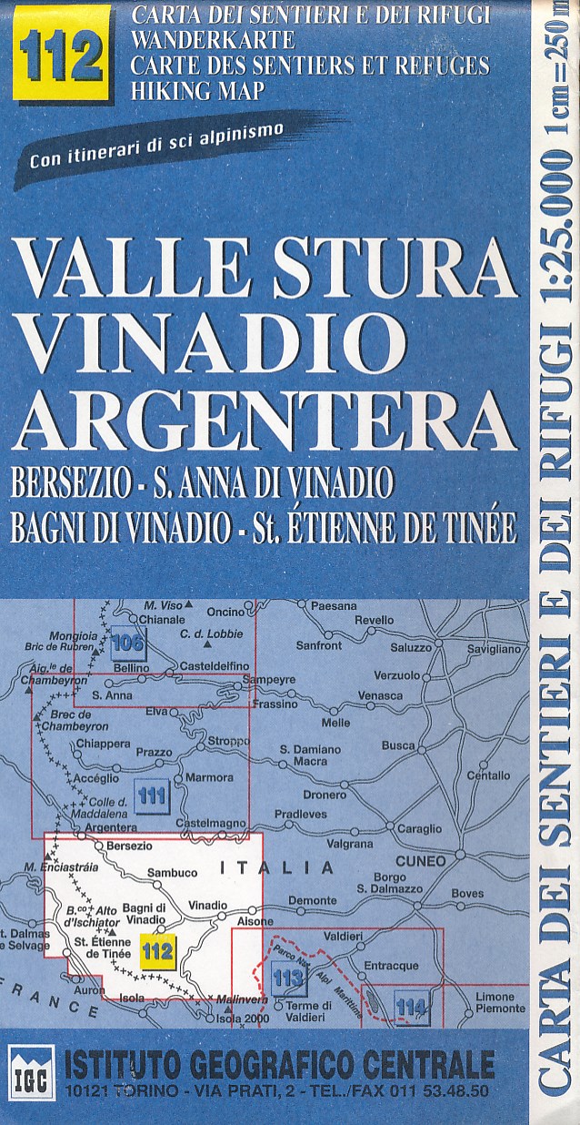
- Valle Stura - Vinadio - Argentera IGC 112
- Valle Stura - Vinadio - Argentera area at 1:25,000 in a series of contoured, GPS compatible walking maps from the Turin based Istituto Geografico Centrale, highlighting hiking trails including long-distance routes, ski routes and alpine accommodation. Maps in this series have contours at 25m intervals, enhanced by shading and graphic relief for... Lire la suite
- Also available from:
- De Zwerver, Netherlands
De Zwerver
Netherlands
Netherlands
- Wandelkaart 112 Valle Stura, Vinadio Argentera | IGC - Istituto Geografico Centrale
- Gedetailleerde wandelkaart met hoogtelijnen, wandelroutes en hutten ingetekend. Lire la suite

Stanfords
United Kingdom
United Kingdom
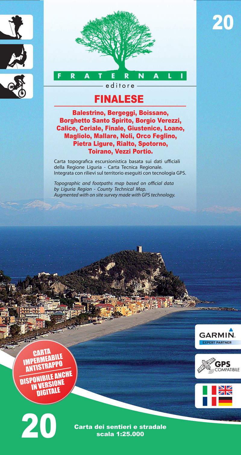
- Finalese
- Finalese area of the Italian Alps presented at 1:25,000 in a series of large, contoured and GPS compatible walking maps from Fraternali Editore, printed on light, waterproof and tear-resistant synthetic paper. Maps in this series have topography shown by contour lines at 5m intervals with relief shading, spot heights, and colouring and/or... Lire la suite
- Also available from:
- De Zwerver, Netherlands
De Zwerver
Netherlands
Netherlands
- Wandelkaart 20 Finalese | Fraternali Editore
- Val Vermenagna - Valle Pesio - Alta Valle Ellero area of the Italian Alps presented at 1:25,000 in a series of large, contoured and GPS compatible walking maps from Fraternali Editore, printed on light, waterproof and tear-resistant synthetic paper. Maps in this series have topography shown by contour lines at 5m intervals with relief shading,... Lire la suite

Stanfords
United Kingdom
United Kingdom
- Valsesia - Monte Rosa - Alagna Valsesia - Rima San Giuseppe - Carcoforo Geo4Map 4
- 1:25,000 hiking map to the north west of Valsesia centred on Rima San Giuseppe and Alagna Valsesia, including Monte Rosa, Carcoforo, Rimasco, Mollia and Riva Valdobbia.Published in association with the CAI, the Italian Alpine Club, who are responsible for the trails. Trails are marked on the map. The key information and more detailed... Lire la suite

Stanfords
United Kingdom
United Kingdom
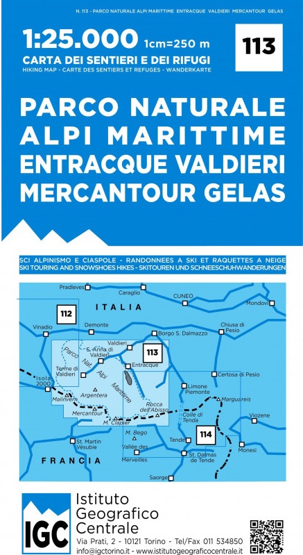
- Maritime Alps Natural Park - Entracque - Valdieri - Mercantour - Gelas IGC 113
- Argentera Regional Park - Entracque - Valdieri area at 1:25,000 in a series of contoured, GPS compatible walking maps from the Turin based Istituto Geografico Centrale, highlighting hiking trails including long-distance routes, ski routes and alpine accommodation. Maps in this series have contours at 25m intervals, enhanced by shading and... Lire la suite
- Also available from:
- De Zwerver, Netherlands

Stanfords
United Kingdom
United Kingdom
- Valle di Bognanco - NP Alpe Veglia Geo4Map 8
- 1:25,000 hiking map to the Valle di Bognanco including Iselle, Crevoladossola, Domodossola, Villadossola and Antronapiana. Published in association with the CAI, the Italian Alpine Club, who are responsible for the trails. Trails are marked on the map. The key information and more detailed information on the rear of the sheet are in Italian,... Lire la suite

Stanfords
United Kingdom
United Kingdom
- Monviso IGC 6
- Monviso / Monte Viso cross-border area with coverage from Châteaux Queyras to Sampeyre and from the Grand Queyron to the Aiguille de Chambeyron in a series contoured hiking maps at 1:50,000 with local trails, long-distance footpaths, mountain accommodation, etc. from the Turin based Istituto Geografico Centrale.Maps in this series have contours... Lire la suite
- Also available from:
- De Zwerver, Netherlands

De Zwerver
Netherlands
Netherlands
- Wandelkaart 06 Monviso | IGC - Istituto Geografico Centrale
- Monviso / Monte Viso cross-border area with coverage from Châteaux Queyras to Sampeyre and from the Grand Queyron to the Aiguille de Chambeyron in a series contoured hiking maps at 1:50,000 with local trails, long-distance footpaths, mountain accommodation, etc. from the Turin based Istituto Geografico Centrale.Maps in this series have contours... Lire la suite
Stanfords
United Kingdom
United Kingdom
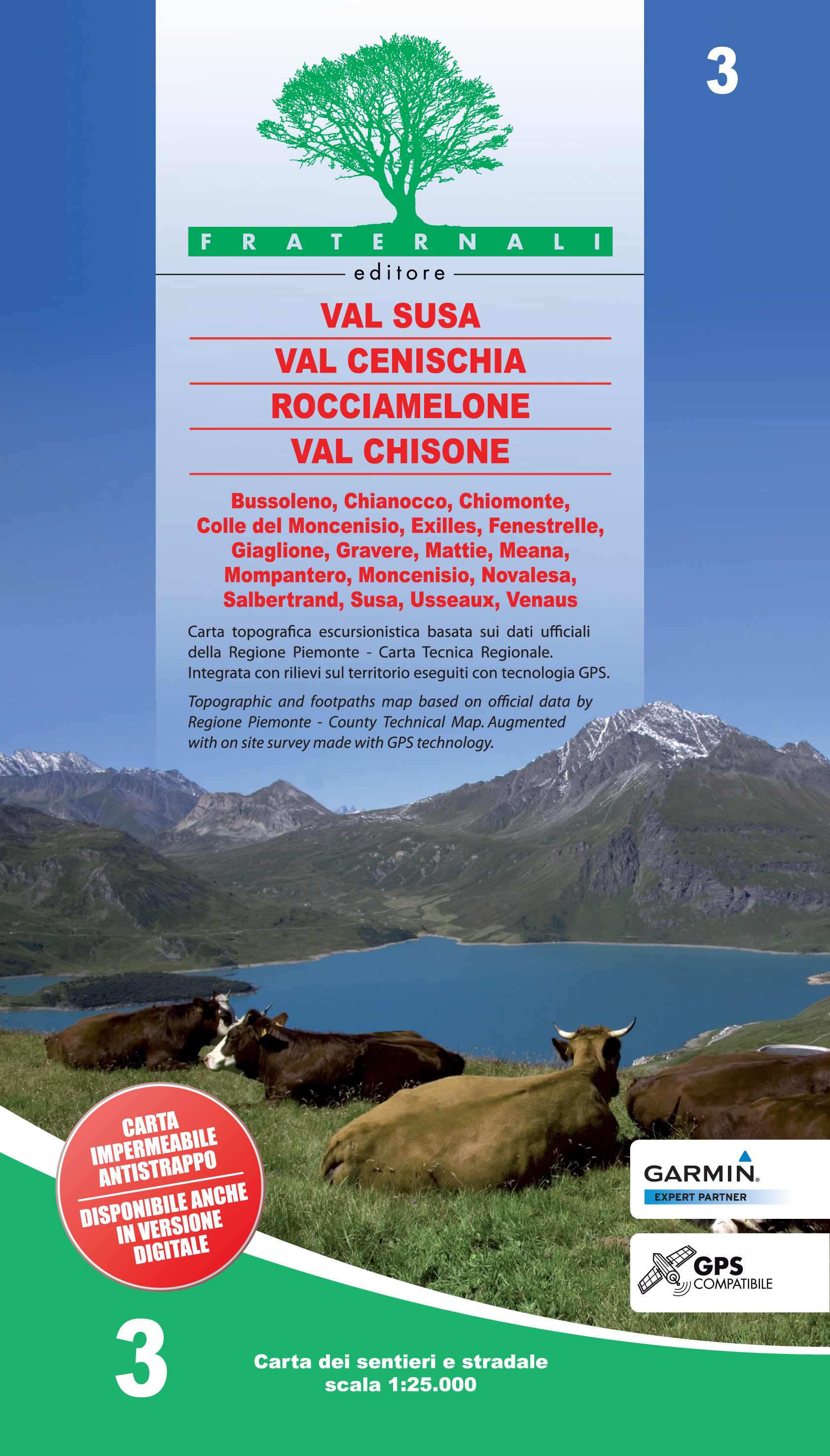
- Val Susa - Val Cenischia - Rocciamelone - Val Chisone
- Val Susa - Val Cenischia - Rocciamelone - Val Chisone area of the Italian Alps presented at 1:25,000 in a series of large, contoured and GPS compatible walking maps from Fraternali Editore, printed on light, waterproof and tear-resistant synthetic paper. Maps in this series have topography shown by contour lines at 5m intervals with relief... Lire la suite
- Also available from:
- De Zwerver, Netherlands
De Zwerver
Netherlands
Netherlands
- Wandelkaart 03 Val Susa - Val Cenischia | Fraternali Editore
- Val Susa - Val Cenischia - Rocciamelone - Val Chisone area of the Italian Alps presented at 1:25,000 in a series of large, contoured and GPS compatible walking maps from Fraternali Editore, printed on light, waterproof and tear-resistant synthetic paper. Maps in this series have topography shown by contour lines at 5m intervals with relief... Lire la suite

Stanfords
United Kingdom
United Kingdom
- Asti - Alba - Acqui Terme IGC 19
- Asti - Alba - Acqui Terme area in a series contoured hiking maps at 1:50,000 with local trails, long-distance footpaths, mountain accommodation, etc. from the Turin based Istituto Geografico Centrale.Maps in this series have contours at 50m intervals, enhanced by shading and graphic relief. An overprint highlights local footpaths and... Lire la suite
- Also available from:
- De Zwerver, Netherlands

De Zwerver
Netherlands
Netherlands
- Wandelkaart 19 Asti, Alba, Acqui terme | IGC - Istituto Geografico Centrale
- Asti - Alba - Acqui Terme area in a series contoured hiking maps at 1:50,000 with local trails, long-distance footpaths, mountain accommodation, etc. from the Turin based Istituto Geografico Centrale.Maps in this series have contours at 50m intervals, enhanced by shading and graphic relief. An overprint highlights local footpaths and... Lire la suite

Stanfords
United Kingdom
United Kingdom
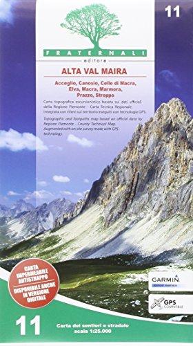
- Alta Valle Maira
- Alta Valle Maira in the Italian Alps presented at 1:25,000 in a series of large, contoured and GPS compatible walking maps from Fraternali Editore, printed on light, waterproof and tear-resistant synthetic paper. Maps in this series have topography shown by contour lines at 5m intervals with relief shading, spot heights, and colouring and/or... Lire la suite
- Also available from:
- De Zwerver, Netherlands
De Zwerver
Netherlands
Netherlands
- Wandelkaart 11 Alta Val Maira | Fraternali Editore
- Alta Valle Maira in the Italian Alps presented at 1:25,000 in a series of large, contoured and GPS compatible walking maps from Fraternali Editore, printed on light, waterproof and tear-resistant synthetic paper. Maps in this series have topography shown by contour lines at 5m intervals with relief shading, spot heights, and colouring and/or... Lire la suite
Stanfords
United Kingdom
United Kingdom
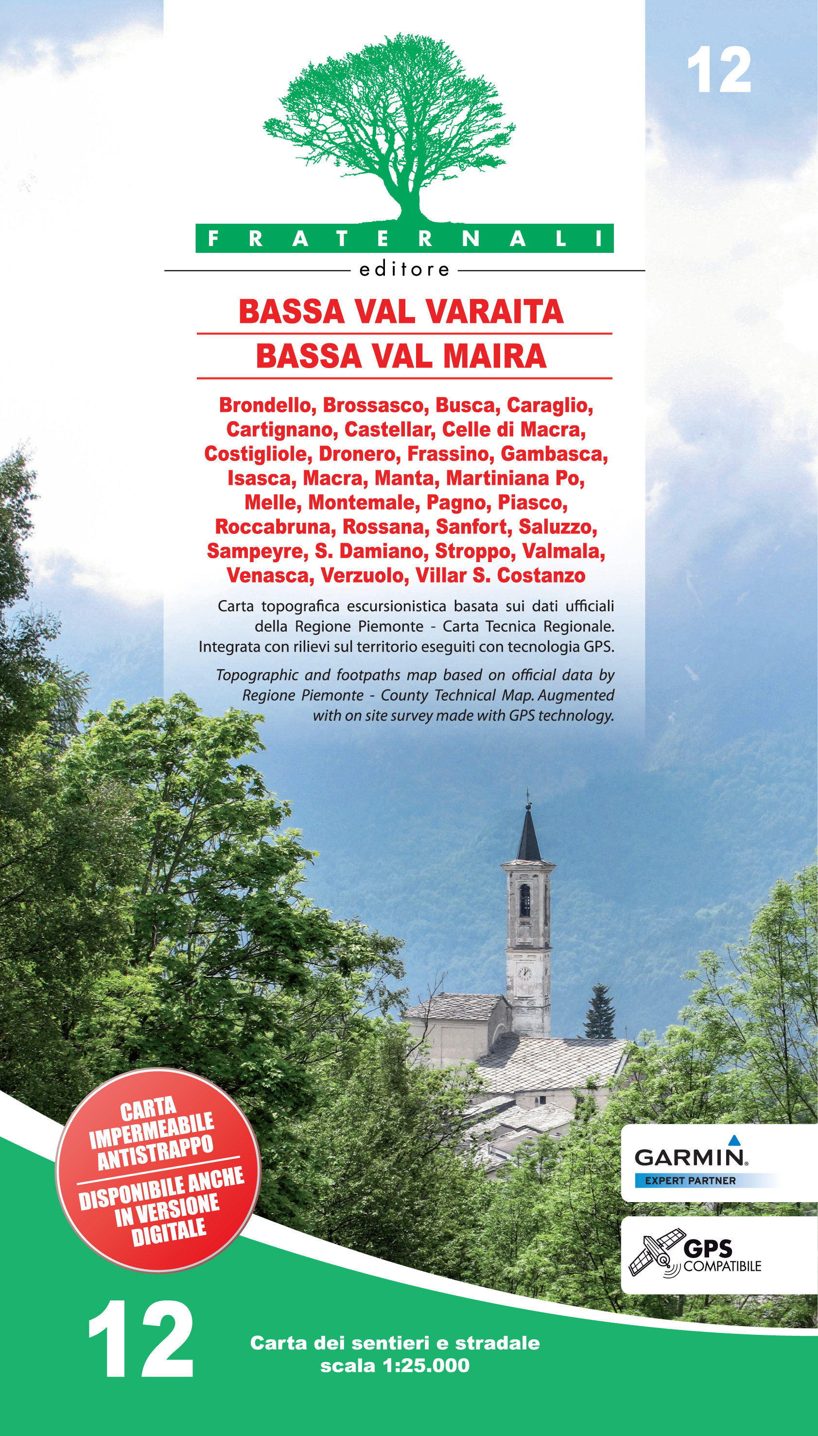
- Bassa Valle Varaita - Bassa Valle Maira Fraternali Editore 12
- Bassa Valle Varaita - Bassa Valle Maira in the Italian Alps presented at 1:25,000 in a series of large, contoured and GPS compatible walking maps from Fraternali Editore, printed on light, waterproof and tear-resistant synthetic paper. Maps in this series have topography shown by contour lines at 5m intervals with relief shading, spot heights,... Lire la suite
- Also available from:
- De Zwerver, Netherlands
De Zwerver
Netherlands
Netherlands
- Wandelkaart 12 Bassa Val Varaita - Bassa Val Maira | Fraternali Editore
- Gebied: Brondello, Brossasco, Busca, Caraglio, Cartignano, Castellar, Celle di Macra, Costigliole, Dronero, Frassino, Gambasca, Isasca, Macra, Manta, Martiniana Po, Melle, Montemale, Pagno, Piasco, Roccabruna, Rossana, Sanfront, Saluzzo, Sampeyre, S. Damiano, Stroppo, Valmala, Venasca, Verzuolo, Villar S. Costanzo Een uitstekende wandelkaart... Lire la suite