Japon
Description
Japan is an exciting country for hiking. Walking comes in all flavors: volcanoes, pilgrimages, trails thousands of kilometers long, alpine hikes and climbs. Main difficulty is the language. Information in English is hard to find. You might get the impression that hiking in Japan is no option. Totally wrong - read on!
Let's do a little research first: what's the geography like? Japan is about the size of Germany, a bit larger, but the population is 1,5 times as large. 127-million people are crammed together on 35% of the land surface, 65% being rugged mountain area. You've got the opportunities, right?
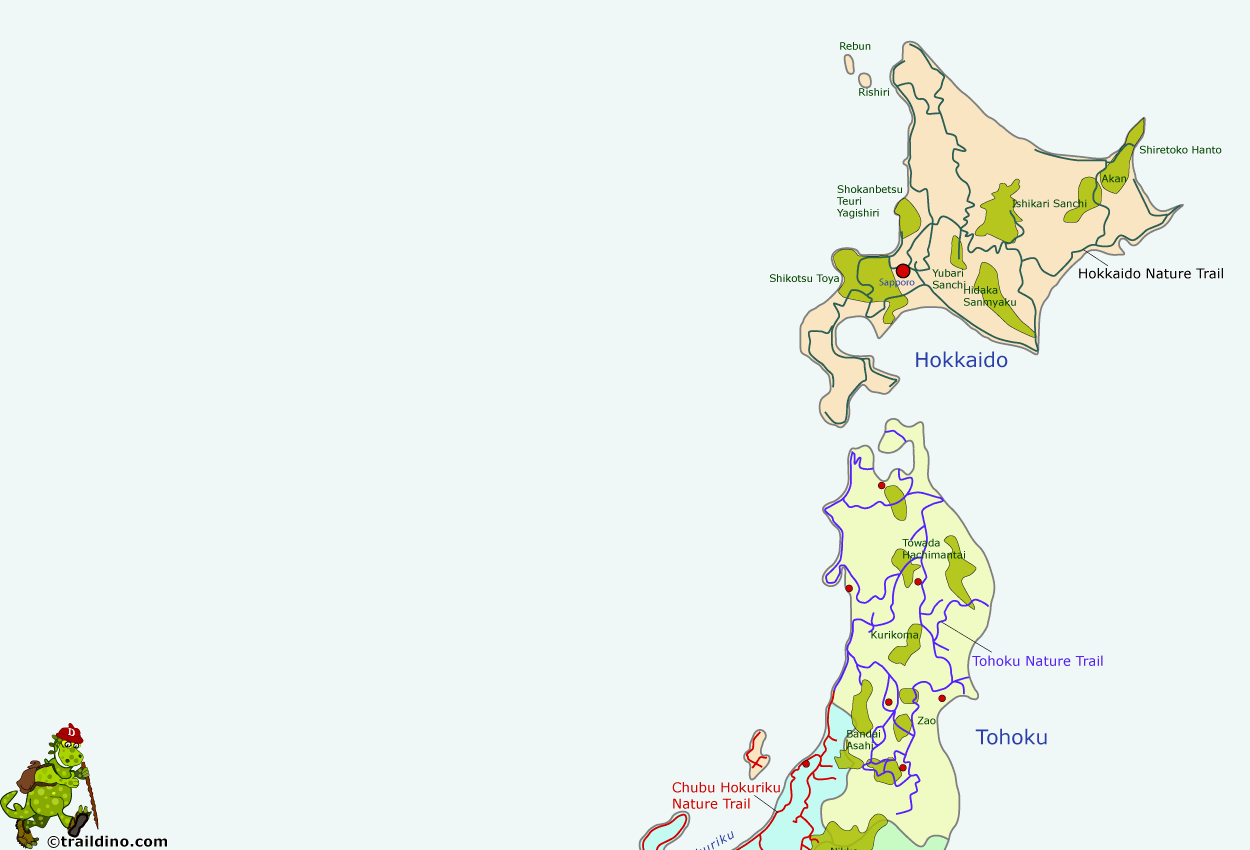
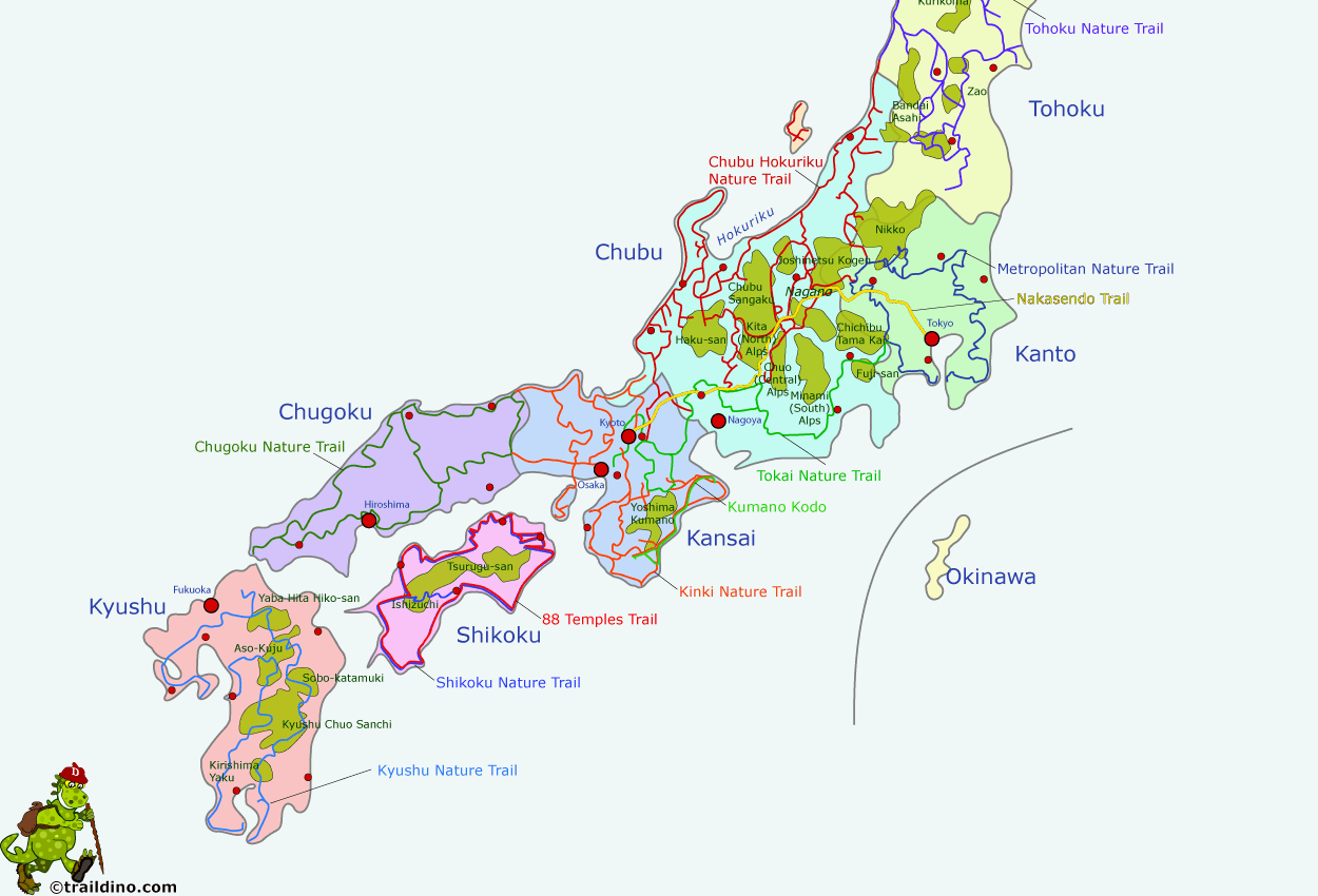
The country counts four large islands and countless smaller ones. These main islands are, from northeast to southwest:
- Hokkaidō, the mountainous island in the north. This island tips the Russian Island of Sakhalin
- Honshū, the main island in the middle, including Osaka and Tokyo
- Kyūshū, the westernmost island
- Shikoku, the island that squeezes in between Honshū and Kyūshū
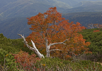
These islands span some 20 degrees in longitude, from the chilly north to the subtropical south! Nature imposes itself mercilessly. On the one hand, Japan exists thanks to the collision of continental shelves. This means, on the other hand, exploding volcanoes and earthquakes. Also, in everyday life Japanese have to cope with typhoons and tsunamis. Nature has enjoyments to offer as well: exuberant colors in autumn, blossoming in spring, wild animals like bears, wild fruits and vegetables...
Politically Japan is divided into 9 regions and 47 prefectures. Let's have a closer look at them. In the centre of the country lies Tokyo, on the main island of Honshu. The Greater Tokyo Area houses 35-million people. This region, Kanto, is rather flat, but even here hiking trails can be found. To the west of Kanto lies the Chubu region, not far from the population centers. This is the region with the highest and wildest mountains, known in the West as the Japanese Alps. Mountains do not rise up higher than 4.000 m in Japan, but their often volcanic origins makes them wild and varied. Not far south of the capital is famous Mount Fuji – Fuji-san, 3776 m – Japan's highest. To the north of the country's mountainous centre lies Tohoku region and finally the island of Hokkaido, the second largest island. Its relatively cool and dry climate, quiet and mountainous, makes it interesting for hiking. To the south of Tokyo and the Chubu region, the main Honshu island continues for a while, less mountainous though. Then we reach the island of Shikoku, island of pilgrimages, half enclosed by Honshu. And in the far west is the island of Kyushu, again mountainous, the elements from below causing havoc (and nice hot springs!). This makes for good hiking, but with a warm and humid climate.
Talking about the climate: the north of the country and the mountains are snow covered in winter. Hiking in this season is still feasible in the south. In summer, Hokkaido in the north is pleasant and not too wet, whereas the rest of Japan is hot and humid. Between June and July, a monsoon works its way from south to north. In large parts of Japan, spring and autumn are best for hiking. Summer is best for the mountains.
Hiking comes in different shapes in Japan. Let's start with the traditional pilgrimages and old imperial roads. These are popular with foreigners. The two months hike on Shikoku, passing 88 temples, is well known, as is the old highway between Kyoto and Tokyo, the Nakasendo Trail. Tour operators will offer their services like luggage transportation and hotel reservations.
But don't forget: the country has an extensive system of long distance trails, the so called Nature Trails, 自然歩道. Popular with Japanese, hardly known abroad, there are nine of them, totaling to 26.000 km. The system was an initiative of the central government dating from around 1970, with the purpose of providing a means for experiencing nature and culture in a healthy and safe manner. The prefectures are upkeeping the trails and providing hiking maps. Usually, the Japanese use Nature Trails for day trips, picking out sections, often around 15 km. These sections are situated in such a way that they can be reached by public transport. The different sections do not always form a continuous trail. On the contrary, in places the system looks more like a fragmented chromosome. Completing all the sections is an honorable goal, rewarded with a medal if proper proof is submitted to the prefecture. The trails are well marked, but mainly in Japanese of course. Hiking the Nature Trails is a perfect way to explore all the corners and backyards of the country, cities and mountains alike.
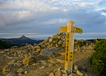
Mountain tramping is popular with the Japanese and foreign visitors. Main focus is reaching the top. The Japanese variant of peak bagging is very popular indeed: the 100 Famous Mountains - Hyukameizan 百名山. To check them all, and possibly fast, is a major achievement. Should you run out of mountains, there is always a list of 200 and even 300 famous mountains. Hiking maps are available in the larger bookstores (see below) Many mountain huts are at your service. Generally these are private huts, not cheap, but good, offering linen (blankets) and dinner. They might be crowded, but not full. The day starts early in these huts. Breakfast sometimes as early as 4.30 am and dinner at 5.00 pm.
Talking about accommodation, it's time to mention some other options for the night. The long distance hiker often uses the Minshuku, a kind of private accommodation, like B&B with often dinner included. Another popular choice is the Ryokan, the traditional Japanese hotel. Popular, especially on the pilgrimage ways, are the temple lodges, Shuboku, offering good value. In any case, do make reservations in advance! Your host will appreciate this very much. Remember dinner is normally included and will be prepared unless explicitly agreed otherwise.
A strategy guide for hiking in the mountains
If you are amidst the noise and chaos of Shinjuku Station in Tokyo, it is hard to fancy how to ever get out into the countryside. Information in English on hiking in the Japanese mountains is scarce and the people around you will speak little if any English. So, how to get started ? Just try the following strategy:
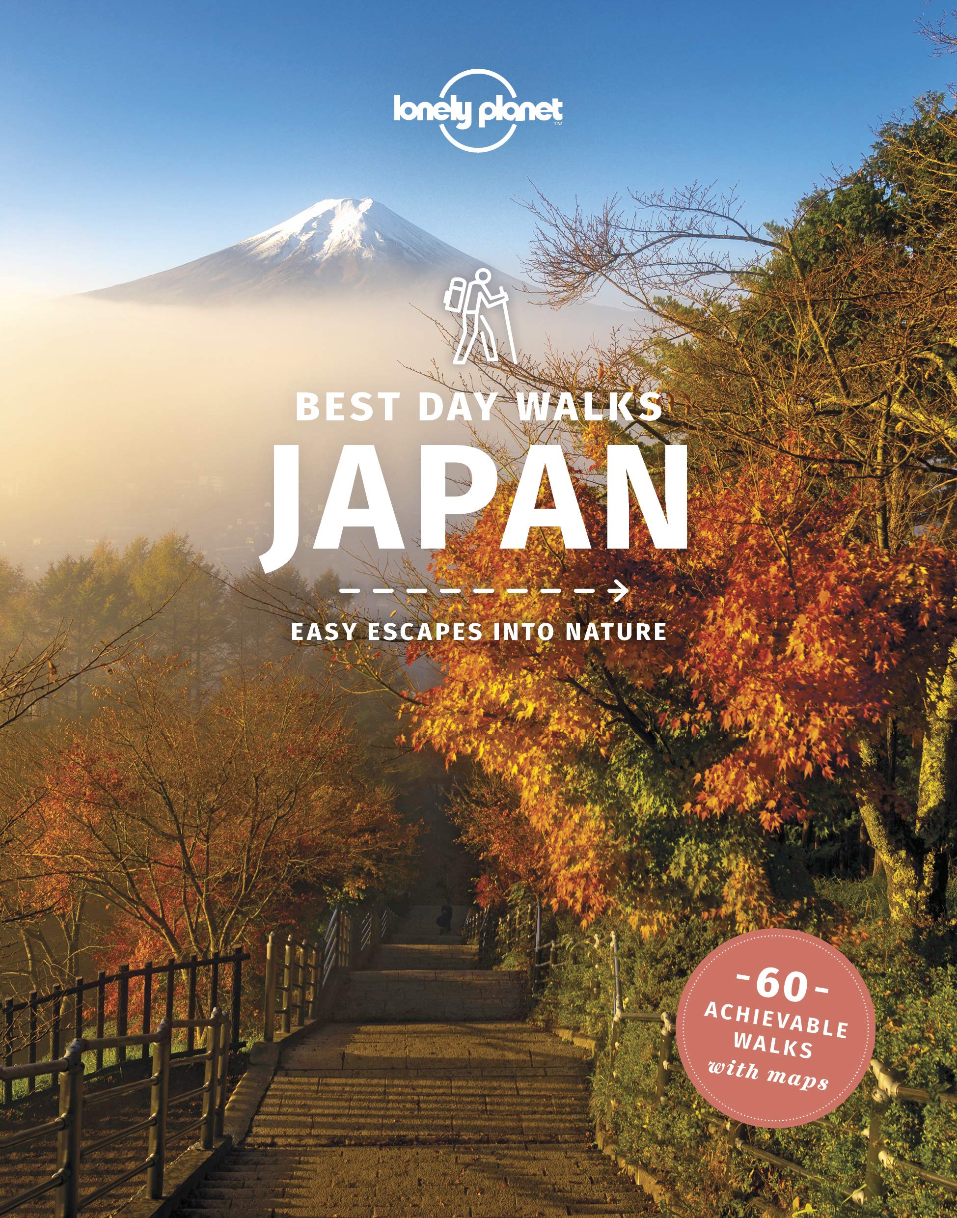
- First, determine where you want to go, which island, which mountain area. Use Traildino for a rough idea, or consult the excellent Lonely Planet Guide for Hiking in Japan. The hikes described in the Lonely Planet are a small selection of the many possible trails in the mountains. Mountain areas have a network of trails, like in the European Alps.
- Now, buy the 1:50.000 map of the area of your choice. Best known are maps of Mapple (http://yamachizu.mapple.net/) and you will find them in the larger bookshops of the larger cities, who usually have the complete series on stock. Sometimes you can also find the 1:25.000 topographical maps, but even if they show more detail, they do not provide any specific hiking information.
- Run into the nearest Starbucks and relax while giving the map a thorough study. These maps are great: trails are marked, hiking times are indicated, huts are marked, difficult passages are indicated. Now, try to imagine your own multi day tramp.
- With this rough idea of your hike - your destination, the time you will spent there, your trailhead - you have to figure out how to get there, and get out in the end. The area overview on the back of the 1:50.000 maps will come in handy. Somebody has to help you now, and this somebody is of course the helpful Tourist Information Centre. You will find these great English speaking people in most cities, often also in a railway station, and they love to help you. Ask them how to get to your destination, whether there are any connecting buses, how much time the journey will take. If you need a stop halfway your starting point, the TIC is glad to arrange your hotel. Also ask them whether the huts are open (they will Google it for you) and maybe they will contact the first hut as well (always a good idea).
- Things can't go wrong now. So rush into the green ticket window of Japan Railways and buy your ticket. If there are more traveling options, the counterman will help you out.
- Last but not least: take lots of cash with you. You will spend more than 10.000 Yen (100 euro, 115 dollar) per person every day in the mountains, because the huts are expensive.
- Just some last advice. Compile a neat table for your own use. On the left side, write down your complete itinerary, including huts, lakes, mountains you will pass etc. On the right site, put down the same information in Japanese (that is: Kanji characters). You can do it using internet, copying and pasting the Japanese names into some text document. This list will come in handy if you need to ask someone the right way, if you want to explain where you're going or if you like to understand the signs on the trail. Once in the mountains, you will find all kind of brochures and information in the huts themselves, including opening times, ski lifts, etc. etc.
Strategy guide for Nature Trails
Hiking in the Japanes mountains is something you will be able to figure out in the end, because people will understand what you want. However, if you rather hike some parts of the Nature Trails system, information is harder to get. Basically, the problem is that foreigners never take these trails, and people will not understand your intentions. Nonetheless, the Nature Trails will be a fine alternative in winter and spring, when mountains are snow covered, or any time of the year if you like to become acquainted with a different Japan.
So, how to get started on the Nature Trails?
- It is pretty useless to inquire in bookshops or the Tourist Information Centre on these Nature Trails. The probability they will understand you, is low. A better idea is to make a print of the website of the Ministry of Environment on these nature trails (http://www.env.go.jp/nature/nats/shizenhodo). This makes communication much easier.
- Be aware that the maps of the Nature Trails are the responsibility of each individual Perfecture. So, if you want to hike near Tokyo, the place to find the maps is the administration of the Tokyo Metropolitan Area.
- But better not go there straight away. You run the risk that nobody will understand you. Better you find someone to help you contacting the Prefecture administration. And this someone of course is the Tourist Information Centre. Armed with the website printout, ask the TIC if they will contact the administration and ask for the department responsible for the Nature Trails and the publication of the maps. Most likely, this introduction will be sufficient to get entry to the right department and right person, who will collect the necessary maps for you.
- Since the maps are in Japanese only, you will need a good deal of fantasy to figure out what all the symbols mean, how to interpret the distances, how to recognise the waymarking. Part of the fun.
- But in the end, once you've got a basic visualisation of your hike, you will need help again. So return to the kind people of the TIC, and ask them to contact the hotels en route, and let them make reservations. It's unwise to just knock on the door of your night address on arrival, without notice.
We will be delighted to get feedback from you on this issue, to make this page even better.
Carte
Sentiers
Régions
- Akan
- Aso Kuju
- Bandai Asahi
- Chichibu Tama Kai
- Chubu
- Chubu Sangaku
- Chugoku
- Chuo Alps
- Haku-san
- Hidaka Sanmyaku
- Hokkaido
- Hokuriku
- Ishikari Sanchi
- Ishizuchi
- Joshinetsu Kogen
- Kansai
- Kanto
- Kirishima Yaku
- Kita Alps
- Kurikoma
- Kyushu
- Kyushu Chuo Sanchi
- Minami Alps
- Nikko
- Shikoku
- Shikotsu Toya
- Shiretiko Hanto
- Shokanbetsu Teuri Yagishiri
- Sobo Katamuki
- Tohoku
- Towada Hachimantai
- Tsurungu-san
- Yaba Hita Hiko-san
- Yoshima Kumano
- Yubari Sanchi
- Zao
Montagnes
Liens
Données
Rapports
Guides et cartes
Hébergement
Organisations
Voyagistes
GPS
Autre
Livres

United Kingdom
- Moon Japan (Second Edition)
- Plan Your Trip, Avoid the Crowds, and Experience the Real Japan Lire la suite
- Also available from:
- De Zwerver, Netherlands

United Kingdom
- Walking the Kiso Road
- A Modern-Day Exploration of Old Japan Lire la suite

Netherlands
- Exploring Kyoto
- The thirty walking tours in Exploring Kyoto take you both to famous sites and to little-known but equally rewarding treasures tucked away up back streets or behind an unassuming gate or doorway. Supplemented with detailed maps for each walk, sixteen pages of color photographs, and thoroughly researched information on the city's culture and... Lire la suite
- Also available from:
- Bol.com, Belgium

Belgium
- Exploring Kyoto
- The thirty walking tours in Exploring Kyoto take you both to famous sites and to little-known but equally rewarding treasures tucked away up back streets or behind an unassuming gate or doorway. Supplemented with detailed maps for each walk, sixteen pages of color photographs, and thoroughly researched information on the city's culture and... Lire la suite

Netherlands
- How to Drift
- The photos in this edition are black and white.Drifting is the newest, most exciting motorsport we have seen in the United States since the invention of the limited slip differential - it may even be the most exhilarating contest man and machine ever devised From the winding mountain passes and desolate industrial roads of Japan, this unique... Lire la suite
- Also available from:
- Bol.com, Belgium

Belgium
- How to Drift
- The photos in this edition are black and white.Drifting is the newest, most exciting motorsport we have seen in the United States since the invention of the limited slip differential - it may even be the most exhilarating contest man and machine ever devised From the winding mountain passes and desolate industrial roads of Japan, this unique... Lire la suite

Netherlands
- Kizuna
- Kizuna is a picture book for all ages. On March 11, 2011, a 9.0 earthquake struck Japan, followed by a tidal wave which destroyed everything in its path. The tragedy brought out the best and worst in ocean and land creatures. Dinosaurs were released from great fissures on the ocean floor caused by the earthquake and washed ashore by the... Lire la suite
- Also available from:
- Bol.com, Belgium

Belgium
- Kizuna
- Kizuna is a picture book for all ages. On March 11, 2011, a 9.0 earthquake struck Japan, followed by a tidal wave which destroyed everything in its path. The tragedy brought out the best and worst in ocean and land creatures. Dinosaurs were released from great fissures on the ocean floor caused by the earthquake and washed ashore by the... Lire la suite

Netherlands
- Wander in Colour
- Gather all your travel details in Wander in Colour: Japan to bring your trip adventure stories to life Find other trip planners too limiting? This colouring trip planner and journal offers structure, flexibility, and colouring pages. Record your travel information, planning notes, and trip details into one place. Unleash your creativity, and... Lire la suite
- Also available from:
- Bol.com, Belgium

Belgium
- Wander in Colour
- Gather all your travel details in Wander in Colour: Japan to bring your trip adventure stories to life Find other trip planners too limiting? This colouring trip planner and journal offers structure, flexibility, and colouring pages. Record your travel information, planning notes, and trip details into one place. Unleash your creativity, and... Lire la suite

Netherlands
- Noto An Unexplored Corner Of Japan
- Toward the middle of the afternoon we reached a part of the coast locally famous or infamous, for the two were one; a stretch of some miles where the mountains made no apology for falling abruptly into the sea. Sheer for several hundred feet, the shore is here unscalable. Nor did it use to be possible to go round by land, for the cliffs are... Lire la suite
- Also available from:
- Bol.com, Belgium

Belgium
- Noto An Unexplored Corner Of Japan
- Toward the middle of the afternoon we reached a part of the coast locally famous or infamous, for the two were one; a stretch of some miles where the mountains made no apology for falling abruptly into the sea. Sheer for several hundred feet, the shore is here unscalable. Nor did it use to be possible to go round by land, for the cliffs are... Lire la suite
Netherlands
2017
- Reisgids The Monocle Travel Guide to Kyoto | Gestalten Verlag
- Monocle reports from around the globe. As its Edited bys and correspondents dart from city to city, they get to know the best places to rest their heads, stretch their limbs, and kick back with a contact in a hard-to-find cocktail bar. That information is now available in The Monocle Travel Guide Series: a line-up of titles that speaks to... Lire la suite

Netherlands
- Intrinsic Values of the Japanese Sword
- The famed samurai sword (nihonto) represents the pinnacle of bladed weaponry in the Japanese warrior's arsenal. This book addresses the sword's intrinsic historic, monetary, military, and artistic values.The seven chapters for this particular anthology were selected from materials published in the Journal of Asian Martial Arts. Tharp's chapter... Lire la suite
- Also available from:
- Bol.com, Belgium

Belgium
- Intrinsic Values of the Japanese Sword
- The famed samurai sword (nihonto) represents the pinnacle of bladed weaponry in the Japanese warrior's arsenal. This book addresses the sword's intrinsic historic, monetary, military, and artistic values.The seven chapters for this particular anthology were selected from materials published in the Journal of Asian Martial Arts. Tharp's chapter... Lire la suite

Netherlands
- Noto, an Unexplored Corner of Japan
- Toward the middle of the afternoon we reached a part of the coast locally famous or infamous, for the two were one; a stretch of some miles where the mountains made no apology for falling abruptly into the sea. Sheer for several hundred feet, the shore is here unscalable. Nor did it use to be possible to go round by land, for the cliffs are... Lire la suite
- Also available from:
- Bol.com, Belgium

Belgium
- Noto, an Unexplored Corner of Japan
- Toward the middle of the afternoon we reached a part of the coast locally famous or infamous, for the two were one; a stretch of some miles where the mountains made no apology for falling abruptly into the sea. Sheer for several hundred feet, the shore is here unscalable. Nor did it use to be possible to go round by land, for the cliffs are... Lire la suite
Cartes
Netherlands
2019
- Wegenkaart - landkaart Japan | ITMB
- Japan 1 : 1 100 000 ab 10.49 EURO Waterproof International Travel Map ITM. 8th edition Lire la suite

Netherlands
- Wegenkaart - landkaart Japan | Freytag & Berndt
- Japan, Autokarte 1:1.000.000 ab 10.9 EURO Touristische Informationen, Entfernungen in km, Fähren Freytag & Berndt Autokarte. Neuauflage. Laufzeit bis 2017 Lire la suite
Netherlands
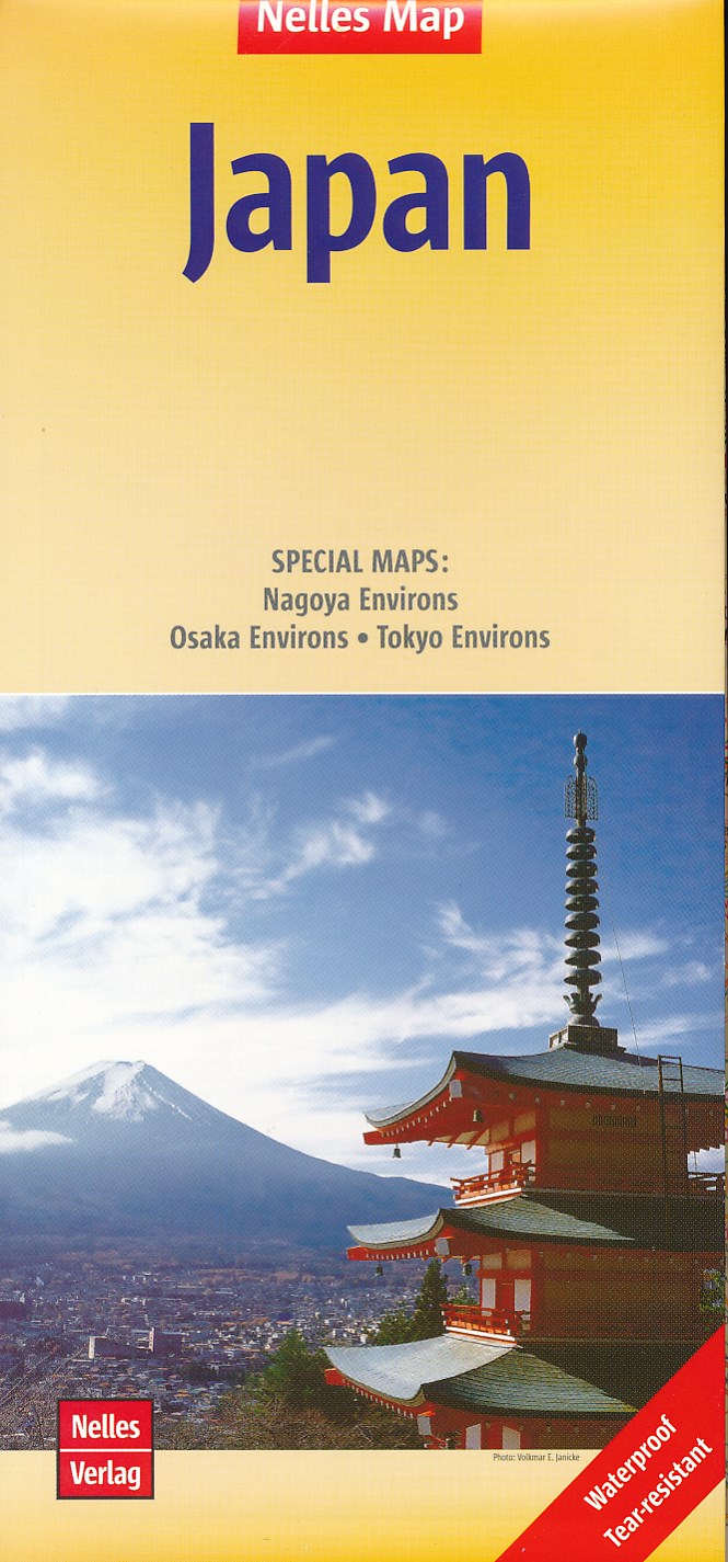
- Wegenkaart - landkaart Japan | Nelles Verlag
- Nelles Map Japan 1 : 1 500 000 ab 9.9 EURO SPECIAL MAPS: Nagoya Environs - Osaka Environs - Tokyo Environs Nelles Map. Neuauflage Lire la suite


