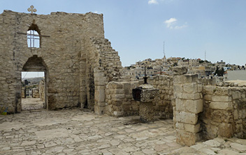
Palestine
Description
For hiking purposes we use the name Palestine for the two geographical areas known as the West Bank and Gaza Strip. Being partly under the control of the Palestinian National Authority, these areas are distinct from Israel.
The West Bank is a landlocked area on the west bank of the River Jordan, with rather dry and rugged hilly terrain. Highest point is Tall Asur (1016 m). There are two long distance hiking trails leading through the Palestinian West Bank: the Nativity Trail and the Abraham's Path.
The Gaza Strip borders on the Mediterranean in the west and Egypt in the south, and is a mostly flat area with some low hills and sand dunes along the coast. Highest point is the hill of Abu Awdah (105 m) in the far souteastern corner. No hiking trails that we know of in Gaza.
When hiking in Palestine, carry lots of drinking water and a hat to protect yourself from the hot sun.
Sentiers
Liens
Données
Rapports
Guides et cartes
Hébergement
Organisations
Voyagistes
GPS
Autre
Livres
- Also available from:
- Bol.com, Netherlands
- Bol.com, Belgium

Netherlands
- Palestinian Walks
- Over two decades of turmoil and change in the Middle East, steered via the history-soaked landscape of Palestine. This new edition includes a previously unpublished epigraph in the form of a walk.When Raja Shehadeh first started hill walking in Palestine, in the late 1970s, he was not aware that he was travelling through a vanishing landscape.... Lire la suite

Belgium
- Palestinian Walks
- Over two decades of turmoil and change in the Middle East, steered via the history-soaked landscape of Palestine. This new edition includes a previously unpublished epigraph in the form of a walk.When Raja Shehadeh first started hill walking in Palestine, in the late 1970s, he was not aware that he was travelling through a vanishing landscape.... Lire la suite

Netherlands
2023
- Reisgids Secret Florence Guide | Jonglez Publishing
- Let Secret Florence guide you around the unusual and unfamiliar. Step off the beaten track with this fascinating Florence guide book and let our local expert show you the well-hidden treasures of this amazing city. Ideal for local inhabitants and curious visitors alike. Visit a church in a prison, learn how Florence became the centre of... Lire la suite


