
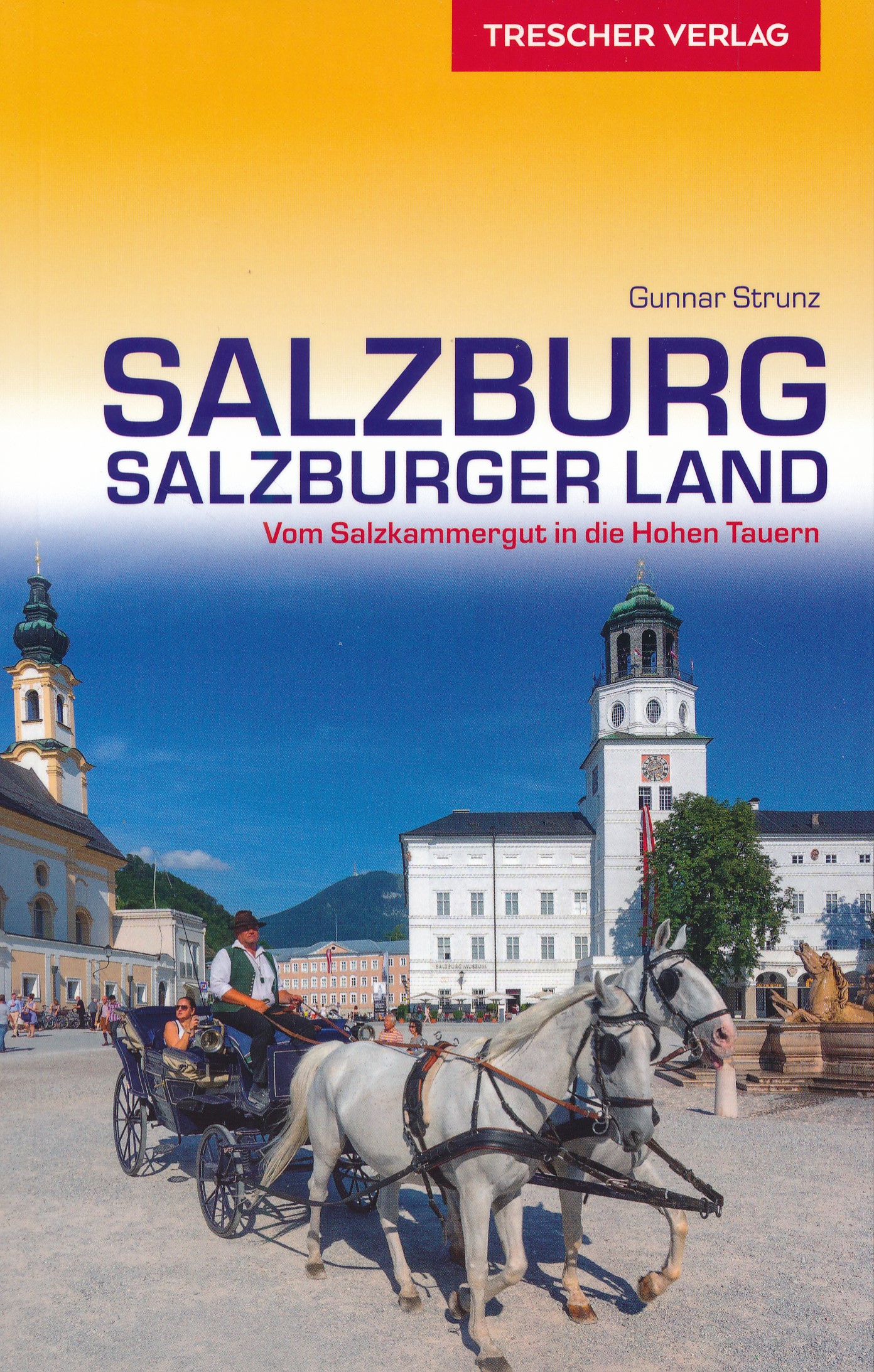
Salzburg
Description
Bundesland around the city of Salzburg, central Austria. Here you will find some of the heighest and wildest mountain regions of the country.
Sentiers de cette état
Liens
Données
Rapports
Guides et cartes
Hébergement
Organisations
Voyagistes
GPS
Autre
Livres

Stanfords
United Kingdom
United Kingdom
- Frommer`s Vienna Day by Day
- Vienna, Austria is so rich with cultural treasures, so replete with sights and wonders, that visitors are often bewildered by the task of planning a visit. Which of nearly 100 museums to visit? Which of countless theatres and concert halls? With an endless number of celebrated restaurants, cafes, lively taverns, bakeries serving famous... Lire la suite

Stanfords
United Kingdom
United Kingdom
- Rick Steves Pocket Munich & Salzburg (Second Edition)
- Make the most of every day and every dollar with Rick Steves! This colorful, compact guidebook is perfect for spending a week or less in Munich and Salzburg: City walks and tours: Five detailed self-guided walks including a Munich city walk, Nymphenburg Palace tour, Sound of Music tour, and more Rick`s strategic advice on what`s worth your time... Lire la suite

Stanfords
United Kingdom
United Kingdom
- Rick Steves Best of Germany (Third Edition): With Salzburg
- Hit Germany`s can`t-miss art, sights, and bites in two weeks or less with Rick Steves Best of Germany! Inside you`ll find:*Strategic advice from Rick Steves on what`s worth your time and money*Short itineraries covering Munich, Bavaria, Rothenburg and the Romantic Road, the Rhine Valley, and Berlin, plus Salzburg, Austria*Rick`s tips for... Lire la suite

Stanfords
United Kingdom
United Kingdom
- St. Johann im Pongau - Salzburger Land Kompass 80
- Salzburger Alps area south of Salzburg itself, including St. Johann in Pongau, Pongau and Bad Gastein, on a detailed, GPS compatible map at 1:50,000 from Kompass with local and long-distance footpaths, cycling routes, accommodation, etc.KOMPASS HIKING & RECREATIONAL MAPS: this title is part of an extensive series covering Austria, much of... Lire la suite

Stanfords
United Kingdom
United Kingdom
- Wolfgangsee - Fuschlsee - Mondsee Kompass 018
- Wolfgangsee - Fuschlsee - Mondsee, the lakes of the Salzkammergut area east of Salzburg, on a detailed, GPS compatible map at 1:25,000 from Kompass with local and long-distance footpaths, cycling routes, accommodation, etc, printed on durable, waterproof and tear-resistant synthetic paper.KOMPASS HIKING & RECREATIONAL MAPS: this title is part... Lire la suite

Stanfords
United Kingdom
2020
United Kingdom
2020
- Walking in the Salzkammergut: the Austrian Lake District: 30 walks in Salzburg`s lakes and mountains, including the Dachstein
- Guidebook of 30 stunning day walks in the beautiful Salzkammergut lake district of Austria. Easy to get to from Linz and Salzburg, the area is studded with lakes and bristling with mountain peaks, and has a great range of waymarked trails, from lakeside strolls to challenging mountain walks. The routes in this book are within the capabilities... Lire la suite
- Also available from:
- The Book Depository, United Kingdom
- De Zwerver, Netherlands

The Book Depository
United Kingdom
2020
United Kingdom
2020
- Walking in the Salzkammergut: the Austrian Lake District
- 30 walks in Salzburg's lakes and mountains, including the Dachstein Lire la suite

De Zwerver
Netherlands
2020
Netherlands
2020

De Zwerver
Netherlands
2018
Netherlands
2018
- Wandelgids Tourist route E4 in Bulgaria | Oilaripi
- Verrassend goede wandelgids van een deel van de E4 in Bulgarije. Goede kaarten, hoogteprofielen, prima beschrijvingen en praktische informatie maken het een volwaardige wandelgids die je in eerste instantie van dit gebied niet zou verwachten. Guidebook along the main ridge of the great alpine route E4 in Bulgaria, also known as �the fiv... Lire la suite
Bol.com
Netherlands
Netherlands
- Austria
- Between Lake Constance and Lake Neusiedler, in the middle of the Bregenz Forest and the Vienna Woods, this guide conveys the magnificent, enthralling, and beautiful scenery of Austria. Lofty peaks, deep-cut valleys, crystal-clear lakes, and lush mountain pastures grace this collection of images, along with the lazy meanderings of the Danube,... Lire la suite
- Also available from:
- Bol.com, Belgium
Bol.com
Belgium
Belgium
- Austria
- Between Lake Constance and Lake Neusiedler, in the middle of the Bregenz Forest and the Vienna Woods, this guide conveys the magnificent, enthralling, and beautiful scenery of Austria. Lofty peaks, deep-cut valleys, crystal-clear lakes, and lush mountain pastures grace this collection of images, along with the lazy meanderings of the Danube,... Lire la suite
Bol.com
Netherlands
Netherlands
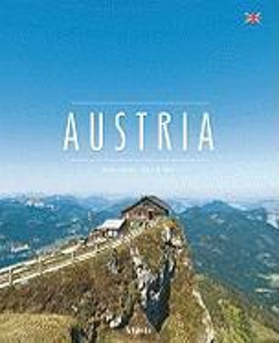
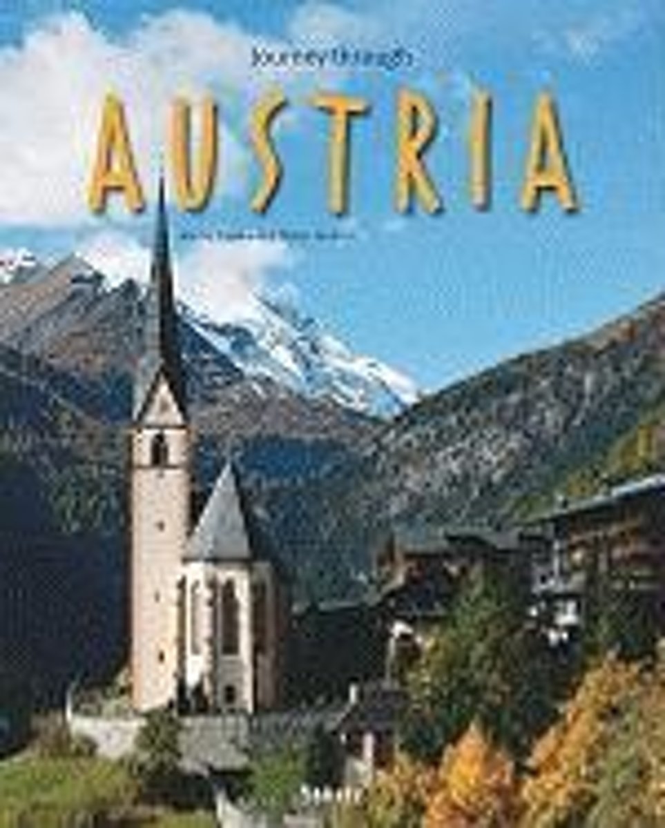
- Journey Through Austria
- Exploring one of the most popular destinations in Europe, this photographic guide illustrates Austria s diverse scenery from Bregenz to the Viennese Forest and from the Salzkammergut to Styria. Snowcapped mountains interspersed with wooden hillsides and serene lakes are depicted, stretching as far as the plateau of the Burgenland. The country s... Lire la suite
- Also available from:
- Bol.com, Belgium
Bol.com
Belgium
Belgium
- Journey Through Austria
- Exploring one of the most popular destinations in Europe, this photographic guide illustrates Austria s diverse scenery from Bregenz to the Viennese Forest and from the Salzkammergut to Styria. Snowcapped mountains interspersed with wooden hillsides and serene lakes are depicted, stretching as far as the plateau of the Burgenland. The country s... Lire la suite
Bol.com
Netherlands
2018
Netherlands
2018
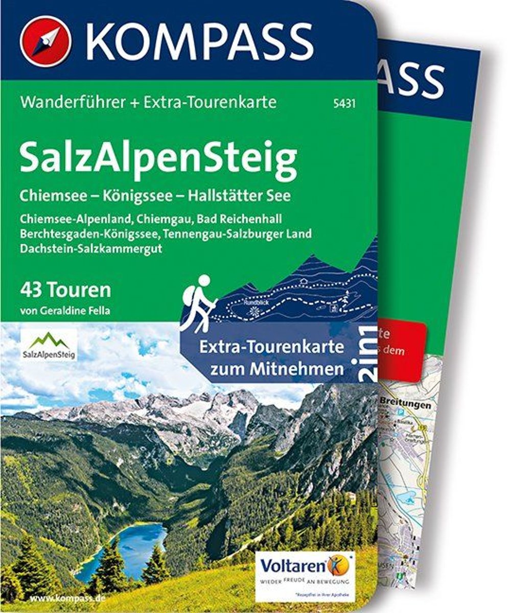
- WF5431 SalzAlpenSteig Kompass
- Destination:. Der SalzAlpenSteig ist ein grenzüberschreitender (bayerisch-österreichischer) Wanderweg mit einer vorläufigen Länge von 230 km.. Eröffnet wird der junge Themenweg 2015.. Das von der EU geförderte Projekt verbindet den Chiemsee über den Königsee und den Tennengau mit dem Hallstätter See und stellt das Thema ''Salz in den Alpen'' in... Lire la suite
- Also available from:
- Bol.com, Belgium
Bol.com
Belgium
2018
Belgium
2018
- WF5431 SalzAlpenSteig Kompass
- Destination:. Der SalzAlpenSteig ist ein grenzüberschreitender (bayerisch-österreichischer) Wanderweg mit einer vorläufigen Länge von 230 km.. Eröffnet wird der junge Themenweg 2015.. Das von der EU geförderte Projekt verbindet den Chiemsee über den Königsee und den Tennengau mit dem Hallstätter See und stellt das Thema ''Salz in den Alpen'' in... Lire la suite
De Zwerver
Netherlands
2020
Netherlands
2020
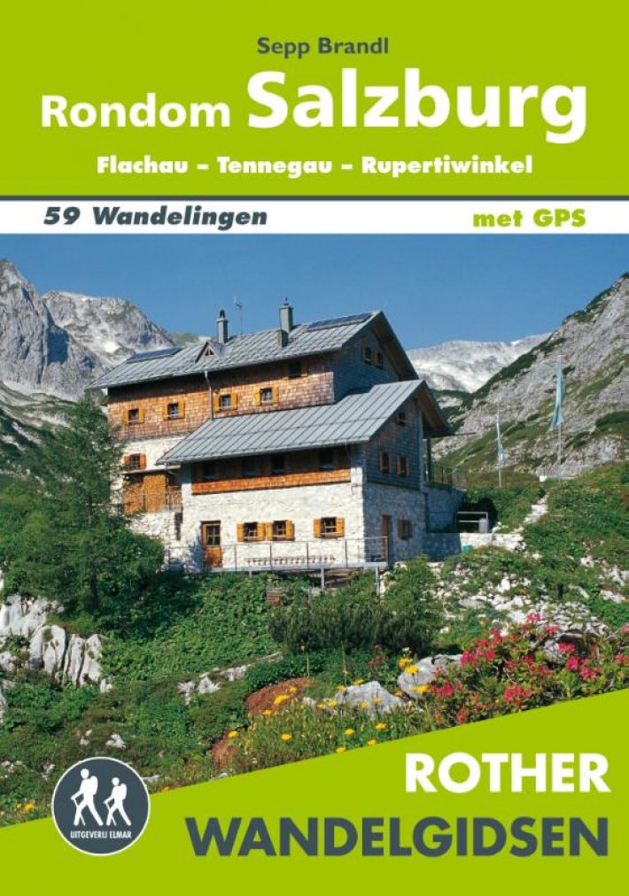
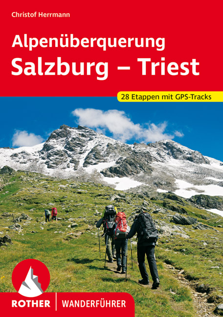
- Wandelgids Alpenüberquerung Salzburg - Triest | Rother Bergverlag
- De Rother wandelgidsen beschrijven zeer goed de wandelingen in specifieke gebieden. In de gids vindt men kaarten, routebeschrijvingen en de nodige praktische informatie om van de wandelingen/trekkings een geslaagde onderneming te maken. 28 Tage Natur pur abseits vom Massentourismus und vor atemberaubender Bergkulisse! Von Salzburg nach Triest... Lire la suite

Bol.com
Netherlands
Netherlands
- Un Jubilado En Los Alpes
- Se aproximaba el verano y era necesario decidirse. Entre unos pocos proyectos previstos hasta esos dias, que habian ido surgiendo en mi imaginacion durante el invierno, se fueron concretando a mitad de la primavera la posibilidad de caminar por el Himalaya, en Cachemira, recorrer algunos valles del Caucaso al norte de Georgia o atravesar los... Lire la suite
- Also available from:
- Bol.com, Belgium
Bol.com
Belgium
Belgium
- Un Jubilado En Los Alpes
- Se aproximaba el verano y era necesario decidirse. Entre unos pocos proyectos previstos hasta esos dias, que habian ido surgiendo en mi imaginacion durante el invierno, se fueron concretando a mitad de la primavera la posibilidad de caminar por el Himalaya, en Cachemira, recorrer algunos valles del Caucaso al norte de Georgia o atravesar los... Lire la suite

Bol.com
Netherlands
Netherlands
- Over the Top & Back Again
- Book of the Year Bronze Award 2010 (travel essays category), ForeWord Magazine After hiking some of the world's great trails, Brandon Wilson was excited to hear about the Via Alpina, paths running across eight countries on the backbone of the Alps. Besides promising immersion into Alpine life and wilderness, it was the ultimate adventure. It... Lire la suite
- Also available from:
- Bol.com, Belgium
Bol.com
Belgium
Belgium
- Over the Top & Back Again
- Book of the Year Bronze Award 2010 (travel essays category), ForeWord Magazine After hiking some of the world's great trails, Brandon Wilson was excited to hear about the Via Alpina, paths running across eight countries on the backbone of the Alps. Besides promising immersion into Alpine life and wilderness, it was the ultimate adventure. It... Lire la suite
Cartes

Stanfords
United Kingdom
United Kingdom
- Styrian Winelands - Southwest Styria F&B WK411
- Styrian Winelands area south-eastern Austria presented at 1:50,000 in a series of contoured and GPS compatible outdoor leisure map from Freytag & Berndt with hiking and cycling routes, mountain huts, campsites and youth hostels, local bus stops, plus other tourist information. To see the list of currently available titles in this series please... Lire la suite

Stanfords
United Kingdom
United Kingdom
- Goms - Aletsch
- Goms - Aletsch area of the Bernese Oberland at 1:50,000 in a series from Hallwag covering Switzerland’s popular hiking regions on light, waterproof and tear-resistant maps highlighting long-distance paths: the nine national routes plus special regional routes, as well as other local hiking trails.Cartography is similar to that used both in... Lire la suite

Stanfords
United Kingdom
United Kingdom
- Zell am See - Kaprun - Saalbach F&B WK382
- Zell-am-See - Kaprun - Saalbach area of the Austrian Alps presented at 1:50,000 in a series of contoured and GPS compatible outdoor leisure map from Freytag & Berndt with hiking and cycling routes, mountain huts, campsites and youth hostels, local bus stops, plus other tourist information. To see the list of currently available titles in this... Lire la suite

Stanfords
United Kingdom
United Kingdom
- Mayrhofen - Zillertal Alps - Gerlos - Krimml - Tuxertal - Zell im Zillertal F&B WK152
- Mayrhofen - Zillertal Alps - Gerlos - Krimml - Tuxertal - Zell im Zillertal area of the Austrian Alps presented at 1:50,000 in a series of contoured and GPS compatible outdoor leisure map from Freytag & Berndt with hiking and cycling routes, mountain huts, campsites and youth hostels, local bus stops, plus other tourist information.To see the... Lire la suite

Stanfords
United Kingdom
United Kingdom
- Hohe Wand - Schneebergland - Gutenstein Alps - Piestingtal - Lilienfeld F&B WK012
- Hohe Wand - Piestingtal - Triestingtal - Gölsental - Gutensteier Alpen – Lilienfeld area south-west of Vienna presented at 1:50,000 in a series of contoured and GPS compatible outdoor leisure map from Freytag & Berndt with hiking and cycling routes, mountain huts, campsites and youth hostels, local bus stops, plus other tourist information.To... Lire la suite

Stanfords
United Kingdom
United Kingdom
- Mattsee - Wallersee - Irrsee - Fuschl - Mondsee - Oberndorf F&B WK391
- Mattsee - Wallersee - Irrsee - Fuschl - Mondsee - Oberndorf - Salzburg - Wolfgangsee area of the Austrian Alps presented at 1:50,000 in a series of contoured and GPS compatible outdoor leisure map from Freytag & Berndt with hiking and cycling routes, mountain huts, campsites and youth hostels, local bus stops, plus other tourist information. To... Lire la suite

Stanfords
United Kingdom
United Kingdom
- Grossglockner - Sonnblick - Kaprun - Zell am See F&B WK120
- Grossglockner - Sonnblick - Kaprun - Zell am See area of the Austrian Alps presented at 1:50,000 in a series of contoured and GPS compatible outdoor leisure map from Freytag & Berndt with hiking and cycling routes, mountain huts, campsites and youth hostels, local bus stops, plus other tourist information.To see the list of currently available... Lire la suite

Stanfords
United Kingdom
United Kingdom
- Attersee - Traunsee - Höllengebirge - Mondsee - Wolfgangsee F&B WK282
- Attersee - Traunsee - Höllengebirge - Mondsee - Wolfgangsee area of the Austrian Alps presented at 1:50,000 in a series of contoured and GPS compatible outdoor leisure map from Freytag & Berndt with hiking and cycling routes, mountain huts, campsites and youth hostels, local bus stops, plus other tourist information. To see the list of... Lire la suite

Stanfords
United Kingdom
United Kingdom
- Gasteinertal - Wagrain - Raurisertal - Grossarltal F&B WK191
- Gasteiner Tal - Wagrain - Grossarltal - St. Johann im Pongau - Bad Hofgastein - Bad Gastein area of the Austrian Alps presented at 1:50,000 in a series of contoured and GPS compatible outdoor leisure map from Freytag & Berndt with hiking and cycling routes, mountain huts, campsites and youth hostels, local bus stops, plus other tourist... Lire la suite

Stanfords
United Kingdom
United Kingdom
- Heidiland - UNESCO Tectonic Arena Sardona 50K K+F Hiking Map No. 33
- Heidiland, including the Swiss Tectonic Arena Sardona – a UNESCO World Heritage Site, at 1:50,000 in Kümmerly + Frey’s hiking series of Switzerland printed on light, waterproof and tear-resistant plastic paper. Coverage includes Walensee, Flumserberg, Pizol, Weisstannental, Sarganserland and Taminatal. Hiking trails highlighted on the map... Lire la suite

Stanfords
United Kingdom
United Kingdom
- Transrhodopi - Long distance hiking and biking trail From Trigrad to Ivaylovgrad
- Western Rhodope Mountains at 1:100,000 on a contoured GPS compatible map from Domino extending from just west of the Pirin National Park to Asenovgrad in the north-east. The map is double-sided with a good overlap between the sides. Topography is shown by contours at 50m intervals with relief shading and spot heights, plus colouring for... Lire la suite
Stanfords
United Kingdom
United Kingdom
- Adelboden - Lenk
- Adelboden - Lenk area of the western Bernese Oberland, from Gstaad to Frutigen and Leukerbad at 1:50,000 in a series from Hallwag covering Switzerland’s popular hiking regions on light, waterproof and tear-resistant maps highlighting long-distance paths: the nine national routes plus special regional routes, as well as other local hiking... Lire la suite

Stanfords
United Kingdom
United Kingdom
- Bavaria South Marco Polo Regional Map 13
- Southern Bavaria on an indexed road map at 1:200,000 in the MairDumont’s Marco Polo series, prominently highlighting interesting locations and protected areas. A 127-page index booklet includes for Munich: a city centre street plan, two enlargements at 1:100,000 of the environs to include access to the city’s international airport, two detailed... Lire la suite

Stanfords
United Kingdom
United Kingdom
- Olympus Geopsis 139
- Mt Olympus in a series of waterproof and tear-resistant hiking maps at scales varying from 1:50,000 to 1:10,000, with a UTM grid for GPS users. Contour interval varies depending on the scale, on most maps it is 20m. Relief shading, spot heights, springs, seasonal streams and, in most titles, landscape/land-use variations, e.g. forests,... Lire la suite

Stanfords
United Kingdom
United Kingdom
- Hungarian National Long-distance Blue Trail (E4): Visegrad to Irott-ko
- Hiking guide to the north-western section of Hungary’s National Blue Trail which forms part of the E4 European long-distance footpath. The guide covers the route from the historic town of Visegrád on the Danube, across the Buda Hills on the outskirts of Budapest and the Bakony Hills along the north-eastern shore of Lake Balaton, to Írott-ko in... Lire la suite