
Jura
Description

The Jura is the mountain range west and north of the Lake of Geneva, roughly situated between Mulhouse and Lyon, shared by France and Switzerland. The Jurassic period of our geoglogical timescale derives its name of this mountain range. The mountains are much older than the Alps. Large forests, long worn ridges, rich grounds: it is a very good area for hiking. The GR5 - E2 traverses the northern part of the Jura. GR9 - E4 lie in the southern part.
Carte


Sentiers de cette région
Liens
Données
Rapports
Guides et cartes
Hébergement
Organisations
Voyagistes
GPS
Autre
Livres

Stanfords
United Kingdom
United Kingdom
- Isles at the Edge of the Sea
- Rising off the western seaboard of mainland Scotland are hundreds of islands; hidden worlds. Beginning on Arran, Jonny Muir sets out to explore these places with a single ambition: to reach the faraway St Kilda archipelago; the islands at the edge of the world. On the way he attempts to find his inner peace on Holy Island, takes part in a... Lire la suite

Stanfords
United Kingdom
2007
United Kingdom
2007
- Le Haut Bugey à pied FFRP Topo-guide No. P011
- Le Haut Bugey à pied, FFRP topo-guide Ref. No. P011, with 24 day walks of varying length and difficulty in the French Jura. Current edition of this title was published in April 2007.To see the list of other FFRP guides with day walks please click on the series link.ABOUT THE FFRP (Fédération française de la randonnée pédestre) TOPOGUIDES:... Lire la suite

Stanfords
United Kingdom
2017
United Kingdom
2017
- Le PNR du Haute-Jura à pied PN15
- Le Parc du Haute-Jura à pied, FFRP topo-guide Ref. No. PN15, with 41 day walks of varying length and difficulty in the French Jura, plus several two- to seven-days long tours including a section of GR9. Each day walk is presented on a separate colour extract from IGN’s topographic survey of France at 1:25,000, with its description... Lire la suite

Stanfords
United Kingdom
2012
United Kingdom
2012
- Le Massif Glières-Parmelan à pied FFRP Topo-guide No. P473
- Le Massif Glières-Parmelan à pied, FFRP topo-guide Ref. No. P743, with 20 day walks of varying length and difficulty in the French Alps, north-east of Lake Annecy between Thônes and La Roche-sur-Foron. Each walk is presented on a separate colour extract from IGN’s topographic survey of France at 1:25,000, with its description cross-referenced... Lire la suite

Stanfords
United Kingdom
United Kingdom
- Randonnées en Franche-Comté de gare en gare FFRP Topo-guide No. RE18
- Randonnées en Franche-Comté de gare en gare, FFRP topo-guide Ref. No. RE18, with 28 day walks of varying length and difficulty in the French Jura between Belfort and St-Claude. Each walk links two SNCF stations and is presented on a separate colour extract from IGN’s topographic survey of France at 1:25,000, with its description... Lire la suite

Stanfords
United Kingdom
United Kingdom
- Pilgrimage: The Great Pilgrim Routes of Britain and Europe
- Shortlisted for a 2018 Edward Stanford Travel Writing Award.Ten historic pilgrim routes of Western Europe, inspiration for today`s long distance walker. Pilgrimage in Europe is thriving on a massive scale. In 1990 the cathedral at Santiago de Compostela recorded less than 5000 pilgrims: today that figure is at least 200,000 a year. Author Derry... Lire la suite

Stanfords
United Kingdom
United Kingdom
- Le Tarn à pied FFRP Topo-guide No. SP02
- Le Tarn à pied, FFRP topo-guide Ref. No. SP02, with 25 day walks of varying length and difficulty in the department of Tarn, including walks in the historic towns of Castres and Albi. Country walks are presented on a separate colour extract from IGN’s topographic survey of France at 1:25,000, city walks are shown on detailed street plans, and... Lire la suite

Stanfords
United Kingdom
United Kingdom
- Les Sentiers des Patrimoines dans le Jura FFRP Topo-guide No. SP03
- Les Sentiers des Patrimoines dans le Jura, FFRP topo-guide Ref. No. SP03, with 25 day walks of varying length and difficulty in the French Jura Mountains between Dole, Lons-le-Saunier and St. Claude. Each walk is presented on a separate colour extract from IGN’s topographic survey of France at 1:25,000, with its description cross-referenced to... Lire la suite

Stanfords
United Kingdom
2011
United Kingdom
2011
- Skye & The Western Isles
- Skye & the Western Isles is a fully revised new edition of the only comprehensive guide to Scotland`s Western Isles, which include Skye, Lewis, Harris, Uist, Iona, Jura, Islay and Arran. These enchanting islands reward the visitor with a rich variety of terrain and wildlife from the stark beauty of the Cuillin mountains of Skye to the raging... Lire la suite

Stanfords
United Kingdom
2013
United Kingdom
2013
- La Haute-Sâone à pied FFRP Topo-guide No. D070
- La Haute-Sâone à pied, FFRP topo-guide ref. no. D070, one of the titles in an extensive series of light, A5-size, high quality paperback guides published by the Fédération Française de la Randonnée Pédestre in association with local authorities, ramblers’ clubs, etc. The guides have *colour extracts from the French topographic survey at... Lire la suite
Stanfords
United Kingdom
2020
United Kingdom
2020
- L`Ain à pied D001
- L`Ain à pied, FFRP topo-guide Ref. No. D001, with 46 day walks in the department of Ain in the southern part of the French Jura Mountains, including the Crête de la Neige, Grand Colombier, etc. Each day walk is presented on a separate colour extract from IGN’s topographic survey of France at 1:25,000, with its description cross-referenced to... Lire la suite

Stanfords
United Kingdom
United Kingdom
- Oxford, Chipping Norton & Bicester OS Landranger Active Map 164 (waterproof)
- Oxford area, including sections of the Thames Path and the E2 European Long-distance Path, on a waterproof and tear-resistant OS Active version of map No. 164 from the Ordnance Survey’s Landranger series at 1:50,000, with contoured and GPS compatible topographic mapping plus tourist information.MOBILE DOWNLOADS: As well as the physical edition... Lire la suite

Stanfords
United Kingdom
2016
United Kingdom
2016
- St-Jacques-de-Compostelle - Moissac to Roncevaux / Roncesvalles GR65-2 IGN 89021
- Chemin de St-Jacques - the Way of St James in France along the GR65 between Moissac and Roncevaux/Roncesvalles in the Spanish Pyrenees presented at 1:100,000 on a double-sided, waterproof and tear-resistant map from IGN with cartography from their highly popular TOP100 series. The route is prominently highlighted on contoured mapping and... Lire la suite

Stanfords
United Kingdom
2019
United Kingdom
2019
- La Grande Traversee du Jura GR5/GR9/GTJ
- La Grande Travesée du Jura, FFRP topoguide Ref. no. 512, covering the GTJ along the Jura Mountains in France from Nommay to Culoz, plus several variants off the main route including parts of the GR5 and GR9 – in all 509kms of hiking trails. Current edition of this title was published in March 2017.The GR509 offers hikers a path punctuated by... Lire la suite

Stanfords
United Kingdom
2015
United Kingdom
2015
- GR654 Chemins de St-Jacques: Vézelay - Périgueux FFRP Topo-guide No. 6542
- Chemins de St-Jacques: Vézelay - Périgueux, FFRP topoguide Ref. no. 6542, covering the 744km route along the GR654 the Way of St. Jamezs from Vézelay via Limoges to Périgueux. Current edition of this title was published in March 2015.ABOUT THE FFRP (Fédération française de la randonnée pédestre) TOPOGUIDES: published in a handy A5 paperback... Lire la suite
Cartes

Stanfords
United Kingdom
United Kingdom
- Jura - Biel-Bienne Supertrail Map
- The new Supertrail Maps show the best singletrails in Europe’s hottest mountain bike spots. These unique topographic maps make the knowledge of locals available to other mountain bikers. Consistent difficulty rating and useful additional information prevent the user from critical situations on the trails. The best singletrails in the best... Lire la suite

Stanfords
United Kingdom
United Kingdom
- Swabian Jura: Hohenzollern 35K Kümmerly + Frey Map No. 41
- Swabian Jura: Hohenzollern area at 1:35,000 from Kümmerly+Frey in a series GPS compatible, double-sided maps printed on durable, waterproof and tear-resistant plastic paper; contoured, with hiking and cycle routes, other recreational activities, etc. Maps in this series are at a scale of either 1:50,000 or 1:35,000. Contour interval varies from... Lire la suite

Stanfords
United Kingdom
United Kingdom
- Basel and Environs
- Basel - Olten area at 1:50,000 in a series from Hallwag covering Switzerland’s popular hiking regions on light, waterproof and tear-resistant maps highlighting long-distance paths: the nine national routes plus special regional routes, as well as other local hiking trails.Cartography is similar to that used both in Hallwag’s hiking atlases and... Lire la suite

Stanfords
United Kingdom
United Kingdom
- Franconian Switzerland - Wiesenttal - Pottenstein K+F Outdoor Map 37
- Fränkische Schweiz region of the Franconian Jura in northern Bavaria at 1:35,000 from Kümmerly+Frey in a series GPS compatible, double-sided maps printed on durable, waterproof and tear-resistant plastic paper; contoured, with hiking and cycle routes, other recreational activities, etc.Maps in this series are at a scale of either 1:50,000 or... Lire la suite

Stanfords
United Kingdom
United Kingdom
- Val d`Arbia, Ombrone and Orcia
- The valleys of Arbia, Ombrone and Orcia in Tuscany directly south of Siena on a detailed contoured map at 1:50,000 from Litografia Artistica Cartografica highlighting the course of La Via Francigena and other waymarked local trails.The map covers an area from Siena southwards to Castel del Piano including several nature reserves. Topography is... Lire la suite

Stanfords
United Kingdom
United Kingdom
- Biel / Bienne - Bernese Jura Mountain Bike Map
- Biel / Bienne - Bernese Jura area at 1:50,000 in a series of waterproof and tear-resistant, contoured mountain biking maps from Hallwag, each highlighting several circuits and providing route profiles, guidance on the difficulty and overall experience, etc. Each map in this series is printed on sturdy, waterproof and tear-resistant plastic, and... Lire la suite

Stanfords
United Kingdom
United Kingdom
- Swabian Jura: Münsinger Alb 35K Kümmerly + Frey Map No. 42
- Swabian Jura: Münsinger Alb area at 1:35,000 from Kümmerly+Frey in a series GPS compatible, double-sided maps printed on durable, waterproof and tear-resistant plastic paper; contoured, with hiking and cycle routes, other recreational activities, etc. Maps in this series are at a scale of either 1:50,000 or 1:35,000. Contour interval varies... Lire la suite
Stanfords
United Kingdom
2019
United Kingdom
2019
- Tours et Traversées du Vercors - du Diois et les Baronnies GR9/GR91
- Tours et Traversées dans Vercors, le Diois et les Baronnies, FFRP topo-guide Ref. No. 904, covering in all over 1000 km of routes and circuits along the GR9, GR91, GR93, GR95, GR429 and GRs de Pays between Grenoble, Die and Brantes in Provence north of Mt Ventoux. Topographic mapping from the IGN is accompanied by detailed route descriptions,... Lire la suite

Stanfords
United Kingdom
United Kingdom
- Hungarian National Long-distance Blue Trail (E4): Visegrad to Irott-ko
- Hiking guide to the north-western section of Hungary’s National Blue Trail which forms part of the E4 European long-distance footpath. The guide covers the route from the historic town of Visegrád on the Danube, across the Buda Hills on the outskirts of Budapest and the Bakony Hills along the north-eastern shore of Lake Balaton, to Írott-ko in... Lire la suite

Stanfords
United Kingdom
United Kingdom
- Alsace Bikeline Cycling Atlas (1550km)
- Alsace Cycle Atlas, offering a total of over 1550km of cycle paths including routes on the German side of the Rhine, presented by the Verlag Esterbauer in guide with maps at 1:75,000 showing the routes and their variants. Extensive information is conveyed by symbols, indicating road surface, campsites and other accommodation, repair workshops,... Lire la suite

Stanfords
United Kingdom
United Kingdom
- Peloponnese Anavasi Road Atlas
- Road Atlas of the Peloponnese from Anavasi, in an A4 paperback format, with contoured, GPS compatible mapping at 1:50,000, very detailed road classification, hiking paths, and place names in both Greek and Latin alphabets.The main section of the atlas has 178 pages of detailed maps with contours at 100m intervals, altitude colouring and relief... Lire la suite
Stanfords
United Kingdom
United Kingdom
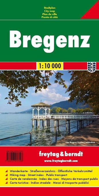
- Bregenz F&B
- Indexed street plan of Bregenz extending north along the Bodensee coast to Lochau and Unter Hochsteg. Detail includes pedestrianised areas, railways, bus routes and cycle paths. Notable buildings are highlighted in red, and symbols indicate post offices, hostels, campsites and car parks.On the reverse is a 1:50,000 contoured map of the... Lire la suite

Stanfords
United Kingdom
United Kingdom
- E4 Arquipelago de Cabo Verde
- Plans included:Porto Novo (Ilha de Santo Antão) (1:10 000)Mindelo (Porto Grande) (Ilha de São Vicente) (1:20 000)Ilha de Santa Luzia (1:not known)Porto de Tarrafal (Ilha de São Nicolau) (1:8500)Porto da Preguiça (Ilha de São Nicolau) (1:8500)Baía da Palmeira (Ilha do Sal) (1:15 000)Porto de Sal-Rei (Ilha da Boavista) (1:30 000)Porto da Praia... Lire la suite


Stanfords
United Kingdom
United Kingdom
- Kocher - Jagst Cycle Route Bikeline Map-Guide
- The Kocher - Jagst Cycle Tour, a 338-km long circuit along the Jagst and the Kocher in the Schwabian Jura, presented by the Verlag Esterbauer in a guide with maps at 1:50,000 showing the route and its variants. Extensive information is conveyed by symbols, indicating road surface, campsites and other accommodation, repair workshops,... Lire la suite