
London
Description
Capital of the United Kingdom. All sorts of walks. The Thames Path runs right through the city center and you can hop on the London Eye after being fooled at the ticket counter and view forward and backward on your trail.
Sentiers de cette région
Liens
Données
Rapports
Guides et cartes
Hébergement
Organisations
Voyagistes
GPS
Autre
Livres

Stanfords
United Kingdom
United Kingdom
- Glastonbury Isle Of Avalon
- Did Jesus really visit the Holy Isle of Avalon as a young man? And did Joseph of Arimathea really found the first church here too? Is King Arthur really buried with Guinevere in the Abbey grounds? In this small guide book, local historian George Wingfield unravels some of the mysteries of this ancient English spiritual centre, telling its story... Lire la suite

Stanfords
United Kingdom
United Kingdom
- The Stubborn Light of Things: A Nature Diary
- A nature diary by award-winning novelist, nature writer and hit podcaster Melissa Harrison, following her journey from urban south London to the rural Suffolk countryside.`A writer of great gifts.` Robert Macfarlane`The journal of a writer to compare to Thomas Hardy. Melissa Harrison is among our most celebrated nature writers.` John Carey, The... Lire la suite

Stanfords
United Kingdom
United Kingdom
- Moon Amsterdam Walks (Second Edition)
- Experience Amsterdam like a local: on foot! Wander along Amsterdam`s sparkling canals and bask in the diversity of its village vibes and cosmopolitan culture. Inside you`ll find:Six customisable walks through the city`s hippest neighbourhoods, including the Center, Westerpark, the Jordaan, De Pijp, and more, with color-coded stops and... Lire la suite

Stanfords
United Kingdom
United Kingdom
- Charles Booth`s London Poverty Maps
- Charles Booth`s landmark survey of life in late-19th-century London, published for the first time in one volume. In the late 19th century, Charles Booth`s landmark social and economic survey found that 35% of Londoners were living in abject poverty. Between 1886 and 1903, Booth`s team of social investigators interviewed Londoners from all walks... Lire la suite

Stanfords
United Kingdom
United Kingdom
- An Opinionated Guide To London Green Spaces
- Don`t be fooled by London`s concrete landscape: it is, in fact, one of the greenest cities in the world. This small paperback featuring the top 50 green spaces to visit is part of a series of opinionated guides that offer simple, highly-curated advice on what to do and see in the capital. Illustrated with original photography and compelling... Lire la suite

Stanfords
United Kingdom
United Kingdom
- Black Londoners
- ”Black Londoners: A History” celebrates three centuries of achievement of Black Londoners in different walks of life, from genetics to the judiciary. It includes the famous, as well as the obscure but outstanding contributions of non-celebrities, many of whom have never before been recognised in print. A series of themed biographies, ”Black... Lire la suite

Stanfords
United Kingdom
United Kingdom
- Walks in the London Borough of Barnet
- Walks in the London Borough of Barnet by John Merrill is a guidebook to walking in this intriguing borough. Barnet has several fascinating places to explore, a wealth of historical buildings and wide range of walks. This guide lists fifteen walks in the borough ranging from one-and-a-half to eighteen miles, including the Barnet sections of the... Lire la suite

Stanfords
United Kingdom
United Kingdom
- The Handy London Bensons Map & Guide
- The Handy London Map & Guide from Bensons MapGuides in their range of street plans of central London, in a handy A5 paperback format with descriptions and an index of essential sights and numerous other places of interest, main shopping streets and markets, plus parks and gardens, all graded according to their importance and popularity.Coverage... Lire la suite

Stanfords
United Kingdom
United Kingdom
- A Walk Around Charles Dickens` London
- This literary Walk will guide you through the Victorian streets of London to many of the places that Dickens and his characters knew well. See the London of Oliver Twist, David Copperfield and Little Nell, and sites such as the Old Curiosity Shop, Fagin’s Den and Bleak House, as well as the site of the Blacking Factory where the young Dickens... Lire la suite

Stanfords
United Kingdom
United Kingdom
- Walk London
- Fifteen themed walks highlighting the best that London has to offer, from historic palaces and gardens to the pleasures of the famous River Thames and the landmarks around Docklands and the City. Original illustrated maps and essential information make this a perfect guide for visitors to the capital. This stunning guide takes in London`s... Lire la suite

Stanfords
United Kingdom
United Kingdom
- Cruickshank`s London: A Portrait of a City in 13 Walks
- `The perfect guide to the hidden history of London`s streets.` BBC History MagazineIn Cruickshank`s London, Britain`s favourite architectural historian describes thirteen walks through one of the greatest cities on earth. From the mysterious Anglo-Saxon origins of Hampstead Heath, via Christopher Wren`s magisterial City churches, to the... Lire la suite

Stanfords
United Kingdom
United Kingdom
- Time Out London For Londoners
- London for Londoners is the ultimate handbook to everyday life in the capital. Borough by borough, Time Out takes you through the London that tourists don`t see. Each area is dissected, by way of facts and figures (council tax, transport, schools, house prices, rents and so on) and by amenities (parks, markets, sports facilities, arts venues,... Lire la suite

Stanfords
United Kingdom
United Kingdom
- Lost Art of Walking
- Walking was once the only way to get around but now we just walk to the bus stop, station or car. Or we walk as a lifestyle choice - trekking holidays, charity walks, urban explorations. Geoff Nicholson`s The Lost Art of Walking brings pedestrianism back to the centre of life by musing on his own walks, reflecting on writers, artists, musicians... Lire la suite

Stanfords
United Kingdom
United Kingdom
- London`s Houses
- From the remains of the Roman amphitheatre to the soaring glass structures of the 21st century city, London offers a unique architectural experience. This revised and expanded, authoritative guide takes the reader through almost 2.000 years of architectural achievement in the capital. Each chapter contains readily accessible examples of... Lire la suite
Stanfords
United Kingdom
United Kingdom
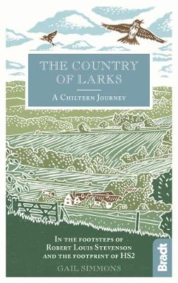
- Country of Larks: A Chiltern Journey: In the footsteps of Robert Louis Stevenson and the footprint of HS2
- Shortlisted for the 2020 Edward Stanford Travel Writing Award`s Lonely Planet Debut Travel Writer of the YearTravel writer and journalist Gail Simmons follows in the footsteps of Robert Louis Stevenson as she walks from High Wycombe in Buckinghamshire to Tring in Hertfordshire via Great Missenden and Wendover, tracing not only the changes in... Lire la suite
Cartes
Stanfords
United Kingdom
United Kingdom
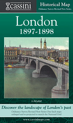
- London 1897-1898
- London in 1897-1898 in the Cassini Historical Series reproducing old Ordnance Survey mapping of England and Wales at 1:50,000. The four London maps cover roughly the area of the present day Greater London rather than following the format of rest of the series which is designed to correspond to the current Landranger maps. Mapping is identical... Lire la suite

Stanfords
United Kingdom
United Kingdom
- London East 1805-1922 (3-map set)
- Map No. 177, London East 1805-1922 (3-map set), in the Cassini Historical Series of old Ordnance Survey mapping of England and Wales at 1:50,000 in a format designed to offer a convenient comparison with the present day coverage from the OS, and most locations in three different editions. Old historical maps have been combined so that the sheet... Lire la suite

Stanfords
United Kingdom
United Kingdom
- Luxembourg South
- One of two topographic survey maps of Luxembourg at 1:50,000, with contours at 10-metres intervals and additional relief shading. An overprint highlights long-distance footpaths, including the GR5 (E-2), cycle routes, and various places of interest, including campsites. The map covers an area of approximately 53 x 43 km / 33 x 27 miles. Map... Lire la suite
Stanfords
United Kingdom
United Kingdom
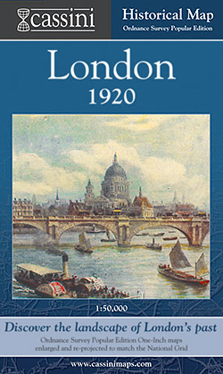
- London 1920
- London in 1920 in the Cassini Historical Series reproducing old Ordnance Survey mapping of England and Wales at 1:50,000. The four London maps cover roughly the area of the present day Greater London rather than following the format of rest of the series which is designed to correspond to the current Landranger maps. Mapping is identical to the... Lire la suite

Stanfords
United Kingdom
United Kingdom
- Sonoma Valley Biking and Hiking Trails
- Sonoma Valley on a contoured hiking and biking map from Map Adventures showing local conservations areas, detailed classification of recreational trails, wineries, etc. On one side a map at 1:30,000 covers the northern part of the valley along the Sonoma Highway from Glen Ellen to Santa Rosa, including the Taylor Mountain Regional Park, Annadel... Lire la suite

Stanfords
United Kingdom
United Kingdom
- England Coast Path Adventure Map - Minehead to Brean Down
- The A-Z Adventure Series of maps combines the best of OS and A-Z, creating the perfect companion for walkers, off-road cyclists, horse riders and anyone wishing to explore the great outdoors.This official Minehead to Brean Down Adventure Map covers a 58 mile (93km) section of the England Coast Path, a new National Trail around England`s coast.... Lire la suite

Stanfords
United Kingdom
United Kingdom
- Ontario MapArt Pocket Road Atlas
- Pocket road atlas of Ontario presenting the southern part of the province at 1:700,000 with the northern part at 1:1,500,000, plus enlargements showing in greater detail 25 municipal areas and downtown street plans for 21 locations, a map showing Highway Service Centres, etc..The atlas presents the southern part of the province at 1:700,000,... Lire la suite
Stanfords
United Kingdom
United Kingdom
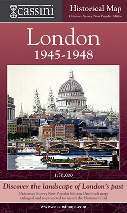
- London 1945-1948
- London in 1945-1948 in the Cassini Historical Series reproducing old Ordnance Survey mapping of England and Wales at 1:50,000. The four London maps cover roughly the area of the present day Greater London rather than following the format of rest of the series which is designed to correspond to the current Landranger maps. Mapping is identical... Lire la suite

Stanfords
United Kingdom
United Kingdom
- Cycle Tours Chilterns, Hertfordshire & Essex
- This spiral-bound guide describes 20 wonderful bike rides in the countryside to the north and west of London. The area offers some excellent and varied cycling: from the challenges of the steep wooded escarpment of the Chilterns in the west to the gentle gradients on networks of quiet lanes in Hertfordshire and north Essex. The book contains 15... Lire la suite

Stanfords
United Kingdom
United Kingdom
- East London and Gonubie
- Street plan of East London at 1:20,000 from the South African travel publishers Map Studio, with an inset providing coverage of the nearby Gonubie. Coverage extends inland to include the city’s airport. The plan shows names of districts, indicates main traffic arteries, and highlights various facilities and important buildings. No street index... Lire la suite
Stanfords
United Kingdom
United Kingdom
- London West 1897-1909
- Map No. 176, London West 1897-1909, in the Cassini Historical Series of old Ordnance Survey mapping of England and Wales at 1:50,000 in a format designed to offer a convenient comparison with the present day coverage from the OS, and most locations in three different editions. Old historical maps have been combined so that the sheet lines... Lire la suite
Stanfords
United Kingdom
United Kingdom
- London West 1805-1822
- Map No. 176, London West 1805-1822, in the Cassini Historical Series of old Ordnance Survey mapping of England and Wales at 1:50,000 in a format designed to offer a convenient comparison with the present day coverage from the OS, and most locations in three different editions. Old historical maps have been combined so that the sheet lines... Lire la suite
Stanfords
United Kingdom
United Kingdom
- London East 1897-1902
- Map No. 177, London East 1897-1902, in the Cassini Historical Series of old Ordnance Survey mapping of England and Wales at 1:50,000 in a format designed to offer a convenient comparison with the present day coverage from the OS, and most locations in three different editions. Old historical maps have been combined so that the sheet lines... Lire la suite
Stanfords
United Kingdom
United Kingdom
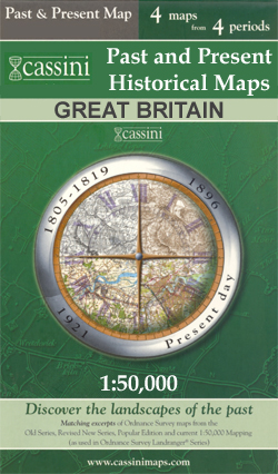
- Richmond and Ealing Past and Present
- London boroughs of Richmond and Ealing in the Cassini Past and Present map series which covers town and cities of England and Wales and offers a unique way of tracing their history and expansion by showing four different periods of their development using Ordnance Survey mapping from the mid-19th century, the late 19th century, the 1920s and... Lire la suite
Plus de cartes …
