
Mexico
Description
Liens
Données
Rapports
Guides et cartes
Hébergement
Organisations
Voyagistes
GPS
Autre
Livres

Stanfords
United Kingdom
United Kingdom
- DK Eyewitness Mexico
- Immerse yourself in a culture like no otherWhether you want to sample sizzling street food in Mexico City, swim in the Yucatan`s crystal-clear cenotes or marvel at towering Maya pyramids, your DK Eyewitness travel guide makes sure you experience all that Mexico has to offer. A cultural bonanza, a sun-seekers paradise, a foodie haven: Mexico is... Lire la suite

Stanfords
United Kingdom
United Kingdom
- Windswept: Walking in the Footsteps of Remarkable Women
- The story of extraordinary women who lost their way - their sense of self, their identity, their freedom - and found it again through walking in the wild. A feminist exploration of the power of walking in nature, following in the footsteps of Gwen John, Georgia O`Keeffe, Frieda Lawrence, Clara Vyvyan, Simone de Beauvoir, Daphne Du Maurier and... Lire la suite

Stanfords
United Kingdom
United Kingdom
- Costa Rica Eyewitness
- Welcome to Costa Rica - unmatched in beauty and biodiversityWhether you want to experience incredible wildlife, scuba dive in crystal-clear waters or savour a cup of world-famous coffee, your DK Eyewitness travel guide makes sure you experience all that Costa Rica has to offer. Inside you`ll find a detailed guide to the country`s animals,... Lire la suite

Stanfords
United Kingdom
United Kingdom
- The Golden Age
- Charles V, Emperor of Europe and the New World, is the central figure The Golden age, the second volume of Hugh Thomas’s superb history of the Spanish Empire. It begins with the return of the remnants of Magellan’s expedition around the world in 1522 and ends with Charles’s death in 1558. In the decades between, the Spaniards conquer Guatemala,... Lire la suite

Stanfords
United Kingdom
United Kingdom
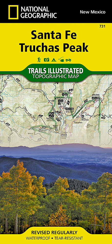
- Santa Fe - Truchas Peak NM
- Map No. 731, Santa Fe - Truchas Peak in New Mexico at 1:63,360, part of an extensive series of GPS compatible, contoured hiking maps of USA’s national and state parks or forests and other popular recreational areas. Cartography, based on the national topographic survey, has extensive additional tourist information.The maps, printed on light,... Lire la suite
- Also available from:
- The Book Depository, United Kingdom
- De Zwerver, Netherlands

De Zwerver
Netherlands
Netherlands
- Wandelkaart 731 Santa Fe, Truchas Peak | National Geographic
- Trails Illustrated Lire la suite

The Book Depository
United Kingdom
United Kingdom
- Pacific Crest Trail Data Book
- Mileages, Landmarks, Facilities, Resupply Data, and Essential Trail Information for the Entire Pacific Crest Trail, from Mexico to Canada Lire la suite

The Book Depository
United Kingdom
United Kingdom
- Zeke's Guide to Travel and Life
- Mexico Stories From the Road and All You Need to Know to Embark on Your Own Adventure Travels Lire la suite


Stanfords
United Kingdom
United Kingdom
- Windswept: why women walk
- The story of extraordinary women who lost their way - their sense of self, their identity, their freedom - and found it again through walking in the wild. `Moving and memorable` Virginia Nicholson, author of How Was It for You?`A triumph ... I felt as though I were being lifted, carried up to peaks` Charlotte Peacock, author of Into the... Lire la suite
- Also available from:
- The Book Depository, United Kingdom


The Book Depository
United Kingdom
United Kingdom
- Best Wildflower Hikes New Mexico
- A Guide to the Area's Greatest Wildflower Hiking Adventures Lire la suite

The Book Depository
United Kingdom
United Kingdom
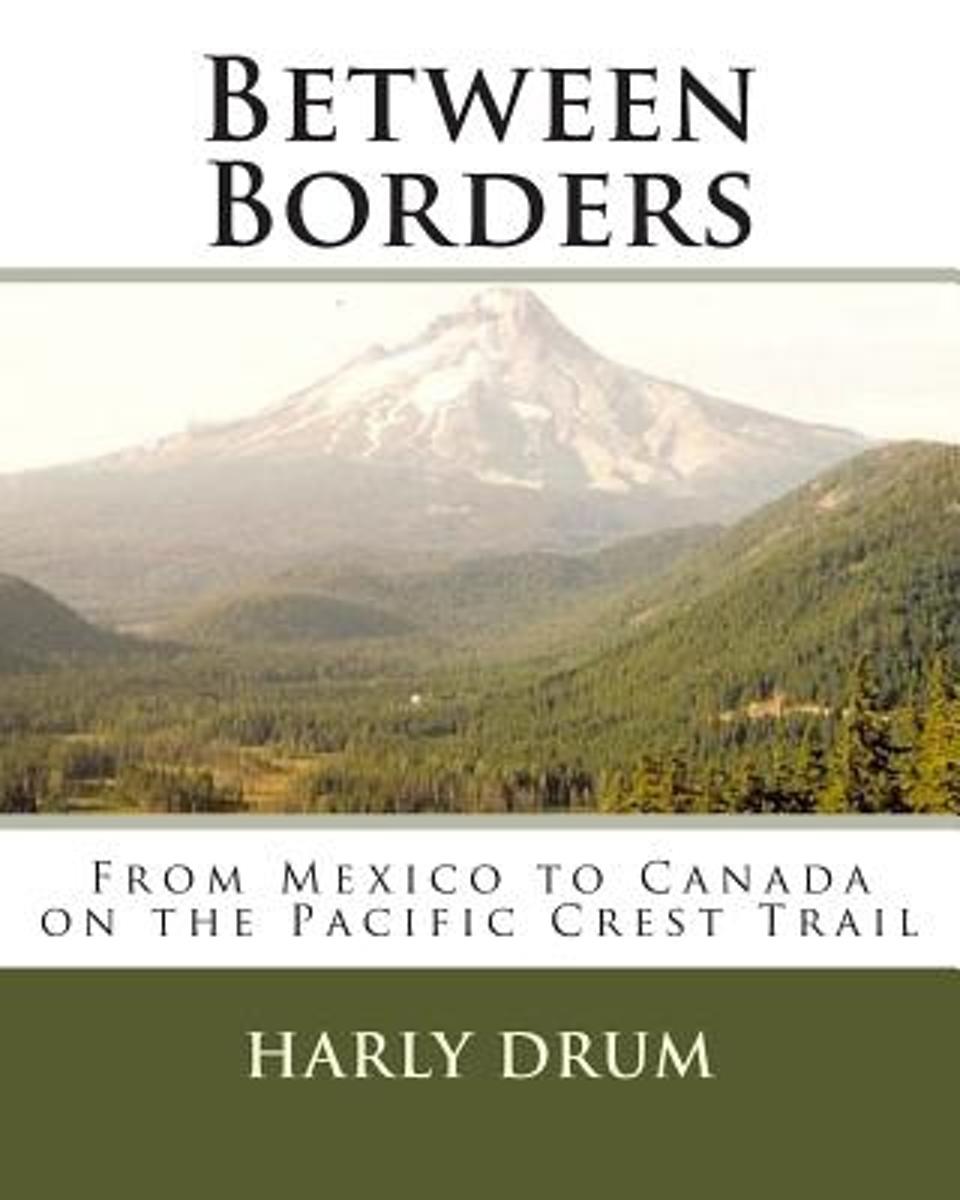
- Between Borders
- From Mexico to Canada on the Pacific Crest Trail Lire la suite
- Also available from:
- Bol.com, Netherlands
- Bol.com, Belgium
Bol.com
Netherlands
Netherlands
- Between Borders
- Between Borders is the true story of Harly Drum's thru-hike on the Pacific Crest Trail and the first book in the Long-Distance Adventure Series. At twenty-one years of age, he began walking north from the Mexican border and nearly 2700 miles later arrived in Manning Park, British Columbia.Between Borders has been prepared in journal form and... Lire la suite
Bol.com
Belgium
Belgium
- Between Borders
- Between Borders is the true story of Harly Drum's thru-hike on the Pacific Crest Trail and the first book in the Long-Distance Adventure Series. At twenty-one years of age, he began walking north from the Mexican border and nearly 2700 miles later arrived in Manning Park, British Columbia.Between Borders has been prepared in journal form and... Lire la suite
Bol.com
Netherlands
2015
Netherlands
2015
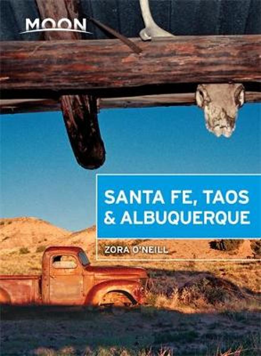
- Moon Santa Fe, Taos & Albuquerque (Fourth Edition)
- New Mexico native Zora O Neill shares her appreciation for the Land of Enchantment, from exploring Acoma Puebloa 12th-century Native American settlement built upon a 367-foot mesato hitting the slopes at Taos Ski Valley. O Neill offers a variety of trip strategies, such as Weekend Getaways, American Indian Heritage, and Not Just Hot Tamalesa... Lire la suite
- Also available from:
- Bol.com, Belgium
Bol.com
Belgium
2015
Belgium
2015
- Moon Santa Fe, Taos & Albuquerque (Fourth Edition)
- New Mexico native Zora O Neill shares her appreciation for the Land of Enchantment, from exploring Acoma Puebloa 12th-century Native American settlement built upon a 367-foot mesato hitting the slopes at Taos Ski Valley. O Neill offers a variety of trip strategies, such as Weekend Getaways, American Indian Heritage, and Not Just Hot Tamalesa... Lire la suite
Bol.com
Netherlands
Netherlands
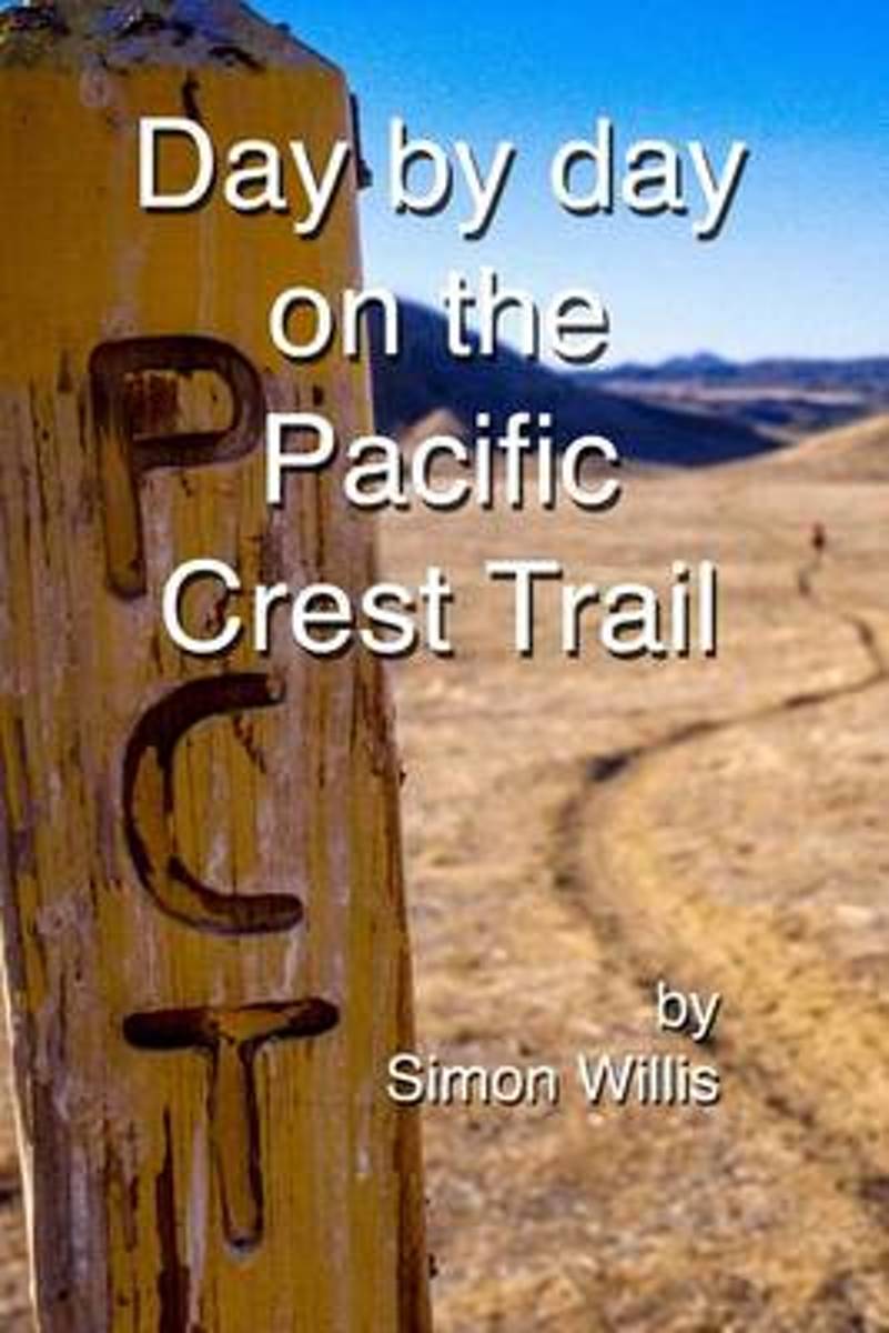
- Day by Day on the Pacific Crest Trail
- Written while hiking the PCT this book reveals, moment by moment, what it smells, tastes and above all, feels like to walk from Mexico to Canada. Former BBC Correspondent Simon Willis charts an emanational course through high mountains, baking deserts and personal tragedy. Illustrated with more than 150 colour photographs - hence the higher... Lire la suite
- Also available from:
- Bol.com, Belgium
Bol.com
Belgium
Belgium
- Day by Day on the Pacific Crest Trail
- Written while hiking the PCT this book reveals, moment by moment, what it smells, tastes and above all, feels like to walk from Mexico to Canada. Former BBC Correspondent Simon Willis charts an emanational course through high mountains, baking deserts and personal tragedy. Illustrated with more than 150 colour photographs - hence the higher... Lire la suite
Bol.com
Netherlands
Netherlands
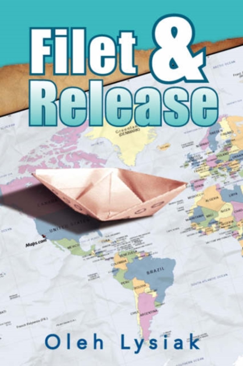
- Filet & Release
- Originally written for the Norwood Post, a truly independent newspaper in southwest Colorado, Filet & Release is a non-fiction collection of meandering tales about fishing, hunting and working around the world, from the high mountain streams of the Colorado Rockies, to the deck of a Russian seismic vessel in the Gulf of Benin, to the Pacific... Lire la suite
- Also available from:
- Bol.com, Belgium
Bol.com
Belgium
Belgium
- Filet & Release
- Originally written for the Norwood Post, a truly independent newspaper in southwest Colorado, Filet & Release is a non-fiction collection of meandering tales about fishing, hunting and working around the world, from the high mountain streams of the Colorado Rockies, to the deck of a Russian seismic vessel in the Gulf of Benin, to the Pacific... Lire la suite
Cartes

Stanfords
United Kingdom
United Kingdom
- Admiralty Routeing Chart 5142(6) - Gulf of Mexico and Caribbean Sea - June
- NEW EDITION ON 02/01/2020Essential for use in passage planning for ocean voyages, Routeing Charts include routes and distances between major ports, ocean currents, ice limits, load lines and wind roses. They also contain expected meteorological and oceanographic conditions for each month of the year.Individual chart scales of 1:5,000,000,... Lire la suite
Stanfords
United Kingdom
United Kingdom
- Admiralty Routeing Chart 5142(7) - Gulf of Mexico and Caribbean Sea - July
- NEW EDITION ON 02/01/2020Essential for use in passage planning for ocean voyages, Routeing Charts include routes and distances between major ports, ocean currents, ice limits, load lines and wind roses. They also contain expected meteorological and oceanographic conditions for each month of the year.Individual chart scales of 1:5,000,000,... Lire la suite

Stanfords
United Kingdom
United Kingdom
- Mexico - Yucatan IGN 85134
- Mexico / Yucatan road and tourist map including scenic routes, national parks, must-see attractions and includes an inset map of the Yucatan Peninsula. Published by IGN France at 1:2,500,000 (1cm = 25km)The series ”Discovery of the Countries of the World” offers you a very complete range of titles, presenting a large number of tourist and road... Lire la suite
Stanfords
United Kingdom
United Kingdom
- Admiralty Routeing Chart 5142(8) - Gulf of Mexico and Caribbean Sea - August
- NEW EDITION ON 02/01/2020Essential for use in passage planning for ocean voyages, Routeing Charts include routes and distances between major ports, ocean currents, ice limits, load lines and wind roses. They also contain expected meteorological and oceanographic conditions for each month of the year.Individual chart scales of 1:5,000,000,... Lire la suite

Stanfords
United Kingdom
United Kingdom
- Admiralty Routeing Chart 5142(1) - Gulf of Mexico and Caribbean Sea - January
- NEW EDITION ON 02/01/2020Essential for use in passage planning for ocean voyages, Routeing Charts include routes and distances between major ports, ocean currents, ice limits, load lines and wind roses. They also contain expected meteorological and oceanographic conditions for each month of the year.Individual chart scales of 1:5,000,000,... Lire la suite

Stanfords
United Kingdom
United Kingdom
- Admiralty Routeing Chart 5142(9) - Gulf of Mexico and Caribbean Sea - September
- NEW EDITION ON 02/01/2020Essential for use in passage planning for ocean voyages, Routeing Charts include routes and distances between major ports, ocean currents, ice limits, load lines and wind roses. They also contain expected meteorological and oceanographic conditions for each month of the year.Individual chart scales of 1:5,000,000,... Lire la suite
Stanfords
United Kingdom
United Kingdom
- Admiralty Routeing Chart 5142(3) - Gulf of Mexico and Caribbean Sea - March
- NEW EDITION ON 02/01/2020Essential for use in passage planning for ocean voyages, Routeing Charts include routes and distances between major ports, ocean currents, ice limits, load lines and wind roses. They also contain expected meteorological and oceanographic conditions for each month of the year.Individual chart scales of 1:5,000,000,... Lire la suite

Stanfords
United Kingdom
United Kingdom
- Admiralty Routeing Chart 5142(10) - Gulf of Mexico and Caribbean Sea - October
- NEW EDITION ON 02/01/2020Essential for use in passage planning for ocean voyages, Routeing Charts include routes and distances between major ports, ocean currents, ice limits, load lines and wind roses. They also contain expected meteorological and oceanographic conditions for each month of the year.Individual chart scales of 1:5,000,000,... Lire la suite

Stanfords
United Kingdom
United Kingdom
- New Mexico Benchmark Road & Recreation Atlas
- New Mexico at 1:400,000 in a series of excellent, detailed, GPS compatible state atlases from Benchmark Maps with extensive information on diverse recreational opportunities and facilities. The main section of the atlas, the Landscape Maps, presents the whole state on 56 pages of detailed mapping at 1:285,000. The Recreational Section is... Lire la suite
Stanfords
United Kingdom
United Kingdom
- Admiralty Routeing Chart 5142(2) - Gulf of Mexico and Caribbean Sea - February
- NEW EDITION ON 02/01/2020Essential for use in passage planning for ocean voyages, Routeing Charts include routes and distances between major ports, ocean currents, ice limits, load lines and wind roses. They also contain expected meteorological and oceanographic conditions for each month of the year.Individual chart scales of 1:5,000,000,... Lire la suite

Stanfords
United Kingdom
United Kingdom
- Admiralty Routeing Chart 5142(11) - Gulf of Mexico and Caribbean Sea - November
- NEW EDITION ON 02/01/2020Essential for use in passage planning for ocean voyages, Routeing Charts include routes and distances between major ports, ocean currents, ice limits, load lines and wind roses. They also contain expected meteorological and oceanographic conditions for each month of the year.Individual chart scales of 1:5,000,000,... Lire la suite

Stanfords
United Kingdom
United Kingdom
- San Antonio Flexi Map OUT OF PRINT
- San Antonio on a laminated, tear-resistant Insight Flexi Map, with street plans of its central districts plus the southern part of the city, maps of the San Antonio area, Canyon Lake and Texas, plus extensive tourist information. On one side is a street plan at 1:17,500 covering the city’s downtown area plus the surrounding districts. One way... Lire la suite

Stanfords
United Kingdom
United Kingdom
- Mexico Central & Mexico City ITMB
- Indexed road map covering central Mexico, with a large plan of central Mexico City on the reverse. The main map extends from Veracruz in the east to Leon in the west, and from Acapulco in the south to Ciudad Victoria in the north. Altitude tinting represents the general relief with spot heights for major peaks. Swamp areas, reefs and national... Lire la suite
Stanfords
United Kingdom
United Kingdom
- Admiralty Routeing Chart 5142(4) - Gulf of Mexico and Caribbean Sea - April
- NEW EDITION ON 02/01/2020Essential for use in passage planning for ocean voyages, Routeing Charts include routes and distances between major ports, ocean currents, ice limits, load lines and wind roses. They also contain expected meteorological and oceanographic conditions for each month of the year.Individual chart scales of 1:5,000,000,... Lire la suite

Stanfords
United Kingdom
United Kingdom
- Admiralty Routeing Chart 5142(12) - Gulf of Mexico and Caribbean Sea - December
- NEW EDITION ON 02/01/2020Essential for use in passage planning for ocean voyages, Routeing Charts include routes and distances between major ports, ocean currents, ice limits, load lines and wind roses. They also contain expected meteorological and oceanographic conditions for each month of the year.Individual chart scales of 1:5,000,000,... Lire la suite