
Monde
Description
Liens
Données
Rapports
Guides et cartes
Hébergement
Organisations
Voyagistes
GPS
Autre
Livres

The Book Depository
United Kingdom
United Kingdom
- The Secret World of Weather
- How to Read Signs in Every Cloud, Breeze, Hill, Street, Plant, Animal, and Dewdrop Lire la suite

The Book Depository
United Kingdom
United Kingdom
- Moon Tokyo Walks (First Edition)
- See the City Like a Local Lire la suite

The Book Depository
United Kingdom
United Kingdom
- Resilient Hope
- 100 Devotions for Building Endurance in an Unpredictable World Lire la suite

The Book Depository
United Kingdom
United Kingdom
- Great Hiking Trails of the World
- 80 Trails, 75,000 Miles, 38 Countries, 6 Continents Lire la suite

The Book Depository
United Kingdom
United Kingdom
- City Walks Edinburgh
- 15 short, fun and informative city walks bringing Edinburgh to life Lire la suite


The Book Depository
United Kingdom
2013
United Kingdom
2013
- A Walk in the Clouds
- 75 short stories of adventures among the mountains of the world Lire la suite

The Book Depository
United Kingdom
United Kingdom
- Running Wild
- Inspirational Trails from Around the World - With a foreword by Dean Karnazes Lire la suite

Stanfords
United Kingdom
2020
United Kingdom
2020
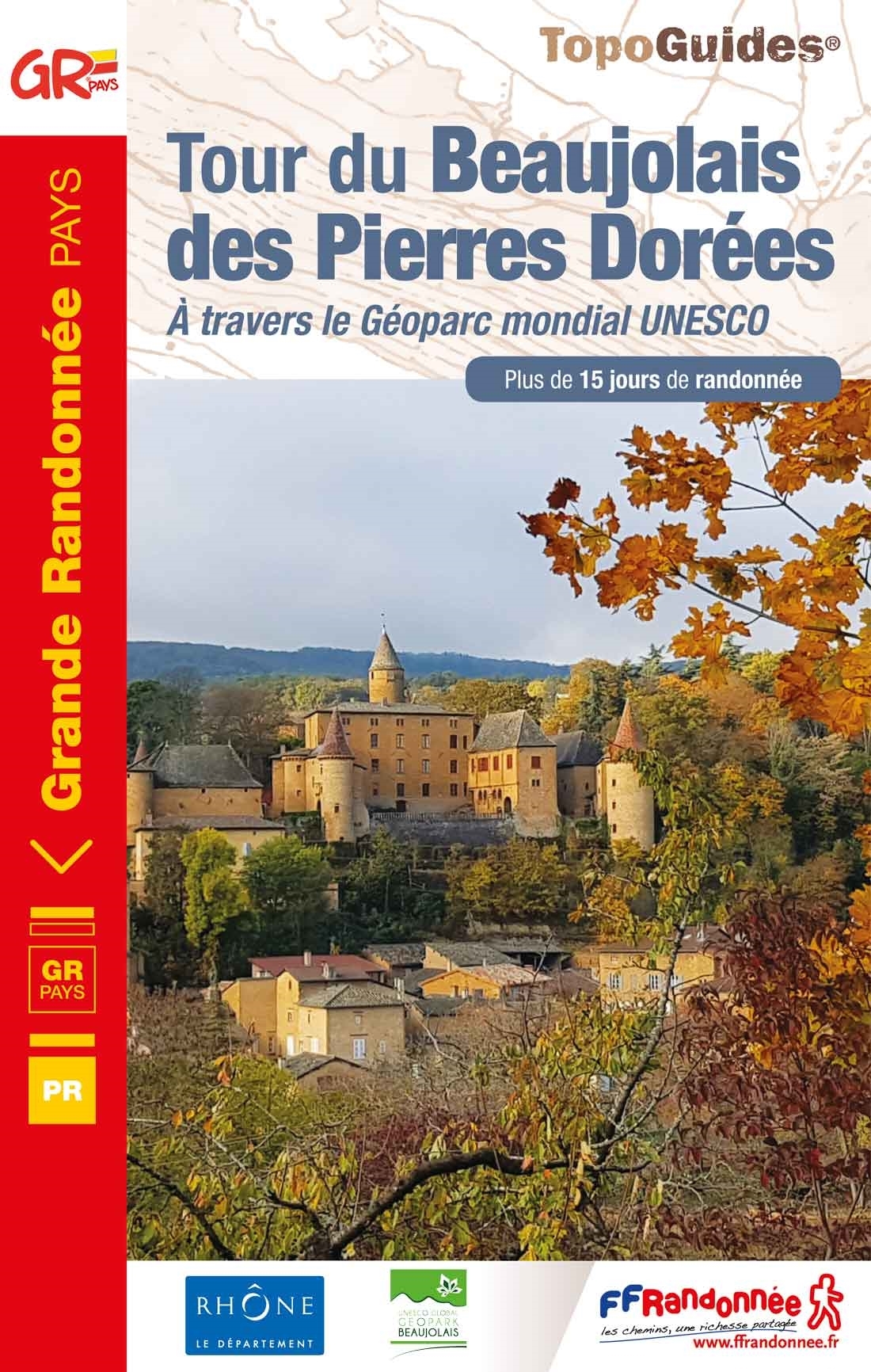
- Le tour du Beaujolais des Pierres Dorées - UNESCO Geopark World Heritage Site
- The Beaujolais tour of Pierres Dorées walking guide in frenchThis GR ®de Pays crosses the Beaujolais Geopark (UNESCO Global Geopark since 2018), which is characterized by the presence of limestone rocks that were used for the construction of the villages of Beaujolais, Lyonnais as well as in Switzerland.This soil gave this yellow ocher stone... Lire la suite
- Also available from:
- The Book Depository, United Kingdom
- De Zwerver, Netherlands

The Book Depository
United Kingdom
2020
United Kingdom
2020
- Tour du Beaujolais des Pierres Dor�es +15j. rand.,12PR
- The Beaujolais tour of Pierres Dorées walking guide in frenchThis GR ®de Pays crosses the Beaujolais Geopark (UNESCO Global Geopark since 2018), which is characterized by the presence of limestone rocks that were used for the construction of the villages of Beaujolais, Lyonnais as well as in Switzerland.This soil gave this yellow ocher stone... Lire la suite
De Zwerver
Netherlands
2020
Netherlands
2020
- Wandelgids 6900 Tour du Beaujolais des Pierres Dorées | FFRP
- The Beaujolais tour of Pierres Dorées walking guide in frenchThis GR ®de Pays crosses the Beaujolais Geopark (UNESCO Global Geopark since 2018), which is characterized by the presence of limestone rocks that were used for the construction of the villages of Beaujolais, Lyonnais as well as in Switzerland.This soil gave this yellow ocher stone... Lire la suite


The Book Depository
United Kingdom
United Kingdom
- Wild Signs and Star Paths
- 52 keys that will open your eyes, ears and mind to the world around you Lire la suite
Cartes
Stanfords
United Kingdom
United Kingdom
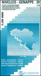
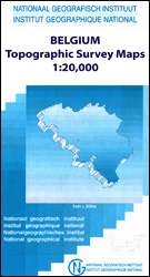
- Ans - Liège 20K NGI Belgium Survey Map No. 42/1-2
- Topographical survey of Belgium at 1:20,000 from Nationaal Geografisch Instituut / Institut Géographique National, the country’s national survey organization. Each 20K map covers one quarter of the corresponding 1:50,000 map (with adjustments in the border and coastal areas). The maps provide all the information expected of topographic mapping... Lire la suite

Stanfords
United Kingdom
United Kingdom
- Barcelona - Zaragoza - Castellón de la Plana 500K CNIG Regional Map No. 7
- The Mediterranean coast of Spain between Barcelona and Castellón de la Plana, extending west to Zaragoza and Teruel, at 1:500,000 in a series of regional road maps from the country’s civilian survey organization IGN-CNIG (Instituto Geográfico Nacional - Centro Nacional de Información Geográfica), vividly presenting the topography by altitude... Lire la suite

Stanfords
United Kingdom
United Kingdom
- Europe Children`s Placemat
- This is a colourful and resistant placemat by Little Wigwam, featuring a political map of Europe with capitals and major cities. All the information is up-to-date and includes Serbia, Kosovo and Montenegro. The seas are named, lines of longitude and latitude are shown at 15 degree intervals, the Arctic Circle is marked and the mat features a... Lire la suite

Stanfords
United Kingdom
United Kingdom
- Vise - St-Martens-Voeren
- Topographical survey of Belgium at 1:20,000 from Nationaal Geografisch Instituut / Institut Géographique National, the country’s national survey organization. Each 20K map covers one quarter of the corresponding 1:50,000 map (with adjustments in the border and coastal areas). The maps provide all the information expected of topographic mapping... Lire la suite
Stanfords
United Kingdom
United Kingdom
- Dalhem - Herve
- Topographical survey of Belgium at 1:20,000 from Nationaal Geografisch Instituut / Institut Géographique National, the country’s national survey organization. Each 20K map covers one quarter of the corresponding 1:50,000 map (with adjustments in the border and coastal areas). The maps provide all the information expected of topographic mapping... Lire la suite

Stanfords
United Kingdom
United Kingdom
- Durban MapStudio Pocket Map
- Central Durban at 1:12,500 on an indexed street plan from the South African map publishers, Map Studio, with on the reverse a road map of the city’s environs at 1:100,000, plus a plan of the uShaka Marine World. Also included is a list of renamed streets giving both the old and the new names, plus on the plan itself newly assigned street names... Lire la suite

Stanfords
United Kingdom
United Kingdom
- Quievrain - Boussu
- Topographical survey of Belgium at 1:20,000 from Nationaal Geografisch Instituut / Institut Géographique National, the country’s national survey organization. Each 20K map covers one quarter of the corresponding 1:50,000 map (with adjustments in the border and coastal areas). The maps provide all the information expected of topographic mapping... Lire la suite

Stanfords
United Kingdom
United Kingdom
- Aurlandsfjellet Nordeca Tourist Route 20005
- This Aurlandsfjellet National Tourist Route Map belongs to a series of 18 map and postcards sets describing popular tourist routes all over Norway. The map set includes a map in 1: 50,000 presenting an accurate topography (based on the Norwegian topographic survey) which describes local footpaths, cycle or ski routes, sport and recreational... Lire la suite
Stanfords
United Kingdom
United Kingdom
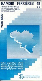
- Hamoir - Ferrieres
- Topographical survey of Belgium at 1:20,000 from Nationaal Geografisch Instituut / Institut Géographique National, the country’s national survey organization. Each 20K map covers one quarter of the corresponding 1:50,000 map (with adjustments in the border and coastal areas). The maps provide all the information expected of topographic mapping... Lire la suite
Stanfords
United Kingdom
United Kingdom
- Vresse-sur-Semois
- Topographical survey of Belgium at 1:20,000 from Nationaal Geografisch Instituut / Institut Géographique National, the country’s national survey organization. Each 20K map covers one quarter of the corresponding 1:50,000 map (with adjustments in the border and coastal areas). The maps provide all the information expected of topographic mapping... Lire la suite
Stanfords
United Kingdom
United Kingdom
- Burg-Reuland - Gross-Bohlscheid
- Topographical survey of Belgium at 1:20,000 from Nationaal Geografisch Instituut / Institut Géographique National, the country’s national survey organization. Each 20K map covers one quarter of the corresponding 1:50,000 map (with adjustments in the border and coastal areas). The maps provide all the information expected of topographic mapping... Lire la suite

Stanfords
United Kingdom
United Kingdom
- Kieldrecht- Doel
- Topographical survey of Belgium at 1:20,000 from Nationaal Geografisch Instituut / Institut Géographique National, the country’s national survey organization. Each 20K map covers one quarter of the corresponding 1:50,000 map (with adjustments in the border and coastal areas). The maps provide all the information expected of topographic mapping... Lire la suite

Stanfords
United Kingdom
United Kingdom
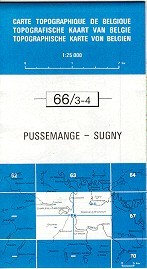
- Pussemange - Sugny
- Topographical survey of Belgium at 1:20,000 from Nationaal Geografisch Instituut / Institut Géographique National, the country’s national survey organization. Each 20K map covers one quarter of the corresponding 1:50,000 map (with adjustments in the border and coastal areas). The maps provide all the information expected of topographic mapping... Lire la suite