
Appennini
Description

The Apennine mountains, or Appennini as they are called in Italy, form the backbone of the Italian peninsula. In the northwest of Italy the Apennines touch on the Ligurian Alps. From there the range forms an arc reaching all the way to the island of Sicily in the south. The Apennines are sub-divided into the Northern, Central and Southern Apennines, with a total length of 1200 km. Including Sicily they even add up to 1500 km. The Central Apennines are the highest, culminating in Corno Grande (2912 m), home to the Calderone glacier.
Being such an extensive mountain range, the different parts of the Apennines are named after the provinces they are in, such as the Ligurian Apennines, the Tuscan-Emilian Apennines, the Umbrian Apennines, the Umbria-Marche Apennines and the Abruzzi Apennines. In turn these often consist of different chains, massifs and valleys. In general, the eastern slopes toward the Adriatic are the steepest, the western slopes being more gentle.
Clearly the Appennini are good hiking area. There are numerous short and long distance trails set out. European long distance trail E1 runs through the Northern and Central Apennines, and the Sentiero Italia crosses the entire Apennine range.
Sentiers de cette région
Liens
Données
Rapports
Guides et cartes
Hébergement
Organisations
Voyagistes
GPS
Autre
Livres

United Kingdom
2014
- Cinque Terre and the Riviera di Levante Walks
- If you enjoyed Sunflower`s best-selling guide to Sorrento and the Amalfi Coast, you`re sure to love the Cinque Terre and Riviera di Levante - the steeply terraced vineyards, ancient mule trails and colourful villages. This was the birthplace of modern tourism in the early 1800s, but over the last 30 years it has become a much-loved hiking... Lire la suite

United Kingdom
2019
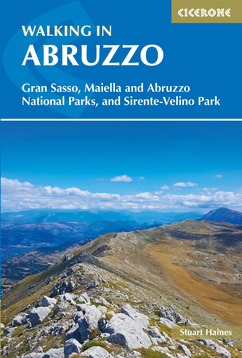
- Walking in Abruzzo: Gran Sasso, Maiella and Abruzzo National Parks, and Sirente-Velino Regional Park
- Guidebook for walking in Abruzzo, a wild region of Italy incorporating the Abruzzo, Maiella, and Gran Sasso national parks and the Sirente-Velino regional park. 40 day-walks are described including an ascent of Corno Grande, the highest point in the Apennines of peninsular Italy. The area is easily reached from the airports at Pescara and Rome. Lire la suite
- Also available from:
- The Book Depository, United Kingdom
- De Zwerver, Netherlands

United Kingdom
2019
- Walking in Abruzzo
- Gran Sasso, Maiella and Abruzzo National Parks, and Sirente-Velino Regional Park Lire la suite
Netherlands
2019
- Wandelgids Walking in Abruzzo - Abruzzen | Cicerone
- Guidebook for walking in Abruzzo, a wild region of Italy incorporating the Abruzzo, Maiella, and Gran Sasso national parks and the Sirente-Velino regional park. 40 day-walks are described including an ascent of Corno Grande, the highest point in the Apennines of peninsular Italy. The area is easily reached from the airports at Pescara and Rome. Lire la suite

United Kingdom
2019
- Walking in Umbria: 40 walks in the `Green Heart` of Italy
- This guidebook by Italian walking expert Gillian Price describes 40 varied day walks in the region of Umbria, taking in the towns of Assisi, Perugia, Orvieto and Norcia. The walks range from 2.5km to 19km in length, the majority of the routes are circular, and several wonderful traverses have been included, with the return to the start point... Lire la suite
- Also available from:
- The Book Depository, United Kingdom
- De Zwerver, Netherlands

United Kingdom
2019
- Walking in Umbria
- 40 walks in the 'Green Heart' of Italy Lire la suite

Netherlands
2019
- Wandelgids Walking in Umbria - Umbrië | Cicerone
- This guidebook describes 40 walks in Umbria, among the ancient towns of Assisi, Perugia, Orvieto and Norcia. Known as the 'green heart' of Italy, the region of Umbria is home to hills reaching up to the Apennines and Sibillini mountains, as well as ancient villages, Roman and Etruscan ruins, dense woodland and nature reserves. Lire la suite

Netherlands
2017
- Wandelgids 411 Kautokeino - Nordkap E1 | Conrad Stein Verlag
- Handzaam boekje met de routebeschrijving inclusief een heleboel praktische informatie. De beschrijving is uitstekend, maar kaarten zijn wat beperkt. Duits. Die 330 km lange Wanderung auf dem E1 von Kautokeino zum Nordkap ist ein unvergessliches Wanderabenteuer. In 15 Etappen laufen Sie durch die Wildnis Nordnorwegens und überqueren die... Lire la suite
Netherlands
2012
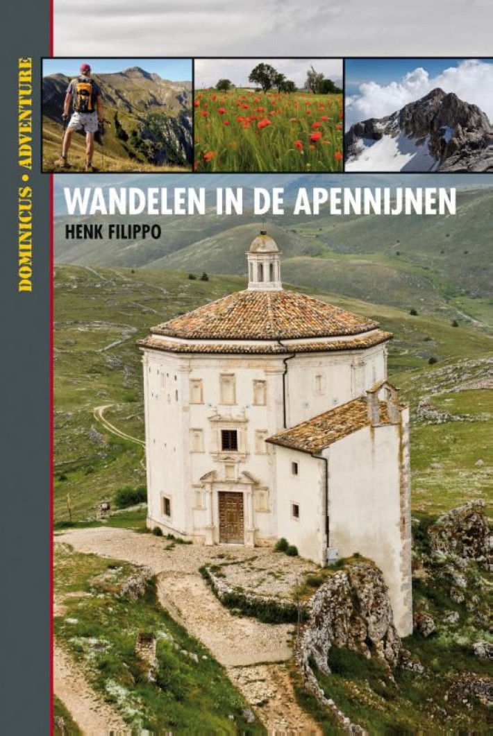
- Wandelgids Dominicus Wandelen in de Apennijnen | Gottmer
- Hoewel de Apennijnen midden in Italië liggen, zijn omgeven door grote steden en je ze van alle kanten snel kunt bereiken, zijn ze niettemin een afgelegen en stil natuurgebied gebleven. Je vindt hier niet het dolce vita of het lieflijke Italië van bijvoorbeeld Toscane. De Apennijnen zijn puur en ruig, en via de wandelingen in dit boek ontdek je... Lire la suite
Netherlands
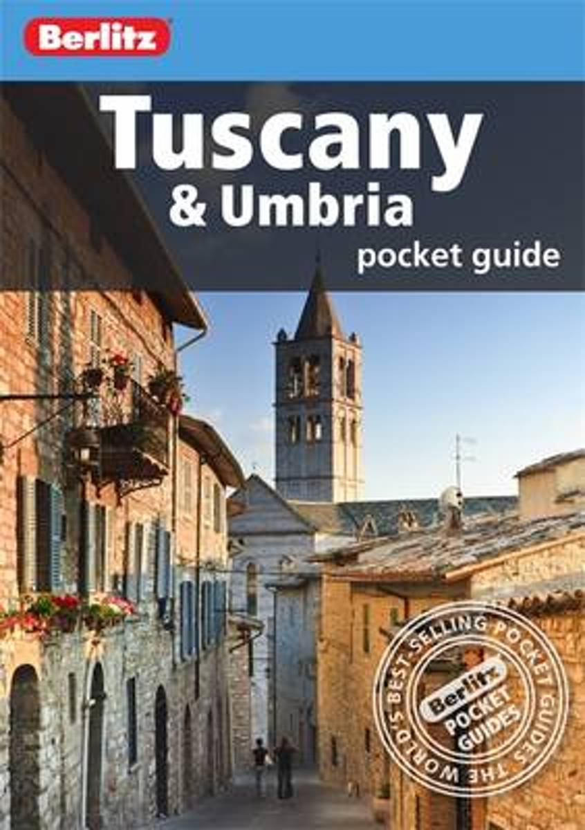
- Berlitz Tuscany & Umbria Pocket Guide
- Berlitz Pocket Guide Tuscany and Umbria is a concise, full-colour travel guide that combines lively text with vivid photography to highlight the very best that this bountiful region has to offer, from its exquisite Renaissance cities to hilltop villages and peaceful, verdant landscapes. Follow in the footsteps of St Francis of Assisi, climb the... Lire la suite
- Also available from:
- Bol.com, Belgium
Belgium
- Berlitz Tuscany & Umbria Pocket Guide
- Berlitz Pocket Guide Tuscany and Umbria is a concise, full-colour travel guide that combines lively text with vivid photography to highlight the very best that this bountiful region has to offer, from its exquisite Renaissance cities to hilltop villages and peaceful, verdant landscapes. Follow in the footsteps of St Francis of Assisi, climb the... Lire la suite
Netherlands
2012
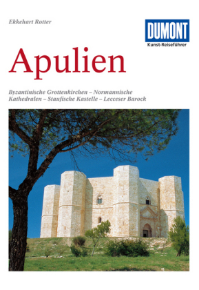
- Reisgids Kunstreiseführer Apulien - Apulië | Dumont
- Fahrten zu byzantinischen Grottenkirchen, normannischen Kathedralen, staufischen Kastellen und Barockbauten in Lecce DuMont Kunst-Reiseführer. 6. Auflage. Lire la suite
Netherlands
2005
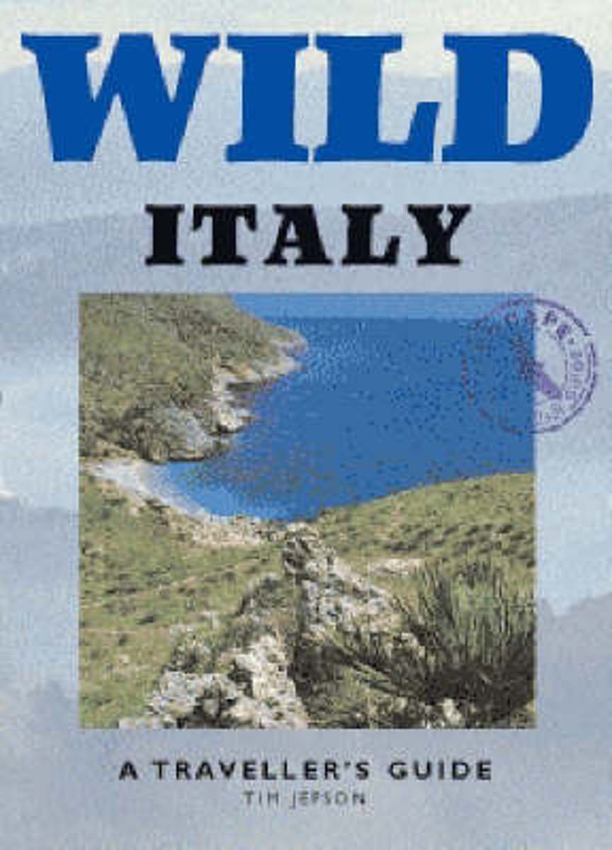
- Wild Italy
- In Wild Italy, Tim Jepson leaves the well-worn tourist haunts of traditional guide books behind him in search of fresher pleasures. He offers a rural, rather than an urban Italy, revealing the best of the long walks, mountain hideaways, woods, plains, sea coasts and remote islands where travellers can still find a refuge from the modern world.... Lire la suite
- Also available from:
- Bol.com, Belgium
Belgium
2005
- Wild Italy
- In Wild Italy, Tim Jepson leaves the well-worn tourist haunts of traditional guide books behind him in search of fresher pleasures. He offers a rural, rather than an urban Italy, revealing the best of the long walks, mountain hideaways, woods, plains, sea coasts and remote islands where travellers can still find a refuge from the modern world.... Lire la suite

Netherlands
2022
Netherlands
2013
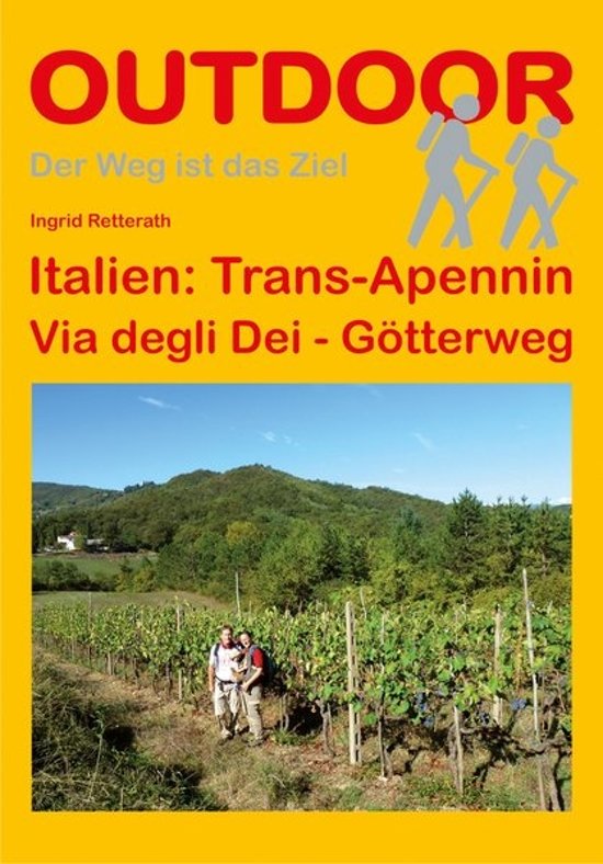
- Wandelgids - Pelgrimsroute Trans-Apennin, Via degli Dei - Gotterweg - Godenweg | Conrad Stein Verlag
- Der Weg ist das Ziel. 1. Auflage. Lire la suite

Netherlands
- Marco Polo Reisgids Noord-Italie
- Ontdek Noord-ItaliëOlijven- en citrusbomen aan de voet van de besneeuwde Alpentoppen, een modern leven in 2000 jaar oude stadjes. Als het echt helder is, wat in de vochtige nevels van de Povlakte niet vaak gebeurt, kan men vanaf het dak van de Dom van Milaan de machtige bergketens van de Centrale Alpen in het noorden en de eerste hoge heuvels... Lire la suite
- Also available from:
- Bol.com, Belgium
Belgium
- Marco Polo Reisgids Noord-Italie
- Ontdek Noord-ItaliëOlijven- en citrusbomen aan de voet van de besneeuwde Alpentoppen, een modern leven in 2000 jaar oude stadjes. Als het echt helder is, wat in de vochtige nevels van de Povlakte niet vaak gebeurt, kan men vanaf het dak van de Dom van Milaan de machtige bergketens van de Centrale Alpen in het noorden en de eerste hoge heuvels... Lire la suite

United Kingdom
2017
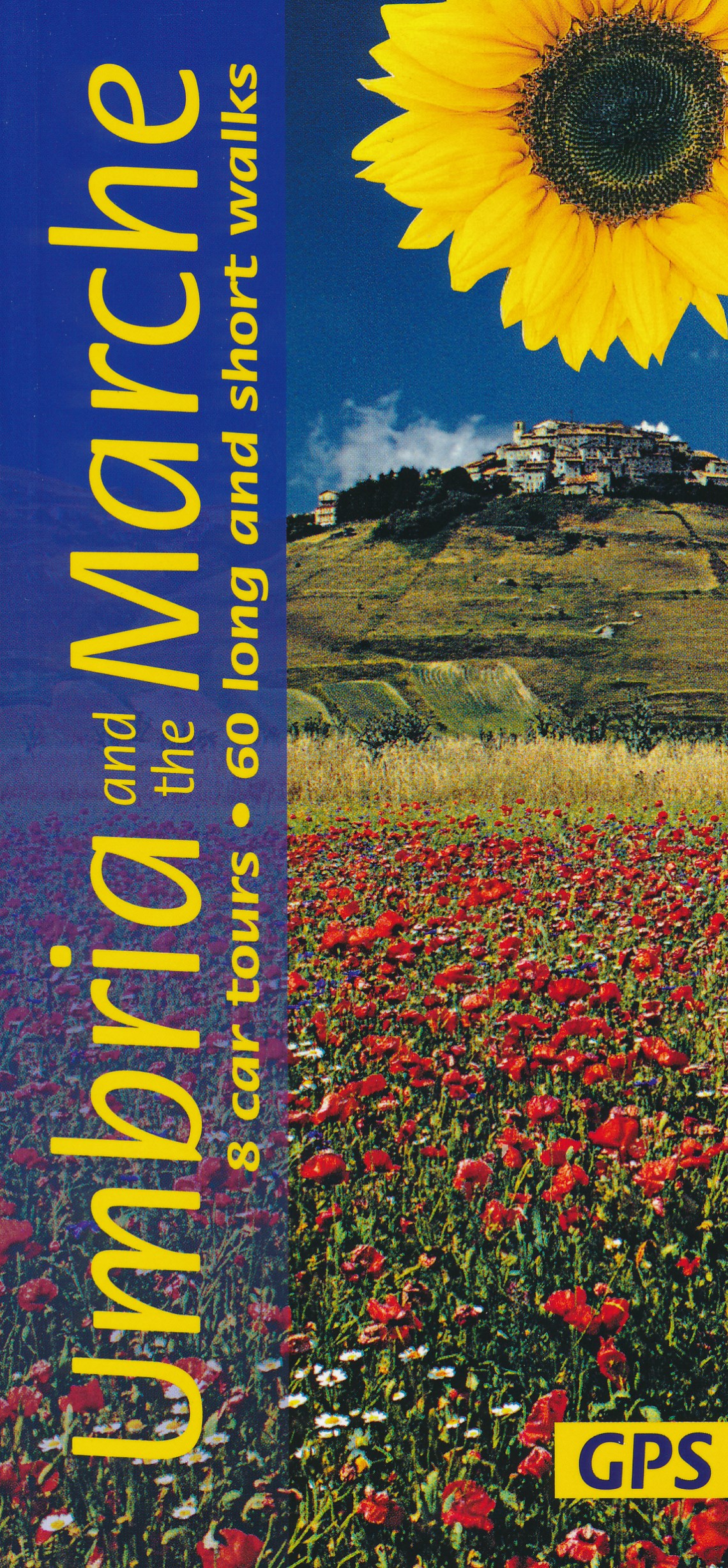
- Umbria and the Marche Sunflower Landscape Guide
- Umbria promotes itself as `Italy`s Green Heart`, and this description applies equally well to the lesser-known neighbouring region of the Marche. The main focal points of this guide are the two most beautiful areas of the Apennines in the region – the idyllic, deeply-etched valley of Valnerina in Umbria and the legendary Monti Sibillini which... Lire la suite
- Also available from:
- De Zwerver, Netherlands

United Kingdom
2016
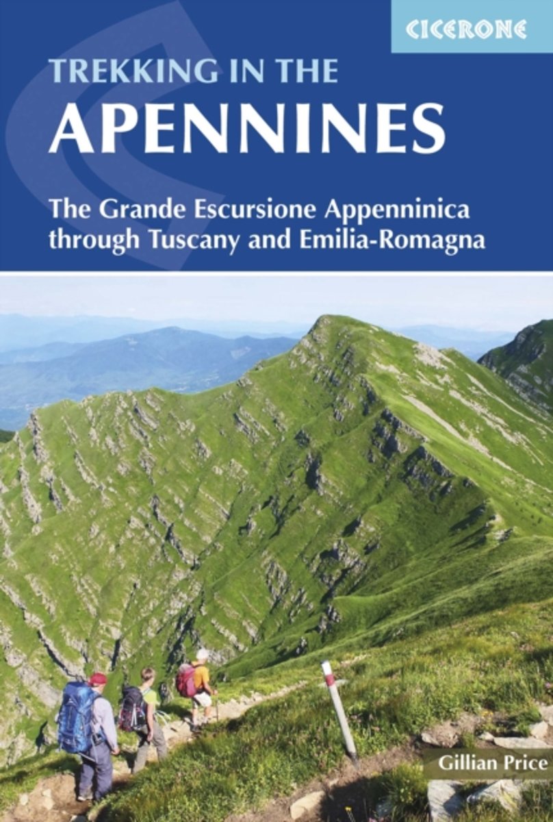
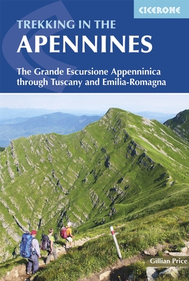
- Apennines Trekking - The Grande Escursione Appenninica
- This guidebook describes the Grande Escursione Appenninica (GEA), a nearly 400km long, three week trek crossing the Appenines in 23 stages, from Bocca Trabaria to Passo Due Santi on the edge of Liguria. The route dips in and out of Tuscany and Emilia-Romagna, never dropping below 400 metres. Best walked between spring and autumn, it is suitable... Lire la suite
- Also available from:
- The Book Depository, United Kingdom
- Bol.com, Netherlands
- Bol.com, Belgium
- De Zwerver, Netherlands

United Kingdom
2016
- Trekking in the Apennines
- The Grande Escursione Appenninica Lire la suite
Netherlands
2016
- Trekking in the Apennines
- This guidebook describes the Grande Escursione Appenninica (GEA), a nearly 400km long, three week trek crossing the Apenines in 23 stages, from Bocca Trabaria to Passo Due Santi on the edge of Liguria. The route dips in and out of Tuscany and Emilia-Romagna, never dropping below 400 metres. Best walked between spring and autumn, it is suitable... Lire la suite
Belgium
2016
- Trekking in the Apennines
- This guidebook describes the Grande Escursione Appenninica (GEA), a nearly 400km long, three week trek crossing the Apenines in 23 stages, from Bocca Trabaria to Passo Due Santi on the edge of Liguria. The route dips in and out of Tuscany and Emilia-Romagna, never dropping below 400 metres. Best walked between spring and autumn, it is suitable... Lire la suite
Netherlands
2016
- Wandelgids Trekking in the Apennines - Apennijnen | Cicerone
- Guidebook to the Grand Apennines Trek, or Grande Escursione Appenninica (GEA). Through Tuscany and Emilia-Romagna and two National Parks, this 400km, 23 day trail explores the mountains, forests and hills of central Italy. Suitable for a range of walkers, it can be split into shorter sections or day walks if needed. Lire la suite
Netherlands
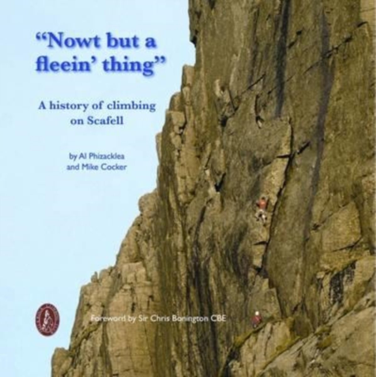
- Nowt but a Fleein' Thing
- In 1874 George Seatree and Stanley Martin made the first ascent of North Climb, which was the first time the main face of Scafell had been ascended outside of the obvious gully lines. It was the start of great things on the crags of Scafell. Upon hearing their report of this new route, Will Ritson, landlord of the Huntsman's Inn, looked at them... Lire la suite
- Also available from:
- Bol.com, Belgium
Belgium
- Nowt but a Fleein' Thing
- In 1874 George Seatree and Stanley Martin made the first ascent of North Climb, which was the first time the main face of Scafell had been ascended outside of the obvious gully lines. It was the start of great things on the crags of Scafell. Upon hearing their report of this new route, Will Ritson, landlord of the Huntsman's Inn, looked at them... Lire la suite

Netherlands
2020
Cartes

United Kingdom
- Arezzo - Casentino - Foreste Casentinesi NP - Monte Falterona Kompass 2459
- Arezzo - Casentino - Monte Falterona map at 1:50,000 from Kompass, printed on durable, waterproof and tear-resistant synthetic paper. Coverage includes Foreste Casentinesi National Park. Contours are at 40m intervals, with a 2-km UTM grid. Extensive overprint includes GEA - Grande Escursione Appenninica, Sentiero Italia, etc, plus cycling and... Lire la suite

United Kingdom
- Alpe della Luna 17
- Map No. 16, Monte Carpegna - Sasso di Simone, in series of contoured, GPS compatible hiking maps at 1:25,000 from the Istituto Geografico Adriatico, covering mainly the spine of the Apennines along the borders of Tuscany, Emilia-Romagna, Umbria and the Marches.Map in this series have contours at 25m intervals with additional shading and... Lire la suite

United Kingdom
- Siena - Volterra - Massa Marittima - Roccastrada Kompass 2462
- Siena - Volterra - Massa Marittima - Rocca Strada map at 1:50,000 from Kompass, printed on durable, waterproof and tear-resistant synthetic paper. Coverage includes Colle di Va d’Elsa, Casole d’Elsa, Metallifere hills, etc. Contours are at 40m intervals, with a 2-km UTM grid. Extensive overprint includes GEA - Grande Escursione Appenninica,... Lire la suite

United Kingdom
- Riviera Cesenate - San Marino
- Map No. 128, Riviera Cesenate - San Marino, in a series of GPS compatible hiking maps at 1:50,000 from the Istituto Geografico Adriatico, covering parts of central Italy: eastern Tuscany, with northern Umbria and the Marches, plus the south-eastern of part of Emilia-Romagna.The maps have contours at 50m intervals with additional shading and... Lire la suite

United Kingdom
- Monti Sibillini National Park 6-Map Set
- Monti Sibillini National Park in a 6 sheet set, contoured and GPS compatible map at 1:25,000 published by Societá Editrice Ricerche. The maps highlight hiking trails, including the Grande Anello dei Monti Sibilini long-distance circuit.Modern cartography from the Italian topographic survey has contours at 20m intervals, relief shading, and... Lire la suite

United Kingdom
- Val Venosta / Vinschgau K+F Outdoor Map 1
- Val Venosta / Vinschgau area in the Dolomites at 1:50,000 in a series of waterproof and tear-resistant, GPS compatible and contoured recreational maps from Kümmerly + Frey with both local and long-distance hiking and cycling trails, ski routes, sites for other outdoor pursuits, accommodation, bus stops, etc. Coverage includes the Ortles/Ortler... Lire la suite

United Kingdom
- Monti Sibillini National Park Edizioni Multigraphic 60/61
- Monti Sibillini National Park at 1:25,000 on a double-sided contoured map from Edizioni Multigraphic highlighting local waymarked hiking routes including the GAS – Grand Anello dei Sibilini, the circular tour around the mountains.The map has contours at 25m intervals with colouring for woodlands. Waymarked routes are highlighted and annotated... Lire la suite
United Kingdom
- Alta Val Marecchia
- Map No. 126, Alta Val Marecchia, in a series of GPS compatible hiking maps at 1:50,000 from the Istituto Geografico Adriatico, covering parts of central Italy: eastern Tuscany, with northern Umbria and the Marches, plus the south-eastern of part of Emilia-Romagna.The maps have contours at 50m intervals with additional shading and numerous spot... Lire la suite
United Kingdom
- Alta Valle del Santerno 23
- Map No. 22, Alta Valle del Lamone: Alto Appennino Faentino – Anello di Marradi, in series of contoured, GPS compatible hiking maps at 1:25,000 from the Istituto Geografico Adriatico, covering mainly the spine of the Apennines along the borders of Tuscany, Emilia-Romagna, Umbria and the Marches.Map in this series have contours at 25m intervals... Lire la suite

United Kingdom
- Prato Province Hiking Routes
- The province of Prato, just north-west of Florence, on a double-sided, contoured and GPS compatible map at 1:25,000 from Edizioni Multigraphic highlighting waymarked routes and other hiking paths, with access by public transports, etc.The map has contours at 20m intervals with relief shading and plenty of spot heights. Hiking paths are... Lire la suite
United Kingdom
- Alta Valle del Metauro: Valle del Candigliano, Monte Nerone, Monte Catria
- Map No. 122, Alta Valle del Metauro: Valle del Candigliano, Monte Nerone, Monte Catria, in a series of GPS compatible hiking maps at 1:50,000 from the Istituto Geografico Adriatico, covering parts of central Italy: eastern Tuscany, with northern Umbria and the Marches, plus the south-eastern of part of Emilia-Romagna.The maps have contours at... Lire la suite
United Kingdom
- Colline di Forlí
- Map No. 127, Colline di Forlí, in a series of GPS compatible hiking maps at 1:50,000 from the Istituto Geografico Adriatico, covering parts of central Italy: eastern Tuscany, with northern Umbria and the Marches, plus the south-eastern of part of Emilia-Romagna.The maps have contours at 50m intervals with additional shading and numerous spot... Lire la suite

United Kingdom
- Lake Maggiore - Lake Orta - Lake Varese K+F Outdoor Map 8
- Lake Maggiore - Lake Orta - Lake Varese area at 1:50,000 in a series of waterproof and tear-resistant, GPS compatible and contoured recreational maps from Kümmerly + Frey with both local and long-distance hiking and cycling trails, ski routes, sites for other outdoor pursuits, accommodation, bus stops, etc. An inset provides a small road map of... Lire la suite

United Kingdom
- Monti Nebrodi
- Parco Naturale dei Monti Nebrodi on the northern coast of Sicily on a contoured and GPS compatible map at 1:50,000 from Litografia Artistica Cartografica in their Global Map imprint, highlighting hiking trails plus various facilities and/or places of interest in and around the park.Topography is shown by contours at 25m intervals with light... Lire la suite
United Kingdom
- Monte Fumaiolo - Monte Comero 18
- Map No. 18, Monte Fumaiolo - Alto Tevere, in series of contoured, GPS compatible hiking maps at 1:25,000 from the Istituto Geografico Adriatico, covering mainly the spine of the Apennines along the borders of Tuscany, Emilia-Romagna, Umbria and the Marches.Map in this series have contours at 25m intervals with additional shading and numerous... Lire la suite