
Portugal
Description

It wasn't until the late nineteen-nineties that Portugal started the construction and marking of hiking paths. Long distance hiking trails are still rare. The major Grande Rota (GR's) are in part no more than a promiss. Of European long distance hiking trail E7 (GR12), 80 km on the border with Spain are ready. The GR11, Camino de Santiago, by now runs from Lisbon to Santiago de Compostela. Most fully completed is the 540 km long GR22, Trail of the Old Towns. Problematic in Portugal are the often outdated maps and sometimes poor condition of paths and markings.
As a good alternative you can hike a range of shorter trails, which you will come across in all national parks and protected landscape areas. These walks last from several hours to a full day, and are marked in red and yellow. Names of these trails start with PR, Pequena Rota (= minor routes), signposts mark the trailheads, although some trails are circular. Try to buy maps and guides through the internet or in you own country in advance, because locally these are hard to come by.
Walking the shorter trails is an excellent way to explore Portugese nature. The first national park that deserves to be mentioned is Peneda-Gerês, a mountain area abounding in water, in the north of Portugal forming the border with Spain. Another good area for hiking is the Serra de Estrela, where you will find mainland Portugal's highest mountain Malhão de Estrela (1993m). Most hikers will be looking for walks in the Algarve, and on the vulcanic islands of Madeira, the Azores (with Mount Pico as the highest at 2351m) and Berlengas. These popular islands harbour bizarre plant and animal life, and offer numerous short marked trails.
Sentiers
Régions
- Alentejo
- Algarve
- Alvão Natural Park
- Arrábida
- Azores
- Berlengas
- Corvo, Azores
- Costa Verde
- Doura
- Estremadura
- Faial, Azores
- Flores, Azores
- Graciosa, Azores
- Madeira
- Montesinho
- Peneda-Gerês
- Pico, Azores
- Porto Santo, Madeira
- Santa Maria, Azores
- São Jorge, Azores
- São Miguel, Azores
- Serra da Estrela
- Serra da Malcata
- Serras de Aires e Candeeiros
- Terceira, Azores
Liens
Données
Rapports
Guides et cartes
Hébergement
Organisations
Voyagistes
GPS
Autre
Livres

United Kingdom
- A1 Traveler
- Portugal (Travel Guide) Planning A Trip To Portugal Lire la suite

United Kingdom
2017
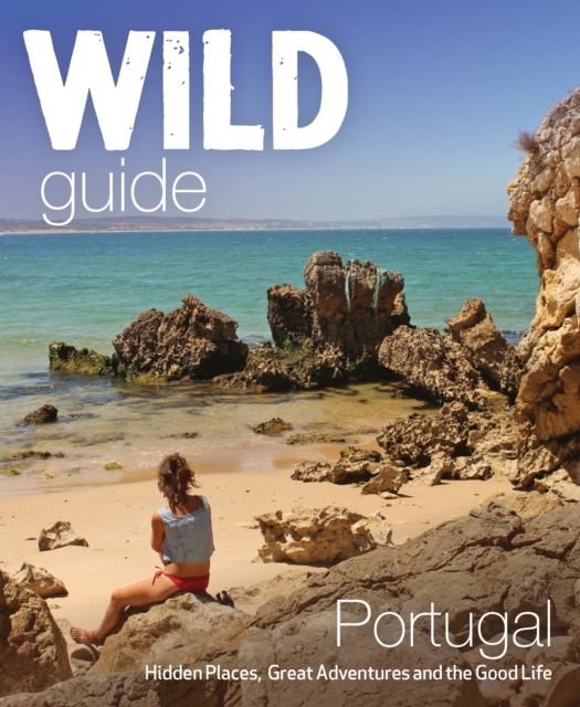
- The Wild Guide Portugal
- Hidden Places, Great Adventures and the Good Life Lire la suite
- Also available from:
- De Zwerver, Netherlands
Netherlands
2017
- Reisgids Wild Guide Portugal | Wild Things Publishing
- Inspirerende gids voor mooie plekken en het goede leven in Portugal. Imagine a summer spent plunging into clear turquoise rivers, playing on hidden beaches, walking in wild flower-strewn cork forests, and tasting wine from boutique vineyards accompanied by the freshest seafood. In this explorer’s compendium you will discover the hidden... Lire la suite


Netherlands
2017
- Reisgids Marco Polo NL Lissabon | 62Damrak
- Eindelijk zijn ze er weer: de Nederlandse versie van de alom bekende en gewaardeerde serie van Marco Polo. Het is een handige en overzichtelijke, kleine reisgids voor een goede kennismaking met de vakantiebestemming. Globale uitklapkaart achterin, makkelijk binnenzakformaat. Toch best veel aandacht voor de toeristische hoogtepunten en leuke... Lire la suite


Netherlands
2023
Netherlands
2015
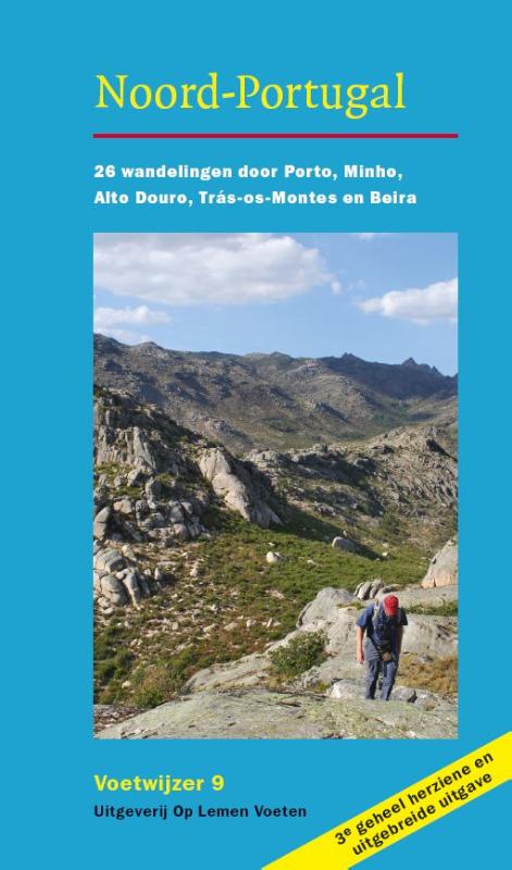
- Wandelgids Voetwijzer Noord Portugal | Op Lemen Voeten
- Noord-Portugal hoort tot de mooiste wandelgebieden van Europa. Er is nog veel authentieks te ontdekken, bijvoorbeeld in de vier natuurparken waaronder het bergachtige Peneda Gerês en het Parque de Montesinho, waar nog wolven leven. De 26 wandelingen liggen in een halve cirkel rond de aantrekkelijke havenstad Porto. Ze zijn goed gespreid over de... Lire la suite
Netherlands
2014
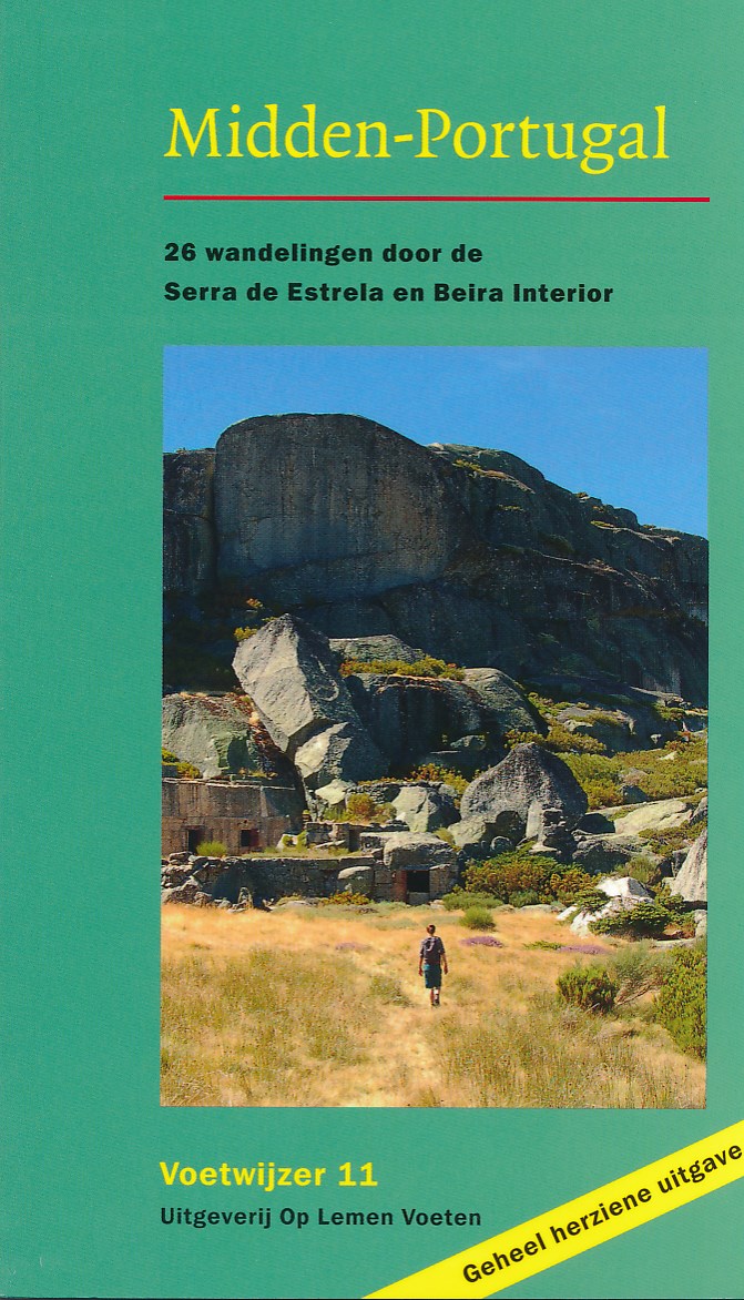
- Wandelgids Voetwijzer Midden Portugal | Op Lemen Voeten
- De gids staat boordevol praktische informatie over routes, onderdak, kaarten en openbaar vervoer. Elke wandeling heeft een eigen routekaartje. Kijkpunten verwijzen naar interessante elementen in het landschap. Ook vindt u in de gids een uitgebreide routebeschrijving van een meerdaagse trektocht door de Serra da Estrela. Kaartmateriaal is... Lire la suite
Netherlands
2023

United Kingdom
2018
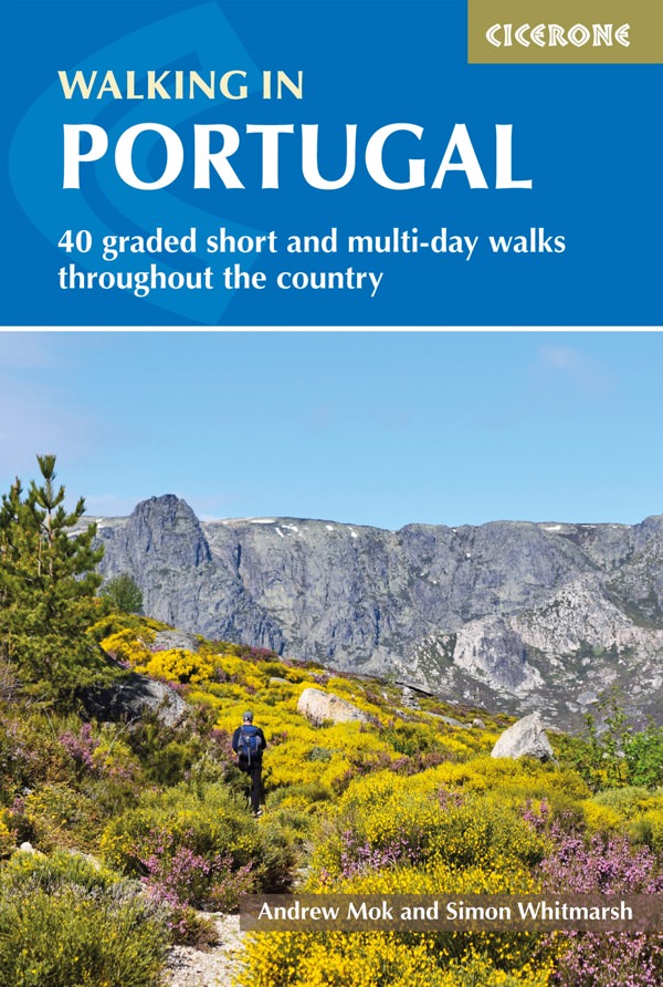
- Walking in Portugal: 40 graded short and multi-day walks throughout the country
- Portugal is something of an undiscovered gem for hikers, offering beautiful, diverse landscapes and vast amounts of space. Thanks to its variety of micro-climates, it is possible to find pleasant walking conditions in all seasons, and the multitude of trails boast fantastic scenery and are rich in natural, historical and cultural interest.This... Lire la suite
- Also available from:
- The Book Depository, United Kingdom
- Bol.com, Netherlands
- Bol.com, Belgium
- De Zwerver, Netherlands

United Kingdom
2018
- Walking in Portugal
- 40 graded short and multi-day walks including Serra da Estrela and Peneda Geres National Park Lire la suite
Netherlands
2018
- Walking in Portugal
- Portugal is something of an undiscovered gem for hikers, offering beautiful, diverse landscapes and vast amounts of space. Thanks to its variety of micro-climates, it is possible to find pleasant walking conditions in all seasons, and the multitude of trails boast fantastic scenery and are rich in natural, historical and cultural interest. This... Lire la suite
Belgium
2018
- Walking in Portugal
- Portugal is something of an undiscovered gem for hikers, offering beautiful, diverse landscapes and vast amounts of space. Thanks to its variety of micro-climates, it is possible to find pleasant walking conditions in all seasons, and the multitude of trails boast fantastic scenery and are rich in natural, historical and cultural interest. This... Lire la suite
Netherlands
2018
- Wandelgids Walking in Portugal | Cicerone
- Guidebook describing over 40 walks throughout Portugal. The mainly circular half-day and day routes cover most National and Nature Parks in Portugal including the country's highest peak in Serra da Estrela, as well as visiting traditional stone-built villages and sites of historical interest. Includes background information. Lire la suite
Netherlands
2019

Cartes

United Kingdom
- Ovar
- Topographic survey of Portugal at 1:50,000 from the Instituto Geográfico do Exército, the country’s military survey organisation. The maps have contours at 20m intervals and in addition to the standard features shown on topographic mapping at this scale also indicate various types of terrain or vegetation (sand, terraces, rocks, woodlands,... Lire la suite

United Kingdom
- Figeiro dos Vinhos
- Topographic survey of Portugal at 1:50,000 from the Instituto Geográfico Português, the country’s civilian survey organisation. The maps have contours at 25m intervals and in addition to the standard features shown on topographic mapping at this scale also indicate various types of vegetation (vineyards, olive groves, etc). Each sheet covers an... Lire la suite
United Kingdom
- Beja
- Topographic survey of Portugal at 1:50,000 from the Instituto Geográfico do Exército, the country’s military survey organisation. The maps have contours at 20m intervals and in addition to the standard features shown on topographic mapping at this scale also indicate various types of terrain or vegetation (sand, terraces, rocks, woodlands,... Lire la suite
United Kingdom
- Marinha Grande
- Topographic survey of Portugal at 1:50,000 from the Instituto Geográfico do Exército, the country’s military survey organisation. The maps have contours at 20m intervals and in addition to the standard features shown on topographic mapping at this scale also indicate various types of terrain or vegetation (sand, terraces, rocks, woodlands,... Lire la suite
United Kingdom
- Coruche
- Topographic survey of Portugal at 1:50,000 from the Instituto Geográfico Português, the country’s civilian survey organisation. The maps have contours at 25m intervals and in addition to the standard features shown on topographic mapping at this scale also indicate various types of vegetation (vineyards, olive groves, etc). Each sheet covers an... Lire la suite
- Also available from:
- Stanfords, United Kingdom
United Kingdom
- Coruche
- Topographic survey of Portugal at 1:50,000 from the Instituto Geográfico do Exército, the country’s military survey organisation. The maps have contours at 20m intervals and in addition to the standard features shown on topographic mapping at this scale also indicate various types of terrain or vegetation (sand, terraces, rocks, woodlands,... Lire la suite
United Kingdom
- Bordeira
- Topographic survey of Portugal at 1:50,000 from the Instituto Geográfico do Exército, the country’s military survey organisation. The maps have contours at 20m intervals and in addition to the standard features shown on topographic mapping at this scale also indicate various types of terrain or vegetation (sand, terraces, rocks, woodlands,... Lire la suite

United Kingdom
- Miranda do Douro
- Topographic survey of Portugal at 1:100,000 from the Instituto Geográfico Português, the country’s civilian survey organisation. The maps have contours at 50m intervals and in addition to the standard features shown on topographic mapping at this scale also indicate various types of vegetation (vineyards, olive groves, etc). Each sheet covers... Lire la suite
- Also available from:
- Stanfords, United Kingdom
United Kingdom
- Miranda do Douro
- Topographic survey of Portugal at 1:50,000 from the Instituto Geográfico do Exército, the country’s military survey organisation. The maps have contours at 20m intervals and in addition to the standard features shown on topographic mapping at this scale also indicate various types of terrain or vegetation (sand, terraces, rocks, woodlands,... Lire la suite
United Kingdom
- Ovar
- Topographic survey of Portugal at 1:50,000 from the Instituto Geográfico Português, the country’s civilian survey organisation. The maps have contours at 25m intervals and in addition to the standard features shown on topographic mapping at this scale also indicate various types of vegetation (vineyards, olive groves, etc). Each sheet covers an... Lire la suite
United Kingdom
- Aquas de Moura
- Topographic survey of Portugal at 1:50,000 from the Instituto Geográfico Português, the country’s civilian survey organisation. The maps have contours at 25m intervals and in addition to the standard features shown on topographic mapping at this scale also indicate various types of vegetation (vineyards, olive groves, etc). Each sheet covers an... Lire la suite
- Also available from:
- Stanfords, United Kingdom
United Kingdom
- Aquas de Moura
- Topographic survey of Portugal at 1:50,000 from the Instituto Geográfico do Exército, the country’s military survey organisation. The maps have contours at 20m intervals and in addition to the standard features shown on topographic mapping at this scale also indicate various types of terrain or vegetation (sand, terraces, rocks, woodlands,... Lire la suite

United Kingdom
- Vila do Bispo
- Topographic survey of Portugal at 1:50,000 from the Instituto Geográfico do Exército, the country’s military survey organisation. The maps have contours at 20m intervals and in addition to the standard features shown on topographic mapping at this scale also indicate various types of terrain or vegetation (sand, terraces, rocks, woodlands,... Lire la suite
United Kingdom
- Rio Ohanca
- Topographic survey of Portugal at 1:100,000 from the Instituto Geográfico Português, the country’s civilian survey organisation. The maps have contours at 50m intervals and in addition to the standard features shown on topographic mapping at this scale also indicate various types of vegetation (vineyards, olive groves, etc). Each sheet covers... Lire la suite
United Kingdom
- Setubal
- Topographic survey of Portugal at 1:50,000 from the Instituto Geográfico Português, the country’s civilian survey organisation. The maps have contours at 25m intervals and in addition to the standard features shown on topographic mapping at this scale also indicate various types of vegetation (vineyards, olive groves, etc). Each sheet covers an... Lire la suite

United Kingdom
- Marvao Topo 348
- Topographic survey of Portugal at 1:25,000 from the Instituto Geográfico do Exército, the country’s military survey organisation.Map legend and a glossary of terms used on the maps include English.To see all the titles in this series please click on the series link. Lire la suite
United Kingdom
- Vila Verde de Ficalho
- Topographic survey of Portugal at 1:50,000 from the Instituto Geográfico Português, the country’s civilian survey organisation. The maps have contours at 25m intervals and in addition to the standard features shown on topographic mapping at this scale also indicate various types of vegetation (vineyards, olive groves, etc). Each sheet covers an... Lire la suite
- Also available from:
- Stanfords, United Kingdom
United Kingdom
- Vila Verde de Ficalho
- Topographic survey of Portugal at 1:50,000 from the Instituto Geográfico do Exército, the country’s military survey organisation. The maps have contours at 20m intervals and in addition to the standard features shown on topographic mapping at this scale also indicate various types of terrain or vegetation (sand, terraces, rocks, woodlands,... Lire la suite

United Kingdom
- Montalegre
- Topographic survey of Portugal at 1:50,000 from the Instituto Geográfico do Exército, the country’s military survey organisation. The maps have contours at 20m intervals and in addition to the standard features shown on topographic mapping at this scale also indicate various types of terrain or vegetation (sand, terraces, rocks, woodlands,... Lire la suite