
England
Description
Carte


Sentiers de cette état
- A Dales Highway
- Allerdale RambleGPX
- Beacon WayGPX
- Borders Abbeys WayGPX
- Calderdale WayGPX
- Cheshire Ring Canal WalkGPX
- Cleveland WayGPX
- Coast to Coast WalkGPX
- Coleridge WayGPX
- Copper Trail
- Cotswold WayGPX
- Cumbria WayGPX
- Dales WayGPX
- Dartmoor WayGPX
- Downs LinkGPX
- E2GPX
- E8GPX
- Essex WayGPX
- Fen Rivers WayGPX
- Geopark WayGPX
- Greensand Ridge WalkGPX
- Greensand WayGPX
- Guernsey Coastal Path
- Hadrian's WallGPX
- Heart of England WayGPX
- Hereward WayGPX
- High Weald Landscape TrailGPX
- Icknield WayGPX
- Isle of Jersey Coastal Path
- Isle of Man Coastal PathGPX
- Isle of Wight Coastal PathGPX
- Lady Anne's WayGPX
- Lands End to John o'GroatsGPX
- Lea Valley WalkGPX
- Leland TrailGPX
- Liberty TrailGPX
- Limestone LinkGPX
- Limestone WayGPX
- Mendip WayGPX
- Minster WayGPX
- Monarch's WayGPX
- Nene WayGPX
- North Buckinghamshire WayGPX
- North Downs WayGPX
- North Sea TrailGPX
- Northumberland Coast PathGPX
- Offa's Dyke PathGPX
- Oxford Canal WalkGPX
- Oxfordshire WayGPX
- Peddars Way and Norfolk Coast PathGPX
- Pendle WayGPX
- Pennine BridlewayGPX
- Pennine WayGPX
- Quantock GreenwayGPX
- Reivers Way
- Ribble WayGPX
- RidgewayGPX
- Robin Hood WayGPX
- Saint Cuthbert's WayGPX
- Saint Oswald's Way
- Saints WayGPX
- Saxon Shore WayGPX
- Severn WayGPX
- Shakespeare's WayGPX
- Shropshire WayGPX
- Solent WayGPX
- South Downs WayGPX
- South West Coast PathGPX
- Staffordshire WayGPX
- Stour Valley PathGPX
- Suffolk Coast and Heaths Path
- Tamar Valley Discovery TrailGPX
- Tarka TrailGPX
- Teesdale WayGPX
- Thames PathGPX
- Trans Pennine TrailGPX
- Two Moors WayGPX
- Via FrancigenaGPX
- Viking WayGPX
- Wayfarer's WalkGPX
- WealdwayGPX
- Weavers WayGPX
- Windermere WayGPX
- Worcestershire WayGPX
- Wychavon WayGPX
- Yorkshire Wolds WayGPX
Liens
Données
Rapports
Guides et cartes
Hébergement
Organisations
Voyagistes
GPS
Autre
Livres

Stanfords
United Kingdom
United Kingdom
- Teashop Walks in Kent
- The perfect way to explore Kent is with a scenic circular walk followed by tea and cake, and the tea rooms in this book are the perfect places to start or finish your adventure. All have been carefully selected for their individual character - there`s one in a lighthouse, one with a collection of 8,000 teapots and several in historic buildings.... Lire la suite

Stanfords
United Kingdom
United Kingdom
- Rick Steves Best of Europe (Third Edition)
- Hit Europe`s can`t-miss art, sights, and bites with Rick Steves Best of Europe!* Expert advice from Rick Steves on what`s worth your time and money* Itineraries for one to four days in the top destinations in England, France, Germany, Italy, the Netherlands, Spain, and Switzerland* Rick`s tips for beating the crowds, skipping lines, and... Lire la suite

Stanfords
United Kingdom
United Kingdom
- Thames Valley - 20 Country Walks For All The Family
- An exciting new gift series of walking guides, aimed at the weekend, family walker. These small-format, portable hardback books have an attractive retro feel, with nostalgic line drawings and hand-drawn maps. Each of the 20 walks have been carefully selected to appeal to family walkers, most are circular and none are too strenuous. Each walk... Lire la suite

Stanfords
United Kingdom
United Kingdom
- Curlew Moon
- `Focuses a razor light on the plight of one of our most iconic birds. Inspirational!` Tim Birkhead Curlews are Britain`s largest wading bird, known for their evocative calls which embody wild places; they provoke a range of emotions that many have expressed in poetry, art and music. ”A bird stands alone on the edge of a mudflat. Its silhouette... Lire la suite

Stanfords
United Kingdom
2019
United Kingdom
2019
- Cornwall Coast Path - Bude to Plymouth (South West Coast Path Part 2)
- Practical, complete hiking route guide, with maps and accommodation for the 288-mile footpath that runs around the entire coastline of Cornwall, from Bude to Plymouth; Part 2 of the South-West-Coast Path, a 630-mile National Trail from Minehead to Poole. Includes * 142 large-scale walking maps (3 1/8inches to 1 mile), 24 town plans, 21 stage... Lire la suite

Stanfords
United Kingdom
United Kingdom
- Yorkshire Coast Path: A guide to walking 120 miles of magnificent coastline from Redcar to the Humber
- The Yorkshire coastline is the second most visited tourist destination in England - so why no walking guide to its entire length? The Trail Guides published by, for example, Aurum, and other walking publishers like Cicerone, sell steady numbers of guides to the Northumberland Coast Path, let alone National Trails like the South-West Coast Path.... Lire la suite

Stanfords
United Kingdom
United Kingdom
- DK Eyewitness USA 7/5/20
- Spectacular scenery, vibrant cities and captivating culture - welcome to the USA.Whether you want to hike in breathtaking Yosemite National Park, take a road trip from coast to coast or sample southern soul food in the Deep South, your DK Eyewitness travel guide makes sure you experience all that the USA has to offer. A nation of sublime... Lire la suite

Stanfords
United Kingdom
United Kingdom
- Britain`s Best Coastal Walks
- Accompanied by beautiful colour photography, ”Britain`s Best Coastal Walks” celebrates the varied treasures to be found on the coastlines of England, Wales and Scotland. Andrew McCloy has devised 15 two- to three-day walks along sections of Britain`s most famous coastal paths, which are shown on clear and detailed maps. His commentaries focus... Lire la suite

Stanfords
United Kingdom
2020
United Kingdom
2020
- Insight Guides Great Breaks Guernsey (Travel Guide with Free eBook)
- Insight Guides Great Breaks Guernsey Travel made easy. Ask local experts. Inspirational travel guide making the most of the British Isles through clearly laid-out walks and tours, now with free eBook. Explore the best of Guernsey with this unique travel guide, packed full of insider information and stunning images. From making sure you don`t... Lire la suite

Stanfords
United Kingdom
United Kingdom
- South Downs - 20 Country Walks For All The Family
- Batsford`s Walking Guides is an exciting new gift series of walking books, aimed at the weekend, family walker. These small-format, portable, hardback books have an attractive retro feel, with nostalgic line drawings and hand-drawn maps. Each of the 20 walks have been carefully selected to appeal to family walkers, most are circular and none... Lire la suite

Stanfords
United Kingdom
United Kingdom
- Moon Boston (Second Edition): Neighborhood Walks, Historic Highlights, Beloved Local Spots
- Stroll through history, catch a game at Fenway, or snag a seat at a famous oyster bar: the best of Beantown is yours with Moon Boston.*Navigate the Neighbourhoods: Follow one of our self-guided neighbourhood walks through Back Bay and Cambridge or along the Boston Harbor*Explore the City: Retrace the founders` footsteps on the Freedom Trail or... Lire la suite

Stanfords
United Kingdom
United Kingdom
- South Devon Coast - Plymouth to Lyme Regis - Classic Walks - South West Coast Path
- These attractive and cleverly structured guides will give walkers ten of the best short circular walks along each of the five sections of the 630-mile long South West Coast Path in a popular pocket-size format.With clear information, an overview and introduction for each walk, expertly written numbered directions, large scale Ordnance Survey... Lire la suite

Stanfords
United Kingdom
2019
United Kingdom
2019
- Pennine Way: Edale to Kirk Yetholm
- Britain`s best-known National Trail winds for 256 miles through three National Parks - the Peak District, Yorkshire Dales and Northumberland. This is the 5th edition. This superb footpath showcases Britain`s finest upland scenery, while touching the literary landscape of the Bronte family and Roman history along Hadrian`s Wall. *138 large-scale... Lire la suite

Stanfords
United Kingdom
United Kingdom
- West Sussex - Year Round Walks
- These 20 circular walks vary in length from 41/2 to 71/2 miles and are enjoyable all year round. The author has divided the routes into seasons to show each at its very best. There are walks over Harting Downs, The Trundle and the South Downs Way, all with superb views; through the majestic woodland of Northpark Copse and Eartham Wood; and... Lire la suite

Stanfords
United Kingdom
United Kingdom
- Walking The Invisible: Following in the Brontës` Footsteps
- Michael Stewart has been captivated by the Brontës since he was a child, and has travelled all over the north of England in search of their lives and landscapes. Now, he`d like to invite you into the world as they would have seen it. Following in the footsteps of the Brontës across meadow and moor, through village and town,... Lire la suite
Cartes
Stanfords
United Kingdom
United Kingdom
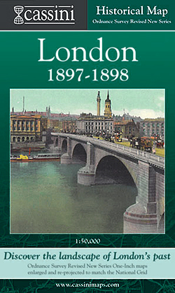
- London 1897-1898
- London in 1897-1898 in the Cassini Historical Series reproducing old Ordnance Survey mapping of England and Wales at 1:50,000. The four London maps cover roughly the area of the present day Greater London rather than following the format of rest of the series which is designed to correspond to the current Landranger maps. Mapping is identical... Lire la suite

Stanfords
United Kingdom
United Kingdom
- Liverpool 1923-1924
- Map No. 108, Liverpool 1924-1924, in the Cassini Historical Series of old Ordnance Survey mapping of England and Wales at 1:50,000 in a format designed to offer a convenient comparison with the present day coverage from the OS, and most locations in three different editions. Old historical maps have been combined so that the sheet lines... Lire la suite
Stanfords
United Kingdom
United Kingdom
- Presteigne and Hay-on-Wye / Llanandras a’r Gelli Gandryll 1919-1920
- Map No. 148, Presteigne and Hay-on-Wye / Llanandras a’r Gelli Gandryll 1819-1920, in the Cassini Historical Series of old Ordnance Survey mapping of England and Wales at 1:50,000 in a format designed to offer a convenient comparison with the present day coverage from the OS, and most locations in three different editions. Old historical maps... Lire la suite
Stanfords
United Kingdom
United Kingdom
- Shrewsbury and Oswestry / Amwythig a Chroesoswallt 1833-1921 (3-map set)
- Map No. 126, Shrewsbury and Oswestry / Amwythig a Chroesoswallt 1833-1921 (3-map set), in the Cassini Historical Series of old Ordnance Survey mapping of England and Wales at 1:50,000 in a format designed to offer a convenient comparison with the present day coverage from the OS, and most locations in three different editions. Old historical... Lire la suite
Stanfords
United Kingdom
United Kingdom
- Ludlow / Llwydlo & Church Stretton 1920-1921 - 137
- Map No. 137, Church Stretton and Ludlow / Llwydlo 1920-1921, in the Cassini Historical Series of old Ordnance Survey mapping of England and Wales at 1:50,000 in a format designed to offer a convenient comparison with the present day coverage from the OS, and most locations in three different editions. Old historical maps have been combined so... Lire la suite
Stanfords
United Kingdom
United Kingdom
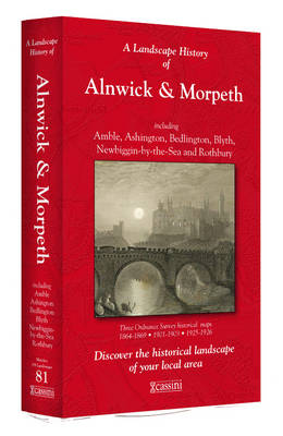
- Alnwick and Morpeth 1864-1926 (3-map set)
- Map No. 81, Alnwick and Morpeth 1864-1926 (3-map set), in the Cassini Historical Series of old Ordnance Survey mapping of England and Wales at 1:50,000 in a format designed to offer a convenient comparison with the present day coverage from the OS, and most locations in three different editions. Old historical maps have been combined so that... Lire la suite
Stanfords
United Kingdom
United Kingdom
- Dorchester and Weymouth 1919
- Map No. 194, Dorchester and Weymouth 1919, in the Cassini Historical Series of old Ordnance Survey mapping of England and Wales at 1:50,000 in a format designed to offer a convenient comparison with the present day coverage from the OS, and most locations in three different editions. Old historical maps have been combined so that the sheet... Lire la suite
Stanfords
United Kingdom
United Kingdom
- Colchester 1898
- Map No. 168, Colchester 1898, in the Cassini Historical Series of old Ordnance Survey mapping of England and Wales at 1:50,000 in a format designed to offer a convenient comparison with the present day coverage from the OS, and most locations in three different editions. Old historical maps have been combined so that the sheet lines correspond... Lire la suite
Stanfords
United Kingdom
United Kingdom
- Alnwick and Morpeth 1925-1926
- Map No. 81, Alnwick and Morpeth 1925-1926, in the Cassini Historical Series of old Ordnance Survey mapping of England and Wales at 1:50,000 in a format designed to offer a convenient comparison with the present day coverage from the OS, and most locations in three different editions. Old historical maps have been combined so that the sheet... Lire la suite
Stanfords
United Kingdom
United Kingdom
- Cambridge Past and Present
- Cambridge in the Cassini Past and Present map series which covers town and cities of England and Wales and offers a unique way of tracing their history and expansion by showing four different periods of their development using Ordnance Survey mapping from the mid-19th century, the late 19th century, the 1920s and the present day. Coverage... Lire la suite
Stanfords
United Kingdom
United Kingdom
- Norwich and The Broads 1837-1922 (3-map set)
- Map No. 134, Norwich and The Broads 1837-1922 (3-map set), in the Cassini Historical Series of old Ordnance Survey mapping of England and Wales at 1:50,000 in a format designed to offer a convenient comparison with the present day coverage from the OS, and most locations in three different editions. Old historical maps have been combined so... Lire la suite
Stanfords
United Kingdom
United Kingdom
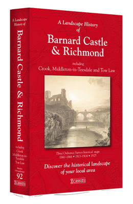
- Barnard Castle and Richmond 1860-1925 (3-map set)
- Map No. 92, Barnard Castle and Richmond 1860-1925 (3-map set), in the Cassini Historical Series of old Ordnance Survey mapping of England and Wales at 1:50,000 in a format designed to offer a convenient comparison with the present day coverage from the OS, and most locations in three different editions. Old historical maps have been combined so... Lire la suite
Stanfords
United Kingdom
United Kingdom
- Gloucester and the Forest of Dean 1919
- Map No. 162, Gloucester and the Forest of Dean 1919, in the Cassini Historical Series of old Ordnance Survey mapping of England and Wales at 1:50,000 in a format designed to offer a convenient comparison with the present day coverage from the OS, and most locations in three different editions. Old historical maps have been combined so that the... Lire la suite
Stanfords
United Kingdom
United Kingdom
- Gloucester and the Forest of Dean 1824-1831
- Map No. 162, Gloucester and the Forest of Dean 1824-1831, in the Cassini Historical Series of old Ordnance Survey mapping of England and Wales at 1:50,000 in a format designed to offer a convenient comparison with the present day coverage from the OS, and most locations in three different editions. Old historical maps have been combined so that... Lire la suite
Stanfords
United Kingdom
United Kingdom
- Ashford and Romney Marsh 1897-1898
- Map No. 189, Ashford and Romney Marsh 1897-1898, in the Cassini Historical Series of old Ordnance Survey mapping of England and Wales at 1:50,000 in a format designed to offer a convenient comparison with the present day coverage from the OS, and most locations in three different editions. Old historical maps have been combined so that the... Lire la suite