
Pays-Bas
Description

Is hiking possible in the Netherlands? After all, the country is flat as a pancake!
The answer is: Yes. In fact there are over 80 long distance hiking trails crisscrossing the country. The most important are labeled LAW, abbreviation for Lange Afstand Wandelpad (Dutch for Long Distance Hiking Trail). Walking them is a most enjoyable way of exploring Dutch countryside. Meadows grazing cows, sheep and horses, forests, sand dunes and wetlands, and many often centuries old towns along the way. Apart from the LAW's (red-white markings) there are (often) circular regional trails, the SP's (red-yellow markings).
The LAW's and SP's are maintained by Stichting Wandelnet, often in cooperation with the NIVON / Friends of Nature. But there are more organisations marking paths: two sport hiking organisations, the KNBLO (red-blue markings) and the NWB (orange-blue markings). Often, topoguides are issued of these paths. Lastly we must mention the provincial nature conservancy organisations, who set out interesting itineraries for nature lovers.
Recomended LAW's:
- Zuiderzeepad, 400 km, Hollands Golden Age on display.
- Trekvogelpad, 380 km, From West to East, varied trail, gives a good impression of the Netherlands as a whole.
- Maarten van Rossumpad, 308 km, also very varied.
- Wad- en Wierdenpad, 123 km, dykes, polders and vast views in the quiet north east of the country.
- Pieterpad, 492 km, maybe not the most attractive, but by far the most popular trail of the Netherlands.
Best hiking in the Netherlands is in the busy west. The Dutch Green Lung is the big empty space between the main cities The Hague, Amsterdam, Rotterdam and Utrecht. This space, barely known by the Dutch themselves (they rush along in cars), consists of polders, ingenuous waterways, dykes, lakes, and very old villages and farmsteads. The polder landscape can be found in the northern provinces too, or along the river delta. Some patches are very beautiful and you will experience real solitude, others can be boring.
All trails are waymarked, but not always very well. Luckily, there are excellent Dutch guidebooks, with an English section and with maps that show you the correct way. Several LAW's coincide with the European Long Distance Trails E2, E8, E9 and E11.
Enjoying the Netherlands is enjoying the odd encounter with people, villages, buildings, architecture, things happening, and the neat houses and gardens showing off one's high morale. There is also some remoteness in the North and North East. Dutch trails have no difficulties, except the occasional crossing of a busy road or sharing the path with horse-carts and bikers. Keep in mind you're walking on paved roads most of the time, and alternatively grassy, often wet dykes. Therefore, light waterproof shoes are best. Along most routes you will find camping sites, B&B's, shops and public transport in almost every village.
Carte


Sentiers
- Achterhoekpad
- Airbornepad Market GardenGPX
- AlmerepadGPX
- Bevrijdingspad
- Brabants GrensdijkjespadGPX
- Brabants VennenpadGPX
- Brabantse WalGPX
- DeltapadGPX
- Dordtse Waardroute
- Drenthelaarspad
- DrenthepadGPX
- Duin- en PolderpadGPX
- Duinweg Rondwandeling
- E11GPX
- E2GPX
- E8GPX
- E9GPX
- Elfbekenpad
- Elfbergenpad
- Elfwegenpad
- Flevopad
- Floris V-padGPX
- Friese KustpadGPX
- Friese WoudenpadGPX
- Friese Woudweg
- Geert Grootepad
- GR12 - Amsterdam - ParisGPX
- GR122 - ScheldelandGPX
- GR5GPX
- GR561 - Kempen-MaaspadGPX
- GR565 - Renier SniederspadGPX
- Graaf van Hornepad
- GraafschapspadGPX
- GrebbeliniepadGPX
- GrenslandpadGPX
- Groene HartpadGPX
- Groene WisselGPX
- Groot-FrieslandpadGPX
- Grote RivierenpadGPX
- Handelsweg
- HanzestedenpadGPX
- Heerlijkheidspad
- Hertog HendrikpadGPX
- HertogenpadGPX
- Hollands KustpadGPX
- Hunze en Fivelpad
- Hunzepad
- IJsselweg
- JabikspaadGPX
- Jac. Gazenbeekweg
- JacobspadGPX
- Jacobspad LimburgGPX
- Jacobsweg Amstelredam
- Jacobsweg Amsvorde
- Jacobsweg Audenzeel
- Jacobsweg Die Haghe
- Jacobsweg Nieumeghen
- Jacobsweg Thuredrecht
- Jagerspad
- KempenGPX
- Kempen-BroekGPX
- KlompenpadenGPX
- KloosterpadGPX
- Koninklijke WegGPX
- KrijtlandpadGPX
- Kuierpaad Fryslân
- LingepadGPX
- Loop van de Drentsche Aa
- Loop van de Reest
- Loop van het Oude Diep
- Maarten van RossumpadGPX
- Maas- en PeelliniepadGPX
- Maas-NiederrheinpadGPX
- MaasduinenGPX
- MarskramerpadGPX
- Napoleonspad
- Nederlands KustpadGPX
- NoaberpadGPX
- Noord-HollandpadGPX
- North Sea TrailGPX
- NS WandeltochtenGPX
- OeverloperpadGPX
- Omringdijk WandelrouteGPX
- Omringdijkpad
- OosterscheldepadGPX
- Oude IJssel-Rijnpad
- Overijssels HavezatenpadGPX
- Peellandpad
- PelgrimspadGPX
- PieterpadGPX
- PionierspadGPX
- Reggepad & Dinkelpad
- ReynaertlandGPX
- Rijndeltapad
- Romeinse LimespadGPX
- Rondom Berg en Bosch
- Rondom de DomGPX
- Rondom de Groene Bedstee
- Rondom de Sint JanGPX
- Sallandspad
- Santiago de Compostela Pilgrims WayGPX
- ScholtenpadGPX
- Stelling van AmsterdamGPX
- Stichtse Dorpenpad
- Streekpad NijmegenGPX
- TexelpadGPX
- Tielerwaard Wandelroute
- TrekvogelpadGPX
- TwentepadGPX
- UilenspiegelpadGPX
- UtrechtpadGPX
- Van Wad tot IJ
- VechtdalpadGPX
- Veluwe ZwerfpadGPX
- Veluweweg
- Via BrabanticaGPX
- Via MonasticaGPX
- VisserpadGPX
- Wad- en WierdenpadGPX
- Walcherenroute
- WaterliniepadGPX
- Watersnoodpad
- WesterborkpadGPX
- Willebrordus Wandelpad
- WillibrorduswandelpadGPX
- Zuid-Hollandse Polderroute
- Zuid-Limburg Wandelroute
- ZuiderzeepadGPX
Régions
Etats


Liens
Données
Rapports
Guides et cartes
Hébergement
Organisations
Voyagistes
GPS
Autre
Livres
Netherlands
2017
- ANWB Extra - Oslo
- Ontdek Oslo met de compleet vernieuwde reisgids ANWB Extra Oslo! In Oslo kan je alle kanten op: 's avonds op hoge hakken en in chique shirts van cocktails nippen in een hippe bar, de volgende dag met wandelschoenen door de uitgestrekte bossen van de Marka lopen. Dit maakt Oslo tot dé bestemming voor een leuke citytrip. De ANWB Extra reisgids... Lire la suite
- Also available from:
- Bol.com, Belgium
Belgium
2017
- ANWB Extra - Oslo
- Ontdek Oslo met de compleet vernieuwde reisgids ANWB Extra Oslo! In Oslo kan je alle kanten op: 's avonds op hoge hakken en in chique shirts van cocktails nippen in een hippe bar, de volgende dag met wandelschoenen door de uitgestrekte bossen van de Marka lopen. Dit maakt Oslo tot dé bestemming voor een leuke citytrip. De ANWB Extra reisgids... Lire la suite
Netherlands
2011
- Beleef toen nu!
- Dat Bonifatius bij Dokkum vermoord is, weten de meeste mensen wel, maar wanneer precies en waarom? En wat is er tegenwoordig ter plekke nog te zien dat herinnert aan die belangrijke historische gebeurtenis? Waar in ons land kun je de Romeinse tijd nog echt voelen en wie waren Eise Eisinga en Hugo de Groot ook alweer? In Beleef toen nu! vind je... Lire la suite
- Also available from:
- Bol.com, Belgium
Belgium
2011
- Beleef toen nu!
- Dat Bonifatius bij Dokkum vermoord is, weten de meeste mensen wel, maar wanneer precies en waarom? En wat is er tegenwoordig ter plekke nog te zien dat herinnert aan die belangrijke historische gebeurtenis? Waar in ons land kun je de Romeinse tijd nog echt voelen en wie waren Eise Eisinga en Hugo de Groot ook alweer? In Beleef toen nu! vind je... Lire la suite
Netherlands
2010
- Wandelgids In en Rondom Maastricht | Uitgeverij Tic
- In en rondom Maastricht zijn veel afwisselende wandelingen te maken. Het historisch centrum wordt bewandeld met een kroegentocht en de shoppingtour, maar ook kerken en kloosters en de vesting Maastricht komen uitgebreid aan de orde in dit wandelboek. In de directe omgeving van Maastricht wordt wijn gemaakt, liggen prachtige hellingbossen, zijn... Lire la suite
Netherlands
2021
Netherlands
- Handboek Touwtechnieken Voor De Bergsport
- Deze uitgave vormt het complete standaardwerk over touwtechniek in de bergsport en is geschreven door dé expert van Nederland, Robert Steenmeijer. Hij demonstreert hierin het beste van alle toegepaste technieken en baseert zich daarbij op zijn jarenlange praktijkervaring als alpinist, gids en expeditieleider. Dit zeer informatieve handboek is... Lire la suite
- Also available from:
- Bol.com, Belgium
Belgium
- Handboek Touwtechnieken Voor De Bergsport
- Deze uitgave vormt het complete standaardwerk over touwtechniek in de bergsport en is geschreven door dé expert van Nederland, Robert Steenmeijer. Hij demonstreert hierin het beste van alle toegepaste technieken en baseert zich daarbij op zijn jarenlange praktijkervaring als alpinist, gids en expeditieleider. Dit zeer informatieve handboek is... Lire la suite
Netherlands
2017
- Reisgids 111 plekken in Rotterdam die je gezien moet hebben | Thoth
- Het hernieuwde zelfvertrouwen van Rotterdan kan niemand ontgaan zijn. De stad bruist, prikkelt en zoemt, en trekt meer bezoekers en toeristen dan ooit tevoren. Maar Rotterdam is meer dan die stad van de ‘opgestroopte mouwen’; Feyenoord, het nieuwe Centraal Station, de Erasmusbrug of de Markthal. Flaneer maar eens over de West-Kruiskade en... Lire la suite
Netherlands
- 20 x logeren en wandelen in Nederland
- Een weekendje pure ontspanning voor de actieve levensgenieter Na het succes van Vlaanderen en de Ardennen, nu een gids over Nederland. 20 x suggesties voor plaatsen waar je heerlijk kunt logeren en bovendien ook nog eens kunt wandelen. Per gebied zijn er twee of drie wandelingen uitgezet in verschillende, voor Holland zo kenmerkende... Lire la suite
- Also available from:
- Bol.com, Belgium
Belgium
- 20 x logeren en wandelen in Nederland
- Een weekendje pure ontspanning voor de actieve levensgenieter Na het succes van Vlaanderen en de Ardennen, nu een gids over Nederland. 20 x suggesties voor plaatsen waar je heerlijk kunt logeren en bovendien ook nog eens kunt wandelen. Per gebied zijn er twee of drie wandelingen uitgezet in verschillende, voor Holland zo kenmerkende... Lire la suite
Netherlands
2018
- WandelBart wandelgidsen 1 - Provinciewandelgids Zuid-Holland
- De twintig wandelroutes in dit boekje zijn zeer divers: van een struinroute langs de Lek tot een industriewandeling door de petrochemische industrie bij Rozenburg. En alles wat daartussen zit: duinen en strand, voorname landgoederen, groene steden, vogelrijke polders en uitgestrekte waarden. Aan een kleurrijke wandelroute door de bollenvelden... Lire la suite
- Also available from:
- Bol.com, Belgium
Belgium
2018
- WandelBart wandelgidsen 1 - Provinciewandelgids Zuid-Holland
- De twintig wandelroutes in dit boekje zijn zeer divers: van een struinroute langs de Lek tot een industriewandeling door de petrochemische industrie bij Rozenburg. En alles wat daartussen zit: duinen en strand, voorname landgoederen, groene steden, vogelrijke polders en uitgestrekte waarden. Aan een kleurrijke wandelroute door de bollenvelden... Lire la suite
Netherlands
2018
- Wandelgids - Pelgrimsroute Jacobswegen in Nederland: deel 1 West | Nederlands Genootschap van Sint Jacob
- De lang gevoelde behoefte aan een gids met Nederlandse routes naar Santiago is in vervulling gegaan. In november 2011 is de dubbelgids Jacobswegen in Nederland verschenen. In deel 1 komen de wegen vanuit het westen aan bod. De hoofdroute begint in Den Oever en voert via Haarlem, Amsterdam, Utrecht en ’s-Hertogenbosch naar Postel en Roermond.... Lire la suite
Netherlands
2016
- Wandelgids Vorstelijk wandelen | Gegarandeerd Onregelmatig
- 12 rondwandelingen van 5 tot 15 kilometer langs parken, beken, bossen en paleizen Lire la suite
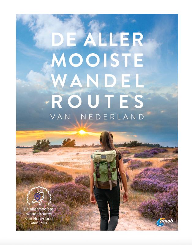
Netherlands
2023
Netherlands
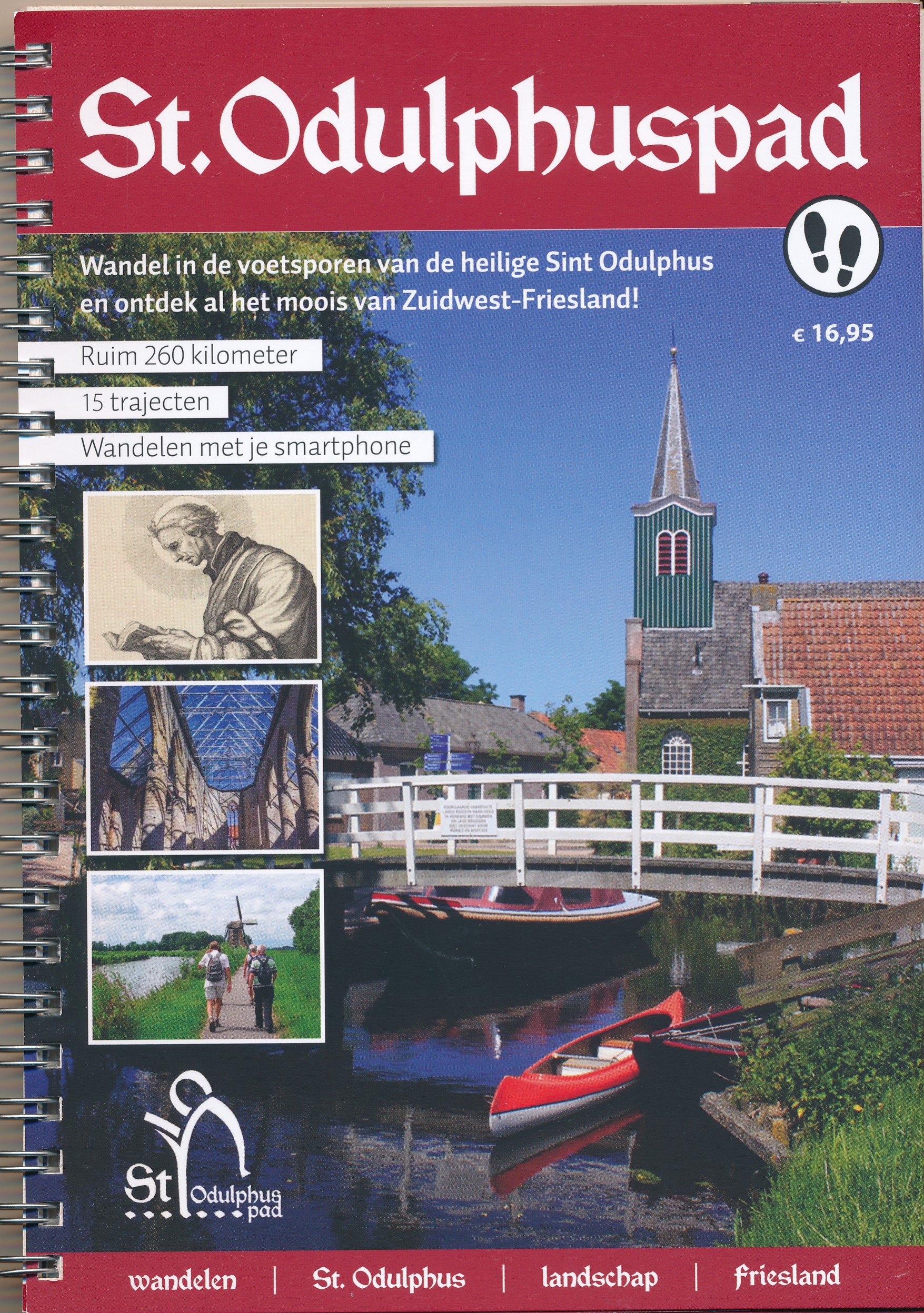
2021
- Wandelgids St. Odulphuspad | St Odulphuspad
- Het St.Odulphuspad is een aaneengesloten wandelpad van 260 kilometer door Zuidwest-Friesland, Gaasterland en de Greidhoeke. Het St. Odulphuspad bestaat uit 15 trajecten. Ieder traject heeft een eigen thema met als doel om je kennis te laten nemen van dit bijzondere gebied, met onbekende landschappelijke kwaliteiten, rijke kerkelijke... Lire la suite
Netherlands
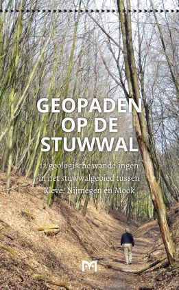
2015
- Wandelgids Geopaden op de stuwwal | Uitgeverij Matrijs
- De stuwwal bij Nijmegen, Mook, Groesbeek, Beek-Ubbergen, Kranenburg en Kleve is een bijzonder mooie heuvelketen, die het landschap in dit grensoverschrijdende gebied bepaalt. Deze stuwwal ontstond in de voorlaatste ijstijd, zo’n 300.000 tot 130.000 jaar geleden. Honderden meters dikke ijslobben van enorme landgletsjers die vanuit Scandinavië... Lire la suite
Cartes

United Kingdom
2010
- Gelderse Valley
- Gelderse Valley on a waterproof, tear-resistant, GPS compatible walking map at 1:25,000 from Trage Paden, in a series of maps with extensive overprint for long-distance and local walking routes. GPS waypoints and route profiles are available for download from the publisher’s website.Contours used in this map series vary between 2,5 to 5m... Lire la suite

United Kingdom
- South-Holland North - Green Heart West and Bollenstreek Falkplan Cycling Map 14
- The northern part of the South Holland Province of the Netherlands at 1:50,000 in a series from Falk B.V. showing the network of signposted cycling routes on large, double-sided indexed maps with prominent highlighting of long-distance LF routes, symbols indicating accommodation and other tourist services, plus in each title two or more panels... Lire la suite

United Kingdom
- Meinweg - Leudal
- Meinweg - Leudal area of the Netherlands in a series of walking and cycling maps at 1:25,000 – 1:35,000, published by Falk BV in cooperation with Staatsbosbeheer – Dutch government’s organization for forestry and the management of nature reserves.Colouring indicates different types of vegetation or terrain: woodland, pastures, heath or sand... Lire la suite

United Kingdom
2010
- The IJssel
- The Ijssel is the first of a series two recreational maps for the Flevoland region.These maps were created to celebrate the 25th anniversary of the province of Flevoland. They are double-sided indexed maps at 1:50,000 scale, featuring a detailed topography with prominent highlighting of the cycle routes and packed with practical tourist... Lire la suite
United Kingdom
- Dwingelderveld - Ruinen
- Dwingelderveld - Ruinen area of the Netherlands in a series of walking and cycling maps at 1:25,000 – 1:35,000, published by Falk BV in cooperation with Staatsbosbeheer – Dutch government’s organization for forestry and the management of nature reserves.Colouring indicates different types of vegetation or terrain: woodland, pastures, heath or... Lire la suite

United Kingdom
- Gooi & Vechtstreek: Hilversum - Amersfoort - Utrecht
- Gooi and Vechtstreek - a popular hiking area south-east of Amsterdam - on a light, double-sided, waterproof and tear-resistant, GPS-compatible maps at 1:25,000 from ANWB, the country’s main motoring and touring organization. Coverage on the northern side extends southwards from the historic town of Naarden, and west/east between the... Lire la suite
United Kingdom
- Drentsche A
- Drentsche A area of the Netherlands in a series of walking and cycling maps at 1:25,000 – 1:35,000, published by Falk BV in cooperation with Staatsbosbeheer – Dutch government’s organization for forestry and the management of nature reserves.Colouring indicates different types of vegetation or terrain: woodland, pastures, heath or sand dunes.... Lire la suite
United Kingdom
- Oostvaardersplassen
- Oostvaardersplassen area of the Netherlands in a series of walking and cycling maps at 1:25,000 – 1:35,000, published by Falk BV in cooperation with Staatsbosbeheer – Dutch government’s organization for forestry and the management of nature reserves.Colouring indicates different types of vegetation or terrain: woodland, pastures, heath or sand... Lire la suite
United Kingdom
- Netherlands Falkplan Cycling Atlas
- Cycling atlas of the Netherlands at 1:75,000 from Falk BV, presenting in one A5 spiral-bound volume the country’s extensive network of signposted cycling routes and junctions, including the long-distance LF trails and smaller local cycle paths. The network consists of numbered junctions joined by sign-posted connecting routes in either... Lire la suite
United Kingdom
- Baronie van Breda
- Baronie van Breda area of the Netherlands in a series of walking and cycling maps at 1:25,000 – 1:35,000, published by Falk BV in cooperation with Staatsbosbeheer – Dutch government’s organization for forestry and the management of nature reserves.Colouring indicates different types of vegetation or terrain: woodland, pastures, heath or sand... Lire la suite
United Kingdom
- De Weerribben
- De Weerribben area of the Netherlands in a series of walking and cycling maps at 1:25,000 – 1:35,000, published by Falk BV in cooperation with Staatsbosbeheer – Dutch government’s organization for forestry and the management of nature reserves.Colouring indicates different types of vegetation or terrain: woodland, pastures, heath or sand dunes.... Lire la suite

United Kingdom
- Rhine Cycle Route 4 - Cologne to Hoek van Holland Bikeline Map-Guide
- The Rhine Cycle Route Part 4 – a 442-km long section from Cologne to the North Sea presented by Verlag Esterbauer in a guide with maps at 1:75,000 showing the route and its variants. Extensive information is conveyed by symbols, indicating road surface, campsites and other accommodation, repair workshops, recreational facilities, places of... Lire la suite
United Kingdom
- Rijk van Nijmegen
- Rijk van Nijmegen area of the Netherlands in a series of walking and cycling maps at 1:25,000 – 1:35,000, published by Falk BV in cooperation with Staatsbosbeheer – Dutch government’s organization for forestry and the management of nature reserves.Colouring indicates different types of vegetation or terrain: woodland, pastures, heath or sand... Lire la suite
United Kingdom
- Brabant West and Central Cycling Map
- The central and western part of the North Brabant Province of the Netherlands at 1:50,000 in a series from Falk B.V. showing the network of signposted cycling routes on large, double-sided indexed maps with prominent highlighting of long-distance LF routes, symbols indicating accommodation and other tourist services, plus in each title two or... Lire la suite

United Kingdom
- C30 Harwich to Hoek van Holland and Dover Strait
- Plans included:Dunkerque (1:25 000)Nieuwpoort (1:30 000)Oostende (1:20 000)Blankenberge (1:10 000)Zeebrugge (1:35 000)Breskens (1:12 500)Vlissingen (1:20 000)On this edition the latest wind farm information is included as is the latest depth survey information. Lire la suite