
Allemagne
Description

If ever any country takes pride in its romantic legacy, it must be Germany. Put on your hiking boots and headphones and enter the realm of Wagner, Brahms and Schumann, walking through the land of Rhine and Danube, of traditional half-timbered houses, mighty castles and ancient taverns serving excellent food and wine. Most popular hiking destinations are the Black Forest in the southwest, Alsace-Lorraine on the border with France, Bavaria in the south, and forested Thüringen and Harz in central Germany. But there is more to explore. Try an autumn clad Swabian Alb for instance, or spring on the northern island of Rügen.
Not surprisingly, Germany counts over 200 long distance hiking trails, all waymarked and well documented. Walk any European long distance trail, except E2 and E7, and you will pass through Germany! Even if not spectacular in terms of altitude, the varying landscapes can be truly wild and offer wonderful panorama's.
On the negative side, bear in mind that Germany is a modern country. Forests and farmland are exploited efficiently and can be pretty boring.
There are no real difficulties and you can go any time of the year, but higher up snow can make walking difficult in wintertime (and create good opportunities for cross country skiing). Finding food and lodging is never an issue, as mountain huts, hotels, inns and private rooms (Zimmer frei) abound, as do campsites.
Interesting is the current tendency in the country to "certify" trails if they comply to a list of standards. The effect is that some trails get much more attention than other trails. They get the predicate "Premiumweg" or get elected the most beautiful trail of the country. Of course, this does NOT mean that other trails are less interesting. The effect, however, is that while new trails are created, old trails gradually disappear.
Carte

Sentiers
- 66 Seen RegionalparkrouteGPX
- Aar HöhenwegGPX
- AhornwegGPX
- Ahr-Venn-WegGPX
- AhrtalwegGPX
- AlemannenwegGPX
- Alpen Weitwanderweg
- Alsenztal Wanderweg
- Alsterwanderweg GPX
- Altmühltal PanoramawegGPX
- ArminiuswegGPX
- AusoniuswegGPX
- Badener Weg
- BaierwegGPX
- Barbarossaweg GPX
- BöhmwegGPX
- Bückebergweg
- Bodensee RundwegGPX
- BonifatiuswegGPX
- BorgmannwegGPX
- Breisgauer WeinwegGPX
- Burgen WanderwegGPX
- BurgensteigGPX
- BurgenwegGPX
- Burgenweg Bergstrasse
- Burgenweg Kulturhistorische Wanderweg
- Burgundenweg
- BurgwaldpfadGPX
- ButjadingerwegGPX
- Christine Kochweg GPX
- Deutsche WeinstrasseGPX
- Dichter Musiker MalerwegGPX
- Diemelsteig
- Donau-ZollernalbwegGPX
- DonauberglandwegGPX
- DonausteigGPX
- DreiländerwegGPX
- E1GPX
- E10GPX
- E11GPX
- E3GPX
- E4GPX
- E5GPX
- E6GPX
- E8GPX
- E9GPX
- Eder HöhenwegGPX
- EggewegGPX
- EhmsenwegGPX
- EifelsteigGPX
- Elb Höhenweg
- Elbe-Weser-WanderwegGPX
- ElisabethpfadGPX
- EmmerwegGPX
- Ems-Hase-Hunte-ElsewegGPX
- Ems-HuntewegGPX
- Ems-JadewegGPX
- EmswegGPX
- Erft-Lieser-Mosel-Weg GPX
- ErzwegGPX
- EselswegGPX
- Europäische Wasserscheideweg
- FörsterwegGPX
- Feengrotten-KyffhäuserwegGPX
- FrankenwegGPX
- Frankenweg (Schwäbischer Albverein)GPX
- Frankenweg Odenwald
- Frankfurter GrünGürtel Rundwanderweg
- Frau HollepfadGPX
- Fränkischer GebirgswegGPX
- Fränkischer Rotwein WanderwegGPX
- FreudenthalwegGPX
- FuldahöhenwegGPX
- GäurandwegGPX
- Görlitz-Greiz
- GeestwegGPX
- Gernsbacher RundeGPX
- GlasschleifererwegGPX
- GoethewegGPX
- GoldsteigGPX
- GR128 - VlaanderenrouteGPX
- GR15 - AE - Ardennes-EifelGPX
- GR5GPX
- GR56 - Hautes Fagnes - EifelGPX
- Graf EngelbertwegGPX
- GunthersteigGPX
- Hainleite-WanderwegGPX
- Handelsweg
- HansawegGPX
- HanseatenwegGPX
- Hansjakobweg I (Kleiner Hansjakobweg)GPX
- Hansjakobweg II (Großer Hansjakobweg)GPX
- Harzer BaudensteigGPX
- Harzer HexenstiegGPX
- Hærvejen - OchsenwegGPX
- Höhenweg Fichtelgebirge
- Höhenweg Steinwaldweg
- HünenwegGPX
- Heilbronner HöhenwegGPX
- HerkuluswegGPX
- HermannshöhenGPX
- HermannswegGPX
- Hessenweg 1GPX
- Hessenweg 10GPX
- Hessenweg 11GPX
- Hessenweg 2GPX
- Hessenweg 3GPX
- Hessenweg 4GPX
- Hessenweg 5GPX
- Hessenweg 6GPX
- Hessenweg 7GPX
- Hessenweg 8GPX
- Hessenweg 9GPX
- Heuberg-AllgäuwegGPX
- HochrhönerGPX
- Hochrhein HöhenwegGPX
- HohenzollernwegGPX
- Hotzenwald QuerwegGPX
- Hunsrück Höhenweg
- Jacobspad LimburgGPX
- JadewegGPX
- Jagtsteig
- JakobswegGPX
- Jakobsweg Breisach - Cluny
- Jakobsweg im Elsass
- Jakobsweg Waldshut-Vézelay
- Josef-Schramm-Weg GPX
- Jubiläumsweg BodenseekreisGPX
- JurasteigGPX
- Kaiser OttowegGPX
- KaiserwegGPX
- Kammweg Erzgebirge-VogtlandGPX
- Kandel HöhenwegGPX
- Karl-Kaufmann-WegGPX
- KarolingerwegGPX
- KarstwanderwegGPX
- KölnpfadGPX
- König LudwigwegGPX
- KellerwaldsteigGPX
- Kelten ErlebniswegGPX
- KlötziestiegGPX
- Kocher Jagst Trail
- KrönungswegGPX
- KunigundenwegGPX
- KyffhäuserwegGPX
- Lahn Dill BerglandpfadGPX
- Lahn WanderwegGPX
- LahnhöhenwegGPX
- Lausitzer SchlangeGPX
- LönspfadGPX
- LöwenwegGPX
- Lech Höhenweg
- LechwegGPX
- LieserpfadGPX
- Limes WanderwegGPX
- LulluspfadGPX
- LutherwegGPX
- Maas-NiederrheinpadGPX
- Main-Donau-BodenseewegGPX
- Main-Neckar-RheinwegGPX
- Main-WerrawegGPX
- Maintal Höhenringweg
- MalerwegGPX
- Markgräfler Wiwegli
- MarskramerpadGPX
- MatthiaswegGPX
- MaximilianswegGPX
- MärchenlandwegGPX
- Mühlen WanderwegGPX
- MühlensteigGPX
- MühlenwegGPX
- Mühlenweg am WiehengebirgeGPX
- Müritz NationalparkwegGPX
- Medebacher BergwegGPX
- MittelwegGPX
- Mosel-OurwegGPX
- MoselhöhenwegGPX
- MoselsteigGPX
- Muldental WanderwegGPX
- MurgleiterGPX
- Nahe HöhenwegGPX
- NaturparkwegGPX
- Natursteig SiegGPX
- NibelungensteigGPX
- NibelungenwegGPX
- NiederrheinwegGPX
- NoaberpadGPX
- Nord-Ostsee-WanderwegGPX
- NordwaldkammwegGPX
- North Sea TrailGPX
- NurtschwegGPX
- Oberallgäuer RundwanderwegGPX
- Oberlausitzer BergwegGPX
- Ortenauer WeinpfadGPX
- Ostfriesland WanderwegGPX
- Ostsee-SaaletalsperrenGPX
- OstwegGPX
- Oude IJssel-Rijnpad
- PandurensteigGPX
- PankewegGPX
- Panoramaweg Baden-BadenGPX
- Panoramaweg SchwarzatalGPX
- Panoramaweg TaubertalGPX
- Pfälzer WeinsteigGPX
- Pickerweg
- PlackwegGPX
- PrälatenwegGPX
- Querweg Freiburg-BodenseeGPX
- Querweg Gengenbach-Alpirsbach
- Querweg Lahr-RottweilGPX
- Querweg Schwarzwald-Kaiserstuhl-RheinGPX
- Römerkanal WanderwegGPX
- Rügen Rundwanderweg
- Rügener Küsten Streckentour
- Remstal HöhenwegGPX
- RenchtalsteigGPX
- RennsteigGPX
- RennwegGPX
- Rhön HöhenwegGPX
- Rhein-Kyll-WegGPX
- Rhein-Rureifel-Weg GPX
- RheinauenwegGPX
- RheinburgenwegGPX
- Rheingauer Riesling Routen
- RheinhöhenwegGPX
- RheinsteigGPX
- Rhine-Meuse Trail
- Romantische StrasseGPX
- RothaarsteigGPX
- RothaarwegGPX
- Rotwein WanderwegGPX
- Ruhr HöhenwegGPX
- Rund um MagdeburgGPX
- RunenwegGPX
- Ruppiner Land-Rundwanderweg
- Saale-Orla-WegGPX
- Saar-HunsrücksteigGPX
- Saarland RundwanderwegGPX
- Santiago de Compostela Pilgrims WayGPX
- Sauerland WaldrouteGPX
- Sächsischer Wein WanderwegGPX
- SchinderhannespfadGPX
- Schlei-Eider-ElbeGPX
- SchluchtensteigGPX
- SchusterachtGPX
- Schwarzwald Nordrand WegGPX
- Schwarzwald-Jura-Bodensee-WegGPX
- Schwarzwald-Schwäbische Alb-Allgäu-WegGPX
- Schwäbisch Allgäuer WanderwegGPX
- Schwäbische Alb Hauptwanderweg 5
- Schwäbische Alb-Südrand-WegGPX
- Schwäbische-Alb-Nordrand-WegGPX
- Schwäbische-Alb-Oberschwaben-WegGPX
- Schweriner See Rundtour
- SeensteigGPX
- Selketalstieg
- Siegerland HöhenringGPX
- SigwardswegGPX
- Sintfeld HöhenwegGPX
- SironawegGPX
- SoonwaldsteigGPX
- SpessartwegGPX
- SponheimerwegGPX
- StörtebekerwegGPX
- Steigerwald PanoramawegGPX
- StormarnwegGPX
- Strandvogt-Törn
- Stromberg-Schwäbischer Waldweg
- StudentenpfadGPX
- TalsperrenwegGPX
- Talsperrenweg Zeulenroda
- Taunus HöhenwegGPX
- Taunus-Rhön-WegGPX
- TöddenwegGPX
- Templar Trail
- ThüringenwegGPX
- Traumpfad München-VenedigGPX
- UplandsteigGPX
- Urwaldsteig EderseeGPX
- Via AlpinaGPX
- Via BalticaGPX
- Via Claudia AugustaGPX
- Via Colonensis
- Vogelsberger Vulkansteig
- Vogtland PanoramawegGPX
- Vulkanring VogelsbergGPX
- VulkanwegGPX
- Wanderweg der Deutschen EinheitGPX
- Weg der FreundschaftGPX
- Weinwanderweg Rhein-NaheGPX
- Wendland RundwegGPX
- WeserberglandwegGPX
- WesergebirgswegGPX
- WesterwaldsteigGPX
- Westfalen WanderwegGPX
- Westpfalz WanderwegGPX
- WestwegGPX
- Westweg FichtelgebirgeGPX
- WildbahnGPX
- Wildnis TrailGPX
- WillibrorduswegGPX
- Winterberger HochtourGPX
- WittekindswegGPX
- WupperwegGPX
- ZeugenbergrundeGPX
- Zittau-WernigerodeGPX
- Zschopautal WanderwegGPX
- ZweitälersteigGPX
Régions
- Alfelder Bergland
- Allgäuer Alpen
- Alps
- Ammergauer Alpen
- Arnsberger Wald
- Bayerische Voralpen
- Bayerischer Wald
- Berchtesgadener Alpen
- Bergisches land
- Bodensee
- Bregenzerwald
- Burgwald
- Chiemgauer Alpen
- Eifel
- Elbsandsteingebirge
- Elstergebirge
- Erzgebirge
- Estergebirge
- Fichtelgebirge
- Frankenwald
- Fränkische Alb
- Fränkische Schweiz
- Gladenbacher Bergland
- Haardt
- Habichtswald
- Harz
- Hautes Fagnes
- Hohenloher Ebene
- Hoher Meissner
- Hunsrück
- Kaiserstuhl
- Karwendel
- Kaufunger Wald
- Kellerwald
- Knüll
- Kyffhäuser
- Lausitzer Bergland
- Lüneburger Heide
- Leinebergland
- Lennegebirge
- Lipper Bergland
- Mangfallgebirge
- München
- Mecklenburgische Seenplatte
- Mosel
- Munsterland
- Naturpark Rheinland
- Nordpfälzer Bergland
- Oberpfälzer Wald
- Odenwald
- Ostfriesland
- Pfälzerwald
- Rügen
- Rhön
- Rheingau
- Rothaargebirge
- Ruhrgebiet
- Saalhauser Berge
- Sauerland
- Sächsische Schweiz
- Schwarzwald
- Schwäbische Alb
- Siebengebirge
- Solling
- Soonwald
- Spessart
- Spreewald
- Steigerwald
- Steinernes Meer
- Sylt
- Tannheimer Bergen
- Taunus
- Teutoburgerwald
- Thüringer Schiefergebirge
- Thüringer Wald
- Vogelsberg
- Vogtland
- Welzheimer Wald
- Wesergebirge
- Westerwald
- Wetterstein
- Wiehengebirge
- Zittauer Gebirge
Etats
Montagnes


Liens
Données
Rapports
Guides et cartes
Hébergement
Organisations
Voyagistes
GPS
Autre
Livres

United Kingdom
- Müritz National Park - Waren - Plauer See - Neusterlitz K+F Outdoor Map 16
- Müritz Lake - Neusterlitz area of eastern Germany’s lake district at 1:50,000 from Kümmerly+Frey in a series GPS compatible, double-sided maps printed on durable, waterproof and tear-resistant plastic paper; contoured, with hiking and cycle routes, other recreational activities, etc. An inset extends coverage to the Wolin Island in Poland.Maps... Lire la suite

United Kingdom
- Pfälzerwald (Palatinate Forest) 50K Kümmerly + Frey Map No. 24
- Pfälzerwald, the Palatinate Forest south of Kaiserslautern, at 1:35,000 from Kümmerly+Frey in a series GPS compatible, double-sided maps printed on durable, waterproof and tear-resistant plastic paper; contoured, with hiking and cycle routes, other recreational activities, etc. Maps in this series are at a scale of either 1:50,000 or 1:35,000.... Lire la suite

United Kingdom
- Württemberg Winelands Cycle Route (360km) Bikeline Map/Guide
- Württemberg Winelands Cycle Route, a 360-km long cycle trail from Rottenburg on the Neckar across the Tauber Valley to Niederstetten, presented by the Verlag Esterbauer in guide with maps at 1:50,000 showing the route and its variants. Extensive information is conveyed by symbols, indicating road surface, campsites and other accommodation,... Lire la suite

United Kingdom
- Ausseerland - Ennstal - Tauplitz Kompass 68
- Map No. 68, Ausseerland, from Kompass, printed on waterproof and tear-resistant synthetic paper in a series of walking maps of selected areas of Germany at 1:50,000, with hiking routes on a topographic base, various types of accommodation, recreational facilities, places of interest, etc. Kompass are Europe’s largest publishers of walking maps,... Lire la suite

United Kingdom
- Erzegebirge - Klingenthal - Altenberg - Fichtelberg - Oberwiesenthal - Seiffen 50K Kümmerly + Frey Map No. 48
- Erzegebirge - Klingenthal - Altenberg - Fichtelberg – Oberwiesenthal - Seiffen region of Germany at 1:50,000 from Kümmerly+Frey in a series GPS compatible, double-sided maps printed on durable, waterproof and tear-resistant plastic paper; contoured, with hiking and cycle routes, other recreational activities, etc.Maps in this series are at a... Lire la suite

United Kingdom
- Fischland - Darß - Kühlungsborn 50K Kümmerly + Frey Map No. 13
- Fischland - Darß - Kühlungsborn area along the Baltic coast of Germany at 1:50,000 from Kümmerly+Frey in a series GPS compatible, double-sided maps printed on durable, waterproof and tear-resistant plastic paper; contoured, with hiking and cycle routes, other recreational activities, etc.Maps in this series are at a scale of either 1:50,000 or... Lire la suite

United Kingdom
- Germany Munich Travel Guide 2023
- Your 7-Day Guide to the City's Best Attractions Lire la suite

United Kingdom
- Turning to Nature in Germany
- Hiking, Nudism, and Conservation, 1900-1940 Lire la suite

United Kingdom
- Germany Birds
- A Folding Pocket Guide to Familiar Species Lire la suite

Netherlands
2014
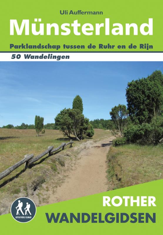
- Rother Wandelgidsen - Munsterland
- Ontdek het wandelgeheim over de grens!De Rother Wandelgids M nsterland beschrijft 50 wandelroutes in deze sprookjesachtige Duitse regio.Wandel langs kleine wegen die kronkelen door bossen en weiden. Geniet van de vele prachtige kastelen en landhuizen. Alle dagwandelingen voor M nsterland hebben betrouwbare routebeschrijvingen, gedetailleerde... Lire la suite
- Also available from:
- Bol.com, Belgium
- De Zwerver, Netherlands
Belgium
2014
- Rother Wandelgidsen - Munsterland
- Ontdek het wandelgeheim over de grens!De Rother Wandelgids M nsterland beschrijft 50 wandelroutes in deze sprookjesachtige Duitse regio.Wandel langs kleine wegen die kronkelen door bossen en weiden. Geniet van de vele prachtige kastelen en landhuizen. Alle dagwandelingen voor M nsterland hebben betrouwbare routebeschrijvingen, gedetailleerde... Lire la suite
Netherlands
2014
- Wandelgids Münsterland | Uitgeverij Elmar
- Ontdek het wandelgeheim over de grens! De Rother Wandelgids Münsterland beschrijft 50 wandelroutes in deze sprookjesachtige Duitse regio. Wandel langs kleine wegen die kronkelen door bossen en weiden. Geniet van de vele prachtige kastelen en landhuizen. Alle dagwandelingen voor Münsterland hebben betrouwbare routebeschrijvingen, gedetailleerde... Lire la suite

Netherlands
2018
- Reisgids Pocket Guide Munich and Bavaria - Munchen & Beieren | Berlitz
- Pocket Guide Berlitz is een handzaam engelstalige reisgids met bezienswaardigheden, kaartjes, hotels en restaurants. Past makkelijk in de binnenzak. BerlitzPocket Guide Munich and Bavariacombines snappy text with full-colour photography to highlight the very bestthat Germany's most popular state has to offer. TheWhere To Go chapter details... Lire la suite
Netherlands
2013
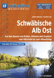
- Wandelgids Hikeline Schwäbische Alb Ost | Esterbauer
- Handzame gids met een goede beschrijving van een groot aantal dagtochten in dit gebied. De gids is in spiraalbinding en elke pagina is op scheur- en watervast papier gedrukt. Daar is echt over nagedacht! Die Schwäbische Alb Ost ist ein Landstrich voller Gegensätze: raues Klima im Winter und herrliche Sommer- und Herbsttage. Kleine Dörfer und... Lire la suite
Netherlands
2020
Netherlands
2011
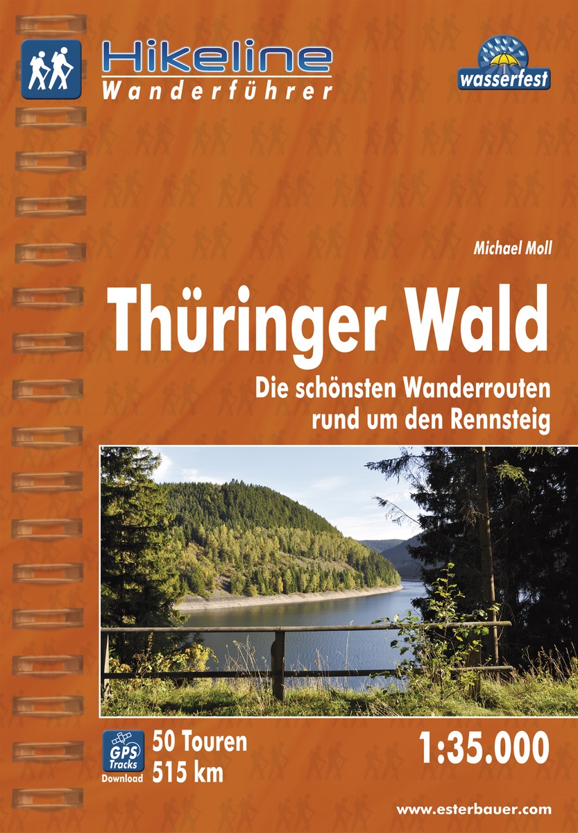
- Wandelgids Hikeline Thüringer Wald | Esterbauer
- Handzame gids met een goede beschrijving van een groot aantal dagtochten in dit gebied. De gids is in spiraalbinding en elke pagina is op scheur- en watervast papier gedrukt. Daar is echt over nagedacht! Länge, Höhenmeter, Anforderungen Die fünfzig Touren in diesem Buch umfassen kurze Spaziergänge für Einsteiger oder Kinder (4-5 km) sowie... Lire la suite

United Kingdom
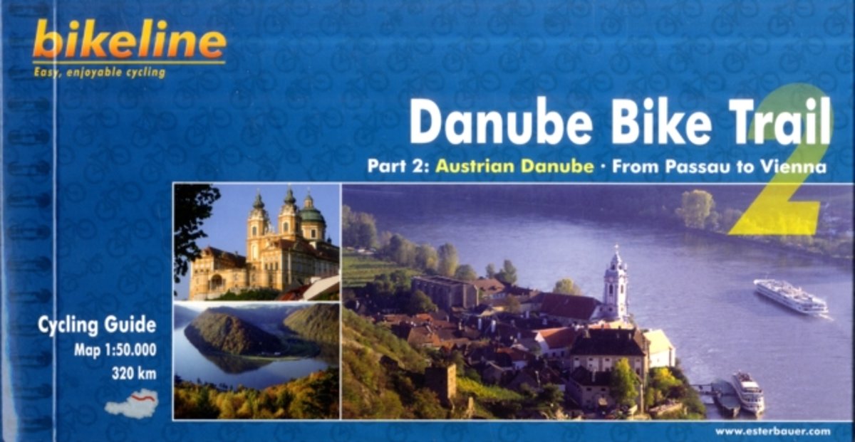
- Danube Cycle Route Part 2: Passau to Vienna ENGLISH Ed.
- The Danube Cycle Route Part 2 – the second, 320-km long section across Austria from the German border to Vienna – in an English language edition of Verlag Esterbauers’ Bikeline series, with detailed mapping at 1:50,000 highlighting the route and its variants, street plans for main cities, and extensive information conveyed by symbols indicating... Lire la suite
- Also available from:
- Bol.com, Netherlands
- Bol.com, Belgium
Cartes

United Kingdom
- Holland Cycling Region Bikeline Map-Guide
- A tour around the Ijsselmeer, plus 15 shorter day tours in the western part of the Netherlands, altogether offering over 1000km of cycle routes presented by the Verlag Esterbauer in guide with maps at 1:75,000 showing the routes and their variants. Extensive information is conveyed by symbols, indicating road surface, campsites and other... Lire la suite

United Kingdom
- North Sea to the Baltic Cycle Route - Brunsbüttel to Kiel Bikeline Map-Guide
- A 314km cycle route along the Kiel Canal linking the North Sea with the Baltic, from Brunsbüttel to Kiel, presented by the Verlag Esterbauer in guide with maps at 1:50,000 showing the route and its variants. Extensive information is conveyed by symbols, indicating road surface, campsites and other accommodation, repair workshops, recreational... Lire la suite

United Kingdom
- Stuttgart - Heilbronn - Göppingen - Pforzheim - Reutlingen - Tübingen ADAC Street Atlas
- Stuttgart - Heilbronn Region Street Atlas in a series of detailed atlases covering the whole of Germany at 1:20,000 with UTM coordinates for GPS navigation, postal codes and public transport, published by ADAC, the country’s largest motoring organization. The plans name all the individual streets and indicate all the main landmarks and public... Lire la suite

United Kingdom
- Hesse Railways Cycle Tours (340km) Bikeline Map/Guide
- Hesse Railways Cycle Tours, 340 kms of cycle routes and tours along the disused railway lines of Hesse, north-east of Frankfurt, presented by the Verlag Esterbauer in guide with maps at 1:50,000 showing the route and its variants. Extensive information is conveyed by symbols, indicating road surface, campsites and other accommodation, repair... Lire la suite

United Kingdom
- Frankfurt am Main F&B
- Indexed street map of Frankfurt am Main at 1:20,000 from Freytag & Berndt with an enlargement of the Sachsenhausen area at 1:10,000. Mapping is bright, colourful and clear, with one-way streets shown, as well as the U-bahn, S-bahn, bus and tram networks with stops clearly indicated.Points of interest such as St. Bartholomeus’ Cathedral, the... Lire la suite

United Kingdom
- Münsterland Ost - Beckumer Berge 50K Kümmerly + Frey Map No. 59
- Münsterland Ost - Beckumer Berge area in Germany at 1:50,000 from Kümmerly+Frey in a series GPS compatible, double-sided maps printed on durable, waterproof and tear-resistant plastic paper; contoured, with hiking and cycle routes, other recreational activities, etc.Maps in this series are at a scale of either 1:50,000 or 1:35,000. Contour... Lire la suite

United Kingdom
- Wismar - Klützer Winkel
- Wismar - Klützer Winkel area of northern Germany on a detailed, GPS compatible map at 1:50,000 from Kompass with local and long-distance footpaths, cycling routes, accommodation, etc, printed on durable, waterproof and tear-resistant synthetic paper.KOMPASS HIKING & RECREATIONAL MAPS: this title is part of an extensive series covering Austria,... Lire la suite
United Kingdom
- Rhine Cycle Route 4 - Cologne to Hoek van Holland Bikeline Map-Guide
- The Rhine Cycle Route Part 4 – a 442-km long section from Cologne to the North Sea presented by Verlag Esterbauer in a guide with maps at 1:75,000 showing the route and its variants. Extensive information is conveyed by symbols, indicating road surface, campsites and other accommodation, repair workshops, recreational facilities, places of... Lire la suite

United Kingdom
- Lower Middle Rhine: Bonn to Koblenz 35K Kümmerly + Frey Map No. 31
- Lower Middle Rhine: Bonn to Koblenz at 1:35,000 from Kümmerly+Frey in a series GPS compatible, double-sided maps printed on durable, waterproof and tear-resistant plastic paper; contoured, with hiking and cycle routes, other recreational activities, etc.Maps in this series are at a scale of either 1:50,000 or 1:35,000. Contour interval varies... Lire la suite

United Kingdom
- Upper Danube Regional Park: Albstadt - Tuttlingen - Sigmaringen
- Upper Danube Regional Park: Albstadt - Tuttlingen - Sigmaringen area of Baden-Württemberg on a detailed, GPS compatible map at 1:50,000 from Kompass with local and long-distance footpaths, cycling routes, accommodation, etc, printed on durable, waterproof and tear-resistant synthetic paper.KOMPASS HIKING & RECREATIONAL MAPS: this title is part... Lire la suite

United Kingdom
- Saar-Hunsrück Nature Park (2-map set)
- Saar-Hunsrück Nature Park on a set of two GPS compatible, topographic recreational maps at 1:50,000 from the survey organizations of Rhineland-Palatinate and Saarland with cartography identical to the standard topographic survey of Germany but with additional extensive overprint highlighting local and long-distance hiking trails, cycle routes,... Lire la suite

United Kingdom
- North Sea Coast Cycle Route 1 - Rotterdam to Leer Bikeline Map-Guide
- The North Sea Cycle Route Part 1 – a 455-km long section from Rotterdam to Lear presented by Verlag Esterbauer in a guide with maps at 1:75,000 showing the route and its variants. Extensive information is conveyed by symbols, indicating road surface, campsites and other accommodation, repair workshops, recreational facilities, places of... Lire la suite

United Kingdom
- Hanover F&B
- Indexed street map of Hanover at 1:20,000 from Freytag & Berndt with an enlargement of central Hanover at 1:10,000. Mapping is bright, colourful and clear, with one-way streets shown, as well as the S-bahn, bus and tram networks with stops clearly indicated.Points of interest such as Hanover’s 40 theatres, the Historic Museum, and parks are... Lire la suite

United Kingdom
- Lahr –Rheinauen – Taubergießen - Kinzigtal
- Lahr –Rheinauen – Taubergießen – Kinzigtal area of central Black Forest on a detailed, GPS compatible map at 1:25,000 from Kompass with local and long-distance footpaths, cycling routes, accommodation, etc, printed on durable, waterproof and tear-resistant synthetic paper.KOMPASS HIKING & RECREATIONAL MAPS: this title is part of an extensive... Lire la suite

United Kingdom
- Rhine Cycle Route 3 - Mainz to Duisburg Bikeline Map-Guide
- The Rhine Cycle Route Part 3 – a 302-km long section from Mainz to Duisburg presented by Verlag Esterbauer in a guide with maps at 1:75,000 showing the route and its variants. Extensive information is conveyed by symbols, indicating road surface, campsites and other accommodation, repair workshops, recreational facilities, places of interest,... Lire la suite